- Colorado census statistical areas
-
 Main article: State of Colorado
The United States Office of Management and Budget {OMB) has defined one Combined Statistical Area (CSA),[1] seven Metropolitan Statistical Areas (MSAs),[2] and seven Micropolitan Statistical Areas (μSAs)[3] in the State of Colorado.[4] At the 2010 United States Census, 91.86% of Coloradans lived in one of these areas.[5]
Contents
Table
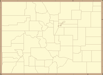
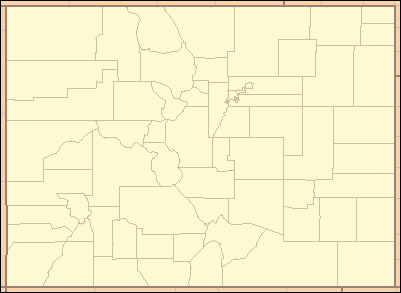
 An enlargeable map of the 14 Core Based Statistical Areas in the State of Colorado
The following table describes the census statistical areas of the State of Colorado with the following information:
- The name of the Combined Statistical Area (CSA), if one is defined[4]
- The CSA population as of April 1, 2010, as enumerated by the 2010 United States Census,[5]
- The name of the Core Based Statistical Area (CBSA)[4]
- The CBSA population as of April 1, 2010, as enumerated by the 2010 United States Census,[5]
- The name of the county[6]
- The county population as of April 1, 2010, as enumerated by the 2010 United States Census,[5]
- The county population as of April 1, 2000, as enumerated by the 2000 United States Census,[5]
- The percent county population change from April 1, 2000, to April 1, 2010.[5]
Census Statistical Areas in the State of Colorado
Combined Statistical Area 2010 Census Core Based Statistical Area 2010 Census County 2010 Census 2000 Census Change Denver-Aurora-Boulder, CO CSA 3,090,874 Denver-Aurora-Broomfield, CO MSA 2,543,482 City and County of Denver, Colorado 600,158 554,636 +8.21% Arapahoe County, Colorado 572,003 487,967 +17.22% Jefferson County, Colorado 534,543 527,056 +1.42% Adams County, Colorado 441,603 363,857 +21.37% Douglas County, Colorado 285,465 175,766 +62.41% City and County of Broomfield, Colorado 55,889 0 NA Elbert County, Colorado 23,086 19,872 +16.17% Park County, Colorado 16,206 14,523 +11.59% Clear Creek County, Colorado 9,088 9,322 −2.51% Gilpin County, Colorado 5,441 4,757 +14.38% Boulder, CO MSA 294,567 Boulder County, Colorado 294,567 291,288 +1.13% Greeley, CO MSA 252,825 Weld County, Colorado 252,825 180,936 +39.73% 52 counties not included in a CSA Colorado Springs, CO MSA 645,613 El Paso County, Colorado 622,263 516,929 +20.38% Teller County, Colorado 23,350 20,555 +13.60% Fort Collins-Loveland, CO MSA 299,630 Larimer County, Colorado 299,630 251,494 +19.14% Pueblo, CO MSA 159,063 Pueblo County, Colorado 159,063 141,472 +12.43% Grand Junction, CO MSA 146,723 Mesa County, Colorado 146,723 116,255 +26.21% Edwards, CO μSA 59,507 Eagle County, Colorado 52,197 41,659 +25.30% Lake County, Colorado 7,310 7,812 −6.43% Durango, CO μSA 51,334 La Plata County, Colorado 51,334 43,941 +16.82% Cañon City, CO μSA 46,824 Fremont County, Colorado 46,824 46,145 +1.47% Montrose, CO μSA 41,276 Montrose County, Colorado 41,276 33,432 +23.46% Fort Morgan, CO μSA 28,159 Morgan County, Colorado 28,159 27,171 +3.64% Silverthorne, CO μSA 27,994 Summit County, Colorado 27,994 23,548 +18.88% Sterling, CO μSA 22,709 Logan County, Colorado 22,709 20,504 +10.75% 39 counties not included in a CBSA Garfield County, Colorado 56,389 43,791 +28.77% Delta County, Colorado 30,952 27,834 +11.20% Montezuma County, Colorado 25,535 23,830 +7.15% Routt County, Colorado 23,509 19,690 +19.40% Otero County, Colorado 18,831 20,311 −7.29% Chaffee County, Colorado 17,809 16,242 +9.65% Pitkin County, Colorado 17,148 14,872 +15.30% Las Animas County, Colorado 15,507 15,207 +1.97% Alamosa County, Colorado 15,445 14,966 +3.20% Gunnison County, Colorado 15,324 13,956 +9.80% Grand County, Colorado 14,843 12,442 +19.30% Moffat County, Colorado 13,795 13,184 +4.63% Prowers County, Colorado 12,551 14,483 −13.34% Archuleta County, Colorado 12,084 9,898 +22.09% Rio Grande County, Colorado 11,982 12,413 −3.47% Yuma County, Colorado 10,043 9,841 +2.05% Kit Carson County, Colorado 8,270 8,011 +3.23% Conejos County, Colorado 8,256 8,400 −1.71% San Miguel County, Colorado 7,359 6,594 +11.60% Huerfano County, Colorado 6,711 7,862 −14.64% Rio Blanco County, Colorado 6,666 5,986 +11.36% Bent County, Colorado 6,499 5,998 +8.35% Saguache County, Colorado 6,108 5,917 +3.23% Crowley County, Colorado 5,823 5,518 +5.53% Lincoln County, Colorado 5,467 6,087 −10.19% Washington County, Colorado 4,814 4,926 −2.27% Phillips County, Colorado 4,442 4,480 −0.85% Ouray County, Colorado 4,436 3,742 +18.55% Custer County, Colorado 4,255 3,503 +21.47% Baca County, Colorado 3,788 4,517 −16.14% Costilla County, Colorado 3,524 3,663 −3.79% Sedgwick County, Colorado 2,379 2,747 −13.40% Dolores County, Colorado 2,064 1,844 +11.93% Cheyenne County, Colorado 1,836 2,231 −17.71% Kiowa County, Colorado 1,398 1,622 −13.81% Jackson County, Colorado 1,394 1,577 −11.60% Hinsdale County, Colorado 843 790 +6.71% Mineral County, Colorado 712 831 −14.32% San Juan County, Colorado 699 558 +25.27% State of Colorado 5,029,196 4,301,261 +16.92% See also
 United States census statistical areas by state, district, or territoryCOASMPGUVI
- State of Colorado
- Colorado census designated places
- Colorado census statistical areas
- Colorado counties
- Colorado metropolitan areas
- Colorado municipalities
- Geography of Colorado
- History of Colorado
- List of cities and towns in Colorado
- List of forts in Colorado
- List of ghost towns in Colorado
- List of places in Colorado
- Outline of Colorado
- Index of Colorado-related articles
- Wikimedia Commons: Colorado
- United States Census Bureau
References
- ^ The United States Office of Management and Budget defines a Combined Statistical Area (CSA) as an aggregate of adjacent Core Based Statistical Areas that are linked by commuting ties.
- ^ The United States Office of Management and Budget defines a Metropolitan Statistical Area (MSA) as a Core Based Statistical Area having at least one urbanized area of 50,000 or more population, plus adjacent territory that has a high degree of social and economic integration with the core as measured by commuting ties.
- ^ The United States Office of Management and Budget defines a Micropolitan Statistical Area (μSA) as a Core Based Statistical Area having at least one urban cluster of at least 10,000 but less than 50,000 population, plus adjacent territory that has a high degree of social and economic integration with the core as measured by commuting ties.
- ^ a b c "OMB Bulletin No. 10-02: Update of Statistical Area Definitions and Guidance on Their Uses". United States Office of Management and Budget. December 1, 2009. http://www.whitehouse.gov/omb/assets/bulletins/b10-02.pdf. Retrieved May 11, 2011.
- ^ a b c d e f "American Factfinder". United States Census Bureau. http://factfinder2.census.gov/main.html. Retrieved May 11, 2011.
- ^ "Colorado Counties as of May 10, 2011". State of Colorado, Department of Local Affairs. May 10, 2011. http://dola.colorado.gov/dlg/local_governments/counties.html. Retrieved May 11, 2011.
External links
Categories:- Census statistical areas
- Demographics of Colorado
- Metropolitan areas of Colorado
- Micropolitan areas of Colorado

Wikimedia Foundation. 2010.