- Bernalillo, New Mexico
Infobox Settlement
official_name = Bernalillo, New Mexico
settlement_type =Town
nickname =
motto =
imagesize =
image_caption =
image_
imagesize =
image_caption =
image_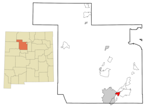
mapsize = 250px
map_caption = Location of Bernalillo, New Mexico
mapsize1 =
map_caption1 =subdivision_type = Country
subdivision_name =United States
subdivision_type1 = State
subdivision_name1 =New Mexico
subdivision_type2 = County
subdivision_name2 = Sandoval
government_footnotes =
government_type =
leader_title =
leader_name =
leader_title1 =
leader_name1 =
established_title =
established_date =unit_pref = Imperial
area_footnotes =area_magnitude =
area_total_km2 = 12.2
area_land_km2 = 11.9
area_water_km2 = 0.3
area_total_sq_mi = 4.7
area_land_sq_mi = 4.6
area_water_sq_mi = 0.1population_as_of = 2000
population_footnotes =
population_total = 6611
population_density_km2 = 554.8
population_density_sq_mi = 1436.9timezone = Mountain (MST)
utc_offset = -7
timezone_DST = MDT
utc_offset_DST = -6
elevation_footnotes =
elevation_m = 1540
elevation_ft = 5052
latd = 35 |latm = 18 |lats = 34 |latNS = N
longd = 106 |longm = 33 |longs = 7 |longEW = Wpostal_code_type =
ZIP code
postal_code = 87004
area_code = 505
blank_name = FIPS code
blank_info = 35-06970
blank1_name = GNIS feature ID
blank1_info = 0928691
website =
footnotes =Bernalillo is a town in
Sandoval County ,New Mexico , in theUnited States . As of the 2000 census, the town population was 6,611. It is thecounty seat ofSandoval County GR|6.Bernalillo is part of the Albuquerque Metropolitan Statistical Area.
Geography
Bernalillo is located at coor dms|35|18|34|N|106|33|7|W|city (35.309363, -106.552032)GR|1.
According to the
United States Census Bureau , the town has a total area of 4.7square mile s (12.2km² ), of which, 4.6 square miles (11.9 km²) of it is land and 0.1 square miles (0.3 km²) of it (2.34%) is water.Demographics
As of the
census GR|2 of 2000, there were 6,611 people, 2,309 households, and 1,724 families residing in the town. Thepopulation density was 1,436.9 people per square mile (554.9/km²). There were 2,473 housing units at an average density of 537.5/sq mi (207.6/km²). The racial makeup of the town was 60.17% White, 0.74% African American, 3.92% Native American, 0.20% Asian, 31.34% from other races, and 3.63% from two or more races. Hispanic or Latino of any race were 74.75% of the population.There were 2,309 households out of which 40.8% had children under the age of 18 living with them, 49.1% were married couples living together, 18.6% had a female householder with no husband present, and 25.3% were non-families. 20.2% of all households were made up of individuals and 6.9% had someone living alone who was 65 years of age or older. The average household size was 2.86 and the average family size was 3.30.
In the town the population was spread out with 31.0% under the age of 18, 9.9% from 18 to 24, 28.5% from 25 to 44, 21.4% from 45 to 64, and 9.2% who were 65 years of age or older. The median age was 32 years. For every 100 females there were 93.9 males. For every 100 females age 18 and over, there were 91.4 males.
The median income for a household in the town was $30,864, and the median income for a family was $36,286. Males had a median income of $27,417 versus $22,125 for females. The
per capita income for the town was $13,100. About 13.9% of families and 18.2% of the population were below thepoverty line , including 25.4% of those under age 18 and 16.3% of those age 65 or over.Cultural references
Acoma is mentioned in
Willa Cather 's 1927 novel "Death Comes for the Archbishop ", Book Three Chapter 4.References
External links
Wikimedia Foundation. 2010.