- Cochiti, New Mexico
-
Cochiti, New Mexico — CDP — 
FlagLocation of Cochiti, New Mexico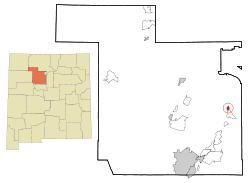
Country United States State New Mexico County Sandoval Area - Total 1.2 sq mi (3.1 km2) - Land 1.2 sq mi (3.1 km2) - Water 0.0 sq mi (0.0 km2) Elevation 5,276 ft (1,608 m) Population (2000) - Total 507 - Density 425.9/sq mi (164.4/km2) Time zone Mountain (MST) (UTC-7) - Summer (DST) MDT (UTC-6) Area code(s) 505 FIPS code 35-16560 GNIS feature ID 1867383 Website http://www.pueblodecochiti.org/ Cochiti Pueblo

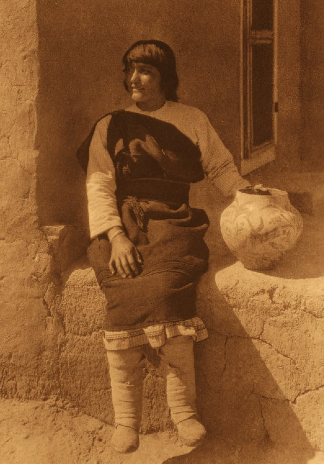
Nearest city: Cochiti, New Mexico Coordinates: 35°36′32″N 106°20′41″W / 35.60889°N 106.34472°WCoordinates: 35°36′32″N 106°20′41″W / 35.60889°N 106.34472°W Built: 1250 Architect: Fr. Juan de Rozas Architectural style: Pueblo Governing body: Private NRHP Reference#: 74001205[1] Added to NRHP: November 20, 1974 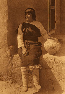 Aiyowitsa, a young woman from Cochiti Pueblo, circa 1925?
Cochiti (
 /ˈkoʊtʃəti/; Eastern Keresan: Kotyit) is a census-designated place (CDP) in Sandoval County, New Mexico, United States. It is part of the Albuquerque Metropolitan Statistical Area. The population was 507 at the 2000 census.
Located 22 miles (35 km) south of Santa Fe, the community is a historic pueblo, which is listed as a historic district on the National Register of Historic Places.[1] The Cochiti pueblo people are a federally recognized tribe of Native Americans; they speak an eastern Keresan language, which is an isolate. The pueblo administers 53,779 acres (217.64 km2) of reservation land and possesses concurrent jurisdiction over the Kasha-Katuwe Tent Rocks National Monument.
The pueblo celebrates the annual feast day for its patron saint, San Buenaventura, in July.
Contents
Geography
Cochiti is located at 35°36′32″N 106°21′1″W / 35.60889°N 106.35028°W (35.608876, -106.350226)[2].
According to the United States Census Bureau, the CDP has a total area of 1.2 square miles (3.1 km2), all of it land.
Demographics
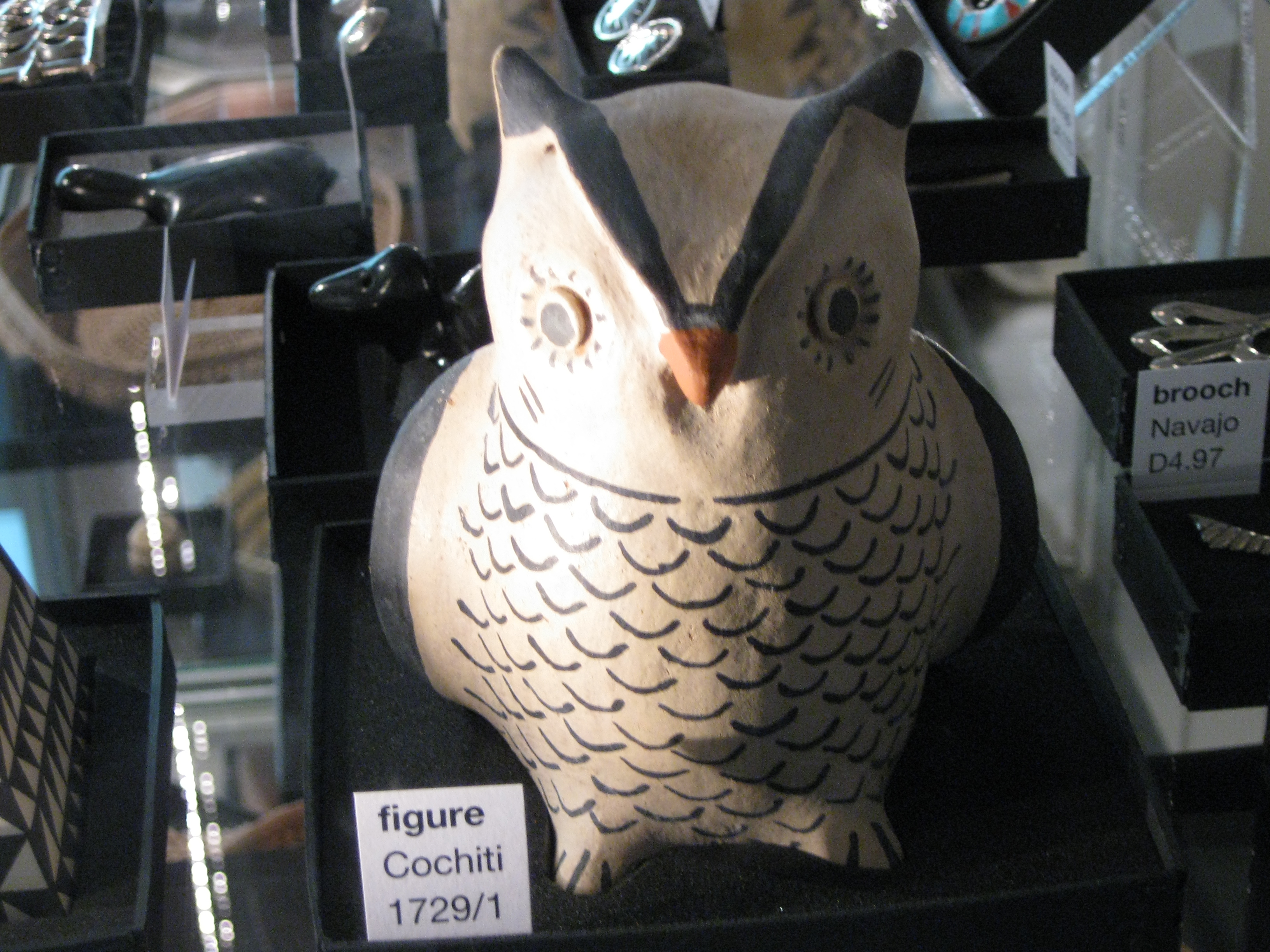
 Cochiti owl figure.
As of the census[3] of 2000, there were 507 people, 143 households, and 116 families residing in the CDP. The population density was 425.9 people per square mile (164.5/km²). There were 176 housing units at an average density of 147.9 per square mile (57.1/km²). The racial makeup of the CDP was 95.27% Native American, 2.37% White, 0.59% from other races, and 1.78% from two or more races. Hispanic or Latino of any race were 3.16% of the population.
There were 143 households out of which 31.5% had children under the age of 18 living with them, 49.0% were married couples living together, 21.7% had a female householder with no husband present, and 18.2% were non-families. 18.2% of all households were made up of individuals and 7.0% had someone living alone who was 65 years of age or older. The average household size was 3.55 and the average family size was 3.99.
In the CDP the population was spread out with 29.2% under the age of 18, 11.0% from 18 to 24, 25.2% from 25 to 44, 18.9% from 45 to 64, and 15.6% who were 65 years of age or older. The median age was 32 years. For every 100 females there were 84.4 males. For every 100 females age 18 and over, there were 83.2 males.
The median income for a household in the CDP was $31,875, and the median income for a family was $37,500. Males had a median income of $19,231 versus $21,641 for females. The per capita income for the CDP was $9,153. About 21.4% of families and 20.9% of the population were below the poverty line, including 21.3% of those under age 18 and 11.8% of those age 65 or over.
See also
References
- ^ a b "National Register Information System". National Register of Historic Places. National Park Service. 2009-03-13. http://nrhp.focus.nps.gov/natreg/docs/All_Data.html.
- ^ "US Gazetteer files: 2010, 2000, and 1990". United States Census Bureau. 2011-02-12. http://www.census.gov/geo/www/gazetteer/gazette.html. Retrieved 2011-04-23.
- ^ "American FactFinder". United States Census Bureau. http://factfinder.census.gov. Retrieved 2008-01-31.
External links
- Official Pueblo de Cochiti website
- Cochiti Pueblo
- "Cochití Pueblo", New Mexico Tourism Dept. website
U.S. National Register of Historic Places Topics Lists by states Alabama • Alaska • Arizona • Arkansas • California • Colorado • Connecticut • Delaware • Florida • Georgia • Hawaii • Idaho • Illinois • Indiana • Iowa • Kansas • Kentucky • Louisiana • Maine • Maryland • Massachusetts • Michigan • Minnesota • Mississippi • Missouri • Montana • Nebraska • Nevada • New Hampshire • New Jersey • New Mexico • New York • North Carolina • North Dakota • Ohio • Oklahoma • Oregon • Pennsylvania • Rhode Island • South Carolina • South Dakota • Tennessee • Texas • Utah • Vermont • Virginia • Washington • West Virginia • Wisconsin • WyomingLists by territories Lists by associated states Other Municipalities and communities of Sandoval County, New Mexico City 
Town Villages Corrales | Cuba | Jemez Springs | San Ysidro
CDPs Algodones | Cochiti | Jemez Pueblo | La Jara | Pena Blanca | Placitas | Ponderosa | Pueblo of Sandia Village | Regina | San Felipe Pueblo | Santa Ana Pueblo | Santo Domingo Pueblo | Torreon | Zia Pueblo
Indian reservations Cochiti Pueblo‡ | Jemez Pueblo | Jicarilla Apache Indian Reservation‡ | Laguna Pueblo‡ | Navajo Nation‡ | San Felipe Pueblo | San Ildefonso Pueblo‡ | Sandia Pueblo‡ | Santa Ana Pueblo | Santa Clara Indian Reservation‡ | Santo Domingo Pueblo‡ | Zia Pueblo
Footnotes ‡This populated place also has portions in an adjacent county or counties
Categories:- Historic districts in New Mexico
- Populated places in Sandoval County, New Mexico
- Census-designated places in New Mexico
- National Register of Historic Places in New Mexico
- Native American tribes in New Mexico
- Populated places in New Mexico with Native American majority populations
- Albuquerque metropolitan area
- Pueblo great houses


Wikimedia Foundation. 2010.