- Zia Pueblo, New Mexico
Infobox Settlement
official_name = Zia Pueblo, New Mexico
settlement_type = CDP
nickname =
motto =
imagesize =
image_caption =
image_
imagesize =
image_caption =
image_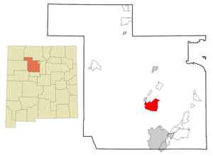
mapsize = 250px
map_caption = Location of Zia Pueblo, New Mexico
mapsize1 =
map_caption1 =subdivision_type = Country
subdivision_name =United States
subdivision_type1 = State
subdivision_name1 =New Mexico
subdivision_type2 = County
subdivision_name2 = Sandoval
government_footnotes =
government_type =
leader_title =
leader_name =
leader_title1 =
leader_name1 =
established_title =
established_date =unit_pref = Imperial
area_footnotes =area_magnitude =
area_total_km2 = 70.8
area_land_km2 = 70.7
area_water_km2 = 0.1
area_total_sq_mi = 27.3
area_land_sq_mi = 27.3
area_water_sq_mi = 0.0population_as_of = 2000
population_footnotes =
population_total = 646
population_density_km2 = 9.1
population_density_sq_mi = 23.7timezone = Mountain (MST)
utc_offset = -7
timezone_DST = MDT
utc_offset_DST = -6
elevation_footnotes =
elevation_m = 1668
elevation_ft = 5472
latd = 35 |latm = 30 |lats = 31 |latNS = N
longd = 106 |longm = 43 |longs = 21 |longEW = Wpostal_code_type =
ZIP code
postal_code = 87053
area_code = 505
blank_name = FIPS code
blank_info = 35-86420
blank1_name = GNIS feature ID
blank1_info = 0928840
website =
footnotes =Zia Pueblo (Eastern Keres: Tsi'ya, Spanish: Zía Pueblo) is a
census-designated place (CDP) in Sandoval County,New Mexico ,United States . The population was 646 at the 2000 census. The pueblo after which the CDP is named is included within the CDP.Zia Pueblo is part of the Albuquerque Metropolitan Statistical Area.
Geography
Zia Pueblo is located at coor dms|35|30|31|N|106|43|21|W|city (35.508657, -106.722576).GR|1
According to the
United States Census Bureau , the CDP has a total area of 27.3 mi² (70.8km² ). 27.3 mi² (70.7 km²) of it is land and 0.04 mi² (0.1 km²) of it (0.15%) is water.Demographics
As of the
census GR|2 of 2000, there were 646 people, 155 households, and 137 families residing in the CDP. Thepopulation density was 23.7 people per square mile (9.1/km²). There were 189 housing units at an average density of 6.9/sq mi (2.7/km²). The racial makeup of the CDP was 99.85% Native American, and 0.15% from two or more races. Hispanic or Latino of any race were 0.46% of the population.There were 155 households out of which 43.9% had children under the age of 18 living with them, 43.9% were married couples living together, 37.4% had a female householder with no husband present, and 11.0% were non-families. 10.3% of all households were made up of individuals and 1.3% had someone living alone who was 65 years of age or older. The average household size was 4.17 and the average family size was 4.38.
In the CDP the population was spread out with 34.8% under the age of 18, 12.4% from 18 to 24, 28.5% from 25 to 44, 18.3% from 45 to 64, and 6.0% who were 65 years of age or older. The median age was 27 years. For every 100 females there were 92.3 males. For every 100 females age 18 and over, there were 87.1 males.
The median income for a household in the CDP was $34,583, and the median income for a family was $37,679. Males had a median income of $20,313 versus $19,271 for females. The
per capita income for the CDP was $8,689. About 15.0% of families and 15.4% of the population were below thepoverty line , including 18.6% of those under age 18 and 9.1% of those age 65 or over.References
External links
* [http://www.nps.gov/history/nr/travel/amsw/ American Southwest, a National Park Service "Discover Our Shared Heritage" Travel Itinerary]
Wikimedia Foundation. 2010.