- Jemez Pueblo, New Mexico
Infobox Settlement
official_name = Jemez Pueblo, New Mexico
settlement_type = CDP
nickname =
motto =
imagesize =
image_caption =
image_
imagesize =
image_caption =
image_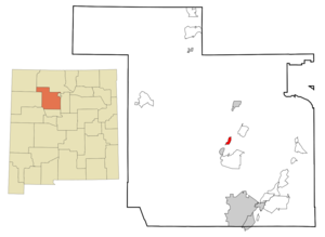
mapsize = 250px
map_caption = Location of Jemez Pueblo, New Mexico
mapsize1 =
map_caption1 =subdivision_type = Country
subdivision_name =United States
subdivision_type1 = State
subdivision_name1 =New Mexico
subdivision_type2 = County
subdivision_name2 = Sandoval
government_footnotes =
government_type =
leader_title =
leader_name =
leader_title1 =
leader_name1 =
established_title =
established_date =unit_pref = Imperial
area_footnotes =area_magnitude =
area_total_km2 = 5.3
area_land_km2 = 5.3
area_water_km2 = 0.0
area_total_sq_mi = 2.0
area_land_sq_mi = 2.0
area_water_sq_mi = 0.0population_as_of = 2000
population_footnotes =
population_total = 1953
population_density_km2 = 369.5
population_density_sq_mi = 957.0timezone = Mountain (MST)
utc_offset = -7
timezone_DST = MDT
utc_offset_DST = -6
elevation_footnotes =
elevation_m = 1708
elevation_ft = 5604
latd = 35 |latm = 36 |lats = 38 |latNS = N
longd = 106 |longm = 43 |longs = 39 |longEW = Wpostal_code_type =
ZIP code
postal_code = 87024
area_code = 505
blank_name = FIPS code
blank_info = 35-35250
blank1_name = GNIS feature ID
blank1_info = 0928742
website =
footnotes = Infobox_nrhp | name =Jemez Pueblo
nrhp_type =

caption =Jemez Pueblo, 1850 illustration
nearest_city=Bernalillo, New Mexico
area =
built =1700
architecture= Late Victorian, Pueblo, Other
added =May 02 ,1977
governing_body = Private
refnum=77000926 cite web|url=http://www.nr.nps.gov/|title=National Register Information System|date=2006-03-15|work=National Register of Historic Places|publisher=National Park Service]Jemez Pueblo (Towa: Walatowa, pronEng|ˈheɪməs) is a
census-designated place (CDP) in Sandoval County,New Mexico ,United States . The population was 1,953 at the 2000 census. It is part of the Albuquerque Metropolitan Statistical Area.The CDP is named after the
pueblo at its center. Among its locals it is known as "Walatowa" [cite web|url=http://www.jemezpueblo-drp.org/POJ.htm|title=The Pueblo of Jemez|date=2008-04-14|publisher=Department of Resource Protection] .Geography
Jemez Pueblo is located at coor dms|35|36|38|N|106|43|39|W|city (35.610435, -106.727509)GR|1.
According to the
United States Census Bureau , the CDP has a total area of 5.3km² . There is no water on this piece of land.Demographics
As of the
census GR|2 of 2000, there were 1,953 people, 467 households, and 415 families residing in the CDP. Thepopulation density was 957.0 people per square mile (369.6/km²). There were 499 housing units at an average density of 244.5/sq mi (94.4/km²). The racial makeup of the CDP was 0.41% White, 99.13% Native American, 0.31% from other races, and 0.15% from two or more races. Hispanic or Latino of any race were 1.95% of the population.There were 467 households out of which 39.0% had children under the age of 18 living with them, 39.2% were married couples living together, 35.1% had a female householder with no husband present, and 11.1% were non-families. 9.9% of all households were made up of individuals and 2.8% had someone living alone who was 65 years of age or older. The average household size was 4.18 and the average family size was 4.45.
In the CDP the population was spread out with 35.0% under the age of 18, 11.1% from 18 to 24, 28.8% from 25 to 44, 18.4% from 45 to 64, and 6.7% who were 65 years of age or older. The median age was 28 years. For every 100 females there were 94.7 males. For every 100 females age 18 and over, there were 86.9 males.
The median income for a household in the CDP was $28,889, and the median income for a family was $30,880. Males had a median income of $20,964 versus $17,262 for females. The
per capita income for the CDP was $8,045. About 27.2% of families and 25.5% of the population were below thepoverty line , including 27.1% of those under age 18 and 34.6% of those age 65 or over.Jemez Runners
As much as 70% of the 1,890 Jemez Indians were living on their reservation lands in the early 1970s. Though by then an increasing number were switching to wage-earning work rather than agriculture, the residents continued to raise chili peppers, corn, and wheat, to speak their native language, and to maintain customary practices.
Running, an old Jemez pastime and ceremonial activity, grew even more popular than it had been before World War II. Prior to the advent of television at Jemez, tales of running feats had been a major form of entertainment on winter nights. Races continued to hold their ceremonial place as the years passed, their purpose being to assist the movement of the sun and moon or to hasten the growth of crops, for example. At the same time, they became a popular secular sport. The year 1959 saw the first annual Jemez All-Indian Track and Field Meet, won by runners from Jemez seven times in the first ten years. A Jemez runner, Steve Gachupin, won the
Pikes Peak Marathon in 1968, the year the novel was published, setting a record by reaching the top in just 2 hours, 14 minutes, 56 seconds.ee also
*
Jemez State Monument References
External links
* [http://www.jemezpueblo.org/ Pueblo of Jemez website]
Wikimedia Foundation. 2010.