- Navajo Nation
-
Navajo Nation
Naabeehó Bináhásdzo
(Diné Bikéyah)— Reservation — 
Flag
SealAnthem: none
Dah Naatʼaʼí Sǫʼ bił Sinil
used for some occasions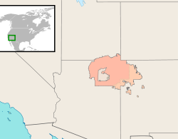
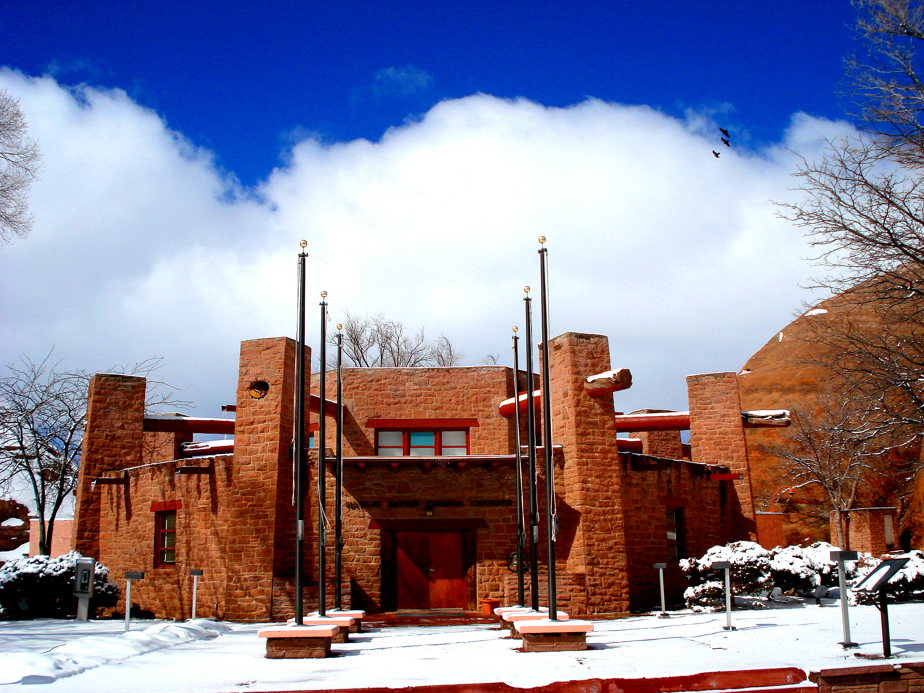
Established June 1, 1868 (Treaty) Expansions 1878–1930 Chapter system 1922 Tribal Council 1923 Capital Window Rock
(Tségháhoodzání)Subdivisions 5 AgenciesGovernment – Body Navajo Nation Council – President Ben Shelly – Vice-President Rex Lee Jim Area – Total 71,000 km2 (27,425 sq mi) Population (2000)Enrolled tribal members – Total 173,987 – Density 2.5/km2 (6.3/sq mi) Time zone MT/MDT Website www.navajo-nsn.gov The Navajo Nation (Navajo: Naabeehó Bináhásdzo) is a semi-autonomous Native American-governed territory covering 27,425 square miles (71,000 km2), occupying all of northeastern Arizona, the southeastern portion of Utah, and northwestern New Mexico. It is the largest land area assigned primarily to a Native American jurisdiction within the United States.
Contents
Name
In English, the initial name for the area was "Navajo Indian Reservation," governed since 1923 by the "Navajo Tribal Council." On April 15, 1969, the official name on the seal used by the government was changed to "Navajo Nation," stating that from that day on "all correspondence, stationary [sic], letterheads [...] of the Navajo Tribe use the designation 'Navajo Nation' to locate the tribe."[1] In 1994, a proposal to change the official designation from "Navajo" to "Diné" was rejected by the council. They said the name Diné represented the time of suffering before the Long Walk, and that Navajo is the appropriate designation for the future.[2]
In Navajo, the geographic entity with its legally defined borders is known as "Naabeehó Bináhásdzo." This contrasts with "Diné Bikéyah" and "Naabeehó Bikéyah" for the general idea of "Navajoland."[3] More importantly, neither of these designations should be confused with "Dinétah," the term used for the traditional homeland of the Navajo people, situated in the area between the mountains Dookʼoʼoosłííd (San Francisco Peaks), Dibé Ntsaa (Hesperus Mountain), Sisnaajiní (Blanca Peak), and Tsoodził (Mount Taylor).
History
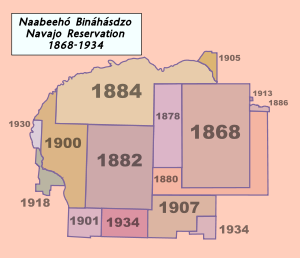 Border changes and expansions of the Navajo Reservation from 1868 to 1934
After the Long Walk and the Navajos' return from their imprisonment in Bosque Redondo, the "Navajo Indian Reservation" was established according to the Treaty of 1868. The borders were defined as the 37th parallel Northern latitude in the North; the southern border as a line running through Fort Defiance; the eastern border as a line running through Fort Lyon; and in the West as longitude 109°30′.[4] Though the treaty had provided for one hundred miles square in the New Mexico Territory, the actual size of the territory was only 3,328,302 acres[4] — slightly more than half. This initial piece of land is represented in the design of the Navajo Nation's flag by a dark-brown rectangle.[5]
However, due to the fact that no physical boundaries or signposts were set in place, many Navajos ignored these formal boundaries and returned to where they had been prior to captivity.[4] A significant population of Dine' still resided along the Little Colorado & Colorado Rivers as well as on Naa'tsis'aan (Navajo Mountain), never suffering in the concentration camps at Hweeldi (Ft. Sumner).
The first expansion of the territory occurred on October 28, 1878, when President Rutherford Hayes signed an executive order pushing the boundary 20 miles to the West.[4] Further additions followed throughout the late 19th and early 20th century (see map). Most of these additions originated in executive orders, some of which were confirmed by acts of Congress; for example, the executive order which added the region around Aneth in 1905 was later confirmed by Congress in 1933.[6]
The history of the Eastern border was mostly shaped by the Dawes Act of 1887. In an attempt to "civilize" Native Americans, the federal government divided selected tribal lands into small parcels (allotments) and promised U.S.-citizenship to those who had been deemed successful at farming the land according to the standards of the time. Unfarmed or "unsuccessfully" farmed parcels were subsequently declared "unclaimed" and auctioned off to Anglo-American settlers. The program continued until 1934. While the Navajo reservation proper was excluded from the act's provisions, the result for the Eastern border was a patchwork of reservation and non-reservation land, known as the "checkerboard" area.[7]
Politics
Background Navajo Nation
Alamo · Ramah · Tohajiilee
Navajo Nation Council
Council Chamber · ChaptersPresidential Elections 2006 · 2010 Presidents and Vice-Presidents Peterson Zah 1991–1994
Marshall Plummer
Albert Hale 1994–1998
Thomas Atcitty
Thomas Atcitty 1998–1999
(vacant)
Milton Bluehouse, Sr. 1999
(vacant)
Kelsey A. Begaye 1999–2003
Taylor McKenzie
Joe Shirley, Jr.2003–2011
Ben Shelly · Frank Dayish Jr.
Ben Shelly 2011–present
Rex Lee JimAs reorganized in 1991, the Nation's government has a three branch system: Executive, Legislative, and Judicial.
History
Rejection of Indian Reorganization Act
The Navajo government has refused three times to establish a new government under the Indian Reorganization Act of 1934. Members twice rejected constitutional initiatives offered by the federal government in Washington, first in 1935 and again in 1953. An initiative in 1963 failed after some members found the process to be too cumbersome and a potential threat to their self-determination. A constitution was drafted and adopted by the governing council but never ratified by the members. The earlier efforts were rejected primarily because members did not find enough freedom in the proposed forms of government to develop their livestock industries, in 1935, and their mineral resources, in 1953.
Constitution
In 2006, a Committee for a Navajo Constitution started to advocate for a Navajo constitutional convention. The committee's goal is to have representation from every chapter on the Navajo Nation represented at a constitutional convention. The committee proposes that the convention be held in the traditional na'achid/modern chapter house manner, where every member of the nation wishing to participate may do so through their home chapters. The committee was formed by three former Navajo Leaders; Kelsey Begaye, Peterson Zah, Peter MacDonald, writer/social activist Ivan Gamble, and other local political activists, according to Indian Country Today.[8]
Jurisdiction
The United States still asserts plenary power to require the Navajo Nation to submit all proposed laws to the United States Secretary of the Interior for Secretarial Review, through the Bureau of Indian Affairs. Most conflicts and controversies between the federal government and the Nation are settled by negotiation and by political agreements. Laws of the Navajo Nation are currently codified in the Navajo Nation Code.
Lands within the exterior boundaries of The Navajo Nation are composed of Public, Tribal Trust, Tribal Fee, BLM, Private, State, and BIA Indian Allotment Lands. On the Arizona and Utah portion of the Navajo Nation, there are a few private and BIA Indian Allotments in comparison to New Mexico's portion which consists of a checkerboard pattern of all the aformentioned lands. The Eastern Agency, as it is referred to, consists of primarily Tribal Fee, BIA Indian Allotments, and BLM Lands. Although there are more Tribal Fee Lands in New Mexico, it is the intention of the Navajo Nation to convert most or all Tribal Fee Lands to Tribal Trust.
Executive
The Title II Amendment of 1989 established the Executive branch of the Navajo nation as an entity independent of the Council, as one part of a three branch government. It is headed by a president and vice-president who are elected every four years. It consists of several divisions, departments, offices, and programs as established by law which administer the laws of the Navajo Nation.[9]
Law enforcement
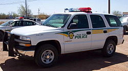 Navajo Police Chevy Tahoe
An important executive function for the Nation is law enforcement through the Navajo Division of Public Safety, with the Navajo Nation Police (formerly the "Navajo Tribal Police"). There is also law enforcement associated with the Navajo Nation Department of Fish and Wildlife: Wildlife Law Enforcement and Animal Control Sections; Navajo Nation Forestry Law Enforcement Officers; and the Navajo Nation EPA Criminal Enforcement Section,
Other local and federal law enforcement agencies that routinely work within the Navajo Nation include Navajo Nation Resource Enforcement (Navajo Rangers, the BIA Police (Ute Mountain Agency, Hopi Agency, and Division of Drug Enforcement); Apache County Sheriff's Office, McKinley County Sheriff's Office, US Marshals and the Federal Bureau of Investigation.
The Navajo governing council continues a historical practice of prohibiting alcohol sales within reservation boundaries. Leaders and some member groups actively oppose the sale of alcohol. They have taken several measures to find and offer treatment for residents suffering from alcoholism.
Legislative
Navajo Nation Council, formerly the Navajo Tribal Council, is the legislative branch of the Navajo Nation. As of 2010[update], the Navajo Nation Council consists of 24 delegates representing the 110 Chapters, elected every four years by registered Navajo voters. Prior to the November 2010 election, the Navajo Nation Council consisted of 88 representatives. The Navajo voted for the change in an effort to have a more efficient government and to curb tribal government corruption associated with council members who established secure seats.[10]
Judiciary
Prior to the Long Walk of the Navajo, Navajo judicial powers were exercised by peace chiefs (Hózhǫ́ǫ́jí Naatʼááh) in a mediation-style process.[11] While the people were held at Bosque Redondo, the U.S. Army handled severe crimes, while lesser crimes and disputes remained in the purview the villages chiefs. After the return from Bosque Redondo in 1868, listed offenses were handled by the Indian Agent of the Bureau of Indian Affairs with the support of the U.S. Army, while lesser disputes remained under Navajo control.
In 1892, BIA Agent David L. Shipley established the Navajo Court of Indian Offenses, and appointed its judges.[12] Prior to that, judicial authority had been exercised by the Indian Agent.[12]
In 1950, the Navajo Tribal Council decided that judges should be elected. By the time of the judicial reorganization of 1958, the Council had determined that, due to problems with delayed decisions and partisan politics, appointment was a better method of selecting judges.[13] The president makes appointments subject to confirmation by the Navajo Nation Council; however, the president is limited to the list of names vetted by the Judiciary Committee of the Council.[14]
The current judicial system for the Navajo Nation was created by the Navajo Tribal Council on 16 October 1958. It established a separate branch of government, the "Judicial Branch of the Navajo Nation Government," which became effective 1 April 1959.[15] The Navajo Court of Indian Offenses was eliminated; the sitting judges became judges in the new system. The resolution established "Trial Courts of the Navajo Tribe" and the "Navajo Tribal Court of Appeals," which was the highest court and the only appellate court.
In 1978, the Navajo Tribal Council established a "Supreme Judicial Council," a political body rather than a court. On a discretionary basis, it could hear appeals from the Navajo Tribal Court of Appeals.[16] Subsequently, the Supreme Judicial Council was criticized for bringing politics directly into the judicial system and undermining impartiality, fairness and equal protection.[17]
In December 1985, the Navajo Tribal Council passed the Judicial Reform Act of 1985, which eliminated the Supreme Judicial Council. It redenominated the "Navajo Tribal Court of Appeals" as the "Navajo Nation Supreme Court", and redenominated the "Trial Courts of the Navajo Tribe" as "District Courts of the Navajo Nation".[18] Navajo courts are governed by Title 7, "Courts and Procedures", of the Navajo Tribal Code.[18]
From 1988 to 2006, there were seven judicial districts and two satellite courts. As of 2010[update], there are ten judicial districts, centered respectively in Alamo (Alamo/Tó'hajiilee), Aneth, Chinle, Crownpoint, Dilkon, Kayenta, Ramah, Shiprock, Tuba City and Window Rock.[19] All of the districts also have family courts, which have jurisdiction over domestic relations, civil relief in domestic violence, child custody and protection, name changes, quiet title and probate. As of 2010[update], there were 17 trial judges presiding in the Navajo district and family courts.[20]
Local and Regional Government
In the traditional Navajo culture, local leadership was organized around clans, which are matrilineal kinship groups. The clan leadership roles have served as a de facto government on the local level of the Navajo reservation. In 1927, agents of the U.S. Federal government initiated a new form of local government entities called Chapters, modeled after government forms more familiar to the Federal agents, such as counties or townships. Each Chapter elected officers and followed parliamentary procedures. By 1933, more than 100 Chapters operated across the reservation. The chapters served as liaisons between the Navajo people and the federal government, and also acted as precincts for the elections of tribal council delegates. They also served as forums for local tribal leaders. But, the chapters had no authority within the structure of the Navajo Nation government. [21]
In 1998, the Council passed the "Local Governance Act," which extended the political roles of the existing 110 chapters, giving them authority to make decisions on behalf of the Chapter members and take over certain roles previously delegated to the Council and Executive branches. This included entering into intergovernmental agreements with federal, state and tribal entities, subject to approval by the Intergovernmental Relations Committee of the Council. In addition to the local Chapter government functions, regional government functions are carried out by the "District Grazing Committees" and "Off-Reservation Land Boards", "Major Irrigation Projects Farm Boards", and "Agency Councils".[22]
Geography
See also: Ramah Navajo Indian Reservation, Alamo Navajo Indian Reservation, and Tohajiilee Indian Reservation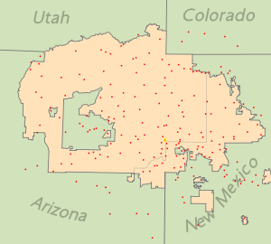 Map showing populated places on the Navajo Nation
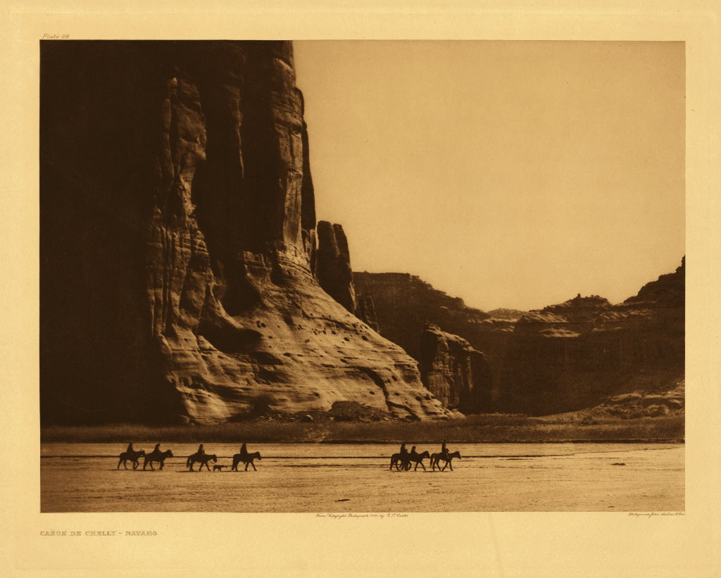
 Canyon de Chelly
The land area of the Navajo Nation is 24,078.127 square miles (62,362.06 km2), making it by far the largest Indian reservation in the United States; it is nearly the same size as the state of West Virginia.
Adjacent to or near the Navajo Reservation are the Southern Ute of Colorado, the Ute Mountain Ute Tribe of Colorado, Utah, and New Mexico, both to the north; the Jicarilla Apache to the east, and other tribes to the west and south. The Navajo Nation's territory surrounds the Hopi Indian Reservation. A conflict over shared lands emerged in the 1980s, when the Department of the Interior attempted to relocate Diné living in the Navajo/Hopi Joint Use Area. The conflict was resolved, or at least forestalled, by the award of a 75-year lease to Navajos who refused to leave the former shared lands.
Situated within the Navajo Nation are Canyon de Chelly National Monument, Monument Valley, Rainbow Bridge National Monument, and the Shiprock landmark. The eastern portion of the reservation, in New Mexico, is popularly called the "Checkerboard" because Navajo lands are mingled with fee lands, owned by both Navajos and non-Navajos, and federal and state lands under various jurisdictions. Three large non-contiguous sections entirely surrounded by New Mexico are also under Navajo jurisdiction: the Ramah Navajo Indian Reservation, the Alamo Navajo Indian Reservation, and the Tohajiilee Indian Reservation.
The Tribal Trust lands have no private land ownerships, and all Tribal Trust land is owned in common and administered by the Nation's government. On the other hand, BIA Indian Allotment lands are privately owned by the heirs and generations of the original BIA Indian Allotee to whom it was issued. With Tribal Trust lands, leases are made both to customary land users (for homesites, grazing, and other uses) and organizations, which may include BIA and other federal agencies, churches and other religious organizations, as well as private or commercial businesses.
Administrative divisions
The Navajo Nation is divided into five agencies, with the seat of government located in Window Rock/Tségháhoodzání. These agencies are similar to provincial entities and match the five Bureau of Indian Affairs (BIA) agencies. The five agencies within the Navajo Indian Reservation are Chinle Agency, Eastern Navajo Agency, Western Navajo Agency, Fort Defiance Agency, and Shiprock Agency. The BIA agencies provide various technical services under direction of the BIA's Navajo Area Office in Gallup, New Mexico. Agencies are further divided into Chapters, similar to counties, as the smallest political unit.
Daylight Saving Time
The Nation is the only region within the state of Arizona that observes Daylight Saving Time (DST); it does this to have consistency among its peoples, as some of the Nation is located within the boundaries of two other states that observe DST. The remainder of Arizona, including the Hopi Reservation, is the only area of the continental United States that does not change its clocks.[23]
Demographics
See also: List of communities on the Navajo NationTribal membership and citizenship
The number of enrolled members of the Navajo Nation is 300,048, as of July 2011.[24] The 2000 census reported 173,987 Navajo citizens, 58.34% of all ethnic Navajos, living on the Navajo Nation's territory.
The Navajo Nation requires a blood quantum of one-quarter for a person to be eligible for enrollment as a member, the equivalent of one grandparent, or having one of four Diné clans, to be and to receive a Certificate of Indian Blood (CIB). In 2004, the Navajo Nation Council voted down a proposal to reduce the blood quantum to one-eighth, which would have effectively doubled the number of individuals qualified to be enrolled Navajo tribal members.
Minorities
Minorities include Anglo-Americans and Hopi, as well as the Paiute around the area of Navajo Mountain. They were federally recognized as the San Juan Paiute tribe in 1980, separate from the Southern Paiute.
Education
Historically the Navajo Nation resisted compulsory education, including boarding schools, as imposed by General Richard Henry Pratt.[25]
Nowadays, education, and the retention of students in all school systems, is a significant priority. A major problem faced by the nation is a very high drop-out rate among high school students. Over 150 public, private and Bureau of Indian Affairs schools serve students from kindergarten through high school. Most schools receive funding from the Navajo Nation under the Johnson O’Malley program.
The Nation also runs a local Head Start, the only educational program operated by the Navajo Nation government. Post-secondary education and vocational training are available on and off the reservation. Kurt Caswell, a well-known writer and professor at Texas Tech University, taught at the Borrego Pass School on the Navajo Reservation. He wrote a memoir, In the Sun's House: My Year on the Navajo Reservation (2009) about his life- changing experiences during that time.
Because drop-out rates are high on the Navajo Nation, the people have adopted programs such as the Literacy is Empowering Project to help combat academic problems. The non-profit project promotes literacy and pre-reading skills for Native children to increase their understanding of standard academic language.[26]
The Navajo Nation Board of Education is an 11-member board to oversee the operations of schools on the Navajo Nation and exercise regulatory functions and duties over its education programs. It was established by the Navajo Nation education code, Title 10 which was enacted in July 2005 by Navajo Nation Council.[27]
The board acts to promote the goals of the Navajo Sovereignty in Education Act of 2005 which include the establishment and management of a Navajo Nation Department of Diné Education, to confirm the commitment of the Navajo Nation to the education of the Navajo People, to repeal obsolete language, and to update and reorganize the existing language of Titles 10 and 2 of the Navajo Nation Code.
The Navajo Nation is committed to promoting lifelong learning for the Navajo people, and to protecting its cultural integrity and sovereignty. A Navajo Nation Board of Education meeting is scheduled the first Friday of every month.
Secondary education
The Nation has six types of secondary establishments, including:
- Eight Arizona Public Schools
- New Mexico Public Schools
- Utah Public Schools
- Bureau of Indian Affairs Public Schools
- Association of Navajo-Controlled Schools
- Navajo Preparatory School, Inc.
Navajo Preparatory School is the only Navajo-sanctioned, college-preparatory school for Native Americans. Its goals are to offer students a challenging, innovative curriculum in science, math, computers, and other traditional academic subjects, as well as to help the youth gain a deep appreciation of the Navajo Language, culture, and history.[28]
Located in Farmington, New Mexico, a few miles outside the Navajo reservation, its mission is "To educate talented and motivated college-bound Navajo and other Native American youth who have the potential to succeed in higher education and become leaders in their respective communities."
Diné College
The Navajo Nation operates Diné College, a two-year community college which has its main campus in Tsaile in Apache County, as well as seven other campuses on the reservation. The Navajo Nation founded the college in 1968 as the first tribal college in the nation.[29] Since then, tribal colleges have been established on numerous reservations and now total 32.[29]
Current enrollment at Diné College is 1,830 students, of which 210 are degree-seeking transfer students for four-year institutions. The college includes the Center for Diné Studies. Its goal is to apply Navajo Sa'ah Naagháí Bik'eh Hózhóón principles to advance quality student learning through Nitsáhákees (thinking), Nahat'á (planning), Iiná (living), and Siihasin (assurance) in study of the Diné language, history, and culture. Students are prepared for further studies and employment in a multi-cultural and technological world.
Health
See also: Uranium mining and the Navajo peopleFor a people who historically had almost no cases,[citation needed] currently several types of cancer are in evidence at rates higher than the national average on the Four Corners Navajo Reservation. (Raloff, 2004) Especially high are the rates of reproductive-organ cancers in teenage Navajo girls, averaging seventeen times higher than the average of girls in the United States.
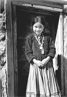
 Navajo woman & child
It has been suspected that uranium mines, both active and abandoned, have released dust into the surrounding air and the water supply. Studies done on mice, exposing them to a soluble form of uranium similar to what might enter groundwater from the mines, showed heavy increases in estrogen levels, which might explain the increased cancer levels among Navajo girls. The amount of uranium given to the mice was half the level permitted by the United States Environmental Protection Agency, and one-tenth the level found in some wells on the Navajo reservation.
Diabetes mellitus is a major health problem among the Navajo, Hopi and Pima tribes, about four times higher than the age-standardized U.S. estimate. Medical researchers believe increased consumption of carbohydrates, coupled with genetic factors, play significant roles in the emergence of this chronic disease among Native Americans.[30]
One in every 2,500 children in the Navajo population inherits severe combined immunodeficiency (SCID), a genetic disorder that results in children with virtually no immune system. In the general population, the genetic disorder is much more rare, affecting one in 100,000 children. The disorder is sometimes known as "bubble boy disease." This condition is a significant cause of illness and death among Navajo children. Research reveals a similar genetic pattern among the related Apache people. In a December 2007 Associated Press article, Mortan Cowan, M.D., director of the Pediatric Bone Marrow Transplant Program at the University of California-San Fransciso, noted that, although researchers have identified about a dozen genes that cause SCID, the Navajo/Apache population has the most severe form of the disorder. This is due to the lack of a gene designated "Artemis." Without the gene, children's bodies are unable to repair DNA or develop disease-fighting cells. (Fonseca, Salt Lake Tribune, B10)
Economy
In recent historical times, the Navajo economy was based on sheep and cattle herding, wool and yarn production, blanket and rug production, and turquoise and silver jewelry making. More recently additional arts such as sand painting, feather work, pottery and others have been added.
Mining, especially of coal and uranium, provided significant income to the tribe in the second half of the 20th century. The uranium market slowed near the end of that period, and the Nation has suffered considerable environmental contamination from poorly regulated mines. As of 2005, it has prohibited further uranium mining. The volume of coal mined has declined in the early 21st century. "The Navajo Nation's extensive mineral resources[31] are among the most valuable held by Native American nations within the United States."[32]
An important business within the reservation is the operation of handmade arts and crafts shops to sell the high-quality goods made by the people. A 2004 study by the Navajo Division of Economic Development found that at least 60 percent of all families have at least one member making arts and crafts.[citation needed] The Navajo work at stores and other businesses on the reservation or in nearby towns, and the Navajo government employs thousands in civil service and administrative jobs.
Until 2004, the Navajo Nation declined to join other Native American nations within the United States that had opened gambling casinos. That year, the nation signed a compact with New Mexico to operate a casino at To'hajiilee, near Albuquerque. Navajo leaders also negotiated with Arizona officials for casinos near Flagstaff, Lake Powell, Winslow, Sanders (Nahata Dziil Chapter), and Cameron (the Grand Canyon entrance). The Dine Development Corporation was formed in 2004 to promote Navajo business and seek viable business development to make use of casino revenues.[33]
The Black Mesa and Lake Powell railroad serves one of the coal mines in the Diné region, carrying coal to the Navajo Generating Station at Page, Arizona. Peabody Energy's Black Mesa coal mine near Kayenta, a controversial strip mine, was shut down on December 31, 2005 for its emission credits. This mine had fed the Mohave Power Station at Laughlin, Nevada, via a slurry pipeline that used water from the Black Mesa aquifer.
In early 2008, the Navajo Nation and Houston-based IPP entered into an agreement to monitor wind resources, with the potential to build a 500-megawatt wind farm some 50 miles (80 km) north of Flagstaff. Known as the Navajo Wind Project, it will be the second commercial wind farm in Arizona after Iberdrola's Dry Lake development. The Navajo Council approved the development by overriding a tribal presidential veto in December 2010. Disagreement between the central Navajo government and the local Navajo Cameron Chapter have led to confusion as to whether the development will be built.
The unemployment level fluctuates between an overall 40 and 45 percent for the nation of reported taxed income. In some communities, it can go as high as 85 percent or as low as 15 percent.[34]
Utah Dineh Corporation Inc
The Utah Diné Corporation is a nonprofit organization established in order to maintain the Utah Navajo Oil Reserve revenues in the Aneth Oil Field section of Utah. Much of this area is within the Utah Navajo side of San Juan County, Utah.
The Special Trustee for American Indians testified to the House Committee on Natural Resources and stated that his office did not have the capacity to administer the Utah Navajo Trust Fund in a manner required by the 1933 Act.[citation needed] The Utah Diné Corporation was established in order to maintain the Utah Navajo Oil Royalties after passage of Senate Bill 1690, proposed and sponsored by US Senator Robert Bennett (R-UT). It was to amend the Act of March 1, 1933, to transfer certain authority and resources to the Utah Diné Corporation, and for other purposes. [35]
The Navajo Nation does not tax corporate income, inventories, and personal income. Additionally, the Nation does not have property or unemployment tax (although this is subject to change). In general, taxation on the Navajo Nation is lower in comparison to other places in the United States. This is particularly true for businesses which are newly established or which have expanded their operation onto the Navajo Nation. There are a number of federal and state tax incentives currently in place.
Currently, the Navajo Nation charges a 4 percent tax on all retail sales; all local business on the Navajo Nation pay this amount.[36]
Housing and transportation
The Navajo Housing Authority, the tribally designated housing entity for the Navajo Nation, has begun construction of new homes on the Navajo Nation with new materials which are more cost-effective and less prone to fire damage. NHA housing developments exist among the six agencies of the Navajo Nation. Many families build scattered-site homes on their traditional homesite lease.
Hooghan means the home for Navajos, and it is the center of learning. The traditional style of home of the Navajo is the hogan. Most modern housing in the Navajo Nation is built as detached single-family homes and mobile homes. Most homes in the Navajo Nation were built in the 1960s, 1970s, or 1980s, although older built homes do exist. Single-family homes are mostly rural-styled homes constructed of wood. Because many homes do not have access to natural gas and electricity, most homes use wood or propane for heat and cooking. Due to the reservation's remote geographic location, many structures do not have telephone or public utility services; they also may lack complete kitchen or plumbing facilities. But the nation has developed more infrastructure through the years, affording Navajo families the modern conveniences of DSL, satellite television and wireless access in some communities. The government-subsidized phone program has brought the most remote locations of the reservation in contact with the rest of the Navajo Nation.
Roads within the reservation vary in condition. Most federally operated U.S. highways are in excellent condition year-round and are suitable for vehicles of any size. Roads are generally unpaved in many rural areas and small villages. In the central parts of the Navajo Nation, near the Black Mesa (Arizona), roads are often poorly maintained, and are sometimes in nearly unusable condition after very heavy rains. In general, except for the most remote regions, road conditions in the Navajo Nation are usually acceptable for routine use.
- Speaker Johnny Naize, 22nd Council
- Katherine Benally, Chairwoman Resource & Development Committee, 22nd Council
- Lorenzo Bates, Chairman Budget & Finance Committee, 22nd Council
- Leonard Tsosie, Navajo Nation Councilman (Whitehorse/Torreon//Pueblo Pintado) / Former State Senator – District 22, New Mexico Senate
- Henry Chee Dodge, first Chairman of Navajo Tribal Council, 1922-1928 and Chairman 1942-1946
- Annie Dodge Wauneka, former Navajo Tribal Councilwoman, 1951-1978
- Edward T. Begay, former Navajo Nation Speaker (Churchrock/Baahali)
- Lilakai Julian Neil, First woman elected to Tribal Council, 1946-1951
- Annie Deschiney, former Navajo Nation Councilwoman (Churchrock/Baahaali)
- Peter MacDonald, Former Navajo Tribal Chairman
- Ben Shelly, President of the Navajo Nation (2011–Present)
- Joe Shirley Jr., President of the Navajo Nation (2003–2010)
References
- ^ "Navajo oppose name change", Indian Country Today, 12 January 1994
- ^ Young, Robert W & William Morgan, Sr. The Navajo Language. A Grammar and Colloquial Dictionary. University of New Mexico Press. Albuquerque, NM: 1987.
- ^ a b c d Iverson, Peter & Monty Roessel. Diné: a history of the Navajos. University of New Mexico Press. Albuquerque, NM: 2002. page 68ff.
- ^ History. Government of the Navajo Nation. Accessed 2010-11-05.
- ^ Hubbell Trading Post. Site History. nps.gov. Accessed 2010-11-05.
- ^ Lee, Tanya. "Navajo group begins process of crafting a constitution", Indian Country Today. 19 June 2006 (retrieved 5 Oct 2009)
- ^ 2 Navajo Nation Code §§ 1001, 1002, 1003, 1005 (1995
- ^ "Majority of Diné vote for 24-member council, line-item veto for president", The Navajo Times Online
- ^ Yazzie, Robert (11 February 2003) "History of the Courts of the Navajo Nation" Navajo Nation Museum, Library & Visitor Center, archived 3 November 2010 at FreezePage
- ^ a b Austin, Raymond Darrel (2009), "The Navajo Nation court system", pp. 1&ndash36, page 21 In Austin, Raymond Darrel (2009) Navajo Courts and Navajo Common Law: A Tradition of Tribal Self-Governance University of Minnesota Press, Minneapolis, Minnesota, ISBN 978-0-8166-6535-8
- ^ "Former justice, legal historian lists problems with electing judges" Navajo Times 29 October 2010, last accessed 3 November 2010
- ^ French, Laurence (2002) Native American Justice Burnham, Chicago, page 151, ISBN 0-8304-1575-0
- ^ Navajo Tribal Council Resolution No. CO-69-58 (16 October 1958)
- ^ Navajo Tribal Council Resolution No. CMY-39-78 (4 May 1978)
- ^ Advisory Committee of the Navajo Tribal Council (9 November 1983) "Recommending the Rescission and Repeal of Resolution CMY-39-78, Which Established the Supreme Judicial Council, and Revocation of Any Inconsistent Authority" available as an attachment to Navajo Tribal Council Resolution CD-94-85
- ^ a b Navajo Tribal Council Resolution No. CD-94-85 (4 December 1985)
- ^ "Judicial Districts of the Navajo Nation" Navajo Courts webpage, 29 May 2010, last accessed 3 November 2010
- ^ "Courts of the Navajo Nation in the Navajo Nation Government: A Public Guide to the Courts of the Navajo Nation" revised January 2010, archived 3 November 2010 at FreezePage
- ^ David E. Wilkins, The Navojo Political Experience, 1999, Rowman & Littlefield Publishers, Inc., pp. 81-82.
- ^ David E. Wilkins, The Navajo Political Experience, 1999, Chapter 9.
- ^ Arizona Time Zone
- ^ Donovan, Bill. "Census: Navajo enrollment tops 300,000." Navajo Times 7 July 2011 (retrieved 8 July 2011)
- ^ Removing Classrooms from the Battlefield: Liberty, Paternalism, and the Redemptive Promise of Educational Choice, 2008 BYU Law Review 377 The Navajo and Richard Henry Pratt
- ^ "Reading is fun! Miss Utah Navajo starts book drive", Gallup Independent (2005)
- ^ http://www.dineeducation.navajo.org/Board%20of%20Education.htm DEPARTMENT OF DINÉ EDUCATION NAVAJO NATION BOARD OF EDUCATION
- ^ a b Marjane Ambler, "While globalizing their movement, tribal colleges import ideas", Tribal College Journal of American Indian Higher Education, Vol. 16 No.4 , Summer 2005, accessed 7 July 2011
- ^ American Indians and Alaska Natives and Diabetes. National Diabetes Information Clearinghouse.
- ^ See the three volumes produced by the Bureau of Indian Affairs 1955–1956: Kiersch, George A. (1956) Mineral resources, Navajo-Hopi Indian Reservations, Arizona-Utah: geology, evaluation, and uses, volumes 1–3, United States. Bureau of Indian Affairs, University of Arizona Press, Tucson, Arizona, OCLC 123188599
- ^ Triefeldt, Laurie (2007) "The Navajo," People & Places Quill Driver Books/Word Dancer Press, Sanger, California, page 62, ISBN 978-1-884956-71-3
- ^ "Diné Development Corporation", retrieved 5 Oct 2009
- ^ "Navajo Division of Economic Development". http://www.navajobusiness.com/fastFacts/Overview.htm. Retrieved 2008-06-18.
- ^ http://indian.senate.gov/public/_files/BENNETTstatement.pdf Statement by Senator Robert F. Bennett before the Committee on Indian Affairs
- ^ "Navajo Nation sales tax to rise one percent on July 1." The Navajo Nation: Office of the President and Vice President. 30 March 2007 (retrieved 15 Jan 2009)
External links
 Navajo Nation
Politics and institutions
Council (Council Chamber) · Supreme Court · Chapter houses · PoliceCulture and education
People · Language · Music · Weaving · Navajo-Churro sheep · Navajo Preparatory School · Diné College · Navajo Nation Zoological and Botanical Park · Miss NavajoMedia
Ádahooníłígíí · Navajo Times · KTNN RadioHistory
The Emergence · Dinétah · Navajo pueblitos (1600s–1700s) · Navajo Wars (1800s) · Long Walk of the Navajo (1864) · Navajo Scouts (1873–1895) · Livestock Reduction (1930s) · Code talkers (1940s)
List of CommunitiesCoordinates: 36°11′13″N 109°34′25″W / 36.18694°N 109.57361°W
Categories:- Navajo Nation
- Regions of Arizona
- Regions of Utah
- Regions of New Mexico
- Native American history of Arizona
- Native American history of New Mexico


Wikimedia Foundation. 2010.