- Tsaile, Arizona
Infobox Settlement
official_name = Tsaile, Arizona
settlement_type = CDP
imagesize =
image_caption =
image_
imagesize =
image_caption =
image_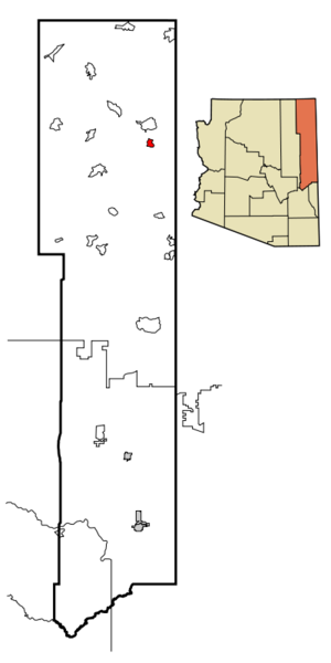
mapsize = 250px
map_caption = Location inApache County and the state ofArizona
mapsize1 =
map_caption1 =
subdivision_type = Country
subdivision_type1 = State
subdivision_type2 = County
subdivision_name =United States
subdivision_name1 =Arizona
subdivision_name2 = Apache
government_type =
leader_title =
leader_name =
established_date =
area_magnitude =
area_total_km2 = 15.5
area_total_sq_mi = 6
area_land_km2 = 15.6
area_land_sq_mi = 6.0
area_water_km2 = 0.0
area_water_sq_mi = 0.0
elevation_ft = 7142
elevation_m = 2177
population_as_of = 2000
population_footnotes =
population_total = 1078
population_metro =
population_density_km2 = 69.3
population_density_sq_mi = 179.5
timezone = MST
utc_offset = -7
latd = 36 |latm = 18 |lats = 17 |latNS = N
longd = 109 |longm = 13 |longs = 24 |longEW = W
timezone_DST =
utc_offset_DST =
postal_code_type =ZIP code
postal_code = 86556
area_code = 928
blank_name = FIPS code
blank_info = 04-75660
blank1_name = GNIS feature ID
blank1_info = 0012750
footnotes =
website =Tsaile (English pronunciation IPAEng|seɪˈliː) ( _nv. Tséhílį́) is a
census-designated place (CDP) in Apache County,Arizona ,United States , within theNavajo Nation . The population was 1,078 at the 2000 census.Tsaile is the home of the main campus of
Diné College (formerly Navajo Community College), a tribally controlled community college with 7 other campuses across the Navajo Nation.Tsaile Public School (Grades K-8) is located in Tsaile. Residents go to
Chinle High School in Chinle for high school.Geography
Tsaile is located at coor dms|36|18|17|N|109|13|24|W|city (36.304753, -109.223385)GR|1, about 29 miles (47 km) east of Chinle, just outside the boundaries of
Canyon de Chelly National Monument .According to the
United States Census Bureau , the CDP has a total area of 6.0square mile s (15.6km² ), all of it land.Demographics
As of the
census GR|2 of 2000, there were 1,078 people, 244 households, and 200 families residing in the CDP. Thepopulation density was 179.5 people per square mile (69.3/km²). There were 345 housing units at an average density of 57.4/sq mi (22.2/km²). The racial makeup of the CDP was 93.32% Native American, 3.62% White, 0.09% Black or African American, 0.09% Asian, 0.09% Pacific Islander, 0.65% from other races, and 2.13% from two or more races. 1.30% of the population were Hispanic or Latino of any race.There were 244 households out of which 55.3% had children under the age of 18 living with them, 50.4% were married couples living together, 27.5% had a female householder with no husband present, and 18.0% were non-families. 16.8% of all households were made up of individuals and 3.7% had someone living alone who was 65 years of age or older. The average household size was 3.98 and the average family size was 4.57.
In the CDP the population was spread out with 38.8% under the age of 18, 19.5% from 18 to 24, 24.1% from 25 to 44, 14.8% from 45 to 64, and 2.8% who were 65 years of age or older. The median age was 22 years. For every 100 females there were 88.8 males. For every 100 females age 18 and over, there were 87.0 males.
The median income for a household in the CDP was $17,500, and the median income for a family was $16,513. Males had a median income of $35,469 versus $21,818 for females. The
per capita income for the CDP was $6,259. About 59.7% of families and 63.2% of the population were below thepoverty line , including 72.3% of those under age 18 and 70.0% of those age 65 or over.Education
The area is served by
Chinle Unified School District #24 .Tsaile Elementary School is located in Tsaile. Residents go to schools in Chinle for middle and high school.
Tsaile is the home of the main campus of
Diné College (formerly Navajo Community College), a tribally controlled community college with seven other campuses across the Navajo Nation.References
External links
Wikimedia Foundation. 2010.