- Window Rock, Arizona
Infobox Settlement
official_name = Window Rock, Arizona
settlement_type = CDP
imagesize =
image_caption =
image_
imagesize =
image_caption =
image_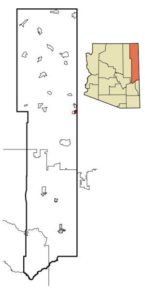
mapsize = 250px
map_caption = Location inApache County and the state ofArizona
mapsize1 =
map_caption1 =
subdivision_type = Country
subdivision_type1 = State
subdivision_type2 = County
subdivision_name =United States
subdivision_name1 =Arizona
subdivision_name2 = Apache
government_type =
leader_title =
leader_name =
established_date =
area_magnitude =
area_total_km2 = 34.7
area_total_sq_mi = 13.4
area_land_km2 = 13.4
area_land_sq_mi = 5.2
area_water_km2 = 0.0
area_water_sq_mi = 0.0
elevation_ft = 6830
elevation_m = 2082
population_as_of = 2000
population_footnotes =
population_total = 3059
population_metro =
population_density_km2 = 227.5
population_density_sq_mi = 589.3
timezone = MST
utc_offset = -7
timezone_DST = MDT
utc_offset_DST = -6
latd = 35 |latm = 40 |lats = 22 |latNS = N
longd = 109 |longm = 3 |longs = 44 |longEW = W
postal_code_type =ZIP code
postal_code = 86515
area_code = 928
blank_name = FIPS code
blank_info = 04-83720
blank1_name = GNIS feature ID
blank1_info = 0013908
footnotes =
website =Window Rock ( _nv. "Tségháhoodzání") is a
census-designated place (CDP) in Apache County,Arizona ,United States . The population was 3,059 at the 2000 census.Window Rock is the seat of government for the
Navajo Nation , the tribal government of the largest Native American tribe in the United States, and contains theNavajo Nation Zoological and Botanical Park . Even though the state of Arizona does not currently observe Daylight Time, the Navajo reservation does.Geography
Window Rock is located at coor dms|35|40|22|N|109|3|44|W|city (35.672752, -109.062097)GR|1.
According to the
United States Census Bureau , the CDP has a total area of 5.2 square miles (13.4km² ), all of it land.Demographics
As of the
census GR|2 of 2000, there were 3,059 people, 876 households, and 713 families residing in the CDP. Thepopulation density was 589.3 people per square mile (227.6/km²). There were 998 housing units at an average density of 192.3/sq mi (74.2/km²). The racial makeup of the CDP was 95.46% Native American, 3.17% White, 0.42% Asian, 0.16% African American, 0.03% Pacific Islander, 0.07% from other races, and 0.69% from two or more races. Hispanic or Latino of any race were 1.44% of the population.There were 876 households out of which 51.0% had children under the age of 18 living with them, 43.7% were married couples living together, 29.7% had a female householder with no husband present, and 18.6% were non-families. 15.6% of all households were made up of individuals and 2.4% had someone living alone who was 65 years of age or older. The average household size was 3.42 and the average family size was 3.81.
In the CDP the population was spread out with 36.3% under the age of 18, 10.9% from 18 to 24, 28.7% from 25 to 44, 19.6% from 45 to 64, and 4.5% who were 65 years of age or older. The median age was 27 years. For every 100 females there were 92.6 males. For every 100 females age 18 and over, there were 88.4 males.
The median income for a household in the CDP was $36,885, and the median income for a family was $36,500. Males had a median income of $27,266 versus $26,902 for females. The
per capita income for the CDP was $11,122. About 24.6% of families and 24.6% of the population were below thepoverty line , including 28.6% of those under age 18 and 6.8% of those age 65 or over.Annual Navajo Nation Fair
The 61st Annual
Navajo Nation Fair was held from September 4th to 9th 2007 in the heart of the Navajo Nation capital. The IJNFR, NCRA, and other rodeo cicuits are held at the Dean C. Jackson Memorial Arena. There is a 1/2 mile midway from the carnival south west to the arena. The Raymond Nakai Hall is full of information similar to aTrade fair . The Gorman Exhibit halls shows all the entry of the years arts and crafts and their awards. There is a frybread contest at the Hazel Yazza Pavilion, authentic Navajo cooking at the Circlr of Life Pavilion, a Navajo Song N' Dance at the Song n Dance Arena. There is the famous Window Rock Powwow held at its designated arena. Many events take place.Education
Window Rock is a part of
Window Rock Unified School District .Window Rock is served by Window Rock Elementary School, Tse Ho Tso Middle School,
Window Rock High School .References
Further reading
*cite book | author=Wittenberg, Jonathan | title=Navajo Nation 1950: Traditional Life in Photographs | publisher=Glitterati Incorporated |year=2006 |id= ISBN 0-9777531-9-0
External links
* [http://www.city-data.com/city/Window-Rock-Arizona.html Window Rock profile, with more links to the most interesting sites about Tségháhoodzání and the Dinétah] Mapit-US-cityscale|35.672752|-109.062097
Wikimedia Foundation. 2010.