- Shiprock, New Mexico
Infobox Settlement
official_name = Shiprock, New Mexico
settlement_type = CDP
nickname =
motto =
imagesize =
image_caption =
image_
imagesize =
image_caption =
image_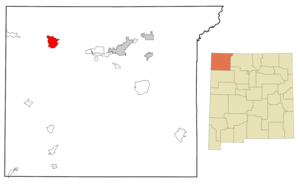
mapsize = 250px
map_caption = Location of Shiprock, New Mexico
mapsize1 =
map_caption1 =subdivision_type = Country
subdivision_name =United States
subdivision_type1 = State
subdivision_name1 =New Mexico
subdivision_type2 = County
subdivision_name2 = San Juan
government_footnotes =
government_type =
leader_title =
leader_name =
leader_title1 =
leader_name1 =
established_title =
established_date =unit_pref = Imperial
area_footnotes =area_magnitude =
area_total_km2 = 42.0
area_land_km2 = 41.1
area_water_km2 = 0.9
area_total_sq_mi = 16.2
area_land_sq_mi = 15.9
area_water_sq_mi = 0.3population_as_of = 2000
population_footnotes =
population_total = 8156
population_density_km2 = 198.3
population_density_sq_mi = 513.6timezone = Mountain (MST)
utc_offset = -7
timezone_DST = MDT
utc_offset_DST = -6
elevation_footnotes =
elevation_m = 1491
elevation_ft = 4892
latd = 36 |latm = 47 |lats = 34 |latNS = N
longd = 108 |longm = 41 |longs = 14 |longEW = Wpostal_code_type =
ZIP code s
postal_code = 87420, 87461
area_code = 505
blank_name = FIPS code
blank_info = 35-72770
blank1_name = GNIS feature ID
blank1_info = 0902354
website =
footnotes =Shiprock (Navajo: Naatʼáanii Nééz) is a
census-designated place (CDP) in San Juan County,New Mexico ,United States , on the Navajo reservation. The population was 8,156 at the 2000 census. It is part of the FarmingtonMetropolitan Statistical Area .Shiprock is named after the nearby
Shiprock rock formation. It is home to the annual Northern Navajo Fair, held every October. It is also home to a campus ofDiné College (formerly Navajo Community College), a tribally controlled community college with 7 other campuses across theNavajo Nation . It is the site of a Chapter House for the Navajo and a BIA Agency. It is the site of a branch ofFarmington Public Library .Shiprock is a key road junction for truck traffic and tourists visiting the Four Corners,
Mesa Verde , and theGrand Canyon . The town lies at the intersection of U.S. Highways 64 and 491 (formerly U.S. Highway 666.) Despite its location at the confluence of two substantial roads and close to many tourist locations the town is notable for having no hotels or motels, the nearest options being inFarmington, New Mexico to the East andCortez, Colorado to the North.Geography
Shiprock is located at coor dms|36|47|34|N|108|41|14|W|city (36.792789, -108.687294)GR|1.
According to the
United States Census Bureau , the CDP has a total area of 16.2square mile s (42.0km² ), of which, 15.9 square miles (41.1 km²) of it is land and 0.3 square miles (0.9 km²) of it (2.10%) is water.Demographics
As of the
census GR|2 of 2000, there were 8,156 people, 2,184 households, and 1,847 families residing in the CDP. Thepopulation density was 513.6 people per square mile (198.3/km²). There were 2,594 housing units at an average density of 163.3/sq mi (63.1/km²). The racial makeup of the CDP was 2.17% White, 0.16% African American, 96.74% Native American, 0.12% Asian, 0.01% Pacific Islander, 0.10% from other races, and 0.70% from two or more races. Hispanic or Latino of any race were 1.29% of the population.There were 2,184 households out of which 52.2% had children under the age of 18 living with them, 48.0% were married couples living together, 28.7% had a female householder with no husband present, and 15.4% were non-families. 13.6% of all households were made up of individuals and 3.7% had someone living alone who was 65 years of age or older. The average household size was 3.73 and the average family size was 4.06.
In the CDP the population was spread out with 38.6% under the age of 18, 11.6% from 18 to 24, 28.4% from 25 to 44, 16.5% from 45 to 64, and 4.9% who were 65 years of age or older. The median age was 25 years. For every 100 females there were 92.8 males. For every 100 females age 18 and over, there were 86.3 males.
The median income for a household in the CDP was $24,523, and the median income for a family was $24,951. Males had a median income of $24,032 versus $17,328 for females. The
per capita income for the CDP was $7,967. About 38.3% of families and 39.2% of the population were below thepoverty line , including 43.2% of those under age 18 and 47.5% of those age 65 or over.Education
Central Consolidated Schools serves Shiprock as well as other communities in western San Juan County.In Film
The 2002 film "
Rocks With Wings ," directed by Rick Derby, follows the Navajo members of the Lady Chieftains, the girls' basketball team fromShiprock High School , as they struggle with a new (black) coach, their own expectations, and those of their community and the "Anglo" world around them.References
External links
Wikimedia Foundation. 2010.