- Nenahnezad, New Mexico
-
Nenahnezad, New Mexico — CDP — Location of Nenahnezan, New Mexico.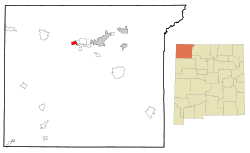
Coordinates: 36°44′9″N 108°24′56″W / 36.73583°N 108.41556°WCoordinates: 36°44′9″N 108°24′56″W / 36.73583°N 108.41556°W Country United States State New Mexico County San Juan Area – Total 3.6 sq mi (9.3 km2) – Land 3.5 sq mi (9.1 km2) – Water 0.1 sq mi (0.2 km2) Elevation 5,164 ft (1,574 m) Population (2000) – Total 726 – Density 205.6/sq mi (79.4/km2) Time zone Mountain (MST) (UTC-7) – Summer (DST) MDT (UTC-6) Area code(s) 505 FIPS code 35-51715 GNIS feature ID 1877178 Nenahnezad (Navajo: Niinahnízaad) is a census-designated place (CDP) in San Juan County, New Mexico, United States. The population was 726 at the 2000 census. The Navajo place name translates as "Long Upgrade". Nenahnezad is a Chapter community just to the south of Fruitland, between the towns of Farmington and Shiprock. It is part of the Farmington Metropolitan Statistical Area.
Contents
Geography
Nenahnezad is located at 36°44′9″N 108°24′56″W / 36.73583°N 108.41556°W (36.735812, -108.415499)[1].
According to the United States Census Bureau, the CDP has a total area of 3.6 square miles (9.3 km2), of which, 3.5 square miles (9.1 km2) of it is land and 0.1 square miles (0.26 km2) of it (2.22%) is water.
Demographics
As of the census[2] of 2000, there were 726 people, 193 households, and 154 families residing in the CDP. The population density was 205.6 people per square mile (79.4/km²). There were 231 housing units at an average density of 65.4 per square mile (25.3/km²). The racial makeup of the CDP was 0.69% White, 97.52% Native American, 0.14% Asian, 0.14% from other races, and 1.52% from two or more races. Hispanic or Latino of any race were 1.93% of the population.
There were 193 households out of which 45.6% had children under the age of 18 living with them, 48.2% were married couples living together, 25.9% had a female householder with no husband present, and 20.2% were non-families. 20.2% of all households were made up of individuals and 3.1% had someone living alone who was 65 years of age or older. The average household size was 3.76 and the average family size was 4.38.
In the CDP the population was spread out with 38.4% under the age of 18, 10.6% from 18 to 24, 27.3% from 25 to 44, 17.1% from 45 to 64, and 6.6% who were 65 years of age or older. The median age was 26 years. For every 100 females there were 103.9 males. For every 100 females age 18 and over, there were 97.8 males.
The median income for a household in the CDP was $22,054, and the median income for a family was $21,250. Males had a median income of $25,156 versus $15,577 for females. The per capita income for the CDP was $6,041. About 51.4% of families and 59.4% of the population were below the poverty line, including 63.0% of those under age 18 and 49.0% of those age 65 or over.
Education
Central Consolidated Schools serves Nenahnezad as well as other communities in western San Juan County.
References
- ^ "US Gazetteer files: 2010, 2000, and 1990". United States Census Bureau. 2011-02-12. http://www.census.gov/geo/www/gazetteer/gazette.html. Retrieved 2011-04-23.
- ^ "American FactFinder". United States Census Bureau. http://factfinder.census.gov. Retrieved 2008-01-31.
- Linford, Laurance D., Navajo Places - History, Legend Landscape The University of Utah Press, Salt Lake City, 2000. ISBN 0-87480-624-0
Municipalities and communities of San Juan County, New Mexico Cities 
CDPs Beclabito | Crystal‡ | Flora Vista | Huerfano | Kirtland | Nageezi | Napi HQ | Naschitti | Nenahnezad | Newcomb | Ojo Amarillo | Sanostee | Sheep Springs | Shiprock | Upper Fruitland | White Rock
Other
communitiesFruitland | Waterflow
Indian reservation Navajo Indian Reservation
Footnotes ‡This populated place also has portions in an adjacent county or counties
Navajo Communities Tónaneezdizí
(Western Agency)Tuba City • Bitter Springs • Cameron • Chilchinbito • Dennehotso • Halchita • Kaibito • Kayenta • Lechee • Leupp • Navajo Mountain • Oljato • Monument Valley • Shonto • TonaleaChʼínílį́
(Chinle Agency)Tséhootsooí
(Fort Defiance Agency)Fort Defiance • Brimhall Nizhoni • Burnside • Crystal • Dilkon • Ganado • Greasewood • Houck • Indian Wells • Jeddito • Nakaibito • Naschitti • Navajo • Sawmill • St. Michaels • Steamboat • Tohatchi • Twin Lakes • Window RockNaatʼáaniinééz
(Shiprock Agency)Shiprock • Aneth • Beclabito • Montezuma Creek • Nenahnezad • Newcomb/Nava • Ojo Amarillo • Red Mesa • Rock Point • Sanostee • Sheep Springs • Teec Nos Pos • Tselakai Dezza • Upper FruitlandTʼiistsʼózí
(Eastern Agency)Categories:- Populated places in San Juan County, New Mexico
- Census-designated places in New Mexico
- Populated places in New Mexico with Native American majority populations


Wikimedia Foundation. 2010.