- Kirtland, New Mexico
Infobox Settlement
official_name = Kirtland, New Mexico
settlement_type = CDP
nickname =
motto =
imagesize =
image_caption =
image_
imagesize =
image_caption =
image_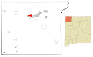
mapsize = 250px
map_caption = Location of Kirtland, New Mexico
mapsize1 =
map_caption1 =subdivision_type = Country
subdivision_name =United States
subdivision_type1 = State
subdivision_name1 =New Mexico
subdivision_type2 = County
subdivision_name2 = San Juan
government_footnotes =
government_type =
leader_title =
leader_name =
leader_title1 =
leader_name1 =
established_title =
established_date =unit_pref = Imperial
area_footnotes =area_magnitude =
area_total_km2 = 30.9
area_land_km2 = 30.2
area_water_km2 = 0.7
area_total_sq_mi = 11.9
area_land_sq_mi = 11.7
area_water_sq_mi = 0.3population_as_of = 2000
population_footnotes =
population_total = 6190
population_density_km2 = 204.8
population_density_sq_mi = 530.5timezone = Mountain (MST)
utc_offset = -7
timezone_DST = MDT
utc_offset_DST = -6
elevation_footnotes =
elevation_m = 1581
elevation_ft = 5187
latd = 36 |latm = 44 |lats = 29 |latNS = N
longd = 108 |longm = 20 |longs = 53 |longEW = Wpostal_code_type =
ZIP code
postal_code = 87417
area_code = 505
blank_name = FIPS code
blank_info = 35-36230
blank1_name = GNIS feature ID
blank1_info = 0902282
website =
footnotes =Kirtland is a
census-designated place (CDP) in San Juan County,New Mexico ,United States . The population was 6,190 at the 2000 census. It is part of the FarmingtonMetropolitan Statistical Area .History
Kirtland was founded in the early 1880s by
Latter-day Saint settlers who named it afterKirtland, Ohio . There had been a few Latter-day Saints who had settled in Fruitland as early as 1878. As of 2000 Fruitland was designated as part of Kirtland by the census. Another Latter-day Saint settlement of these early days was Waterflow, just west of Fruitland, which appears on maps as late as the 1950s. [Jensen, Richard L. "Pioneer Settlements in New Mexico" in Ludlow, Daniel H., ed., "Selections from the Encyclopedia of Mormonism". (Salt Lake City: Deseret Book, 1995) p. 386] ["Hammond's Complete World Atlas" (New York: C. S. Hammond and Co., 1951) p. 210]An LDS meetinghouse was dedicated in Kirtland by
Heber J. Grant in 1928. ["Conference Report", October 1928, p. 4]Geography
Kirtland is located at coor dms|36|44|29|N|108|20|53|W|city (36.741470, -108.348064)GR|1.
According to the
United States Census Bureau , the CDP has a total area of 11.9square mile s (31.0km² ), of which, 11.7 square miles (30.2 km²) of it is land and 0.3 square miles (0.7 km²) of it (2.34%) is water.Demographics
As of the
census GR|2 of 2000, there were 6,190 people, 1,822 households, and 1,517 families residing in the CDP. Thepopulation density was 530.5 people per square mile (204.8/km²). There were 1,994 housing units at an average density of 170.9/sq mi (66.0/km²). The racial makeup of the CDP was 43.38% White, 0.19% African American, 48.93% Native American, 0.24% Asian, 0.02% Pacific Islander, 4.26% from other races, and 2.97% from two or more races. Hispanic or Latino of any race were 9.45% of the population.There were 1,822 households out of which 50.5% had children under the age of 18 living with them, 61.6% were married couples living together, 14.9% had a female householder with no husband present, and 16.7% were non-families. 13.7% of all households were made up of individuals and 4.7% had someone living alone who was 65 years of age or older. The average household size was 3.40 and the average family size was 3.71.
In the CDP the population was spread out with 36.4% under the age of 18, 11.2% from 18 to 24, 27.4% from 25 to 44, 18.9% from 45 to 64, and 6.1% who were 65 years of age or older. The median age was 27 years. For every 100 females there were 98.0 males. For every 100 females age 18 and over, there were 93.6 males.
The median income for a household in the CDP was $45,000, and the median income for a family was $45,491. Males had a median income of $41,014 versus $21,146 for females. The
per capita income for the CDP was $14,053. About 12.5% of families and 14.8% of the population were below thepoverty line , including 19.6% of those under age 18 and 9.0% of those age 65 or over.Education
Central Consolidated Schools serves Kirtland as well as other communities in western San Juan County.References
External links
Wikimedia Foundation. 2010.