- Tse Bonito, New Mexico
Infobox Settlement
official_name = Tse Bonito, New Mexico
settlement_type = CDP
nickname =
motto =
imagesize =
image_caption =
image_
imagesize =
image_caption =
image_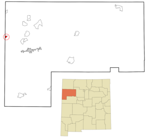
mapsize = 250px
map_caption = Location of Tse Bonito, New Mexico
mapsize1 =
map_caption1 =subdivision_type = Country
subdivision_name =United States
subdivision_type1 = State
subdivision_name1 =New Mexico
subdivision_type2 = County
subdivision_name2 = McKinley
government_footnotes =
government_type =
leader_title =
leader_name =
leader_title1 =
leader_name1 =
established_title =
established_date =unit_pref = Imperial
area_footnotes =area_magnitude =
area_total_km2 = 3.6
area_land_km2 = 3.6
area_water_km2 = 0.0
area_total_sq_mi = 1.4
area_land_sq_mi = 1.4
area_water_sq_mi = 0.0population_as_of = 2000
population_footnotes =
population_total = 261
population_density_km2 = 71.7
population_density_sq_mi = 185.7timezone = Mountain (MST)
utc_offset = -7
timezone_DST = MDT
utc_offset_DST = -6
elevation_footnotes =
elevation_m = 2080
elevation_ft = 6824
latd = 35 |latm = 39 |lats = 10 |latNS = N
longd = 109 |longm = 1 |longs = 42 |longEW = Wpostal_code_type =
postal_code =
area_code = 505
blank_name = FIPS code
blank_info = 35-79885
blank1_name = GNIS feature ID
blank1_info = 0897558
website =
footnotes =Tse Bonito (Navajo: IPA|Tsé Biniiʼ Tó) is a
census-designated place (CDP) in McKinley County,New Mexico ,United States . The population was 261 at the 2000 census.Geography
Tse Bonito is located at coor dms|35|39|10|N|109|1|42|W|city (35.652787, -109.028385)GR|1, and is bordered to the west by
Window Rock, Arizona , the seat of the Navajo Nation government. The northern portions of Tse Bonito lie within the Navajo Nation.According to the
United States Census Bureau , the CDP has a total area of 1.4square mile s (3.7km² ), all of it land.Demographics
As of the
census GR|2 of 2000, there were 261 people, 78 households, and 62 families residing in the CDP. Thepopulation density was 185.7 people per square mile (71.5/km²). There were 102 housing units at an average density of 72.6/sq mi (27.9/km²). The racial makeup of the CDP was 71.26% Native American, 22.61% White, 0.38% Asian, 2.68% from other races, and 3.07% from two or more races. Hispanic or Latino of any race were 4.21% of the population.There were 78 households out of which 42.3% had children under the age of 18 living with them, 53.8% were married couples living together, 14.1% had a female householder with no husband present, and 20.5% were non-families. 19.2% of all households were made up of individuals and 2.6% had someone living alone who was 65 years of age or older. The average household size was 3.35 and the average family size was 3.77.
In the CDP the population was spread out with 37.5% under the age of 18, 9.6% from 18 to 24, 23.0% from 25 to 44, 24.5% from 45 to 64, and 5.4% who were 65 years of age or older. The median age was 28 years. For every 100 females there were 107.1 males. For every 100 females age 18 and over, there were 98.8 males.
The median income for a household in the CDP was $38,077, and the median income for a family was $38,365. Males had a median income of $24,915 versus $24,625 for females. The
per capita income for the CDP was $20,187. About 12.7% of families and 16.2% of the population were below thepoverty line , including 40.0% of those under the age of eighteen and none of those sixty five or over.References
External links
Wikimedia Foundation. 2010.