- McKinley County, New Mexico
-
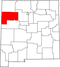
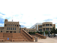
McKinley County, New Mexico McKinley County Courthouse in Gallup, New Mexico
Seal
Location in the state of New Mexico
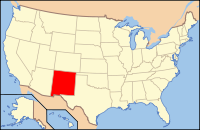
New Mexico's location in the U.S.Founded information needed Seat Gallup Largest city Gallup Area
- Total
- Land
- Water
5,455 sq mi (14,128 km²)
5,449 sq mi (14,113 km²)
6 sq mi (16 km²), 0.12%Population
- (2010)
- Density
71,492
13/sq mi (5/km²)Website www.co.mckinley.nm.us McKinley County is a county located in the U.S. state of New Mexico. As of 2010, the population was 71,492.[1] Its county seat is Gallup.[2]
Contents
Geography
According to the U.S. Census Bureau, the county has a total area of 5,455 square miles (14,130 km2), of which 5,449 square miles (14,110 km2) is land and 6 square miles (16 km2) (0.12%) is water.
Adjacent counties
- San Juan County, New Mexico - north
- Sandoval County, New Mexico - east
- Cibola County, New Mexico - south
- Apache County, Arizona - west
Major highways
 Interstate 40
 U.S. Route 491 (formerly
  )
)- New Mexico Highway 264
- New Mexico Highway 371
- New Mexico Highway 602
National protected areas
- Chaco Culture National Historical Park (part)
- Cibola National Forest (part)
Demographics
Historical populations Census Pop. %± 2000 74,798 — 2010 71,492 −4.4% 2010
Whereas according to the 2010 U.S. Census Bureau:
- 15.2% White
- 0.5% Black
- 75.5% Native American
- 0.8% Asian
- 0.0% Native Hawaiian or Pacific Islander
- 3.1% Two or more races
- 4.6% Other races
- 13.3% Hispanic or Latino (of any race)
2000
As of the census of 2000,[3] there were 74,798 people, 21,476 households, and 16,686 families residing in the county. The population density was 14 people per square mile (5/km²). There were 26,718 housing units at an average density of 5 per square mile (2/km²). The racial makeup of the county was 74.72% Native American, 16.39% White, 0.46% Asian, 0.40% Black or African American, 0.04% Pacific Islander, 5.47% from other races, and 2.52% from two or more races. 12.40% of the population were Hispanic or Latino of any race.
There were 21,476 households out of which 46.00% had children under the age of 18 living with them, 47.70% were married couples living together, 22.70% had a female householder with no husband present, and 22.30% were non-families. 19.50% of all households were made up of individuals and 5.30% had someone living alone who was 65 years of age or older. The average household size was 3.44 and the average family size was 3.99.
In the county the population was spread out with 38.00% under the age of 18, 9.70% from 18 to 24, 27.80% from 25 to 44, 17.60% from 45 to 64, and 6.90% who were 65 years of age or older. The median age was 27 years. For every 100 females there were 93.50 males. For every 100 females age 18 and over, there were 89.30 males.
The median income for a household in the county was $25,005, and the median income for a family was $26,806. Males had a median income of $26,963 versus $21,014 for females. The per capita income for the county was $9,872. About 31.90% of families and 36.10% of the population were below the poverty line, including 42.30% of those under age 18 and 31.50% of those age 65 or over. The county's per-capita income makes it one of the poorest counties in the United States.
McKinley County is one of only 38 county-level census divisions of the United States where the most spoken language is not English and one of only 3 where it is neither English nor Spanish. 45.75% of the population speak Navajo at home, followed by English at 38.87%, Zuñi at 9.03%, and Spanish at 5.72%.
Localities
City
Census-designated places
- Black Rock
- Brimhall Nizhoni
- Church Rock
- Crownpoint
- Crystal
- Nakaibito
- Navajo
- Pueblo Pintado
- Ramah
- Rock Springs
- Thoreau
- Tohatchi
- Tse Bonito
- Twin Lakes
- Yah-ta-hey
- Zuni Pueblo
Other locality
See also
References
- ^ http://2010.census.gov/2010census/data/
- ^ "Find a County". National Association of Counties. http://www.naco.org/Counties/Pages/FindACounty.aspx. Retrieved 2011-06-07.
- ^ "American FactFinder". United States Census Bureau. http://factfinder.census.gov. Retrieved 2008-01-31.

San Juan County 
Apache County, Arizona 
Sandoval County  McKinley County, New Mexico

Cibola County Municipalities and communities of McKinley County, New Mexico City CDPs Black Rock | Brimhall Nizhoni | Church Rock | Crownpoint | Crystal‡ | Nakaibito | Navajo | Pueblo Pintado | Ramah | Rock Springs | Thoreau | Tohatchi | Tse Bonito | Twin Lakes | Yah-ta-hey | Zuni Pueblo
Unincorporated
communityBorrego Pass | Pinedale
Indian reservation Footnotes ‡This populated place also has portions in an adjacent county or counties
 State of New Mexico
Topics Delegations · Geography · Government · History · Landmarks · Military · Natural history · New Mexicans · Settlements · Transportation · Tribes · Visitor attractions
Society Culture · Demographics · Economy · Education · Politics
Regions Cities Alamogordo · Albuquerque · Artesia · Carlsbad · Clovis · Corrales · Deming · Española · Farmington · Gallup · Grants · Hobbs · Las Cruces · Las Vegas · Los Alamos · Los Lunas · Lovington · Portales · Raton · Rio Rancho · Roswell · Ruidoso · Santa Fe · Silver City · Socorro · Sunland Park · Taos · Tucumcari
Counties Bernalillo · Catron · Chaves · Cibola · Colfax · Curry · De Baca · Doña Ana · Eddy · Grant · Guadalupe · Harding · Hidalgo · Lea · Lincoln · Los Alamos · Luna · McKinley · Mora · Otero · Quay · Rio Arriba · Roosevelt · Sandoval · San Juan · San Miguel · Santa Fe · Sierra · Socorro · Taos · Torrance · Union · Valencia
Categories:- New Mexico counties
- McKinley County, New Mexico
- Counties of the United States with Native American majority populations
Wikimedia Foundation. 2010.


