- Mora County, New Mexico
-
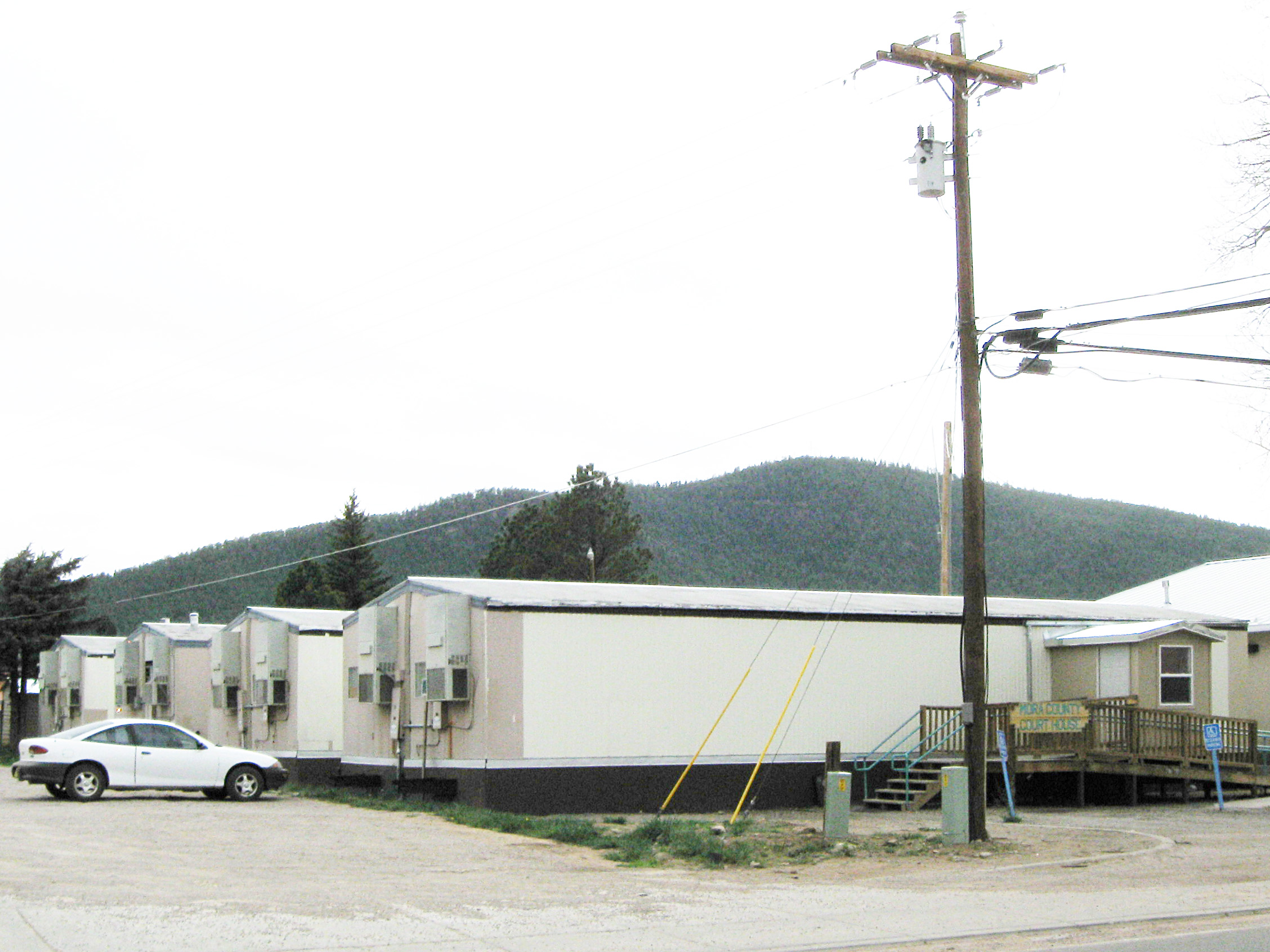
Mora County, New Mexico 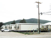 Mora County Courthouse in Mora, New Mexico
Location in the state of New Mexico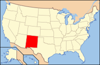
New Mexico's location in the U.S.Founded 1860 Seat Mora Largest city Wagon Mound Area
- Total
- Land
- Water
1,933 sq mi (5,006 km²)
1,931 sq mi (5,001 km²)
2 sq mi (5 km²), 0.12%Population
- (2000)
- Density
5,180
3/sq mi (1/km²)Website countyofmora.com Mora County is a county located in the U.S. state of New Mexico. As of 2000, the population was 5,180. Its county seat is Mora.[1]
Contents
Geography
According to the U.S. Census Bureau, the county has a total area of 1,933 square miles (5,008 km²), of which 1,931 square miles (5,002 km²) is land and 2 square miles (6 km²) (0.12%) is water. The highest point in the county is the summit of Truchas Peak at 13,102'.
Adjacent counties
- Colfax County, New Mexico - north
- Harding County, New Mexico - east
- San Miguel County, New Mexico - south
- Santa Fe County, New Mexico - west
- Rio Arriba County, New Mexico - west
- Taos County, New Mexico - northwest
National protected areas
- Carson National Forest (part)
- Fort Union National Monument
- Kiowa National Grassland (part)
- Santa Fe National Forest (part)
Demographics
Historical populations Census Pop. %± 2000 5,180 — 2010 4,881 −5.8% 2010
Whereas according to the 2010 U.S. Census Bureau:
- 70.9% White
- 0.7% Black
- 1.3% Native American
- 0.3% Asian
- 0.0% Native Hawaiian or Pacific Islander
- 3.3% Two or more races
- 23.5% Other races
- 81.0% Hispanic or Latino (of any race)
2000
As of the census[2] of 2000, there were 5,180 people, 2,017 households, and 1,397 families residing in the county. The population density was 3 people per square mile (1/km²). There were 2,973 housing units at an average density of 2 per square mile (1/km²). The racial makeup of the county was 58.88% White, 0.10% Black or African American, 1.14% Native American, 0.12% Asian, 36.97% from other races, and 2.80% from two or more races. 81.64% of the population were Hispanic or Latino of any race.
There were 2,017 households out of which 31.20% had children under the age of 18 living with them, 50.50% were married couples living together, 11.90% had a female householder with no husband present, and 30.70% were non-families. 26.90% of all households were made up of individuals and 10.60% had someone living alone who was 65 years of age or older. The average household size was 2.54 and the average family size was 3.08.
In the county the population was spread out with 26.70% under the age of 18, 7.50% from 18 to 24, 24.30% from 25 to 44, 26.10% from 45 to 64, and 15.40% who were 65 years of age or older. The median age was 40 years. For every 100 females there were 102.00 males. For every 100 females age 18 and over, there were 100.20 males.
The median income for a household in the county was $24,518, and the median income for a family was $27,648. Males had a median income of $24,483 versus $18,000 for females. The per capita income for the county was $12,340. About 20.90% of families and 25.40% of the population were below the poverty line, including 25.90% of those under age 18 and 18.40% of those age 65 or over.
History
Prior to Spanish conquest, the Mora area was Indian country. Although not an area of heavy Indian settlement by such tribes as the Pueblo Indians, the Mora valley was much used by nomadic tribes: the Utes, Navajos and Apache.
The Mora Valley then became a travel-way for various Spanish explorers and others. It was not settled until the early part of the 19th century. The history of the settlement of Mora dates to 1817 when a group of settlers petitioned for a priest.[3]
The next significant event was the Mexican Land Grant through which on September 28, 1835 Governor Albino Pérez, the governor of the New Mexico Territory, gave land title for over 800,000 acres (3,200 km²) to some 25 families.[4]
"Mora" is actually today three plazas and three villages; Mora, Cleveland (originally San Antonio), and Chacon. Holman (originally Agua Negra) lies between Chacon and Cleveland.
Historical and genealogical records for Mora are difficult to obtain for a number of reasons. One is that Mora was destroyed by Americans in 1848 in the course of the rebellion against the new government and most of the archives were lost. "Not until artillery was brought up (by the United States Army) and Mora practically destroyed did the insurgents yield. "[5] A US Government Proclamation at the time (February 15, 1847) wrote that the US Army " proceeded with a body of men and one canon to Moro and razed the towns (Upper and Lower Moro) to the ground."[6]
Localities
Village
Other localities
Places of interest
See also
References
- ^ "Find a County". National Association of Counties. http://www.naco.org/Counties/Pages/FindACounty.aspx. Retrieved 2011-06-07.
- ^ "American FactFinder". United States Census Bureau. http://factfinder.census.gov. Retrieved 2008-01-31.
- ^ [1]
- ^ New Mexico, A Guide to the Colorful State, Compiled by Workers of the Writers' Program of the Works Projects Administration in the State of New Mexico, University of New Mexico Press, Albuquerque, NM, 1945 p. 378
- ^ Lavender, David, Bent's Fort, Doubleday and Company, Inc., Garden City, NY 1954 p. 285
- ^ McNierney, Michael, Taos 1847: The Revolt in Contemporary Accounts, Johnson Publishing Company, Boulder, CO, 1980 p 35
External links

Taos County Colfax County Santa Fe County and Rio Arriba County 
Harding County  Mora County, New Mexico

San Miguel County Municipalities and communities of Mora County, New Mexico Village 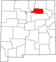
Unincorporated
communitiesGolondrinas | La Cueva | Mora
 State of New Mexico
Topics Delegations · Geography · Government · History · Landmarks · Military · Natural history · New Mexicans · Settlements · Transportation · Tribes · Visitor attractions
Society Culture · Demographics · Economy · Education · Politics
Regions Cities Alamogordo · Albuquerque · Artesia · Carlsbad · Clovis · Corrales · Deming · Española · Farmington · Gallup · Grants · Hobbs · Las Cruces · Las Vegas · Los Alamos · Los Lunas · Lovington · Portales · Raton · Rio Rancho · Roswell · Ruidoso · Santa Fe · Silver City · Socorro · Sunland Park · Taos · Tucumcari
Counties Bernalillo · Catron · Chaves · Cibola · Colfax · Curry · De Baca · Doña Ana · Eddy · Grant · Guadalupe · Harding · Hidalgo · Lea · Lincoln · Los Alamos · Luna · McKinley · Mora · Otero · Quay · Rio Arriba · Roosevelt · Sandoval · San Juan · San Miguel · Santa Fe · Sierra · Socorro · Taos · Torrance · Union · Valencia
Categories:- New Mexico counties
- Mora County, New Mexico
- 1860 establishments
- Counties of the United States with Hispanic majority populations


Wikimedia Foundation. 2010.