- National Register of Historic Places listings in Mora County, New Mexico
-
 Location of Mora County in New Mexico
This is a list of the National Register of Historic Places listings in Mora County, New Mexico.
This is intended to be a complete list of the properties and districts on the National Register of Historic Places in Mora County, New Mexico, United States. Latitude and longitude coordinates are provided for many National Register properties and districts; these locations may be seen together in a Google map.[1]
There are 22 properties and districts listed on the National Register in the county, including 2 National Historic Landmarks.
-
- This National Park Service list is complete through NPS recent listings posted November 10, 2011.[2]
Contents: Counties in New Mexico Bernalillo – Catron – Chaves – Cibola – Colfax – Curry – De Baca – Doña Ana – Eddy – Grant – Guadalupe – Harding – Hidalgo – Lea – Lincoln – Los Alamos – Luna – McKinley – Mora – Otero – Quay – Rio Arriba – Roosevelt – San Juan – San Miguel – Sandoval – Santa Fe – Sierra – Socorro – Taos – Torrance – Union – Valencia Current listings
[3] Landmark name [4] Image Date listed Location City or town Summary 1 Cassidy Mill December 6, 1978 Southeast of Cleveland off State Road 3
35°59′08″N 105°21′29″W / 35.985556°N 105.358056°WCleveland 2 Daniel Cassidy and Sons General Merchandise Store August 1, 1979 State Road 3
35°59′41″N 105°22′16″W / 35.994722°N 105.371111°WCleveland 3 Daniel Cassidy House July 27, 1990 Address Restricted Mora 4 James J. Cassidy House September 1, 2005 Northeastern corner of the junction of State Road 518 and San Antonio Rd.
35°59′40″N 105°22′13″W / 35.99444°N 105.37028°W[5]Cleveland 5 Fort Union National Monument 
October 15, 1966 9 miles north of Watrous on State Road 477
35°54′26″N 105°01′06″W / 35.907222°N 105.018333°WWatrous 6 Garcia House December 24, 1990 Address Restricted Mora 7 Gordon-Sanchez Mill July 27, 1990 Address Restricted Mora 8 La Cueva Historic District May 25, 1973 6 miles southeast of Mora at the junction of State Roads 3 and 21
35°56′34″N 105°14′51″W / 35.942778°N 105.2475°WMora 9 Ledoux Rural Historic District December 24, 1990 Address Restricted Ledoux 10 Mora Historic District December 24, 1990 Address Restricted Mora 11 North Carmen Historic District December 24, 1990 Address Restricted Ledoux 12 Ocate Creek Crossing and the Santa Fe Trail-Mora County Trail Segments April 21, 1994 1.75 miles north of the junction of State Road 127 and the road to Mora Ranch
36°09′02″N 104°54′03″W / 36.150556°N 104.900833°WOcate 13 Jose Olquin Barn-Corral Complex December 24, 1990 Address Restricted Mora 14 Santa Clara Hotel May 16, 1991 111 Railroad Ave.
36°00′30″N 104°42′22″W / 36.008333°N 104.706111°WWagon Mound 15 St. Vrain's Mill August 28, 1973 On State Road 38
35°58′32″N 105°19′44″W / 35.975556°N 105.328889°WMora 16 J. P. Strong Store July 27, 1979 State Roads 21 and 120
36°10′31″N 105°02′54″W / 36.175278°N 105.048333°WOcate 17 Tipton-Black Willow Ranch Historic District June 29, 2001 3 miles east of Watrous
35°47′28″N 104°55′34″W / 35.791111°N 104.926111°WWatrous 18 Desiderio Valdez House December 24, 1990 Address Restricted Cleveland 19 Narciso Valdez House July 11, 1980 State Road 120
36°10′34″N 105°02′52″W / 36.176111°N 105.047778°WOcate 20 Valmora Sanatorium Historic District March 23, 1995 State Road 97, 4 miles east of its junction with State Road 161 northeast of Watrous
33°22′56″N 104°55′31″W / 33.382222°N 104.925278°WWatrous 21 Wagon Mound 
October 15, 1966 East of Wagon Mound on U.S. Route 85
36°00′39″N 104°42′10″W / 36.010833°N 104.702778°WWagon Mound 22 Watrous 
October 15, 1966 U.S. Route 85
35°48′03″N 105°00′05″W / 35.800833°N 105.001389°WWatrous See also
- List of National Historic Landmarks in New Mexico
- National Register of Historic Places listings in New Mexico
References
- ^ The latitude and longitude information provided in this table was derived originally from the National Register Information System, which has been found to be fairly accurate for about 99% of listings. For about 1% of NRIS original coordinates, experience has shown that one or both coordinates are typos or otherwise extremely far off; some corrections may have been made. A more subtle problem causes many locations to be off by up to 150 yards, depending on location in the country: most NRIS coordinates were derived from tracing out latitude and longitudes off of USGS topographical quadrant maps created under the North American Datum of 1927, which differs from the current, highly accurate WGS84 GPS system used by Google maps. Chicago is about right, but NRIS longitudes in Washington are higher by about 4.5 seconds, and are lower by about 2.0 seconds in Maine. Latitudes differ by about 1.0 second in Florida. Some locations in this table may have been corrected to current GPS standards.
- ^ "National Register of Historic Places: Weekly List Actions". National Park Service, United States Department of the Interior. Retrieved on November 10, 2011.
- ^ Numbers represent an ordering by significant words. Various colorings, defined here, differentiate National Historic Landmark sites and National Register of Historic Places Districts from other NRHP buildings, structures, sites or objects.
- ^ "National Register Information System". National Register of Historic Places. National Park Service. . http://nrhp.focus.nps.gov/natreg/docs/All_Data.html.
- ^ Location is derived from its NRIS-provided coordinates; the NRIS lists it as "Address Restricted" but provides the coordinates
U.S. National Register of Historic Places Topics Lists by states Alabama • Alaska • Arizona • Arkansas • California • Colorado • Connecticut • Delaware • Florida • Georgia • Hawaii • Idaho • Illinois • Indiana • Iowa • Kansas • Kentucky • Louisiana • Maine • Maryland • Massachusetts • Michigan • Minnesota • Mississippi • Missouri • Montana • Nebraska • Nevada • New Hampshire • New Jersey • New Mexico • New York • North Carolina • North Dakota • Ohio • Oklahoma • Oregon • Pennsylvania • Rhode Island • South Carolina • South Dakota • Tennessee • Texas • Utah • Vermont • Virginia • Washington • West Virginia • Wisconsin • WyomingLists by territories Lists by associated states Other Municipalities and communities of Mora County, New Mexico Village 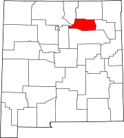
Unincorporated
communitiesGolondrinas | La Cueva | Mora
Categories:- National Register of Historic Places in New Mexico by county
- Mora County, New Mexico
- History of Mora County, New Mexico
-


Wikimedia Foundation. 2010.