- National Register of Historic Places listings in San Miguel County, New Mexico
-
 Location of San Miguel County in New Mexico
This is a list of the National Register of Historic Places listings in San Miguel County, New Mexico.
This is intended to be a complete list of the properties and districts on the National Register of Historic Places in San Miguel County, New Mexico, United States. Latitude and longitude coordinates are provided for many National Register properties and districts; these locations may be seen together in a Google map.[1]
There are 103 properties and districts listed on the National Register in the county, including 2 National Historic Landmarks.
-
- This National Park Service list is complete through NPS recent listings posted November 10, 2011.[2]
Contents: Counties in New Mexico Bernalillo – Catron – Chaves – Cibola – Colfax – Curry – De Baca – Doña Ana – Eddy – Grant – Guadalupe – Harding – Hidalgo – Lea – Lincoln – Los Alamos – Luna – McKinley – Mora – Otero – Quay – Rio Arriba – Roosevelt – San Juan – San Miguel – Sandoval – Santa Fe – Sierra – Socorro – Taos – Torrance – Union – Valencia Current listings
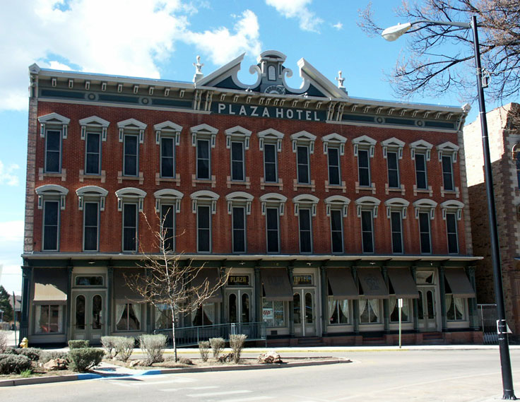
[3] Landmark name [4] Image Date listed Location City or town Summary 1 Acequia Madre March 19, 1987 Roughly from the Gallinas River to the intersection of S. Pacific and U.S. Route 85
35°35′05″N 105°13′26″W / 35.584722°N 105.223889°WLas Vegas 2 Arturo Angel House September 26, 1985 926 S. Pacific
35°35′12″N 105°13′22″W / 35.586667°N 105.222778°WLas Vegas 3 E. N. Charles and Lewis Arthur House September 26, 1985 Douglas Ave.
35°35′37″N 105°13′02″W / 35.593611°N 105.217222°WLas Vegas 4 AT & SF Roundhouse September 26, 1985 Northeast of Grand Ave.
35°35′12″N 105°12′53″W / 35.586667°N 105.214722°WLas Vegas 5 Baca-Korte House September 26, 1985 615 S. Pacific
35°34′58″N 105°13′15″W / 35.582778°N 105.220833°WLas Vegas 6 Bean-Newlee House September 26, 1985 1045 5th St.
35°36′04″N 105°13′03″W / 35.601111°N 105.2175°WLas Vegas 7 Bell Ranch Headquarters October 6, 1970 North and east of the Conchas Reservoir Tucumcari 8 Bridge Street Historic District July 26, 1978 100 block of Bridge St.
35°35′36″N 105°13′27″W / 35.593333°N 105.224167°WLas Vegas 9 Building at 1202 9th Street September 26, 1985 1202 9th St.
35°36′02″N 105°13′20″W / 35.600556°N 105.222222°WLas Vegas 10 Building at 1214 Bridge September 26, 1985 1214 Bridge
35°35′41″N 105°13′22″W / 35.594722°N 105.222778°WLas Vegas 11 Building at 2005 Montezuma September 26, 1985 2005 Montezuma
35°35′31″N 105°13′57″W / 35.591944°N 105.2325°WLas Vegas 12 Building at 1406 Romero September 26, 1985 1406 Romero
35°35′15″N 105°13′51″W / 35.5875°N 105.230833°WLas Vegas 13 Lowery Clevenger House September 26, 1985 1013 2nd
35°36′08″N 105°12′47″W / 35.602222°N 105.213056°WLas Vegas 14 Conchas Dam Historic District May 22, 2005 Roughly bounded by the State Park South Area, State Park North Area, Conchas Reservoir, and Bell Ranch
35°23′00″N 104°11′47″W / 35.383333°N 104.196389°WConchas Dam 15 James Cook House September 26, 1985 1017 11th
35°35′48″N 105°13′21″W / 35.596667°N 105.2225°WLas Vegas 16 Distrito de las Escuelas March 18, 1980 S. Pacific and S. Gonzales Sts.
35°35′32″N 105°13′31″W / 35.592222°N 105.225278°WLas Vegas 17 Douglas Avenue School August 5, 1983 900 Douglas Ave.
35°35′35″N 105°13′06″W / 35.593056°N 105.218333°WLas Vegas 18 Douglas-Sixth Street Historic District July 21, 1983 Roughly bounded by Grand, Lincoln, and 7th Sts., and University Ave.
35°35′41″N 105°12′14″W / 35.594722°N 105.203889°WLas Vegas 19 Eldorado Hotel September 26, 1985 514 Grand
35°35′39″N 105°12′48″W / 35.594167°N 105.213333°WLas Vegas 20 First Baptist Church September 26, 1985 700 University
35°35′47″N 105°13′02″W / 35.596389°N 105.217222°WLas Vegas 21 Eugenio Gatignole House September 26, 1985 1114 S. Gonzales
35°35′18″N 105°13′24″W / 35.588333°N 105.223333°WLas Vegas 22 Glorieta Baldy Lookout Tower January 27, 1988 Santa Fe National Forest
35°39′00″N 105°47′57″W / 35.65°N 105.799167°WLa Cueva 23 Glorieta Pass Battlefield 
October 15, 1966 10 miles southeast of Santa Fe on U.S. Routes 84/85
35°33′36″N 105°47′08″W / 35.56°N 105.785556°WSanta Fe 24 Esperansa Herrera House September 26, 1985 2231 Church
35°35′41″N 105°13′51″W / 35.594722°N 105.230833°WLas Vegas 25 House at 913 2nd September 26, 1985 913 2nd
35°36′01″N 105°12′44″W / 35.600278°N 105.212222°WLas Vegas 26 House at 915 2nd September 26, 1985 915 2nd
35°36′02″N 105°12′44″W / 35.600556°N 105.212222°WLas Vegas 27 House at 919 2nd September 26, 1985 919 2nd
35°36′02″N 105°12′45″W / 35.600556°N 105.2125°WLas Vegas 28 House at 1513 8th September 26, 1985 1513 8th
35°36′19″N 105°13′28″W / 35.605278°N 105.224444°WLas Vegas 29 House at 1616 8th September 26, 1985 1616 8th
35°36′24″N 105°13′28″W / 35.606667°N 105.224444°WLas Vegas 30 House at 1717 8th September 26, 1985 1717 8th
35°36′28″N 105°13′34″W / 35.607778°N 105.226111°WLas Vegas 31 House at 1114 10th September 26, 1985 1114 10th
35°35′53″N 105°13′16″W / 35.598056°N 105.221111°WLas Vegas 32 House at 1007 11th Street September 26, 1985 1007 11th St.
35°35′47″N 105°13′19″W / 35.596389°N 105.221944°WLas Vegas 33 House at 821 12th September 26, 1985 821 12th
35°35′41″N 105°13′22″W / 35.594722°N 105.222778°WLas Vegas 34 House at 933 12th September 26, 1985 933 12th
35°35′44″N 105°13′24″W / 35.595556°N 105.223333°WLas Vegas 35 House at 921 Chavez September 26, 1985 921 Chavez
35°35′09″N 105°13′27″W / 35.585833°N 105.224167°WLas Vegas 36 House at 1116 Columbia September 26, 1985 1116 Columbia
35°35′44″N 105°13′20″W / 35.595556°N 105.222222°WLas Vegas 37 House at 810 Douglas September 26, 1985 810 Douglas
35°35′47″N 105°13′02″W / 35.596389°N 105.217222°WLas Vegas 38 House at 812 Douglas September 26, 1985 812 Douglas
35°35′39″N 105°13′02″W / 35.594167°N 105.217222°WLas Vegas 39 House at 814 Douglas September 26, 1985 814 Douglas
35°35′38″N 105°13′03″W / 35.593889°N 105.2175°WLas Vegas 40 House at 818 Douglas September 26, 1985 818 Douglas
35°35′38″N 105°13′03″W / 35.593889°N 105.2175°WLas Vegas 41 House at 822 Douglas September 26, 1985 822 Douglas
35°35′38″N 105°13′04″W / 35.593889°N 105.217778°WLas Vegas 42 House at 12 Grand September 26, 1985 12 Grand
35°35′17″N 105°12′54″W / 35.588056°N 105.215°WLas Vegas 43 House at 16 Grand September 26, 1985 16 Grand
35°35′18″N 105°12′53″W / 35.588333°N 105.214722°WLas Vegas 44 House at 613 Mora September 26, 1985 613 Mora
35°35′45″N 105°14′02″W / 35.595833°N 105.233889°WLas Vegas 45 House at 618 Mora September 26, 1985 618 Mora
35°35′21″N 105°14′02″W / 35.589167°N 105.233889°WLas Vegas 46 House at 2203 New Mexico September 26, 1985 2203 New Mexico
35°35′40″N 105°13′57″W / 35.594444°N 105.2325°WLas Vegas 47 House at 521 S. Pacific September 26, 1985 521 S. Pacific
35°34′54″N 105°13′12″W / 35.581667°N 105.22°WLas Vegas 48 House at 921 S. Pacific September 26, 1985 921 S. Pacific
35°35′10″N 105°13′22″W / 35.586111°N 105.222778°WLas Vegas 49 House at 800 Pecos September 26, 1985 800 Pecos
35°35′48″N 105°12′30″W / 35.596667°N 105.208333°WLas Vegas 50 House at 931 Prince September 26, 1985 931 Prince
35°35′18″N 105°12′59″W / 35.588333°N 105.216389°WLas Vegas 51 House at 119 Railroad September 26, 1985 119 Railroad
35°35′20″N 105°12′51″W / 35.588889°N 105.214167°WLas Vegas 52 House at 309 Railroad September 26, 1985 309 Railroad
35°35′29″N 105°12′49″W / 35.591389°N 105.213611°WLas Vegas 53 House at 733 Railroad September 26, 1985 733 Railroad
35°35′50″N 105°12′43″W / 35.597222°N 105.211944°WLas Vegas 54 House at 919 Railroad September 26, 1985 919 Railroad
35°36′00″N 105°12′40″W / 35.6°N 105.211111°WLas Vegas 55 House at 1025 Railroad September 26, 1985 1025 Railroad
35°36′06″N 105°12′39″W / 35.601667°N 105.210833°WLas Vegas 56 House at 1221 San Francisco September 26, 1985 1221 San Francisco
35°35′49″N 105°13′28″W / 35.596944°N 105.224444°WLas Vegas 57 House at 2501 Taos Alley September 26, 1985 2501 Taos Alley
35°35′48″N 105°14′05″W / 35.596667°N 105.234722°WLas Vegas 58 House at 312 Tecolote September 26, 1985 312 Tecolote
35°35′10″N 105°13′25″W / 35.586111°N 105.223611°WLas Vegas 59 House at 508 University September 26, 1985 508 University
35°35′52″N 105°12′51″W / 35.597778°N 105.214167°WLas Vegas 60 House at 514 University September 26, 1985 514 University
35°35′52″N 105°12′52″W / 35.597778°N 105.214444°WLas Vegas 61 Adele Ilfeld Auditorium January 8, 1980 New Mexico Highlands University campus
35°35′41″N 105°13′09″W / 35.594722°N 105.219167°WLas Vegas 62 Charles Ilfeld Memorial Chapel September 26, 1985 Colonias and Romero
35°35′48″N 105°14′16″W / 35.596667°N 105.237778°WLas Vegas 63 Johnsen House September 26, 1985 1523 8th
35°36′19″N 105°13′29″W / 35.605278°N 105.224722°WLas Vegas 64 Johnsen Mortuary September 26, 1985 801 Douglas
35°35′37″N 105°13′00″W / 35.593611°N 105.216667°WLas Vegas 65 Norman L. King Memorial Stadium September 17, 1999 2.7 miles northwest of the junction of State Road 65 and Mill Ave.
35°36′40″N 105°15′31″W / 35.611111°N 105.258611°WLas Vegas 66 Las Vegas Municipal Building 
October 24, 2007 727 Grand Ave.
35°35′52″N 105°12′47″W / 35.597778°N 105.213056°WLas Vegas 67 Las Vegas Plaza 
December 16, 1974 Bounded by Valencia and Moreno Sts. and the rear property line of the building on Gonzales St. and Hot Springs Boulevard
35°35′34″N 105°13′35″W / 35.592778°N 105.226389°WLas Vegas 68 Las Vegas Railroad and Power Company Building September 26, 1985 12th and San Francisco
35°35′52″N 105°13′25″W / 35.597778°N 105.223611°WLas Vegas 69 Library Park Historic District 
March 12, 1979 Liberty Park and environs
35°35′52″N 105°12′52″W / 35.597778°N 105.214444°WLas Vegas 70 Lincoln Park Historic District August 6, 1979 7th, 8th, Lincoln and Jackson Sts
35°35′33″N 105°12′57″W / 35.5925°N 105.215833°WLas Vegas 71 Montezuma Hotel Complex 
May 3, 1974 6 miles northwest of Las Vegas in Gallinas Canyon
35°39′15″N 105°16′53″W / 35.654167°N 105.281389°WLas Vegas 72 Nolan House September 26, 1985 110 10th St.
35°35′22″N 105°13′03″W / 35.589444°N 105.2175°WLas Vegas 73 North New Town Historic District August 18, 1983 Roughly bounded by National, Friedman, 3rd, and 8th Sts.
35°35′58″N 105°13′05″W / 35.599444°N 105.218056°WLas Vegas 74 Old Las Vegas Post Office September 26, 1985 901 Douglas
35°35′36″N 105°13′05″W / 35.593333°N 105.218056°WLas Vegas 75 Old Town Residential Historic District October 28, 1983 Roughly bounded by Perey St. to Mills Ave., and from New Mexico to Gonzales St.
35°35′31″N 105°13′42″W / 35.591944°N 105.228333°WLas Vegas 76 Our Lady of Sorrows Church September 8, 1976 W. National Ave.
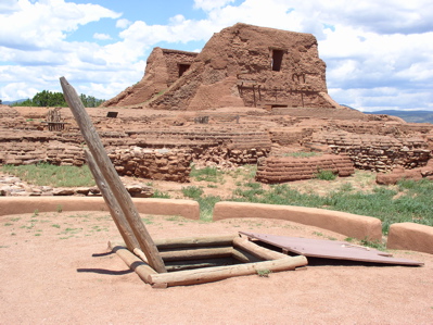
35°35′31″N 105°13′43″W / 35.591944°N 105.228611°WLas Vegas 77 Pecos National Historical Park July 2, 1991 State Road 63 southwest of its junction with State Road 50
35°33′00″N 105°41′04″W / 35.55°N 105.684444°WPecos 78 Pecos National Monument 
October 15, 1966 South of Pecos on State Road 63 Pecos 79 Pecos River Bridge at Terrero July 15, 1997 State Road 63 over the Pecos River
35°44′26″N 105°40′40″W / 35.740556°N 105.677778°WTerrero 80 Pendaries Grist Mill February 2, 1979 1 mile (1.6 km) east of Rociada off State Road 105
35°50′35″N 105°23′45″W / 35.843056°N 105.395833°WRociada 81 Pimter-O'Neil Rooming House September 26, 1985 313 Railroad
35°35′31″N 105°12′49″W / 35.591944°N 105.213611°WLas Vegas 82 Presbyterian Mission Church November 17, 1978 1413 Chavez St.
35°35′22″N 105°13′34″W / 35.589444°N 105.226111°WLas Vegas 83 Railroad Avenue Historic District August 6, 1979 U.S. Route 85
35°35′38″N 105°12′45″W / 35.593889°N 105.2125°WLas Vegas 84 Rogers Administration Building September 22, 1988 National Ave., on the New Mexico Highlands University campus
35°35′43″N 105°13′10″W / 35.595278°N 105.219444°WLas Vegas 85 Rowe Pueblo May 26, 2000 Address Restricted Rowe 86 St. Anthony's Hospital Annex September 26, 1985 700 Friedman
35°36′10″N 105°13′19″W / 35.602778°N 105.221944°WLas Vegas 87 St. Paul's Memorial Episcopal Church and Guild Hall November 7, 1976 714-716 National Ave.
35°35′46″N 105°13′04″W / 35.596111°N 105.217778°WLas Vegas 88 Vidal and Elisa Salazar House September 26, 1985 824 Railroad
35°35′55″N 105°12′39″W / 35.598611°N 105.210833°WLas Vegas 89 San Antonio de Padua Church September 13, 1978 State Road 63
35°34′59″N 105°40′31″W / 35.583056°N 105.675278°WPecos 90 San Geronimo Historic District November 15, 1983 Off State Road 283
35°34′47″N 105°23′44″W / 35.579722°N 105.395556°WSan Geronimo 91 San Miguel del Vado Historic District July 17, 1972 Southeast of San Jose on State Road 3, off U.S. Route 84
35°21′47″N 105°27′01″W / 35.363056°N 105.450278°WSan Jose 92 Santa Fe Trail-San Miguel County Trail Segments April 21, 1994 West of Interstate 25, south of Tecolote
35°27′08″N 105°16′49″W / 35.452222°N 105.280278°WTecolote 93 Schmitt-Laemmle House September 26, 1985 1106 Columbia
35°35′44″N 105°13′19″W / 35.595556°N 105.221944°WLas Vegas 94 Serna-Blanchard House September 26, 1985 2203 N. Gonzales
35°35′46″N 105°13′41″W / 35.596111°N 105.228056°WLas Vegas 95 Shawn-Guerin House September 26, 1985 140 Delgado
35°35′47″N 105°13′39″W / 35.596389°N 105.2275°WLas Vegas 96 M. M. Sundt House September 26, 1985 1607 8th
35°36′21″N 105°13′30″W / 35.605833°N 105.225°WLas Vegas 97 Taichert Building September 26, 1985 1201 National
35°35′37″N 105°13′20″W / 35.593611°N 105.222222°WLas Vegas 98 Taichert Warehouse September 26, 1985 623 12th
35°35′35″N 105°13′19″W / 35.593056°N 105.221944°WLas Vegas 99 Truder Park September 26, 1985 Roughly bounded by 2nd, Washington, and Grand
35°36′03″N 105°12′43″W / 35.600833°N 105.211944°WLas Vegas 100 Trujillo-Gonzales House September 26, 1985 935 New Mexico
35°35′10″N 105°13′36″W / 35.586111°N 105.226667°WLas Vegas 101 Valencia Ranch Historic Archaeological District February 9, 1984 Address Restricted Pecos 102 Variadero Bridge July 22, 1997 State Road 104 over Rio Conchas
35°23′21″N 104°27′33″W / 35.389167°N 104.459167°WVariadero 103 C. W. G. Ward House September 26, 1985 1301 8th
35°36′08″N 105°13′26″W / 35.602222°N 105.223889°WLas Vegas See also
- List of National Historic Landmarks in New Mexico
- National Register of Historic Places listings in New Mexico
References
- ^ The latitude and longitude information provided in this table was derived originally from the National Register Information System, which has been found to be fairly accurate for about 99% of listings. For about 1% of NRIS original coordinates, experience has shown that one or both coordinates are typos or otherwise extremely far off; some corrections may have been made. A more subtle problem causes many locations to be off by up to 150 yards, depending on location in the country: most NRIS coordinates were derived from tracing out latitude and longitudes off of USGS topographical quadrant maps created under North American Datum of 1927, which differs from the current, highly accurate GPS system used by Google maps. Chicago is about right, but NRIS longitudes in Washington are higher by about 4.5 seconds, and are lower by about 2.0 seconds in Maine. Latitudes differ by about 1.0 second in Florida. Some locations in this table may have been corrected to current GPS standards.
- ^ "National Register of Historic Places: Weekly List Actions". National Park Service, United States Department of the Interior. Retrieved on November 10, 2011.
- ^ Numbers represent an ordering by significant words. Various colorings, defined here, differentiate National Historic Landmark sites and National Register of Historic Places Districts from other NRHP buildings, structures, sites or objects.
- ^ "National Register Information System". National Register of Historic Places. National Park Service. . http://nrhp.focus.nps.gov/natreg/docs/All_Data.html.
U.S. National Register of Historic Places Topics Lists by states Alabama • Alaska • Arizona • Arkansas • California • Colorado • Connecticut • Delaware • Florida • Georgia • Hawaii • Idaho • Illinois • Indiana • Iowa • Kansas • Kentucky • Louisiana • Maine • Maryland • Massachusetts • Michigan • Minnesota • Mississippi • Missouri • Montana • Nebraska • Nevada • New Hampshire • New Jersey • New Mexico • New York • North Carolina • North Dakota • Ohio • Oklahoma • Oregon • Pennsylvania • Rhode Island • South Carolina • South Dakota • Tennessee • Texas • Utah • Vermont • Virginia • Washington • West Virginia • Wisconsin • WyomingLists by territories Lists by associated states Other  Category:National Register of Historic Places •
  Portal:National Register of Historic Places
Municipalities and communities of San Miguel County, New Mexico County seat: Las Vegas City 
Villages Unincorporated
communitiesMontezuma | Ribera | Rowe | Trementina | Villanueva
Ghost towns Las Ruedas
Footnotes ‡This populated place also has portions in an adjacent county or counties
Categories:- National Register of Historic Places in New Mexico by county
- San Miguel County, New Mexico
- History of San Miguel County, New Mexico
-


Wikimedia Foundation. 2010.