- National Register of Historic Places listings in Doña Ana County, New Mexico
-
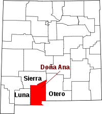 Location of Doña Ana County in New Mexico
This is a list of the National Register of Historic Places listings in Doña Ana County, New Mexico.
This is intended to be a complete list of the properties and districts on the National Register of Historic Places in Doña Ana County, New Mexico, United States. Latitude and longitude coordinates are provided for many National Register properties and districts; these locations may be seen together in a Google map.[1]
There are 26 properties and districts listed on the National Register in the county, including 2 National Historic Landmarks.
-
- This National Park Service list is complete through NPS recent listings posted November 10, 2011.[2]
Contents: Counties in New Mexico Bernalillo – Catron – Chaves – Cibola – Colfax – Curry – De Baca – Doña Ana – Eddy – Grant – Guadalupe – Harding – Hidalgo – Lea – Lincoln – Los Alamos – Luna – McKinley – Mora – Otero – Quay – Rio Arriba – Roosevelt – San Juan – San Miguel – Sandoval – Santa Fe – Sierra – Socorro – Taos – Torrance – Union – Valencia Current listings
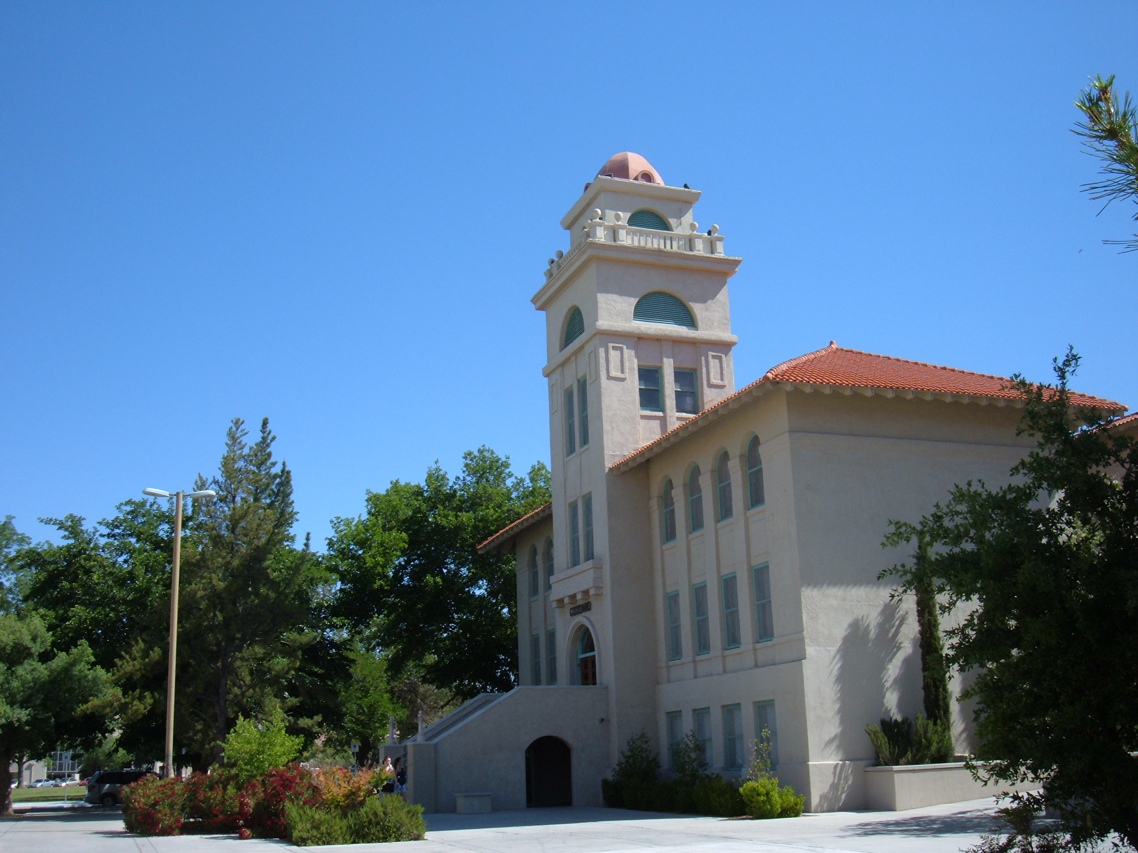
[3] Landmark name [4] Image Date listed Location City or town Summary 1 Air Science 
May 16, 1989 Northeastern corner of N. Horseshoe and Espina St. on the New Mexico State University campus
32°17′00″N 106°45′19″W / 32.283333°N 106.755278°WLas Cruces Today the William Conroy Honors Center 2 Alameda-Depot Historic District 
April 11, 1985 Includes properties centered around Pioneer Park and extending up Alameda Boulevard
32°18′45″N 106°47′01″W / 32.3125°N 106.783611°WLas Cruces 3 Nestor Armijo House 
December 12, 1976 Lohman Ave. and Church St.
32°18′20″N 106°46′35″W / 32.305556°N 106.776389°WLas Cruces 4 Barela-Reynolds House 
January 20, 1978 Off State Road 292
32°16′27″N 106°47′43″W / 32.274167°N 106.795278°WMesilla 5 L.B. Bentley General Merchandise 
March 22, 2006 16125 Old Organ Main St.
32°25′40″N 106°35′55″W / 32.427778°N 106.598611°WOrgan 6 Thomas Branigan Memorial Library 
September 15, 2004 106 W. Hadley St.
32°18′52″N 106°46′48″W / 32.314444°N 106.78°WLas Cruces Original library building; replaced by newer facility in 1979 7 Dona Ana Village Historic District September 27, 1996 Roughly bounded by the Dona Ana lateral irrigation ditch, Interstate 25, State Road 320, and Dona Ana School Rd.
32°23′17″N 106°48′56″W / 32.388056°N 106.815556°WDona Ana 8 Elephant Butte Irrigation District August 8, 1997 Roughly along U.S. Route 85 between its junction with State Road 90 and the El Paso city limits
32°12′58″N 106°57′31″W / 32.216111°N 106.958611°WLas Cruces 9 Fort Fillmore July 30, 1974 Eastern side of Holy Cross Rd., southeast of Las Cruces
32°15′28″N 106°44′36″W / 32.25778°N 106.74333°W[5]Las Cruces 10 Fort Selden 
July 9, 1970 18 miles north of Las Cruces
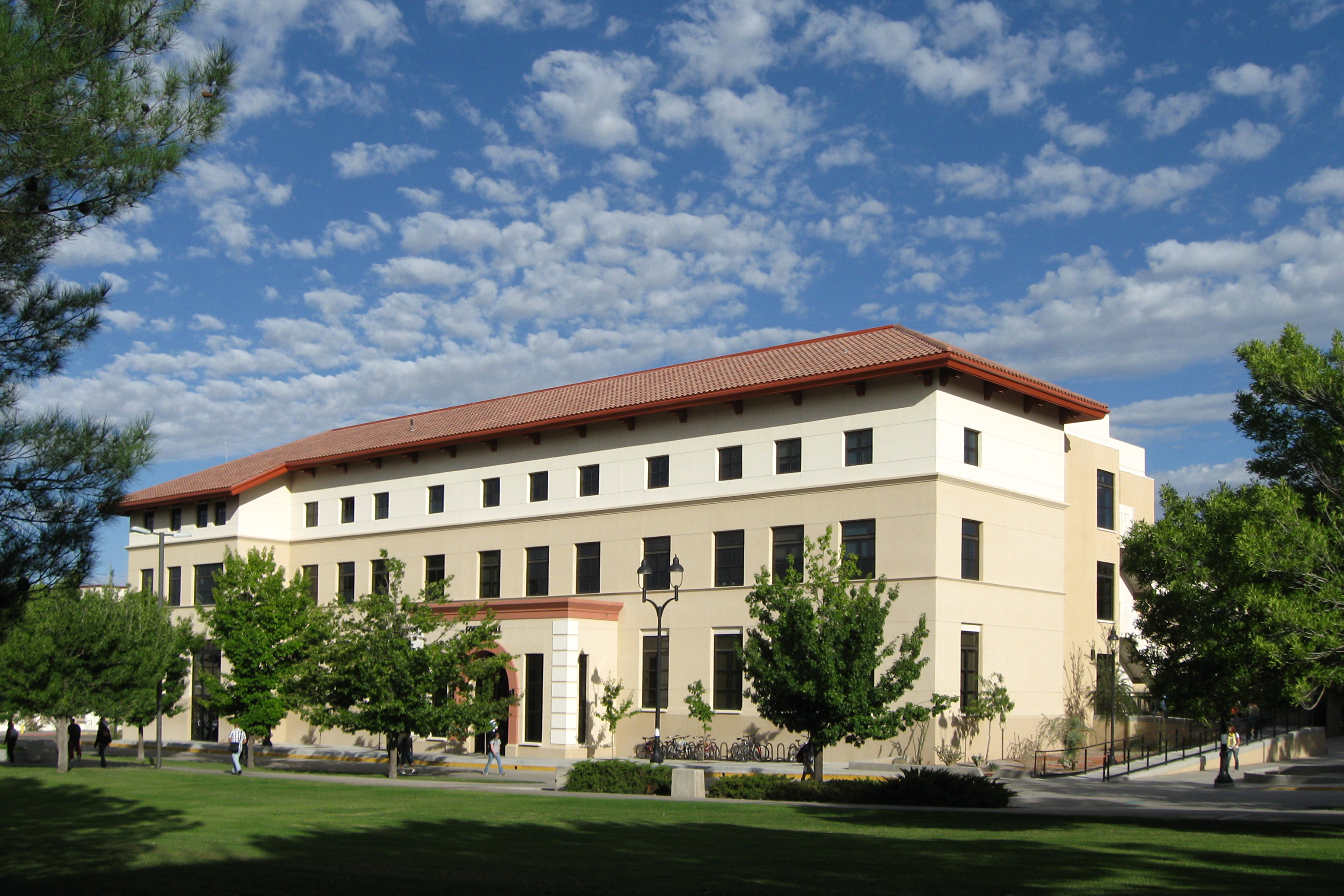
32°29′45″N 106°55′30″W / 32.495833°N 106.925°WLas Cruces 11 Foster Hall 
May 16, 1989 Southeastern corner of the junction of S. Horseshoe and Sweet on the New Mexico State University campus
32°16′53″N 106°45′09″W / 32.281389°N 106.7525°WLas Cruces 12 Goddard Hall 
September 22, 1988 S. Horseshoe between Espina and Sweet on the New Mexico State University campus
32°16′53″N 106°45′13″W / 32.281389°N 106.753611°WLas Cruces 13 Green Bridge 
August 21, 2008 4100 Dripping Springs Rd. Las Cruces 14 Hadley-Ludwick House 
April 3, 1991 2640 El Paseo
32°16′59″N 106°45′42″W / 32.283056°N 106.761667°WLas Cruces 15 International Boundary Marker No. 1, U.S. and Mexico September 10, 1974 West of El Paso off Interstate 10
31°47′03″N 106°31′45″W / 31.784167°N 106.529167°WSunland Park 16 La Mesilla Historic District 
July 20, 1982 Roughly bounded by Calle del Norte, Calle del El Paso, Calle del Cura and Calleion Guerro
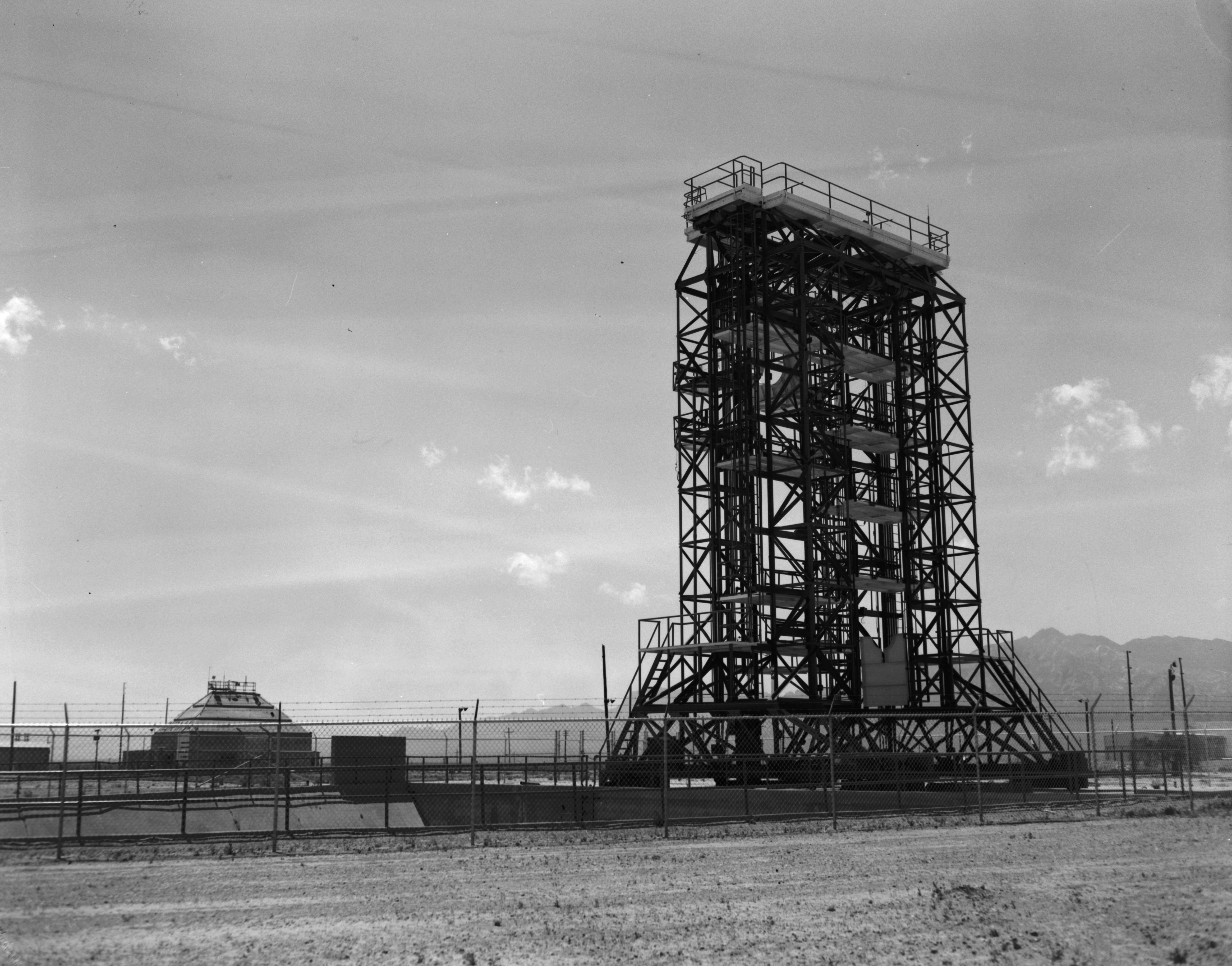
32°16′49″N 106°47′39″W / 32.280278°N 106.794167°WMesilla 17 Launch Complex 33 
October 3, 1985 White Sands Missile Range
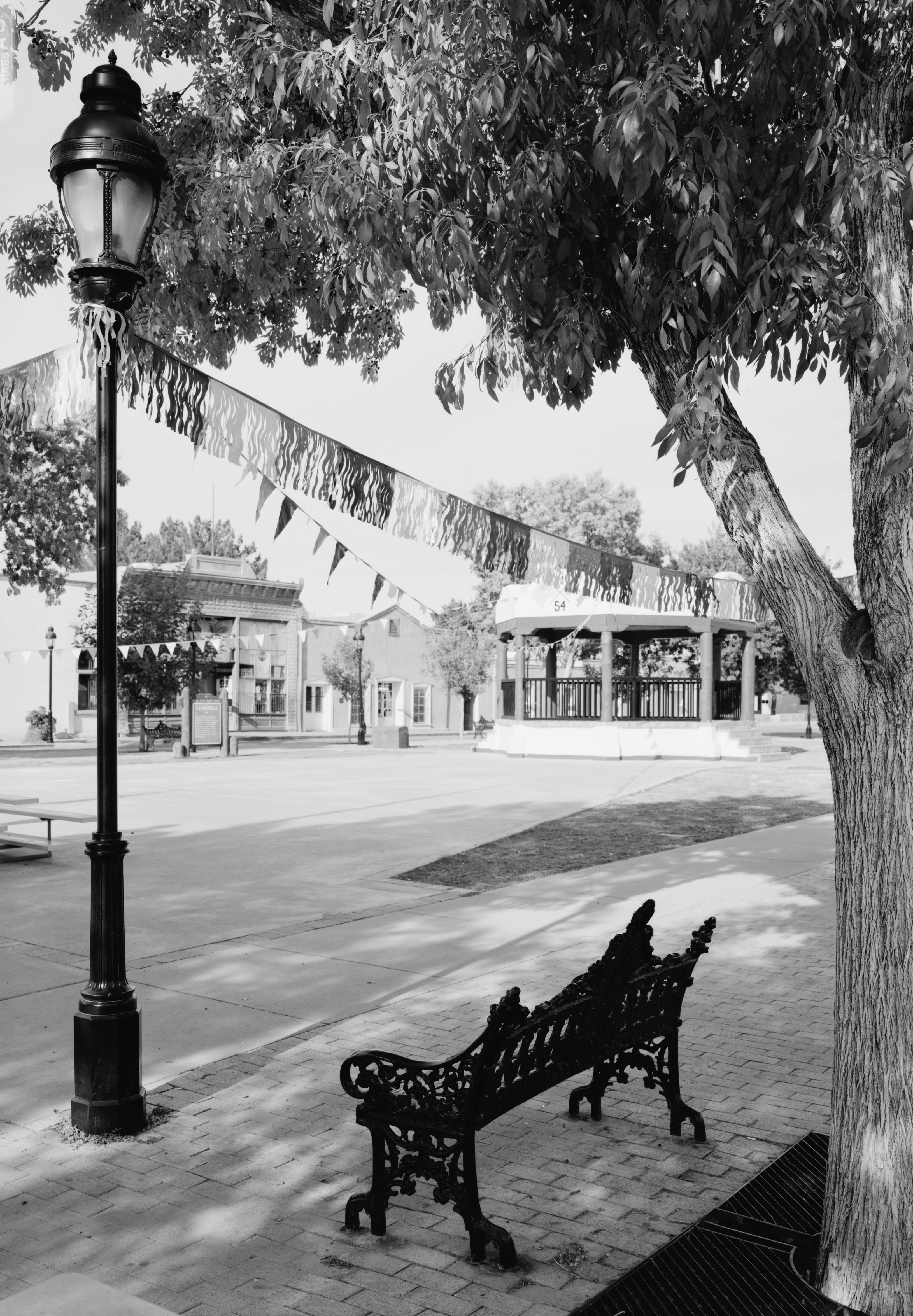
32°24′04″N 106°22′40″W / 32.401111°N 106.377778°WWhite Sands Missile Range 18 Mesilla Plaza 
October 15, 1966 2 miles south of Las Cruces on State Road 28
32°16′25″N 106°48′16″W / 32.273611°N 106.804444°WMesilla 19 Mesquite Street Original Townsite Historic District 
August 1, 1985 Roughly bounded by E. Texas, Campo, Tornillo, and E. Court
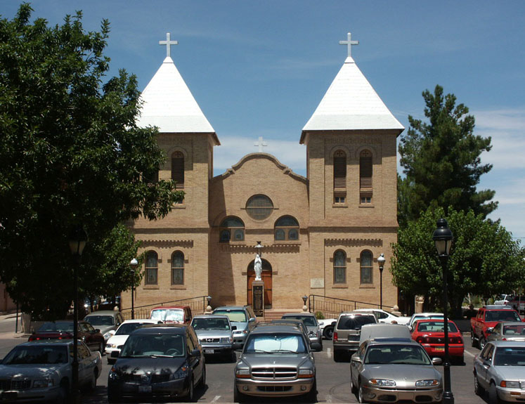
32°18′31″N 106°46′26″W / 32.308611°N 106.773889°WLas Cruces 20 Our Lady of Purification Catholic Church 
June 27, 1985 Camino Real and 2nd St.
32°23′14″N 106°48′59″W / 32.387222°N 106.816389°WDona Ana 21 Phillips Chapel CME Church 
August 4, 2003 638 N. Tornillo St.
32°18′54″N 106°46′25″W / 32.315°N 106.773611°WLas Cruces 22 Rio Grande Bridge at Radium Springs 
July 15, 1997 State Road 185 over the Rio Grande
32°29′09″N 106°55′28″W / 32.485833°N 106.924444°WRadium Springs 23 Rio Grande Theatre 
January 2, 2004 211 N. Downtown Mall
32°18′38″N 106°46′42″W / 32.310556°N 106.778333°WLas Cruces 24 San Jose Church 
January 21, 1993 317 Josephine St.
32°07′23″N 106°42′16″W / 32.123056°N 106.704444°WLa Mesa 25 Summerford Mountain Archeological District January 22, 2007 Dona Ana Mountains Radium Springs 26 University President's House 
May 16, 1989 South of University Ave. between Espina and Solano on the New Mexico State University campus
32°17′02″N 106°45′16″W / 32.283889°N 106.754444°WLas Cruces See also
- List of National Historic Landmarks in New Mexico
- National Register of Historic Places listings in New Mexico
References
- ^ The latitude and longitude information provided in this table was derived originally from the National Register Information System, which has been found to be fairly accurate for about 99% of listings. For about 1% of NRIS original coordinates, experience has shown that one or both coordinates are typos or otherwise extremely far off; some corrections may have been made. A more subtle problem causes many locations to be off by up to 150 yards, depending on location in the country: most NRIS coordinates were derived from tracing out latitude and longitudes off of USGS topographical quadrant maps created under the North American Datum of 1927, which differs from the current, highly accurate WGS84 GPS system used by Google maps. Chicago is about right, but NRIS longitudes in Washington are higher by about 4.5 seconds, and are lower by about 2.0 seconds in Maine. Latitudes differ by about 1.0 second in Florida. Some locations in this table may have been corrected to current GPS standards.
- ^ "National Register of Historic Places: Weekly List Actions". National Park Service, United States Department of the Interior. Retrieved on November 10, 2011.
- ^ Numbers represent an ordering by significant words. Various colorings, defined here, differentiate National Historic Landmark sites and National Register of Historic Places Districts from other NRHP buildings, structures, sites or objects.
- ^ "National Register Information System". National Register of Historic Places. National Park Service. . http://nrhp.focus.nps.gov/natreg/docs/All_Data.html.
- ^ Location derived from its GNIS feature record; the NRIS lists the site as "Address Restricted"
U.S. National Register of Historic Places Topics Lists by states Alabama • Alaska • Arizona • Arkansas • California • Colorado • Connecticut • Delaware • Florida • Georgia • Hawaii • Idaho • Illinois • Indiana • Iowa • Kansas • Kentucky • Louisiana • Maine • Maryland • Massachusetts • Michigan • Minnesota • Mississippi • Missouri • Montana • Nebraska • Nevada • New Hampshire • New Jersey • New Mexico • New York • North Carolina • North Dakota • Ohio • Oklahoma • Oregon • Pennsylvania • Rhode Island • South Carolina • South Dakota • Tennessee • Texas • Utah • Vermont • Virginia • Washington • West Virginia • Wisconsin • WyomingLists by territories Lists by associated states Other Municipalities and communities of Doña Ana County, New Mexico Cities 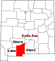
Town Village CDPs Chaparral | Doña Ana | Mesquite | Radium Springs | Rincon | Salem | Santa Teresa | University Park | Vado | White Sands
Other
communitiesBerino | Organ
Ghost town Lanark
Categories:- National Register of Historic Places in New Mexico by county
- Doña Ana County, New Mexico
- History of Doña Ana County, New Mexico
-


Wikimedia Foundation. 2010.