- Anthony, New Mexico
Infobox Settlement
official_name = Anthony, New Mexico
settlement_type = CDP
nickname =
motto =
imagesize =
image_caption =
image_
imagesize =
image_caption =
image_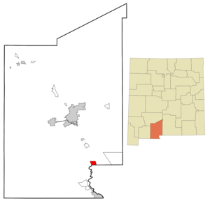
mapsize = 250px
map_caption = Location of Anthony, New Mexico
mapsize1 =
map_caption1 =subdivision_type = Country
subdivision_name =United States
subdivision_type1 = State
subdivision_name1 =New Mexico
subdivision_type2 = County
subdivision_name2 = Dona Ana
government_footnotes =
government_type =
leader_title =
leader_name =
leader_title1 =
leader_name1 =
established_title =
established_date =unit_pref = Imperial
area_footnotes =area_magnitude =
area_total_km2 = 10.2
area_land_km2 = 10.2
area_water_km2 = 0.0
area_total_sq_mi = 3.9
area_land_sq_mi = 3.9
area_water_sq_mi = 0.0population_as_of = 2000
population_footnotes =
population_total = 7904
population_density_km2 = 773.1
population_density_sq_mi = 2002.4timezone = Mountain (MST)
utc_offset = -7
timezone_DST = MDT
utc_offset_DST = -6
elevation_footnotes =
elevation_m = 1159
elevation_ft = 3802
latd = 32 |latm = 0 |lats = 22 |latNS = N
longd = 106 |longm = 36 |longs = 2 |longEW = Wpostal_code_type =
ZIP code s
postal_code = 88000-88099
area_code = 575
blank_name = FIPS code
blank_info = 35-03820
blank1_name = GNIS feature ID
blank1_info = 0920558
website =
footnotes =Anthony is a
census-designated place (CDP) in Doña Ana County,New Mexico , USA. The population was 7,904 at the 2000 census. It is located south of Las Cruces on the New Mexico-Texas state line in the Upper Mesilla Valley alongInterstate 10 . The city is also part of the Las CrucesMetropolitan Statistical Area .Geography
Anthony is located at coor dms|32|0|22|N|106|36|2|W|city (32.006028, -106.600669)GR|1.
According to the
United States Census Bureau , the CDP has a total area of 4.0square mile s (10.2km² ), all of it land.Demographics
As of the
census GR|2 of 2000, there were 7,904 people, 2,077 households, and 1,858 families residing in the CDP. Thepopulation density was 2,002.4 people per square mile (772.6/km²). There were 2,217 housing units at an average density of 561.6/sq mi (216.7/km²). The racial makeup of the CDP was 57.78% White, 0.27% African American, 0.94% Native American, 0.23% Asian, 0.14% Pacific Islander, 37.82% from other races, and 2.83% from two or more races.There were 2,077 households out of which 57.7% had children under the age of 18 living with them, 59.7% were married couples living together, 25.2% had a female householder with no husband present, and 10.5% were non-families. 8.9% of all households were made up of individuals and 3.9% had someone living alone who was 65 years of age or older. The average household size was 3.81 and the average family size was 4.02.
In the CDP the population was spread out with 39.7% under the age of 18, 12.0% from 18 to 24, 26.3% from 25 to 44, 14.7% from 45 to 64, and 7.2% who were 65 years of age or older. The median age was 24 years. For every 100 females there were 92.3 males. For every 100 females age 18 and over, there were 85.0 males.
The median income for a household in the CDP was $22,547, and the median income for a family was $24,298. Males had a median income of $23,307 versus $17,757 for females. The
per capita income for the CDP was $6,674. About 33.2% of families and 38.0% of the population were below thepoverty line , including 45.9% of those under age 18 and 15.9% of those age 65 or over.Notable native
*
Anthony Cobos - Texan judge raised on a nearby farm.References
External links
* [http://www.anthonynewmexico.org Community website]
Wikimedia Foundation. 2010.