- U.S. Route 85
-
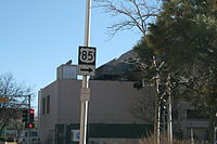
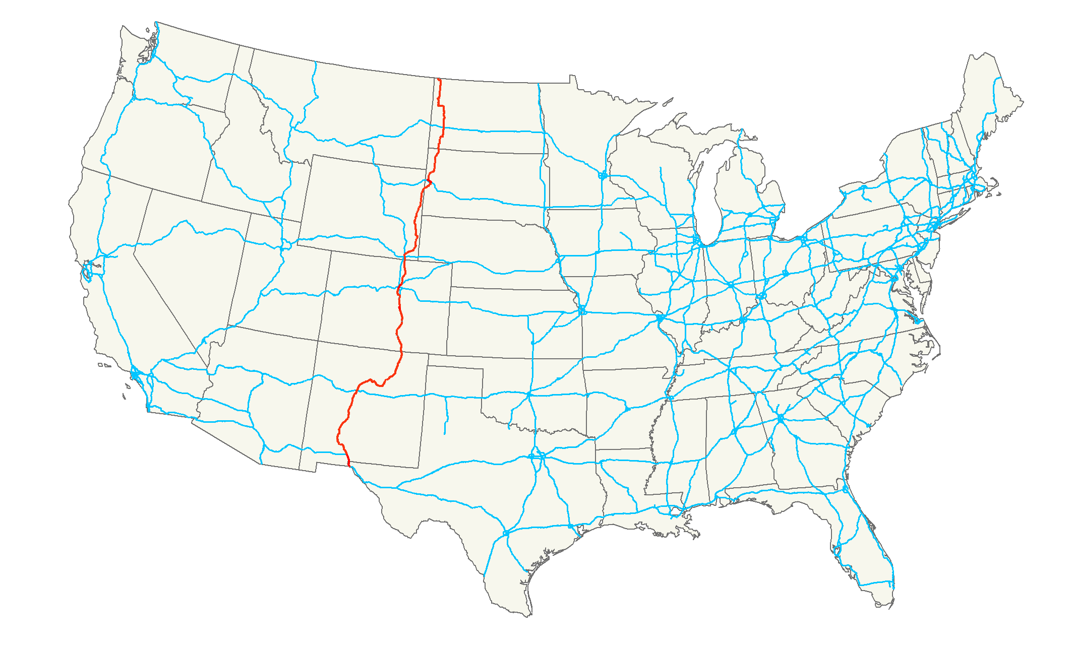
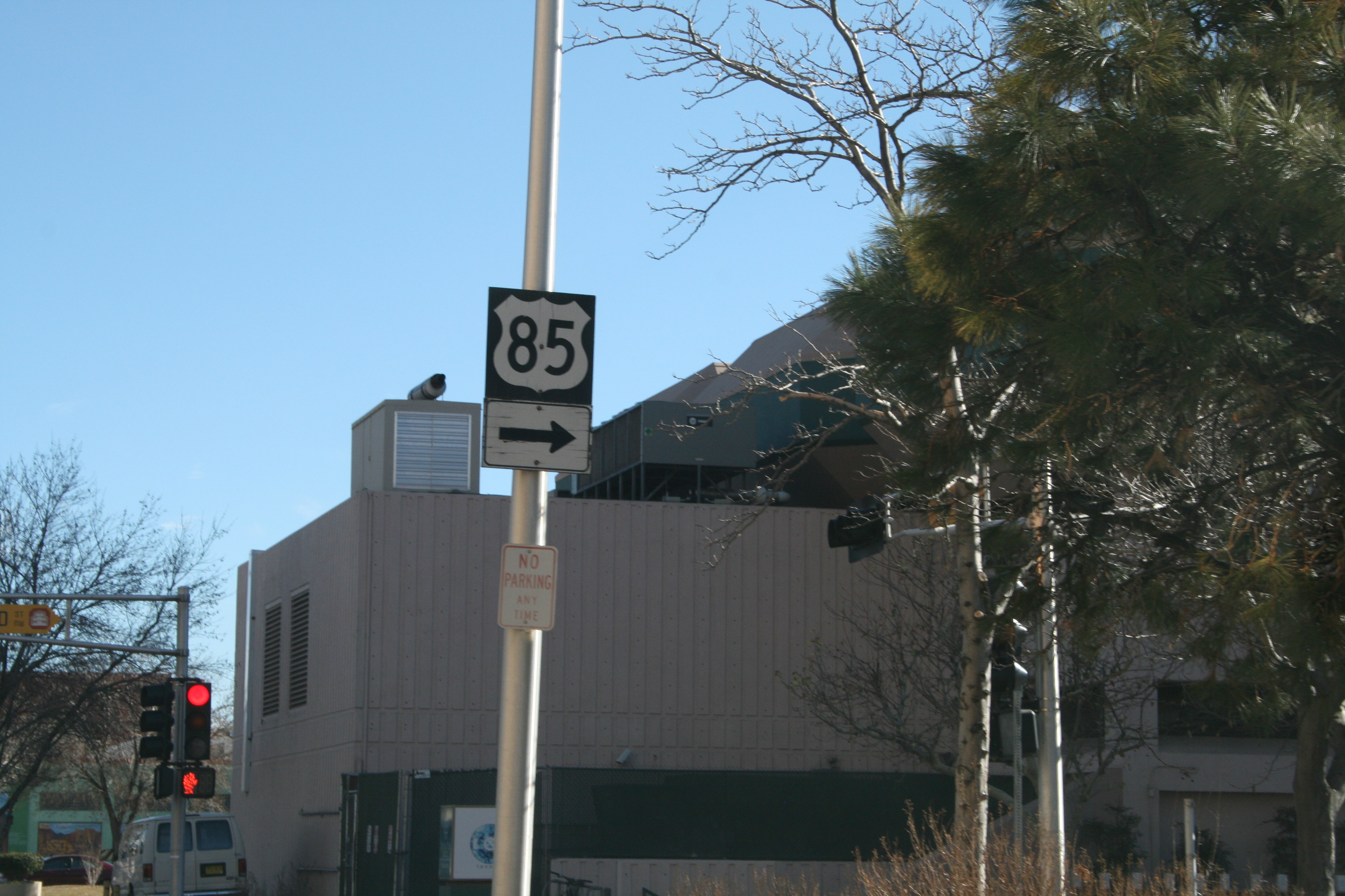
U.S. Route 85
CanAm Highway 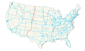
Route information Length: 1,479 mi[1] (2,380 km) Existed: 1926[1] – present Major junctions South end:  MX 45 at the Mexican Border at El Paso, TX
 I-10 at El Paso, TX
 I-25 at Las Cruces, NM
 I-40 at Albuquerque, NM
 I-25 in Colorado Springs, CO
 I-70 in Denver, CO
 I-76 in Denver, CO
 I-80 at Cheyenne, WY
 I-90 near Deadwood, SD
 I-94 at Belfield, ND
North end:  Hwy 35 at Canadian border at Fortuna, ND
Highway system United States Numbered Highways
List • Bannered • Divided • ReplacedU.S. Route 85 (US 85) is a north–south United States highway that runs for 1,479 miles (2,380 km) in the Mountain - Northern Plains states of the United States. The southern terminus of the route is at the United States-Mexico border in El Paso, Texas, connecting with Mexican Federal Highway 45. The northern terminus is at the United States-Canada border in Fortuna, North Dakota, where the route continues north as Saskatchewan Highway 35. In both the United States and Saskatchewan, Canada the route is known as the CanAm Highway.
Contents
Route description
Lengths mi[2] km TX 21 34 NM 483 777 CO 310 499 WY 256 412 SD 154 248 ND 255 410 Total 1479 2380 The highway passes through Texas, New Mexico, Colorado, Wyoming, South Dakota, and North Dakota.
Texas
Main article: U.S. Route 85 in TexasUS 85 in Texas begins at the United States/Mexico border with U.S. 62 and travels north through El Paso, beginning at the Santa Fe Street Bridge, and following Santa Fe street, then Paisano Drive westward, along the Rio Grande until Paisano Drive ends where it joins with I-10, about 14 miles (23 km) before both reach the New Mexico border. The route is concurrent with Interstate 10 for the remainder of its route within Texas.
The original route of US 85 in Texas had the highway concurrent with Doniphan Drive (after Paisano Drive), and parallelling the Atchison, Topeka and Santa Fe Railway through the Mesilla Valley communities of Canutillo, Vinton and Anthony before crossing the Texas/New Mexico state line in Anthony, New Mexico, then following the road which is now New Mexico State Road 478 up the Mesilla Valley to Las Cruces. This route is marked as Texas State Highway 20 north of the intersection with Mesa Street/Country Club Drive.
New Mexico
 Remnant US-85 sign at Third Street and Roma Street in downtown Albuquerque, New Mexico. US-85 was rerouted off this alignment circa 1990.
U.S. 85 in New Mexico is entirely concurrent with Interstate Routes. For the first 20 miles (32 km) it shares its route with I-10, then continues north for the remainder of its length in New Mexico concurrent with I-25. It is not signed.[3] US-85 was de-signed in segments between 1970 and 1990 as I-25 was built through the state. I-25 between Bernalillo and a point just south of Santa Fe was built over the old US-85 alignment. I-25 was also built directly over US-85 from east of Santa Fe to Las Vegas and from US-64 to the Colorado border at Raton Pass.
The original route from Anthony to Las Cruces is now signed as New Mexico State Road 478. The original route from Las Cruces to Hatch is now signed as New Mexico State Road 185; New Mexico State Road 187 south of Truth or Consequences (T or C); New Mexico State Road 181 north of T or C; New Mexico State Road 1 from Redrock to Socorro; New Mexico State Road 314 from Belen to Albuquerque; New Mexico State Road 313 from Albuquerque to Bernalillo; New Mexico State Road 14 and New Mexico State Road 466 through Santa Fe; and New Mexico State Road 445 from Maxwell to US Route 64[4] Remnant US-85 signs can still be seen on Fourth Street in downtown Albuquerque, the original route through the city before I-25 was built.
The New Mexico Department of Transportation has removed US-85 from its route logs, but the American Association of State Highway and Transportation Officials (AASHTO) retains US-85 on a concurrent alignment with I-10 and I-25 to maintain continuity with signed segments in Texas and Colorado.
Colorado
U.S. 85 enters Colorado from New Mexico concurrent with I-25 but is not signed. US-85 leaves I-25 at Exit 128 and follows Santa Fe Avenue through Fountain before turning west briefly onto Lake Avenue, then turning north following Nevada Avenue through Colorado Springs before rejoining I-25 at Exit 148. Approaching the south side of Denver, US-85 again leaves I-25 at Exit 182. From there it heads west and north as a two lane rural highway. It becomes an expressway near Chatfield Lake and the southern Denver suburbs of Littleton and Englewood. It continues north through Denver for a few miles before once again joining with I-25 at mile marker 207. There it becomes a concurrency with U.S. Route 87 as well as I-25 and heads north through downtown Denver. At exit 214 U.S. 85 turns east and becomes a concurrency with Interstate 70 and U.S. Route 6 for about a mile where it exits with U.S. 6 and heads northeast through Commerce City. In just a few miles the U.S. 6/U.S. 85 concurrency merges with Interstate 76 at mile marker 9. They travel concurrently for 3 miles (4.8 km) until exit 12 when U.S. 85 becomes an expressway and continues north out of the Denver area through Brighton. From there it parallels I-25 for about 75 miles (121 km) passing through Fort Lupton, Platteville, Evans, Greeley, and Eaton before crossing into Wyoming.
Wyoming
US 85 enters Wyoming from Colorado 8 miles (13 km) south of Cheyenne. In Cheyenne it joins with Business Route 87, and a mile later with Interstate 180 until it meets with U.S. Route 30. The segment with I-180 is the only fully at-grade interstate route in the U.S. [2] At exit 12, it joins with I-25 and U.S. Route 87 in a concurrency for 5 miles (8.0 km) until US 85 leaves at exit 17 and travels northeast towards Meriden. From there it heads north to Torrington, where it meets with U.S. Route 26 and concurrencies for 10 miles (16 km) until Lingle, and 47 miles (76 km) later it meets U.S. Route 20 and U.S. Route 18 at Lusk. It shares the next 47 miles (76 km) with US 18 and 33 miles (53 km) later meets U.S. Route 16 near Newcastle. From here it is 29 miles (47 km) until it enters South Dakota in the Black Hills.
South Dakota
The South Dakota section of U.S 85., with the exception of two concurrencies with U.S. 14 Alternate and a concurrency with Interstate 90, is defined at South Dakota Codified Laws § 31-4-181.[5]
U.S. 85 enters the Black Hills from Wyoming and travels northeast until it meets with U.S. 14 Alternate east. The two routes form a concurrency from there until I-90 where U.S. 85 overlaps for 8 miles (13 km) while heading west. At exit 10 U.S. 85 heads back north towards Belle Fourche where it crosses U.S. 212. From there it continues to North Dakota passing only through the small towns of Redig, Buffalo, and Ludlow.
North Dakota
U.S. 85 enters North Dakota in the southwest part of the state. The first city on its route is Bowman at the junction of U.S. Route 12. Continuing north, it passes between North Dakota's two highest points, White Butte and Black Butte. Near Amidon it heads east for 9 miles (14 km) before going back north along the Little Missouri National Grassland for about 125 miles (201 km). Near Belfield it junctions with Interstate 94. After forming a concurrency with North Dakota Highway 200, it eventually passes through part of the scenic Badlands, crosses the Little Missouri river and passes near the Theodore Roosevelt National Park (North Unit).
Then, at Watford City it travels west for 16 miles (26 km) where it turns back north before Alexander. U.S. 85 continues north as North Dakota 200 turns west toward Montana. South of Williston it crosses the Missouri River. A few miles later it meets with U.S. Route 2 where the two overlap for 19 miles (31 km) as an expressway, which now bypasses Williston to the northwest. After U.S. 2 heads east U.S. 85 continues north to a concurrency with North Dakota Highway 5. From there it is 7 miles (11 km) to Fortuna where U.S. 85 heads back north for its remaining 6 miles (9.7 km) to the U.S./Canada border.
History
What is now US 85 from El Paso, Texas to then-U.S. Route 66 (now SR 6) in Los Lunas, New Mexico (south of Albuquerque) was shown as U.S. Route 466 in an early 1925 plan for the U.S. Highway System. This north–south route was never signed in the field; instead, the route was designated as part of US 85. This proposed routing is often referred to as "US 466 (I)" to distinguish it from the later, signed US 466.
Major intersections
- Mexican Federal Highway 45 at the U.S.-Mexico border between El Paso, Texas and Ciudad Juárez, Chih.
- U.S. Highway 62 in El Paso
- Interstate 10 and U.S. Route 180 in El Paso
- Interstate 25 and U.S. Highway 70 in Las Cruces, New Mexico
- Interstate 40 in Albuqurerque, New Mexico
- U.S. Highway 64 in Raton, New Mexico
- U.S. Highway 350 in Trinidad, Colorado
- U.S. Highway 160 near Walensburg, Colorado
- U.S. Highway 50 in Pueblo, Colorado
- U.S. Highway 24 in Colorado Springs, Colorado
- U.S. Highway 285 in Englewood, Colorado
- Interstate 25 south of downtown Denver, Colorado (intersects with I-25/US-87)
- U.S. Highway 40 and U.S. Highway 287 in Denver, Colorado (paired together)
- Interstate 70 in Denver, Colorado
- U.S. Highway 36 and Interstate 270 north of Denver, Colorado (paired together)
- U.S. Highway 6 and Interstate 76 north of Denver, Colorado (they are paired with U.S. 85)
- U.S. Highway 34 in Greeley, Colorado
- Interstate 80 in Cheyenne, Wyoming
- U.S. Highway 30 in Cheyenne, Wyoming
- U.S. Highway 87 north of Cheyenne, Wyoming
- U.S. Highway 26 in Lingle, Wyoming
- U.S. Highway 20 in Lusk, Wyoming
- U.S. Highway 18 west of Edgemont, South Dakota
- U.S. Highway 16 in Newcastle, Wyoming
- U.S. Highway 14 in Deadwood, South Dakota
- U.S. Highway 385 in Deadwood, South Dakota
- Interstate 90 and U.S. Highway 14 in Spearfish exit 10
- U.S. Highway 212 in Belle Fourche, South Dakota
- U.S. Highway 12 in Bowman, North Dakota
- Interstate 94 exit 42 at Belfield, North Dakota
- U.S. Highway 2 north of Williston, North Dakota
References
- ^ a b Droz, Robert V. U.S. Highways : From US 1 to (US 830). URL accessed 02:55, 4 July 2006 (UTC).
- ^ "U.S. Route Number Database". American Association of State Highway and Transportation Officials. http://nchrp20-7-228.com/USRoute.aspx. Retrieved 2011-2-17.
- ^ [1]
- ^ US Highways in New Mexico, Accessed May 22, 2009
- ^ South Dakota Codified Laws
 Main U.S. Routes
1 2 3 4 5 6 7 8 9 10 11 12 13 14 15 16 17 18 19 20 21 22 23 24 25 26 27 28 29 30 31 32 33 34 35 36 37 38 40 41 42 43 44 45 46 48 49 50 51 52 53 54 55 56 57 58 59 60 61 62 63 64 65 66 67 68 69 70 71 72 73 74 75 76 77 78 79 80 81 82 83 84 85 87 89 90 91 92 93 94 95 96 97 98 99 101 163 400 412 425 Lists U.S. Routes • Bannered • Divided • Bypassed Browse numbered routes ←  US 84
US 84TX SH 85  →
→← US 84CO SH 86  →
→← I-80WY US 87  →
→←  SD 85
SD 85SD US 85E  →
→←  US 83
US 83ND ND 89  →
→U.S. Routes related to US 85 
Bridges of the Missouri River Upstream
ND 58 Bridge

US 85 Bridge

Downstream
Four Bears Bridge
 Categories:
- U.S. Highway System
- U.S. Highways in North Dakota
- U.S. Highways in South Dakota
- U.S. Highways in Wyoming
- U.S. Highways in Colorado
- U.S. Highways in New Mexico
- U.S. Highways in Texas
- Theodore Roosevelt Expressway

Wikimedia Foundation. 2010.