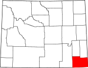
- Cheyenne, Wyoming
-
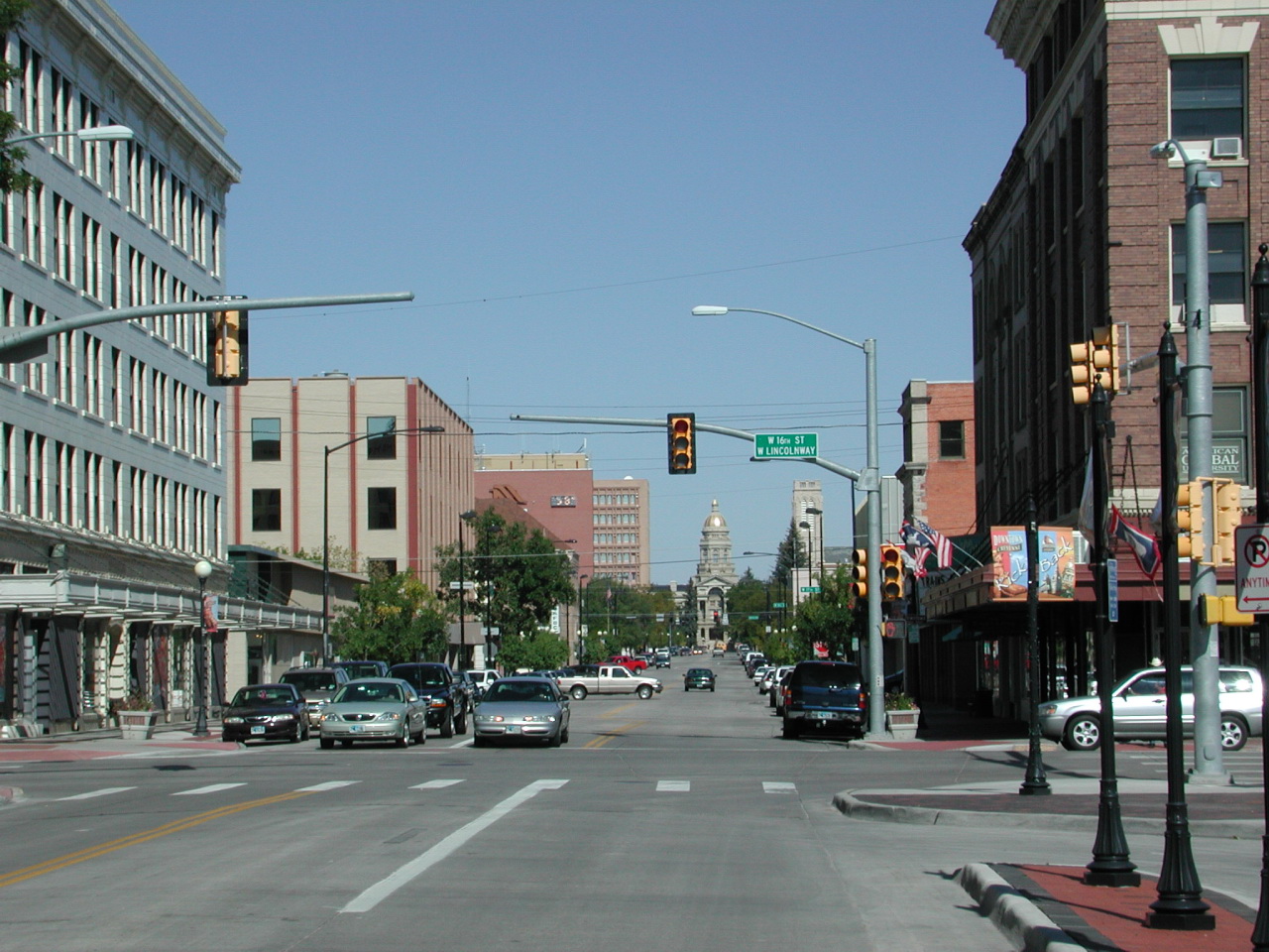
City of Cheyenne — City — Capitol Ave. in Downtown Cheyenne
SealNickname(s): Magic City of the Plains; Capital City (of Wyoming); The Frontier City Location in Wyoming
Coordinates: 41°8′44″N 104°48′7″W / 41.14556°N 104.80194°WCoordinates: 41°8′44″N 104°48′7″W / 41.14556°N 104.80194°W Country United States State Wyoming County Laramie Founded 1867 Government – Mayor Richard Kaysen[1] Area – City 21.2 sq mi (121 km2) – Land 21.0 sq mi (151.6 km2) – Water 0.2 sq mi (0.5 km2) 0.38% Elevation 6,062 ft (1,848 m) Population (2010) – City 59,466 – Density 2,805/sq mi (392.2/km2) – Urban 71,775 – Metro 91,738 Time zone Mountain (UTC-7) – Summer (DST) Mountain (UTC-6) Area code(s) 307 FIPS code 56-13900[2] GNIS feature ID 1609077[3] Website www.cheyennecity.org Most populous Wyoming City Cheyenne (pronounced /ʃaɪˈæn/ or /ʃaɪˈɛn/ or Shy-anne) is the capital and most populous city of the U.S. state of Wyoming and the county seat of Laramie County.[4] It is the principal city of the Cheyenne, Wyoming, Metropolitan Statistical Area which encompasses all of Laramie County. The population is 59,466 at the 2010 census. Cheyenne is the northern terminus of the extensive and fast-growing Front Range Urban Corridor. Cheyenne is situated on Crow Creek and Dry Creek. The Cheyenne, Wyoming Metropolitan Area had a 2010 population of 91,738, making it the 354th most populated metropolitan area in the United States.
Contents
History
On July 5, 1867, General Grenville M. Dodge and his survey crew platted the site now known as Cheyenne in Dakota Territory (later Wyoming Territory). This site was chosen as the point at which the Union Pacific Railroad crossed Crow Creek, a tributary of the South Platte River. The city was not named by Dodge, as his memoirs state, but rather by friends who accompanied him to the area Dodge called "Crow Creek Crossing." It was named for the American Indian Cheyenne nation, one of the most famous and prominent Great Plains tribes closely allied with the Arapaho.
There were many from a hundred miles around who felt the construction of the Union Pacific Railroad through the area would bring them prosperity. By the time the first track was built into Cheyenne November 13, 1867, over four thousand people had migrated into the new city.
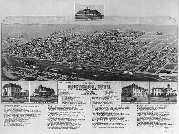
 Bird's eye view of Cheyenne, Wyoming, in 1882
Those who did not leave with the westward construction of the railroad were joined by gamblers, saloon owners, thieves, opportunists, prostitutes, displaced cowboys, miners, transient railroad gangs, proper business men, soldiers from "Camp Cheyenne," (later named Fort D.A. Russell, now F.E. Warren Air Force Base), and men from Camp Carlin.
As the capital of the Wyoming Territory and the only city of any consequence, as well as being the seat of the stockyards where cattle were loaded on the Union Pacific Railroad, the city's Cheyenne Club was the natural meeting place for the organization of the large well-capitalized ranches called the Wyoming Stock Growers Association. (See Johnson County War of 1892, the largest of the "range wars" of early Wyoming history).
Geography and climate
Cheyenne is located at 41°8′44″N 104°48′7″W / 41.14556°N 104.80194°W (41.145548, -104.802042)[5]. Lying near the southeast corner of the state, it is one of the least centrally located state capitals in the nation (together with cities such as Carson City, Nevada and Juneau, Alaska).
According to the United States Census Bureau, the city has a total area of 21.2 square miles (54.9 km²). 21.0 square miles (54.7 km²) of it is land and 0.2 square miles (0.2 km²) of it (0.38%) is water.
Climate
Cheyenne, like most of the rest of Wyoming, is semi-arid (Koppen BSk). Winters are cold and moderately long, but relatively dry, with a January average of 25.9 °F (−3.4 °C), highs that fail to reach freezing occur 37 days per year, and lows dip to the 0 °F (−18 °C) mark on 12 nights.[6] However, the coldness is often interrupted, with chinook winds blowing downslope from the Rockies that can warm conditions, bringing the high above 50 °F (10 °C) on 20 days from December to February.[6] Snowfall is greatest in March and April, averaging 60 inches (152 cm) for the season, yet thick snow cover rarely stays.[6][6] Summers are warm, with a July average of 67.7 °F (19.8 °C), and highs reaching 90 °F (32 °C) 8 times. Spring and autumn are quick transitions, with the median freeze dates being May 12 and September 26.[6] The annual precipitation tends to be concentrated from May to August and is low during fall and winter, contributing to the area's 2980 hours (~68%) of the possible total, of sunshine per year.
Climate data for Cheyenne, Wyoming Month Jan Feb Mar Apr May Jun Jul Aug Sep Oct Nov Dec Year Record high °F (°C) 66
(19)71
(22)77
(25)83
(28)91
(33)100
(38)100
(38)96
(36)95
(35)85
(29)75
(24)69
(21)100
(38)Average high °F (°C) 37.1
(2.8)40.5
(4.7)46.4
(8.0)54.4
(12.4)64.4
(18.0)75.4
(24.1)81.9
(27.7)79.8
(26.6)70.3
(21.3)58.2
(14.6)44.5
(6.9)38.1
(3.4)57.6 Daily mean °F (°C) 25.9
(−3.4)28.8
(−1.8)34.2
(1.2)41.6
(5.3)51.3
(10.7)61.5
(16.4)67.7
(19.8)65.9
(18.8)56.6
(13.7)45.4
(7.4)33.3
(0.7)27.1
(−2.7)44.9 Average low °F (°C) 14.8
(−9.6)17.2
(−8.2)22.0
(−5.6)28.7
(−1.8)38.3
(3.5)47.5
(8.6)53.4
(11.9)52.0
(11.1)42.9
(6.1)32.5
(0.3)22.1
(−5.5)16.1
(−8.8)32.3 Record low °F (°C) −38
(−39)−34
(−37)−21
(−29)−8
(−22)8
(−13)25
(−4)33
(1)25
(−4)8
(−13)−5
(−21)−21
(−29)−28
(−33)−38
(−39)Precipitation inches (mm) 0.45
(11.4)0.44
(11.2)1.05
(26.7)1.55
(39.4)2.48
(63)2.12
(53.8)2.26
(57.4)1.82
(46.2)1.43
(36.3)0.75
(19.1)0.64
(16.3)0.46
(11.7)15.45
(392.4)Snowfall inches (cm) 7.3
(18.5)6.9
(17.5)12.7
(32.3)9.1
(23.1)2.5
(6.4)0
(0)0
(0)0
(0)1.6
(4.1)4.1
(10.4)8.4
(21.3)7.3
(18.5)59.9
(152.1)Avg. precipitation days (≥ 0.01 in) 5.6 5.9 9.1 10.3 12.5 10.4 11.3 11.2 8.1 6.6 6.8 6.1 103.9 Avg. snowy days (≥ 0.1 in) 6.1 6.0 8.4 6.3 1.5 0 0 0 0.9 3.3 6.3 6.3 45.1 Sunshine hours 192.2 203.4 254.2 273.0 291.4 303.0 316.2 297.6 261.0 235.6 180.0 176.7 2,984.3 Source no. 1: The Weather Channel[7] Source no. 2: NOAA (normals, 1971-2000),[6] HKO[8] Neighborhoods
Cheyenne includes many neighborhoods within and out of its city limits. Not all listed, but some of them include:
- Alta Vista in East-Central Cheyenne
- Antilope Hills in North-West Cheyenne
- Archer Estates in Eastern Cheyenne
- Crystal Valley Estates in Northern Cheyenne
- Capitol Heights/Avenues in West-Central Cheyenne
- Yellowstone Estates in Northern Cheyenne
- Teton Estates in North-East Cheyenne
- Western Hills in North-West Cheyenne
- Bar-X in North-Western Cheyenne
Demographics
Historical populations Census Pop. %± 1870 1,450 — 1880 3,456 138.3% 1890 11,690 238.3% 1900 14,087 20.5% 1910 11,320 −19.6% 1920 13,829 22.2% 1930 17,361 25.5% 1940 22,474 29.5% 1950 31,935 42.1% 1960 43,505 36.2% 1970 41,254 −5.2% 1980 47,283 14.6% 1990 50,008 5.8% 2000 53,011 6.0% 2010 59,466 12.2% State of Wyoming, U.S. Census Bureau,[9][10] At the 2005-2007 American Community Survey 3-Year Estimates, the city's population was 89.3% White (79.2% non-Hispanic White alone), 12.7% Hispanic or Latino (of any race), 4.5% Black or African American, 2.5% American Indian and Alaska Native, 2.1% Asian and 6.4% from some other race.[11] 22.5% of the total population had a Bachelor's degree or higher.[12]
As of the census[2] of 2000, there were 53,011 people, 22,324 households, 14,175 families residing in the city, and 81,607 people residing in the Metropolitan Statistical Area making it the largest city and metropolitan area in the state of Wyoming. The population density was 2,511.4 inhabitants per square mile (969.6/km²). There were 23,782 housing units at an average density of 1,126.7 per square mile (435.0/km²). The racial makeup of the city was 88.1% White, 2.8% Black or African American, 0.8% Native American, 1.1% Asian, 0.1% Pacific Islander, 4.4% from other races, and 2.7% from two or more races. 12.5% of the population were Hispanic or Latino of any race.
There were 22,324 households out of which 30.4% had children under the age of 18 living with them, 49.2% were married couples living together, 10.6% had a female householder with no husband present, and 36.5% were non-families. 31.3% of all households were made up of individuals and 10.6% had someone living alone who was 65 years of age or older. The average household size was 2.33 and the average family size was 2.93.
In the city the population was spread out with 24.9% under the age of 18, 8.8% from 18 to 24, 29.7% from 25 to 44, 22.8% from 45 to 64, and 13.8% who were 65 years of age or older. The median age was 37 years. For every 100 females there were 95.3 males. For every 100 females age 18 and over, there were 92.7 males.
The median income for a household in the city was $38,856, and the median income for a family was $46,771. Males had a median income of $32,286 versus $24,529 for females. The per capita income for the city was $19,809. About 6.3% of families and 8.8% of the population were below the poverty line, including 11.1% of those under age 18 and 5.8% of those age 65 or over.
Government
Cheyenne's government consists of a mayor and a city council. The mayor is elected in a citywide vote. The city council has nine members each of whom are elected from one of three wards. Each ward elects three members.[13]
Education
Primary and secondary schools
Public education in the city of Cheyenne is provided by Laramie County School District #1. The district is served by four high schools, Central High on the northwest side, East High on the east side, South High on the south side, and Triumph High also on the south side.
Colleges and universities
Cheyenne is home to Laramie County Community College (LCCC), a branch of Institute of Business & Medical Careers, and a branch of University of Phoenix.
Economy
Government is the largest sector of Cheyenne's economy. The state of Wyoming operates a multitude of offices in downtown Cheyenne. Many area residents are employed by or are dependent on the U.S. Air Force, through F.E. Warren Air Force Base to the west of the city, or by the Wyoming National Guard. Railroads remain a major economic force for the city, with both the Burlington Northern Santa Fe and Union Pacific employing many residents.[14]
Steps have been taken in recent years to diversify the city's economy. Lowe's and Wal-Mart both operate distribution centers on the city's outskirts. Sierra Trading Post is headquartered in the city and also operates its distribution and fulfillment centers in the city.[15]
Cheyenne's high elevation, coupled with its position on the continent, make it one of the windiest cities in America. The abundance of wind makes Cheyenne an opportune place to develop wind energy and to fly kites. Wind turbines are currently being placed around Laramie County. Laramie County Community College is home to a leading wind energy technician program, where students learn to maintain these turbines. The opening of a Vestas wind turbine blade assembly in nearby Weld County, Colorado, as well as other alternative energy manufacturing facilities around Colorado, are transforming the region into a center for alternative energy.
Great Lakes Airlines and Taco John's are headquartered in Cheyenne.[16][17]
List of tallest buildings in Cheyenne:
- Wyoming State Capitol 146 ft.
- Wyoming Financial Center 110 ft.
- Joseph C. O'Mahoney Federal Building 80 ft.
- Burke Senior Center 80 ft.
- Cheyenne Regional Medical Center 70 ft.
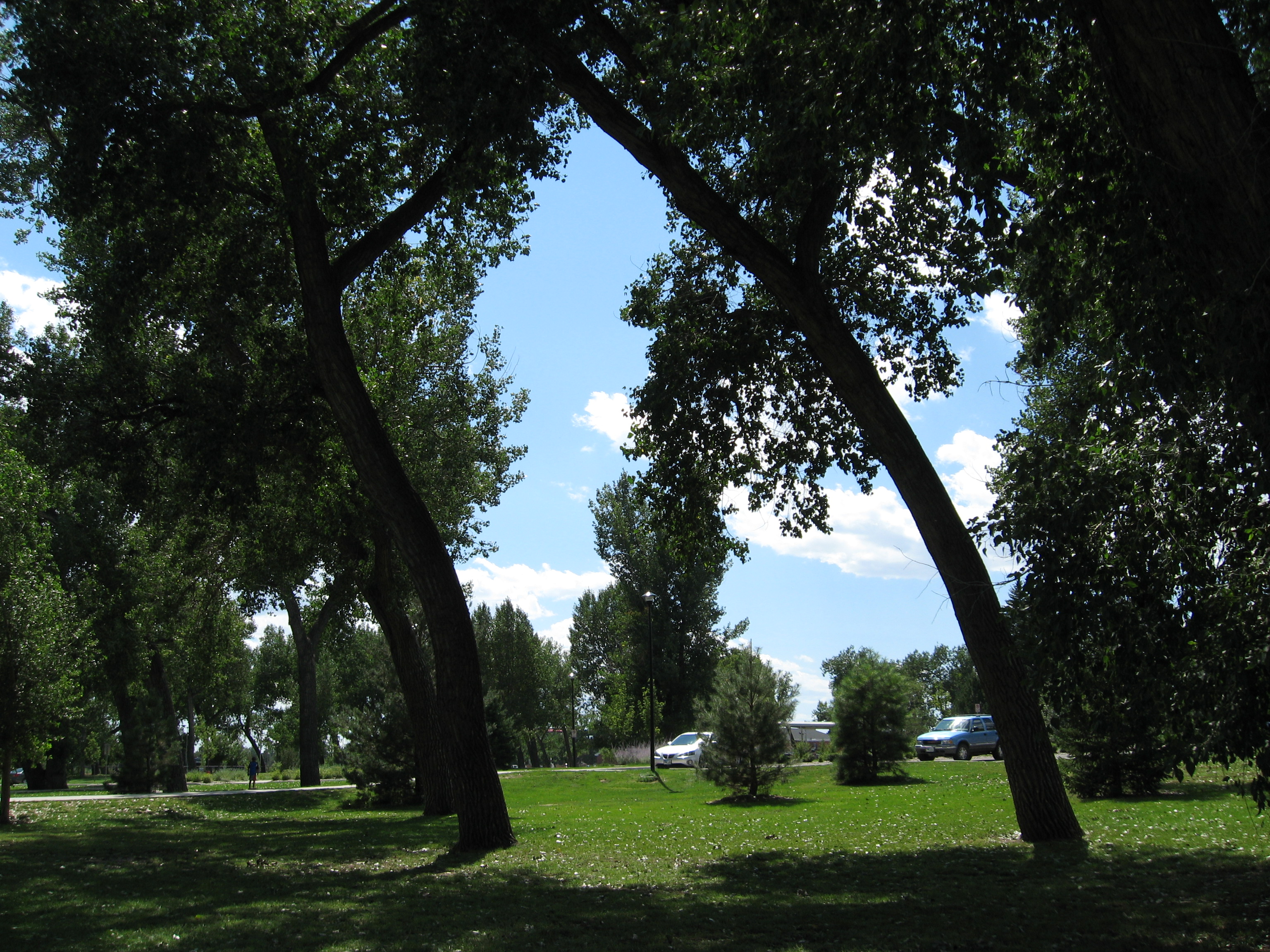
Parks and Recreation
Below is a list of parks in Cheyenne:
- Lions
- Western Hills
- Bar X
- Centennial
- Pointe
- Smaley
- Mylar
- Frontier
- Cahill
- Brimmer
- Sun Valley
- Sun Valley Open Space
- Saddle Ridge
- United Nations
- VFW Pride
- Norris Refinery
- Lincoln
- Optimist
- Timberline
- Crow Creek Pocket
- Romero
- Martin Luther King, Jr.
- Clear Creek
- North Cheyenne
- Jaycee
- Leo Pando
- Pioneer
- Big sky
- LCCC Natural Area
- Holliday
- Civitan
In addition to the parks, Cheyenne has many paths that make up the Greater Cheyenne Greenway. The greenway serves as a gateway to the parks and neighborhoods of Cheyenne. In 1996, as a result of the greenway, Cheyenne was named " Trail Town USA " by the National Park service and the American Hiking Society.
Recreation includes:
- Taco Johns Event Center
- 2 Bar Bowl bowling alley
- Roller City
- Cheyenne Rec Center
- Junior League Complex
- Dutcher Field
- BNSF Rail Trail
- and more
Golf Couses in Cheyenne are
- Airport Golf Course
- Prairie View Golf course
- Cheyenne Country Club
Cheyenne has one of only three enclosed shopping malls in Wyoming, the Frontier Mall. The others being Eastridge Mall in Casper, and the White Mountain Mall in Rock Springs.
Landmarks
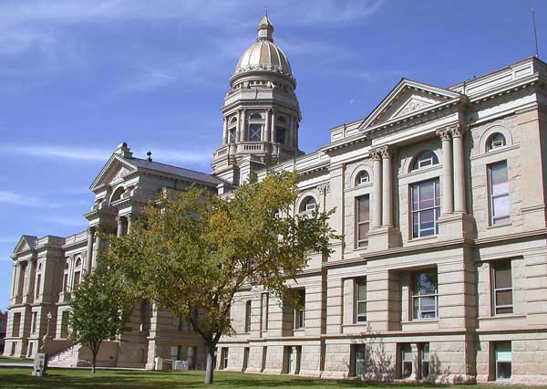
 Wyoming State Capitol in Cheyenne
 Lions Park
- Wyoming State Capitol
- Cheyenne Botanic Gardens
- F.E. Warren Air Force Base, one of the nation's oldest, continuously active installations (orig. U.S. Army).
- Nagle Warren Mansion
Historic places
Over fifty different locations in Cheyenne are listed on the National Register of Historical Places, including:
- the Atlas Theatre (added 1973)
- Union Pacific Depot (1973)
- the Governor's Mansion (1969)
- Nagle-Warren Mansion (1976)
- First Presbyterian Church (1869)
- First United Methodist Church (1975)
- St. Mark's Episcopal Church (1970)
- St. Mary's Catholic Cathedral (1974)
- Cheyenne High School (2005)
- Storey Gymnasium (2005)
- Park Addition School (1970)
Several districts in the city are also listed, including:
- the Downtown District (1978, with boundary increase in 1980, 1988, 1996. Encompasses 205 acres (0.83 km2) and 67 buildings)
- Lakeview District (1996, 350 acres 109 buildings)
- Rainsford District (1984, 1980 acres 288 buildings)
- Capitol North District (1980, 204 acres 112 buildings)
- Fort David A. Russell (1969, 6300 acres 19 buildings)
- Union Pacific Roundhouse, Turntable and Machine Shop (1992, 113 acres 2 buildings)
- South Side District (2006)
Transportation
Highways
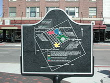 Plaque depicting Cheyenne's street grid along with historic districts
 Map of Cheyenne Road Network
Interstate Highways
 I-25
I-25- North-South Interstate running from New Mexico to Wyoming intersects I-80 southwest of Cheyenne.
 I-80
I-80- East-West Interstate running from California to New Jersey. Intersects I-25 southwest of Cheyenne.
- North-South interstate that runs concurrent with US 85 from I-80 to US 30.
(It is the only Interstate Highway that is not up to Interstate Highway standards along its entire route)
US Routes
 US 30 (Lincolnway)
- East-West route through Cheyenne
 US 85 (South Greely Hwy., Central Ave. (Southbound), Warren Ave. (Northbound))
- North-South route through Cheyenne
 US 87
US 87- North-South through Cheyenne that runs concurrent with I-25 through Cheyenne
Wyoming State Highways
 WYO 210 (Happy Jack Rd.)
- East-West route from I-25/US 87 (Exit 10) west out of Cheyenne towards Laramie
 WYO 212 (College Dr., Four Mile Rd.)
- North-South route that forms a beltway around Cheyenne. From I-25 (Exit 7) to WYO 219
 WYO 219 (Yellowstone Rd.)
- North-South route from US 85 in Cheyenne near the Cheyenne Airport north out of the city
 WYO 221 (Fox Farm Rd.)
- East-west route from US 85 east to WYO 212 in Cheyenne
 WYO 222 (Fort Access Rd.)
- North-South route from WYO 225 just southeast of Cheyenne and travels north to F.E. Warren Air Force Base and continues on its north route east of the city to WYO 221
 WYO 225 (Otto Rd.)
- East-West route from I-80/US 30 southwest of Cheyenne west
Airports
Cheyenne Regional Airport features daily service from Great Lakes Airlines (to Denver) and American Eagle Airlines (to Dallas-Fort Worth).[18]
Railroads
The Union Pacific and BNSF railroads intersect in Cheyenne. The city is home to a BNSF railyard, as well as the Union Pacific's steam program. UP's 844 and 3985 reside in the steam shop.[19]
Cheyenne Frontier Days
Cheyenne Frontier Days, which occurs during 10 days centered around the last full week in July, is the largest outdoor rodeo in the US. The events include professional bull riding, cattle roping, barrel racing and many others. During this week there are many parades and other events. Additionally there is a carnival with numerous rides, games and shops. Frontier Days concerts scheduled for 2011 are: Kid Rock, Jason Aldean, The Charlie Daniels Band, Motley Crue, Darius Rucker, Sara Evans, Zac Brown Band, and Toby Keith with Eric Church.[20]
Fictional references to Cheyenne
In the Spike TV series Blue Mountain State, the main characters Alex Moran and Sammy Cacciatore are from Cheyenne.
Three novels by Philip K. Dick are partly set in Cheyenne. In The Man in the High Castle, it is where Hawthorne Abendsen lives in the eponymous "High Castle". In Dr. Bloodmoney, it is the seat of a military dictatorship. In The Penultimate Truth, several characters are linked by post-apocalyptic Cheyenne.
In the American serial drama Jericho, Cheyenne is the capital city of the Allied States of America, a separatist faction of the United States formed after a surprise nuclear attack on the country's major metropolitan areas.
In the 1984 motion picture Red Dawn, Cheyenne is the farthest north that the Cuban, Soviet, and Nicaraguan forces have pushed American forces. In the motion picture Ready to Rumble, the two main protagonists go to a live WCW Monday Night Nitro in Cheyenne.
Garth Brooks recorded the song "Beaches of Cheyenne". James McMurtry wrote and recorded a song titled, "Lights of Cheyenne".Guided by Voices have a song titled "Cheyenne" on Universal Truths and Cycles. A B-side of The Hold Steady's Stay Positive is titled "Cheyenne Sunrise" ("there's nothing like a Cheyenne sunrise to make us has-beens feel too old"). Country singer George Strait recorded the song "I Can Still Make Cheyenne". Country singer Eric Church makes reference to spurring a bull in Cheyenne in the song "These Boots".
Sister cities
Cheyenne's sister cities are:
 United States:
 Republic of China: Taichung, Taiwan
 France: Lourdes
 Tunisia: Hammam Sousse
Notable natives and residents
- Vernon Baker - Medal of Honor recipient
- James M. Flinchum - editor-in-chief of former Wyoming State Tribune from 1961 to 1985
- Shirley E. Flynn - Cheyenne historian and author
- John Frullo - former Cheyenne resident and member of the Texas House of Representatives from Lubbock
- John Godina — Shot putter; won a silver medal at the 1996 Atlanta Olympics and a bronze medal at the 2000 Sydney games
- Curt Gowdy — national sportscaster
- Tom Horn — an American Old West lawman, scout, soldier, hired gunman, detective, outlaw and assassin
- James Johnson — forward for the Toronto Raptors
- Ralph S. Johnson - aviator and state representative (1951–1953)
- Robert H. Johnson - journalist, lawyer, state senator (1967–1978)
- William T. Kane — physicist in field of fiber optics
- Cynthia Lummis — former Wyoming state treasurer and member of the United States House of Representatives
- Lori Millin — state representative for the district including Cheyenne
- John C. Ostlund — Republican member of the Wyoming State Senate and 1978 gubernatorial nominee
- Bryan Pedersen - Republican member of the Wyoming House of Representatives since 2009
- Dean T. Prosser — Republican member of the Wyoming House from 1971–1983 and leader in environmental legislation
- Charles E. Richardson — newspaper publisher, Rock Springs Daily Rocket-Miner; retired to Cheyenne
- Tracy Ringolsby — sportswriter and sportscaster
- Robert Schliske — Former Laramie County Community College faculty member and former member of the Wyoming House of Representatives
- Joseph D. Selby — former Republican member of the Wyoming House of Representatives and municipal judge
- Larry D. Shippy — former Republican member of the Wyoming House of Representatives and official of Cheyenne Frontier Days rodeo
- Richard V. Thomas - Wyoming Supreme Court justice, 1974–2001
- Edwin H. Whitehead — former member of the Wyoming House of Representatives and leader of the John F. Kennedy forces in Wyoming in 1960
- Alvin Wiederspahn — former member of both houses of the Wyoming legislature; husband of Cynthia Lummis
- Dan Zwonitzer — Republican member of the Wyoming House of Representatives
- Jennifer Nichols - Archer who competed in both the 2004 Summer Olympics and the 2008 Summer Olympics
- James Butler Hickok - Former Cheyenne resident
- Sammy Davis Jr - Was drafted in 1944 and attended boot camp at Fort Warren
- Chris Ledoux - Graduate of Cheyenne Central High, Rodeo Champion and Country music legend.
- Neil Diamond - lived in Cheyenne during his fathers military service in the World War II era.
Media
- Wyoming Tribune Eagle newspaper
Cheyenne, WY Laramie, WY Scottsbluff, NE Defunct stations Cable-only stations See also: Casper TV • Denver TV • Salt Lake City TV • Rapid City TV • Lincoln TVRadio stations in the Cheyenne, Wyoming market By FM frequency By AM frequency By callsign Wyoming Radio Markets: Casper • Cheyenne
Other Wyoming Radio Regions: Gillette • Laramie • Riverton/Lander • Rock Springs • Sheridan • South Central Wyoming • Southwestern WyomingSee also: List of radio stations in WyomingReferences
- ^ Mayor's Office, Cheyenne. Accessed 2009-01-18.
- ^ a b "American FactFinder". United States Census Bureau. http://factfinder.census.gov. Retrieved 2008-01-31.
- ^ "US Board on Geographic Names". United States Geological Survey. 2007-10-25. http://geonames.usgs.gov. Retrieved 2008-01-31.
- ^ "Find a County". National Association of Counties. http://www.naco.org/Counties/Pages/FindACounty.aspx. Retrieved 2011-06-07.
- ^ "US Gazetteer files: 2010, 2000, and 1990". United States Census Bureau. 2011-02-12. http://www.census.gov/geo/www/gazetteer/gazette.html. Retrieved 2011-04-23.
- ^ a b c d e f "Climatography of the United States No. 20 (1971–2000)" (PDF). National Oceanic and Atmospheric Administration. 2004. http://cdo.ncdc.noaa.gov/climatenormals/clim20/wy/481675.pdf. Retrieved 2010-05-17.
- ^ "Average Weather for Cheyenne, WY". The Weather Channel. http://www.weather.com/outlook/travel/businesstraveler/wxclimatology/monthly/graph/USWY0032?from=month_bottomnav_business. Retrieved 2001-10-20.
- ^ "Climatological Normals of Cheyenne". Hong Kong Observatory. http://www.weather.gov.hk/wxinfo/climat/world/eng/n_america/us/Cheyenne_e.htm. Retrieved 2010-05-17.
- ^ Moffatt, Riley (1996). Population History of Western U.S. Cities & Towns, 1850–1990. Lanham: Scarecrow. p. 338. ISBN 0810830337.
- ^ "Subcounty population estimates: Wyoming 2000-2007" (CSV). United States Census Bureau, Population Division. 2009-03-18. http://www.census.gov/popest/cities/files/SUB-EST2007-56.csv. Retrieved 2009-05-09.
- ^ [1]
- ^ [2]
- ^ http://wy-cheyenne.civicplus.com/index.aspx?NID=134
- ^ http://www.cheyenneleads.org/demographics/major-employers.php
- ^ Bowman, Robert J. (May 1, 2007). "A Random Walk Through Sierra Trading Post’s Warehouse". Global Logistics & Supply Chain Strategies. http://www.supplychainbrain.com/content/technology-solutions/warehouse-management/single-article-page/article/a-random-walk-through-sierra-trading-posts-warehouse/.
- ^ "Contact Us". Great Lakes Airlines. http://www.flygreatlakes.com/contact_us/contact_us.htm. Retrieved May 25, 2009.
- ^ "Contact Us". Taco John's. http://www.tacojohns.com/contact.asp. Retrieved February 25, 2010.
- ^ www.flycheyenne.net
- ^ "UP: Steam". http://www.up.com/aboutup/special_trains/steam/index.shtml. Retrieved 2010-08-18.
- ^ http://www.cfdrodeo.com
External links
- Visit Cheyenne Official Website
- Cheyenne Chamber of Commerce
- City of Cheyenne
- Cheyenne newspapers in the Wyoming Newspaper Project
Municipalities and communities of Laramie County, Wyoming County seat: CheyenneCity Cheyenne
Towns Albin | Burns | Pine Bluffs
CDPs Fox Farm-College | Ranchettes | South Greeley | Warren AFB
Unincorporated
communitiesCarpenter | Granite | Hillsdale | Horse Creek | Meriden
 State of WyomingCheyenne (capital)
Topics - Governors
- Delegations
- Geography
- Government
- History
- People
- Visitor Attractions
- State Symbols
- Radio Stations
Society - Crime
- Demographics
- Economy
- Education
- Politics
Regions Cities Counties Categories:- Cheyenne, Wyoming
- Populated places established in 1867
- Cities in Wyoming
- State capitals in the United States
- County seats in Wyoming


Wikimedia Foundation. 2010.