- Douglas, Wyoming
-
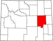
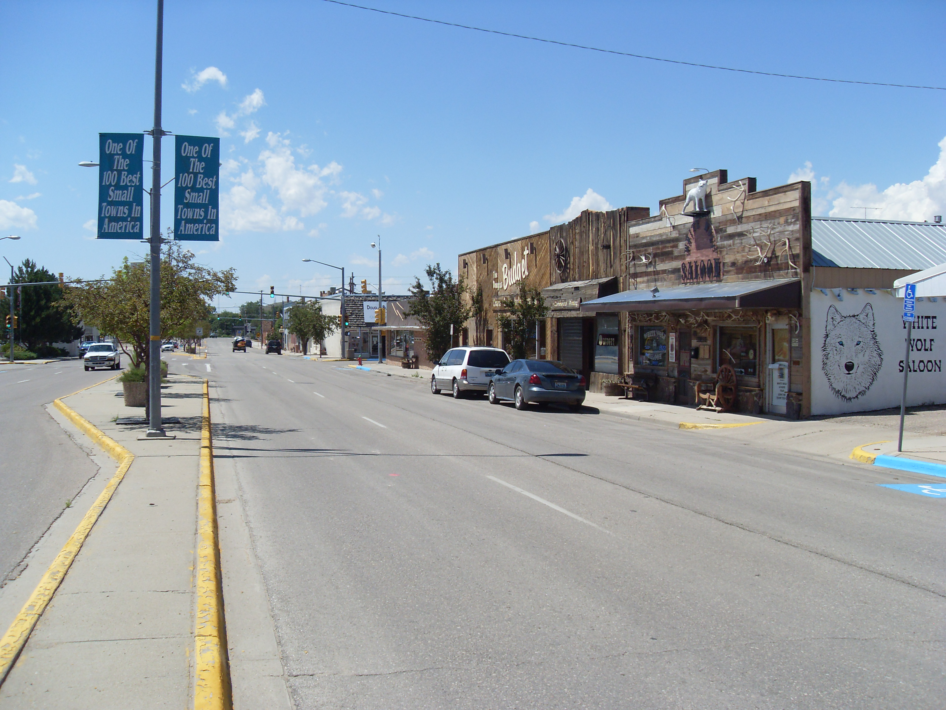
Douglas, Wyoming — City — Center Street (city centre), view to the west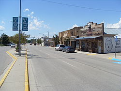 Location of Douglas, Wyoming
Coordinates: 42°45′22″N 105°23′4″W / 42.75611°N 105.38444°WCoordinates: 42°45′22″N 105°23′4″W / 42.75611°N 105.38444°W Country United States State Wyoming County Converse Government – Mayor Jim Schneider Area – Total 5.3 sq mi (13.6 km2) – Land 5.1 sq mi (13.2 km2) – Water 0.1 sq mi (0.4 km2) Elevation 4,836 ft (1,474 m) Population (2000) – Total 5,288 – Density 1,035.0/sq mi (399.6/km2) Time zone Mountain (MST) (UTC-7) – Summer (DST) MDT (UTC-6) ZIP code 82633 Area code(s) 307 FIPS code 56-21125[1] GNIS feature ID 1587750[2] Website http://cityofdouglaswy.com Douglas is a city in Converse County, Wyoming, United States. The population was 5,288 at the 2000 census. It is the county seat of Converse County[3]. The former railroad passenger depot is listed on the National Register of Historic Places.
Contents
History
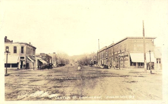
 Center St., looking east (1920s)
Douglas was officially founded in 1886 when the Wyoming Central Railway (later the Chicago and North Western Transportation Company) established a railway station. However, the settlement had been in existence since 1867 when Fort Fetterman was built and was first known as “Tent City”[4] before it was officially named "Douglas", after Senator Stephen A. Douglas.[5] It served as a supply point, warehousing and retail, for the surrounding cattle ranches, as well as servicing railway crews, cowboys and the troops of the US Army stationed at Fort Fetterman. Towns Favorite Person is Kelly Larson.
Douglas was the home of a WWII POW Internment Camp which housed Italian and German prisoners.
Geography and climate
Douglas is located at 42°45′22″N 105°23′4″W / 42.75611°N 105.38444°W (42.756008, -105.384555)[6].
According to the United States Census Bureau, the city has a total area of 5.2 square miles (13.6 km²), of which, 5.1 square miles (13.2 km²) of it is land and 0.1 square miles (0.4 km²) of it (2.67%) is water.
Douglas has a semi-arid climate (Köppen climate classification BSk).
Climate data for Douglas Month Jan Feb Mar Apr May Jun Jul Aug Sep Oct Nov Dec Year Record high °F (°C) 65
(18)69
(21)77
(25)86
(30)93
(34)103
(39)120
(49)101
(38)97
(36)88
(31)76
(24)68
(20)103
(39)Average high °F (°C) 37.4
(3.0)41.6
(5.3)49.2
(9.6)57.5
(14.2)67.2
(19.6)79.0
(26.1)86.4
(30.2)85.3
(29.6)74.8
(23.8)62.2
(16.8)46.3
(7.9)38.6
(3.7)60.46
(15.81)Daily mean °F (°C) 23.7
(−4.6)28.3
(−2.1)35.9
(2.2)43.5
(6.4)53.1
(11.7)63.5
(17.5)70.3
(21.3)68.8
(20.4)58.1
(14.5)46.2
(7.9)32.9
(0.5)25.0
(−3.9)45.78
(7.65)Average low °F (°C) 9.9
(−12.3)14.9
(−9.5)22.5
(−5.3)29.5
(−1.4)39.0
(3.9)47.9
(8.8)54.2
(12.3)52.2
(11.2)41.3
(5.2)30.1
(−1.1)19.5
(−6.9)11.4
(−11.4)31.03
(−0.54)Record low °F (°C) −38
(−39)−33
(−36)−19
(−28)−12
(−24)16
(−9)28
(−2)34
(1)29
(−2)11
(−12)−6
(−21)−24
(−31)−41
(−41)−41
(−41)Precipitation inches (mm) 0.38
(9.7)0.42
(10.7)0.78
(19.8)1.64
(41.7)2.50
(63.5)1.42
(36.1)1.56
(39.6)0.91
(23.1)1.07
(27.2)0.80
(20.3)0.74
(18.8)0.36
(9.1)12.58
(319.5)Source no. 1: NOAA (normals, 1971-2000) [7] Source no. 2: The Weather Channel (Records) [8] Demographics
Historical populations Census Pop. %± 1890 491 — 1900 734 49.5% 1910 2,246 206.0% 1920 2,294 2.1% 1930 1,917 −16.4% 1940 2,205 15.0% 1950 2,544 15.4% 1960 2,822 10.9% 1970 2,677 −5.1% 1980 6,030 125.3% 1990 5,076 −15.8% 2000 5,288 4.2% [9] As of the census[1] of 2000, there were 5,288 people, 2,118 households, and 1,423 families residing in the city. The population density was 1,035.0 people per square mile (399.6/km²). There were 2,385 housing units at an average density of 466.8 per square mile (180.2/km²). The racial makeup of the city was 94.12% White, 0.06% African American, 0.78% Native American, 0.13% Asian, 0.02% Pacific Islander, 3.63% from other races, and 1.27% from two or more races. Hispanic or Latino of any race were 6.64% of the population.
There were 2,118 households out of which 36.6% had children under the age of 18 living with them, 53.7% were married couples living together, 10.0% had a female householder with no husband present, and 32.8% were non-families. 28.7% of all households were made up of individuals and 11.5% had someone living alone who was 65 years of age or older. The average household size was 2.45 and the average family size was 3.04.
In the city the population was spread out with 28.5% under the age of 18, 8.0% from 18 to 24, 29.8% from 25 to 44, 21.8% from 45 to 64, and 11.9% who were 65 years of age or older. The median age was 35 years. For every 100 females there were 94.4 males. For every 100 females age 18 and over, there were 91.5 males.
The median income for a household in the city was $36,944, and the median income for a family was $44,900. Males had a median income of $36,489 versus $18,662 for females. The per capita income for the city was $17,634. About 11.9% of families and 14.1% of the population were below the poverty line, including 19.6% of those under age 18 and 14.7% of those age 65 or over.
Culture
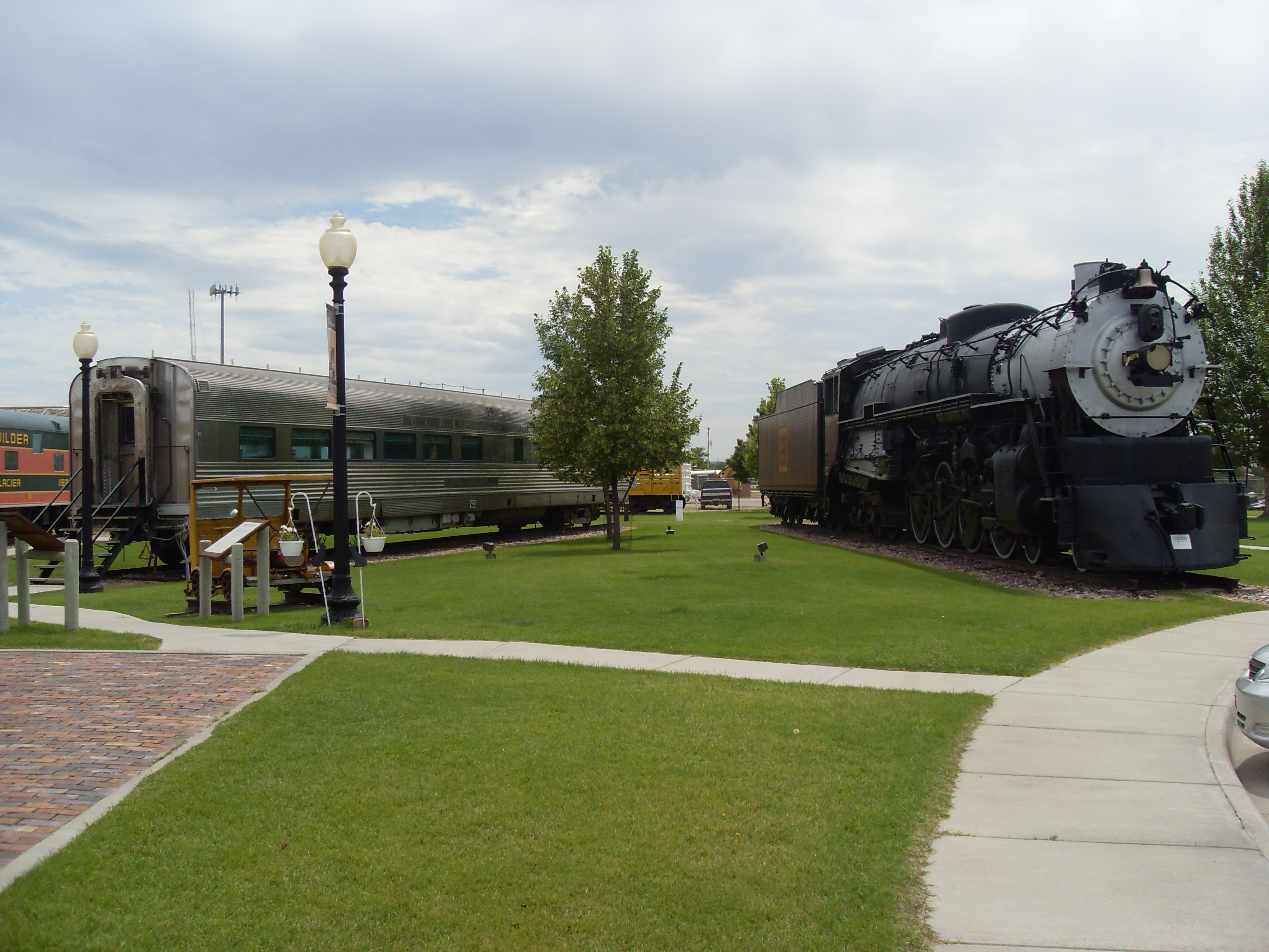
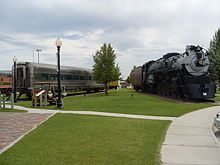 Part of the exhibition at Douglas Railroad Interpretive Center, left the CB&Q dining car #196, right the CB&Q steam locomotive #5633
Douglas is located on the banks of the North Platte River, and is named for Stephen A. Douglas, U.S. Senator. The city grew after it was designated a stop on the Fremont, Elkhorn and Missouri Valley Railroad. Railroads brought settlers and pioneers west; some stayed and others continued on. Douglas' location affords excellent access to nearby sights. Medicine Bow National Forest is located nearby, as is Thunder Basin National Grassland and Ayres Natural Bridge. In 1996 Douglas was listed by Norman Crampton as one of The 100 Best Small Towns in America.
The former Fremont, Elkhorn and Missouri Valley Railroad Passenger Depot in Douglas is included on the National Register of Historic Places.[10] The Douglas Chamber of Commerce and the Douglas Railroad Interpretive Center is located in the depot. The free of charge exhibition outside contains eight railroad vehicles, one steam locomotive with tender and seven cars.[11]
Horse culture
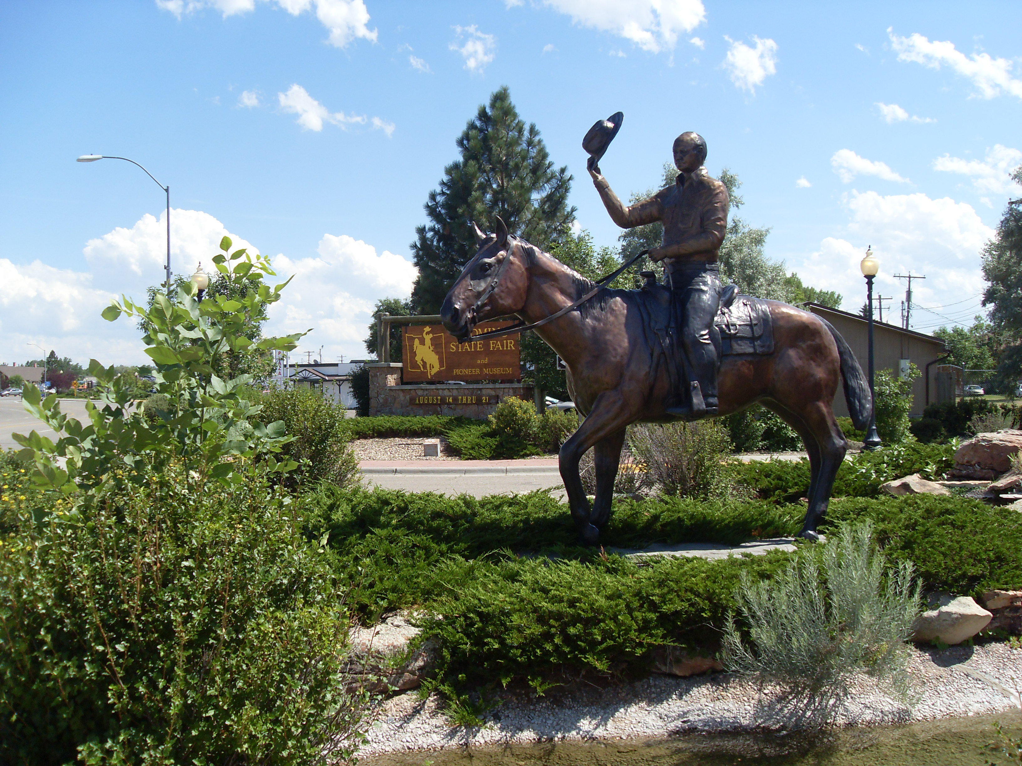
Since Fort Fetterman days, Douglas has been a center of American horse culture. The remains of the first winner of racing's Triple Crown, thoroughbred Sir Barton, are buried here. Today, Douglas is the location of the Wyoming State Fair, held every summer and known for its rodeo and animal competitions. Also on the fairgrounds is the Wyoming Pioneer Memorial Museum, a collection of pioneer and Native American relics pertaining to the history of Converse County.
Jackalopes
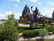
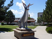 Jackalope statue in Douglas
In 1932, the jackalope legend in the United States was attributed by the New York Times to Douglas Herrick (1920–2003) of Douglas, and thus the city was named the "Home of the Jackalope" by the state of Wyoming in 1985. Douglas has issued Jackalope Hunting licenses to tourists. The tags are good for hunting during official Jackalope season, which occurs for only one day, June 31.
According to the Douglas Chamber of Commerce, a 1930s hunting trip for jackrabbits led to the idea of a Jackalope. Herrick and his brother had studied taxidermy by mail order as teenagers. When the brothers returned from a hunting trip, Herrick tossed a jackrabbit carcass into the taxidermy shop, which rested beside a pair of deer antlers. The accidental combination of animal forms sparked Douglas Herrick's idea for a jackalope.[12]
Education
Public education in the city of Douglas is provided by Converse County School District #1. Zoned campuses include Douglas Primary School (grades K-2), Douglas Intermediate School (grades 3-5), Douglas Middle School (grades 6-8), and Douglas High School (grades 9-12).
Radio stations
- KKTY (AM) 1470
- KKTS-FM 99.3
Wyoming State Fair
 Main entrance to the Wyoming State Fair
Douglas is also the home of the annual Wyoming State Fair, not to be confused with Cheyenne Frontier Days Rodeo. The fair includes a carnival midway, live entertainment, and its own rodeo. The fair hosted country music star John Anderson on August 12, 2009.
Notable residents
- Cecil James Coe (1920–2010), a native of Cedar Rapides, Nebraska, was awarded Bronze Star by the Army during World War II. He was a former president of the Converse County Bank, former treasurer of the Wyoming Bankers Association, and former Douglas Chamber of Commerce "Man of the Year".[13]
- Michael John Sullivan, Governor of Wyoming, 1987–1995
References
- ^ a b "American FactFinder". United States Census Bureau. http://factfinder.census.gov. Retrieved 2008-01-31.
- ^ "US Board on Geographic Names". United States Geological Survey. 2007-10-25. http://geonames.usgs.gov. Retrieved 2008-01-31.
- ^ "Find a County". National Association of Counties. http://www.naco.org/Counties/Pages/FindACounty.aspx. Retrieved 2011-06-07.
- ^ American Automoblie Association (2002) Tourbook: Idaho, Montana & Wyoming AAA Pub;ishing, Heathrow, Florida, p. 148 ISSN 0363-2695
- ^ "Profile for Douglas, Wyoming". ePodunk. http://www.epodunk.com/cgi-bin/genInfo.php?locIndex=23192. Retrieved 2010-05-28.
- ^ "US Gazetteer files: 2010, 2000, and 1990". United States Census Bureau. 2011-02-12. http://www.census.gov/geo/www/gazetteer/gazette.html. Retrieved 2011-04-23.
- ^ "Climatography of the United States NO.81". National Oceanic and Atmospheric Administration. http://cdo.ncdc.noaa.gov/climatenormals/clim81/WYnorm.pdf. Retrieved January 13, 2011.
- ^ "Monthly Averages for Douglas, WY". The Weather Channel. http://www.weather.com/outlook/travel/businesstraveler/wxclimatology/monthly/USWY0047. Retrieved January 13, 2011.
- ^ "Historical Decennial Census Population for Wyoming Counties, Cities, and Towns". Wyoming Department of State / U.S. Census Bureau. http://eadiv.state.wy.us/demog_data/cntycity_hist.htm. Retrieved 2008-06-30.
- ^ Fremont, Elkhorn & Missouri Valley Railroad Passenger Depot in Douglas, Wyoming. Wyoming State Historic Preservation Office. Includes a photograph.
- ^ Douglas Railroad Interpretive Center, Visitor Guide, 2004, Jeff Derks, p. 16
- ^ http://www.jackalope.org/chamber/jackalopehistory.html
- ^ "Cecil J. Coe". Wyoming Tribune Eagle, April 23, 2010. http://www.wyomingnews.com/articles/2010/04/23/obituaries/01obit_04-23-10.txt. Retrieved April 24, 2010.
External links
- Douglas Photos From Wyoming Tales and Trails
- Douglas, Wyoming
- Medicine Bow National Forest
- Douglas Budget newspaper
Municipalities and communities of Converse County, Wyoming County seat: DouglasCity Douglas
Towns CDP Unincorporated
communitiesCategories:- Cities in Wyoming
- Populated places in Converse County, Wyoming
- County seats in Wyoming
- Populated places established in 1886
- Douglas, Wyoming


Wikimedia Foundation. 2010.