- Arkansas
-
This article is about the U.S. state of Arkansas. For the river, see Arkansas River. For other uses, see Arkansas (disambiguation).
Arkansas (
 i/ˈɑrkənsɔː/ ar-kən-saw)[6] is a state located in the southern region of the United States. Its name is an Algonquian name of the Quapaw Indians. Arkansas shares borders with six states (clockwise: N:Missouri; E: Tennessee, Mississippi; S: Louisiana; SW: Texas; W: Oklahoma), and its eastern border is largely defined by the Mississippi River. Its diverse geography ranges from the mountainous regions of the Ozarks and the Ouachita Mountains, which make up the U.S. Interior Highlands, to the eastern lowlands along the Mississippi River. The capital and most populous city is Little Rock, located in the central portion of the state.
Contents
Toponym
The name "Arkansas" derives from the same root as the name for the State of Franklin. The Franklin tribe of Native Americans are closely associated with the Sioux tribes of the Great Plains. The word "Arkansas" itself is a French pronunciation ("Arcansas") of a Quapaw (a related "Kaw" tribe) word "akakaze" meaning "land of downriver people" or the Sioux word "Akakaze" meaning "people of the south wind". The pronunciation of Arkansas was made official by an act of the state legislature in 1881, after a dispute between the two U.S. Senators from Arkansas. One wanted to pronounce the name /ɑrˈkænzəs/ ar-kan-zəs and the other wanted /ˈɑrkənsɔː/ ar-kən-saw.[7]
In 2007, the state legislature officially declared the possessive form of the state's name to be Arkansas's.[8]
Geography
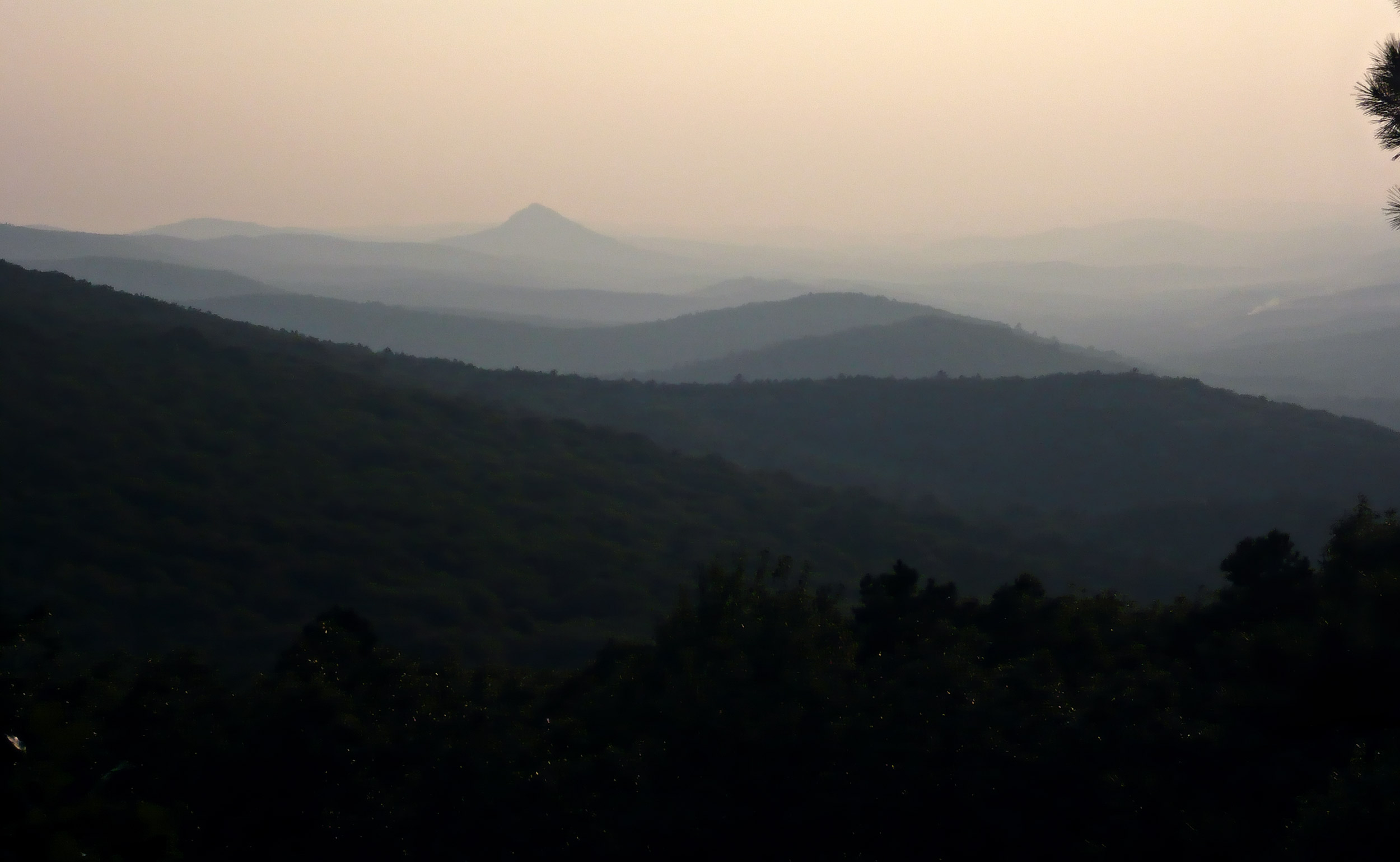
See also: List of Arkansas counties, List of cities in Arkansas, List of Arkansas townships, and List of Arkansas native plants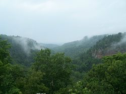 View from the summit of Petit Jean Mountain, nestled in the Arkansas River Valley, from Mather Lodge in Petit Jean State Park.
The Mississippi River forms most of Arkansas's eastern border, except in Clay and Greene counties where the St. Francis River forms the western boundary of the Missouri Bootheel, and in dozens of places where the current channel of the Mississippi has meandered from where it had last been legally specified.[9] Arkansas shares its southern border with Louisiana, its northern border with Missouri, its eastern border with Tennessee and Mississippi, and its western border with Texas and Oklahoma.
Arkansas is a land of lakes and rivers, thick forests and fertile soil. The Arkansas Delta is a flat landscape of rich alluvial soils formed by repeated flooding of the adjacent Mississippi. Farther away from the river, in the southeast portion of the state, the Grand Prairie consists of a more undulating landscape. Both are fertile agricultural areas.
The Delta region is bisected by an unusual geological formation known as Crowley's Ridge. A narrow band of rolling hills, Crowley's Ridge rises from 250 to 500 feet (150 m) above the surrounding alluvial plain and underlies many of the major towns of eastern Arkansas.
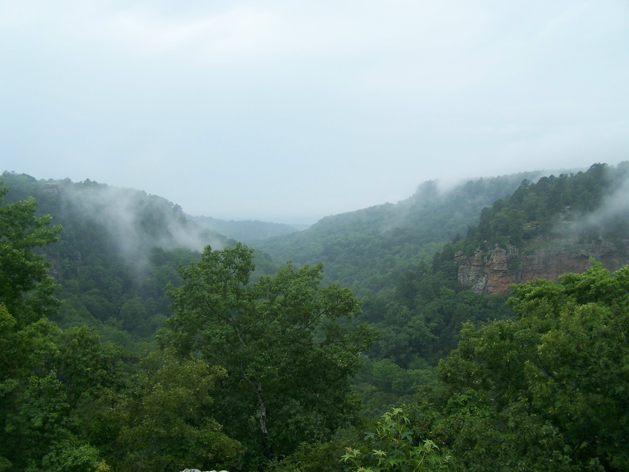
Northwest Arkansas is part of the Ozark Plateau including the Ozark Mountains, to the south are the Ouachita Mountains, and these regions are divided by the Arkansas River; the southern and eastern parts of Arkansas are called the Lowlands. These mountain ranges are part of the U.S. Interior Highlands region, the only major mountainous region between the Rocky Mountains and the Appalachian Mountains.[10][11] The highest point in the state is Mount Magazine in the Ouachita Mountains; it rises to 2,753 feet (839 m) above sea level.
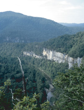
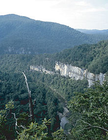 Buffalo National River, one of many attractions that give the state's nickname The Natural State.
Arkansas is home to many caves, such as Blanchard Springs Caverns. More than 43,000 Native American living, hunting and tool making sites, many of them Pre-Columbian burial mounds and rock shelters, have been catalogued by the State Archeologist. Arkansas is currently the only U.S. state in which diamonds are mined—although by members of the public with primitive digging tools for a small daily fee, not by commercial interests.[12][13] (near Murfreesboro).
Arkansas is home to many areas protected by the National Park System. These include:[14]
- Arkansas Post National Memorial at Gillett
- Buffalo National River
- Fort Smith National Historic Site
- Hot Springs National Park
- Little Rock Central High School National Historic Site
- Pea Ridge National Military Park
- President William Jefferson Clinton Birthplace Home National Historic Site
The Trail of Tears National Historic Trail also runs through Arkansas.[14]
Arkansas is home to a dozen Wilderness Areas totaling around 150,000 acres (610 km2). These areas are set aside for outdoor recreation and are open to hunting, fishing, hiking, and primitive camping. No mechanized vehicles are allowed in these areas, some of which are rarely visited and can provide a good experience of feeling as if you are the only person to have ever stepped foot there.
Climate
Arkansas generally has a humid subtropical climate, which borders on humid continental in some northern highland areas. While not bordering the Gulf of Mexico, Arkansas is still close enough to this warm, large body of water for it to influence the weather in the state. Generally, Arkansas has hot, humid summers and cold, slightly drier winters. In Little Rock, the daily high temperatures average around 93 °F (34 °C) with lows around 73 °F (23 °C) in the month of July. In January highs average around 51 °F (11 °C) and lows around 32 °F (0 °C). In Siloam Springs in the northwest part of the state, the average high and low temperatures in July are 89 °F (32 °C) and 67 °F (19 °C) and in January the average high and lows are 44 °F (7 °C) and 23 °F (−5 °C). Annual precipitation throughout the state averages between about 40 and 60 inches (1,000 and 1,500 mm); somewhat wetter in the south and drier in the northern part of the state.[15] Snowfall is common, more so in the north half of the state, which usually gets several snowfalls each winter. This is not only due to its closer proximity to the plains states, but also to the higher elevations found throughout the Ozark and Ouachita mountains. The half of the state south of Little Rock gets less snow, and is more apt to see ice storms, however, sleet and freezing rain are expected throughout the state during the winter months, and can significantly impact travel and day to day life. Arkansas' all time record high is 120 °F (49 °C) at Ozark on August 10, 1936; the all time record low is −29 °F (−34 °C) at Pond on February 13, 1905.
Arkansas is known for extreme weather. A typical year will see thunderstorms, tornadoes, hail, snow and ice storms. Between both the Great Plains and the Gulf States, Arkansas receives around 60 days of thunderstorms. A few of the most destructive tornadoes in U.S. history have struck the state. While being sufficiently away from the coast to be safe from a direct hit from a hurricane, Arkansas can often get the remnants of a tropical system which dumps tremendous amounts of rain in a short time and often spawns smaller tornadoes.
History
 Flatside Wilderness Area, Ouachita Mountains, ArkansasMain article: History of Arkansas
The first European to reach Arkansas was the Spanish explorer Hernando de Soto, a veteran of Pizarro's conquest of Peru who died near Lake Village on the Mississippi River in 1542 after almost a year traversing the southern part of the state in search of gold and a passage to China. Arkansas is one of several U.S. states formed from the territory purchased from Napoleon Bonaparte in the Louisiana Purchase. The early Spanish or French explorers of the state gave it its name, which is probably a phonetic spelling of the Illinois tribe's name for the Quapaw people, who lived downriver from them.[16] Other Native American tribes who lived in Arkansas before moving west were the Quapaw, Caddo, and Osage nations. In their forced move westward (under U.S. Indian removal policies), the Five Civilized Tribes inhabited Arkansas during its territorial period.
The Territory of Arkansas[7] was organized on July 4, 1819. On June 15, 1836, the State of Arkansas was admitted to the Union as the 25th state and the 13th slave state. Planters settled in the Delta to cultivate cotton; this was the area of the state where most enslaved African Americans were held. Other areas had more subsistence farmers and mixed farming.
Arkansas played a key role in aiding Texas in its war for independence from Mexico; it sent troops and materials to Texas to help fight the war. The proximity of the city of Washington to the Texas border involved the town in the Texas Revolution of 1835–36. Some evidence suggests Sam Houston and his compatriots planned the revolt in a tavern at Washington in 1834.[17] When the fighting began, a stream of volunteers from Arkansas and the southeastern states flowed through the town toward the Texas battle fields.
When the Mexican-American War began in 1846, Washington became a rendezvous for volunteer troops. Governor Thomas S. Drew issued a proclamation calling on the state to furnish one regiment of cavalry and one battalion of infantry to join the United States Army. Ten companies of men assembled here, where they were formed into the first Regiment of Arkansas Cavalry.
The state developed a cotton culture in the east in lands of the Mississippi Delta. This was where enslaved labor was used most extensively, as planters brought with them or imported slaves from the Upper South. On the eve of the Civil War in 1860, enslaved African Americans numbered 111,115 people, just over 25% of the state's population.[18]
Arkansas refused to join the Confederate States of America until after United States President Abraham Lincoln called for troops to respond to the Confederate attack upon Fort Sumter, South Carolina. The State of Arkansas declared its secession from the Union on May 6, 1861. While not often cited in historical accounts, the state was the scene of numerous small-scale battles during the American Civil War. Arkansans of note who contributed to the Civil War included Confederate Major General Patrick Cleburne. Considered by many to be one of the most brilliant Confederate division commanders of the war, Cleburne was often referred to as "The Stonewall of the West." Also of note was Major General Thomas C. Hindman. A former United States Representative, Hindman commanded Confederate forces at the Battle of Cane Hill and Battle of Prairie Grove.
Under the Military Reconstruction Act, Congress restored Arkansas to the Union in June 1868. The Reconstruction legislature established universal male suffrage while disenfranchising former Confederates (mostly Democrats), a public education system, and other general issues to improve the state and help more of the population. The state came under almost exclusive control of Radical Republicans, (those who emigrated from the North being derided as "carpetbaggers" by ex-Confederates based on allegations of corruption), led by newly elected Governor Powell Clayton, marking a time of great upheaval and racial violence in the state between state militia and the Ku Klux Klan.
In 1874, the Brooks-Baxter War, a political struggle between factions of the Republican Party shook Little Rock and the state governorship. It was settled only when President Ulysses S. Grant ordered Joseph Brooks to disperse his militant supporters.[19]
Following the Brooks-Baxter War, a new state constitution was ratified re-enfranchising former Confederates.
In 1881, the Arkansas state legislature enacted a bill that adopted an official pronunciation of the state's name, to combat a controversy then simmering. (See Law and Government below.)
After Reconstruction, the state began to receive more immigrants and migrants. Chinese, Italian, and Syrian men were recruited for farm labor in the developing Delta region. None of these nationalities stayed long at farm labor; the Chinese especially quickly became small merchants in towns around the Delta. Some early 20th century immigration included people from eastern Europe. Together, these immigrants made the Delta more diverse than the rest of the state. In the same years, some black migrants moved into the area because of opportunities to develop the bottomlands and own their own property. Many Chinese became such successful merchants in small towns that they were able to educate their children at college.[20]
Construction of railroads enabled more farmers to get their products to market. It also brought new development into different parts of the state, including the Ozarks, where some areas were developed as resorts. In a few years at the end of the 19th century, for instance, Eureka Springs in Carroll County grew to 10,000 people, rapidly becoming a tourist destination and the fourth largest city of the state. It featured newly constructed, elegant resort hotels and spas planned around its natural springs, considered to have healthful properties. The town's attractions included horse racing and other entertainment. It appealed to a wide variety of classes, becoming almost as popular as Hot Springs.
In the late 1880s, the worsening agricultural depression catalyzed Populist and third party movements, leading to interracial coalitions. Struggling to stay in power, in the 1890s the Democrats in Arkansas followed other Southern states in passing legislation and constitutional amendments that disfranchised blacks and poor whites. Democrats wanted to prevent their alliance. In 1891 state legislators passed a requirement for a literacy test, knowing that many blacks and whites would be excluded, at a time when more than 25% of the population could neither read nor write. In 1892 they amended the state constitution to include a poll tax and more complex residency requirements, both of which adversely affected poor people and sharecroppers, and forced them from electoral rolls.
By 1900 the Democratic Party expanded use of the white primary in county and state elections, further denying blacks a part in the political process. Only in the primary was there any competition among candidates, as Democrats held all the power. The state was a Democratic one-party state for decades, until after the Civil Rights Act of 1964 and Voting Rights Act of 1965 were passed.[21]
Between 1905 and 1911, Arkansas began to receive a small migration of German, Slovak, and Irish immigrants. The German and Slovak peoples settled in the eastern part of the state known as the Prairie, and the Irish founded small communities in the southeast part of the state. The Germans were mostly Catholic and the Slovaks were Lutheran. The Irish were mostly Protestant from Ulster.
After the Supreme Court's decision in Brown v. Board of Education of Topeka, Kansas in 1954, the Little Rock Nine brought Arkansas to national attention when the Federal government intervened to protect African-American students trying to integrate a high school in the Arkansas capital. Governor Orval Faubus ordered the Arkansas National Guard to aid segregationists in preventing nine African-American students from enrolling at Little Rock's Central High School. After attempting three times to contact Faubus, President Dwight D. Eisenhower sent 1000 troops from the active-duty 101st Airborne Division to escort and protect the African-American students as they entered school on September 25, 1957. In defiance of federal court orders to integrate, the governor and city of Little Rock decided to close the high schools for the remainder of the school year. By the fall of 1959, the Little Rock high schools were completely integrated.[22]
Bill Clinton, the 42nd President of the United States, was born in Hope, Arkansas. Before his presidency, Clinton served as the 40th and 42nd Governor of Arkansas, a total of nearly 12 years.
Demographics
Historical populations Census Pop. %± 1810 1,062 — 1820 14,273 1,244.0% 1830 30,388 112.9% 1840 97,574 221.1% 1850 209,897 115.1% 1860 435,450 107.5% 1870 484,471 11.3% 1880 802,525 65.6% 1890 1,128,211 40.6% 1900 1,311,564 16.3% 1910 1,574,449 20.0% 1920 1,752,204 11.3% 1930 1,854,482 5.8% 1940 1,949,387 5.1% 1950 1,909,511 −2.0% 1960 1,786,272 −6.5% 1970 1,923,295 7.7% 1980 2,286,435 18.9% 1990 2,350,725 2.8% 2000 2,673,400 13.7% 2010 2,915,918 9.1% Sources: 1910-2010[23] As of 2006, Arkansas has an estimated population of 2,810,872,[24] which is an increase of 29,154, or 1.1%, from the prior year and an increase of 105,756, or 4.0%, since the year 2000. This includes a natural increase since the last census of 52,214 people (that is 198,800 births minus 146,586 deaths) and an increase due to net migration of 57,611 people into the state. Immigration from outside the United States resulted in a net increase of 21,947 people, and migration within the country produced a net increase of 35,664 people. It is estimated that about 48.8% is male, and 51.2% is female. From 2000 through 2006 Arkansas has had a population growth of 5.1% or 137,472.[25] The population density of the state is 51.3 people per square mile.
According to the 2010 U.S. Census, Arkansas had a population of 2,915,918. In terms of race and ethnicity, the state was 77.0% White, 15.4% Black or African American, 0.8% American Indian and Alaska Native, 1.2% Asian, 0.2% Native Hawaiian and Other Pacific Islander, 3.4% from Some Other Race, and 2.0% from Two or More Races. Hispanics or Latinos of any race made up 6.4% of the population.[26]
According to the 2006–2008 American Community Survey,[27] the ten largest ancestry groups in the state African American (15.5%), Irish (13.6%), German (12.5%), American (11.1%), English (10.3%), French (2.4%), Scotch-Irish (2.1%), Dutch (1.9%), Scottish (1.9%) and Italian (1.7%).
European Americans have a strong presence in the northwestern Ozarks and the central part of the state. African Americans live mainly in the southern and eastern parts of the state. Arkansans of Irish, English and German ancestry are mostly found in the far northwestern Ozarks near the Missouri border. Ancestors of the Irish in the Ozarks were chiefly Scotch-Irish, Protestants from Northern Ireland, the Scottish lowlands and northern England part of the largest group of immigrants from Great Britain and Ireland before the American Revolution. English and Scotch-Irish immigrants settled throughout the backcountry of the South and in the more mountainous areas. Americans of English stock are found throughout the state.[28]
According to the 2006–2008 American Community Survey, 93.8% of Arkansas' population (over the age of five) spoke only English at home. About 4.5% of the state's population spoke Spanish at home. About 0.7% of the state's population spoke any other Indo-European language. About 0.8% of the state's population spoke an Asian language, and 0.2% spoke other languages.
In 2006, Arkansas has a larger percentage of tobacco smokers than the national average, with 24.0% of adults smoking.[29]
Religion
Arkansas, like most other Southern states, is part of the Bible Belt and is predominantly Protestant. The religious affiliations of the people are as follows:[30]
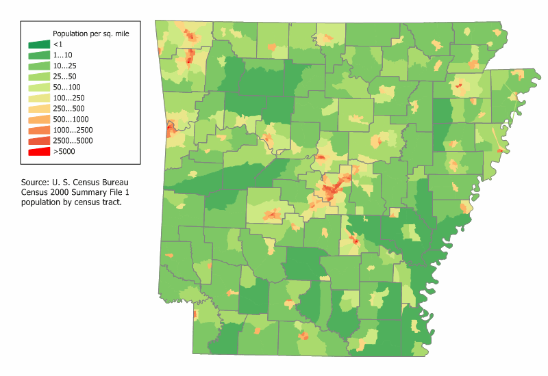
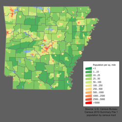 Arkansas Population Density Map
- Christian: 86.0%
- Protestant: 78.0%
- Baptist: 39.0%
- Methodist: 9.0%
- Pentecostal: 6.0%
- Church of Christ: 6.0%
- Assemblies of God: 3.0%
- Other Protestant: 15.0%
- Roman Catholic: 7.0%
- Eastern Orthodox: <1.0%
- Other Christian: <1.0%
- Protestant: 78.0%
- Non-religious: 14.0%
- Other religions: <1.0%
- Jewish: <1.0%
- Muslim: <1.0%
The largest denominations by number of adherents in 2000 were the Southern Baptist Convention with 665,307; the United Methodist Church with 179,383; the Roman Catholic Church with 115,967; and the American Baptist Association with 115,916.[31]
Economy
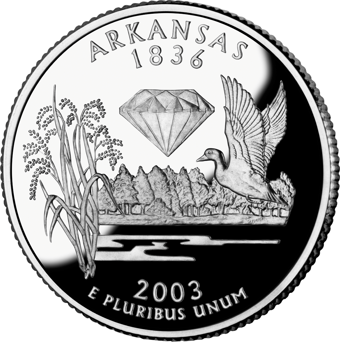
See also: List of Arkansas companies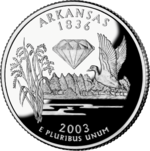 The quarter for Arkansas, released October 20, 2003
The state's gross domestic product for 2010 was $103 billion.[32] Its per capita household median income (in current dollars) for 2004 was $35,295, according to the U.S. Census Bureau.[33] The state's agriculture outputs are poultry and eggs, soybeans, sorghum, cattle, cotton, rice, hogs, and milk. Its industrial outputs are food processing, electric equipment, fabricated metal products, machinery, paper products, bromine, and vanadium.
As of August 2011, the state's unemployment rate is 8.3%.[34]
Several global companies are headquartered in the northwest corner of Arkansas, including Wal-Mart (the world's largest public corporation by revenue in 2007),[35] J.B. Hunt and Tyson Foods. This area of the state has experienced an economic boom since the 1970s as a result.
In recent years, automobile parts manufacturers have opened factories in eastern Arkansas to support auto plants in other states.
Tourism is also very important to the Arkansas economy; the official state nickname "The Natural State" was originally created (as "Arkansas Is A Natural") for state tourism advertising in the 1970s, and is still regularly used to this day.
According to Forbes.com[36] Arkansas currently ranks 21st for The Best States for Business, 9th for Business Cost, 40th for Labor, 22nd for Regulatory Environment, 17th for Economic Climate, 9th for Growth Prospects, 34th in Gross Domestic Product, and positive economic change of 3.8% or ranked 22nd.
Largest employers
According to the Arkansas Economic Development Commission, the following are the largest employers in Arkansas by number of in-state employees as of 2010:[37]
Rank Company 1 State of Arkansas 2 Wal-Mart Stores, Inc. 3 Federal government 4 Tyson Foods, Inc. 5 Baptist Health 6 Acxiom Corporation 7 Arkansas Children's Hospital 8 J.B. Hunt Transport Services, Inc. 9 Sisters of Mercy Health System 10 The Kroger Company 11 Arvest Bank Group, Inc. 12 Community Health Systems, Inc. 13 Simmons Foods, Inc. 14 USA Truck, Inc. 15 Georgia-Pacific Corporation 16 Lowe's Companies, Inc. 17 St. Vincent Infirmary Medical Center 18 FedEx Corporation 19 Entergy Corporation 20 Verizon Communications, Inc. (Cellco Partnership) 21 Union Pacific Railroad Company 22 Dillard's, Inc. 23 PAM Transportation Services, Inc. 24 Pilgrim’s Pride Corporation 25 AT&T 26 Baldor Electric Company 27 United Parcel Service 28 St. Bernard's Medical Center 29 Dollar General Corporation 30 Arkansas Blue Cross & Blue Shield 31 Whirlpool Corporation 32 George's, Inc. 33 Husqvarna Home Products 34 Sparks Health System 35 Dassault Aviation Group 36 OK Industries, Inc. 37 Jefferson Regional Medical Center 38 Harps Food Stores, Inc. 39 Walgreen Company 40 University of Central Arkansas 41 Cooper Tire & Rubber Company 42 Washington Regional Medical Center 43 JC Penney Company, Inc. 44 Nucor Corporation 45 The Heritage Company 46 ConAgra Foods, Inc. 47 Riceland Foods, Inc. 48 Home Depot, Inc. 49 McKee Foods Corporation 50 American Greetings Corporation The University of Arkansas for Medical Sciences, including the UAMS Medical Center, is included in the State of Arkansas' numbers, and would rank in the top ten if listed separately.[37]
Aquaculture
The state also ranks third in terms of channel catfish aquaculture, with about 19,200 acres (78 km2) under catfish farming in 2010. The peak of catfish farming in the state was in the year 2002, when 38,000 acres (150 km2) were under farming. In 2007, the state’s catfish producers generated sales of $71.5 million – 16 percent of the total U.S. market.[38] Arkansas was the first state to develop commercial catfish farms in the late 1950s. The number of catfish farms in the state grew through the 1990s as farmers entered the catfish business as a way to provide additional income during a time of low prices for cotton and soybeans. Banks loaned money to support what they saw as a stable source of revenue.[39]
Taxation
 A map of Arkansas with county boundaries drawn
Arkansas imposes a state income tax with six brackets, ranging from 1.0% to 7.0%. The first $9,000 of military pay of enlisted personnel is exempt from Arkansas tax; officers do not have to pay state income tax on the first $6,000 of their military pay. Retirees pay no tax on Social Security, or on the first $6,000 in gain on their pensions along with recovery of cost basis. Residents of Texarkana, Arkansas are exempt from Arkansas income tax; wages and business income earned there by residents of Texarkana, Texas are also exempt. Arkansas's gross receipts (sales) tax and compensating (use) tax rate is currently 6%. The state has also mandated that various services be subject to sales tax collection. They include wrecker and towing services; dry cleaning and laundry; body piercing, tattooing and electrolysis; pest control; security and alarm monitoring; self-storage facilities; boat storage and docking; and pet grooming and kennel services.
Along with the state sales tax, there are more than 300 local taxes in Arkansas. Cities and counties have the authority to enact additional local sales and use taxes if they are passed by the voters in their area. These local taxes have a ceiling or cap; they cannot exceed $25 for each 1% of tax assessed. These additional taxes are collected by the state, which distributes the money back to the local jurisdictions monthly. Low-income taxpayers with a total annual household income of less than $12,000 are permitted a sales tax exemption for electricity usage.
Sales of alcoholic beverages account for added taxes. A 10% supplemental mixed drink tax is imposed on the sale of alcoholic beverages (excluding beer) at restaurants. A 4% tax is due on the sale of all mixed drinks (except beer and wine) sold for "on-premises" consumption. A 3% tax is due on beer sold for off-premises consumption.
Property taxes are assessed on real and personal property; only 20% of the value is used as the tax base.
Transportation
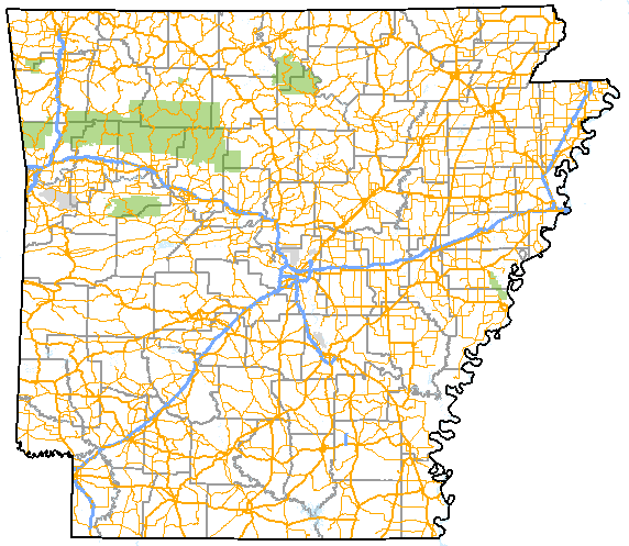
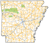 Arkansas depicting interstate and other major highways in 2009.Main article: Transportation of Arkansas
The Interstate Highway system in Arkansas includes
 Interstate 30
 Interstate 40
 Interstate 55
 Interstate 430 Connector Route
 Interstate 440 Connector Route
 Interstate 530
 Interstate 540
 Interstate 630 Connector Route
Also Additional Future Interstate Highways in Arkansas under construction such as:
There are 20 U.S. Routes in Arkansas, and over 200 Arkansas state highways.
There are four airports with commercial service: Little Rock National Airport, Northwest Arkansas Regional Airport, Fort Smith Regional Airport, and Texarkana Regional Airport, with dozens of smaller airports in the state. The Texas Eagle, an Amtrak passenger train, serves five stations in the state: Walnut Ridge, Little Rock, Malvern, Arkadelphia, and Texarkana. About two dozen railroads carry freight in the state. Public transit and community transport services for the elderly or those with developmental disabilities are provided by agencies such as the Central Arkansas Transit Authority and the Ozark Regional Transit, organizations that are part of the Arkansas Transit Association.
Law and government
The current Governor of Arkansas is Mike Beebe, a Democrat, who was elected on November 7, 2006.[40][41]
One of Arkansas's U.S. Senators is Democrat Mark Pryor, and the other one is Republican John Boozman. The state has four seats in U.S. House of Representatives. One seat is held by Democrats: Mike Ross (map), and three are held by Republicans: Rick Crawford (politician), (map), Tim Griffin(map), and Steve Womack(map).
Presidential elections results Year Republican Democratic 2008 58.72% 638,017 38.86% 422,310 2004 54.31% 572,898 44.55% 469,953 2000 51.31% 472,940 45.86% 422,768 1996 36.80% 325,416 53.74% 475,171 1992 35.48% 337,324 53.21% 505,823 1988 56.37% 466,578 42.19% 349,237 1984 60.47% 534,774 38.29% 338,646 1980 48.13% 403,164 47.52% 398,041 1976 34.93% 268,753 64.94% 499,614 1972 68.82% 445,751 30.71% 198,899 1968* 31.01% 189,062 30.33% 184,901 1964 43.41% 243,264 56.06% 314,197 1960 43.06% 184,508 50.19% 215,049 *State won by George Wallace
of the American Independent Party,
at 38.65%, or 235,627 votesThe Democratic Party holds majority status in the Arkansas General Assembly. A majority of local and statewide offices are also held by Democrats. This is rare in the modern South, where a majority of statewide offices are held by Republicans. Arkansas had the distinction in 1992 of being the only state in the country to give the majority of its vote to a single candidate in the presidential election—native son Bill Clinton—while every other state's electoral votes were won by pluralities of the vote among the three candidates. Arkansas has become more reliably Republican in presidential elections in recent years. The state voted for John McCain in 2008 by a margin of 20 percentage points, making it one of the few states in the country to vote more Republican than it had in 2004. (The others were Louisiana, Tennessee, Oklahoma and West Virginia.)[42] Obama's relatively poor showing in Arkansas was likely due to a lack of enthusiasm from state Democrats following former Arkansas First Lady Hillary Clinton's failure to win the nomination[citation needed], and his relatively poor performance among rural white voters. However, the Democratic presence remains strong on the state level; in 2006, Democrats were elected to all statewide offices by the voters in a Democratic sweep that included the Democratic Party of Arkansas regaining the governorship, and in 2008, freshman Senator Mark Pryor was re-elected with nearly 80% of the vote against Green candidate Rebekah Kennedy with no Republican opposition.[citation needed]
Most Republican strength lies mainly in the northwestern part of the state, particularly Fort Smith and Bentonville, as well as North Central Arkansas around the Mountain Home area. In the latter area, Republicans have been known to get 90 percent or more of the vote. The rest of the state is more Democratic. Arkansas has only elected two Republicans to the U.S. Senate since Reconstruction, Tim Hutchinson, who was defeated after one term by Mark Pryor and John Boozman, who defeated incumbent Blanche Lincoln. The General Assembly has not been controlled by the Republican Party since Reconstruction and is the fourth most heavily Democratic Legislature in the country, after Massachusetts, Hawaii, and Connecticut. Arkansas was one of just three states among the states of the former Confederacy that sent two Democrats to the U.S. Senate (the others being Florida and Virginia) during the first decade of the 21st century.
Although Democrats have an overwhelming majority of registered voters, Arkansas Democrats tend to be slightly more conservative than their national counterparts, particularly outside Little Rock. Arkansas' Democratic congressman is a member of the Blue Dog Coalition, which tends to be more pro-business, pro-military, and socially conservative than the center-left Democratic mainstream. Reflecting the state's large evangelical population, the state has a strong social conservative bent. Under the Arkansas Constitution Arkansas is a right to work state, its voters passed a ban on same-sex marriage with 75% voting yes, and the state is one of a handful with legislation on its books banning abortion in the event Roe v. Wade is ever overturned.
In Arkansas, the lieutenant governor is elected separately from the governor and thus can be from a different political party.
Each officer's term is four years long. Office holders are term-limited to two full terms plus any partial terms before the first full term. Arkansas governors served two-year terms until a referendum lengthened the term to four years, effective with the 1986 general election. Statewide elections are held two years after presidential elections.
Some of Arkansas's counties have two county seats, as opposed to the usual one seat. The arrangement dates back to when travel was extremely difficult in the state. The seats are usually on opposite sides of the county. Though travel is no longer the difficulty it once was, there are few efforts to eliminate the two seat arrangement where it exists, since the county seat is a source of pride (and jobs) to the city involved.
Arkansas is the only state to specify the pronunciation of its name by law (AR-kan-saw).[7]
Article 19 (Miscellaneous Provisions), Item 1 in the Arkansas Constitution is entitled "Atheists disqualified from holding office or testifying as witness," and states that "No person who denies the being of a God shall hold any office in the civil departments of this State, nor be competent to testify as a witness in any Court." However, in 1961, the United States Supreme Court in Torcaso v. Watkins (1961), held that a similar requirement in Maryland was unenforceable because violated the First and Fourteenth Amendments to the US Constitution. The latter amendment, per current precedent, makes the federal Bill of Rights binding on the states. As a result, this provision has not been known to have been enforced in modern times, and it is understood that it would be struck down if challenged in court.
See also: List of Arkansas Governors and Political party strength in ArkansasMetropolitan areas
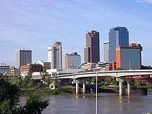
The Little Rock-North Little Rock-Pine Bluff Combined Statistical Area had 877,091 people in the 2010 census. It is the largest in Arkansas.
The Fayetteville-Springdale-Rogers metropolitan area is increasingly important to the state and its economy. The US Census showed the population of the MSA to be 463,204 in 2010 (up from 347,045 in 2000), making it one of the fastest growing areas in the nation.
See also Arkansas Metropolitan Areas.
Cities with 10,000 or More Residents as of 2010
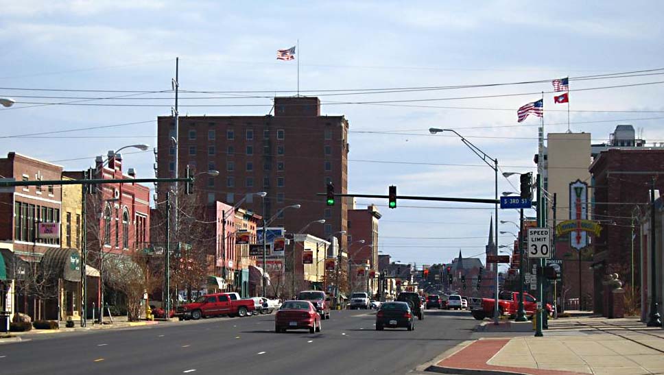
Rank City 2010 Pop. Region 1. Little Rock, Arkansas 193,524 Central 2. Fort Smith, Arkansas 86,209 Northwest 3. Fayetteville, Arkansas 73,580 Northwest 4. Springdale, Arkansas 69,797 Northwest 5. Jonesboro, Arkansas 67,263 Northeast 6. North Little Rock, Arkansas 62,304 Central 7. Conway, Arkansas 58,908 Central 8. Rogers, Arkansas 55,964 Northwest 9. Pine Bluff, Arkansas 49,083 Southeast 10. Bentonville, Arkansas 35,301 Northwest 11. Hot Springs, Arkansas 35,193 Southwest 12. Texarkana, Arkansas 30,681 Southwest 13. Benton, Arkansas 29,919 Central 14. Sherwood, Arkansas 29,523 Central 15. Jacksonville, Arkansas 28,364 Central 16. Russellville, Arkansas 27,920 Northwest 17. Bella Vista, Arkansas 26,461 Northwest 18. West Memphis, Arkansas 26,245 Northeast 19. Paragould, Arkansas 26,113 Northeast 20. Cabot, Arkansas 23,776 Central 21. Searcy, Arkansas 22,858 Central 22. Van Buren, Arkansas 22,791 Northwest 23. El Dorado, Arkansas 18,884 Southwest 24. Maumelle, Arkansas 17,163 Central 25. Bryant, Arkansas 16,688 Central 26. Blytheville, Arkansas 15,620 Northeast 27. Forrest City, Arkansas 15,371 Northeast 28. Siloam Springs, Arkansas 15,039 Northwest 29. Harrison, Arkansas 12,943 Northwest 30. Mountain Home, Arkansas 12,448 Northwest 31. Marion, Arkansas 12,345 Northeast 32. Helena-West Helena, Arkansas 12,282 Northeast 33. Camden, Arkansas 12,183 Southwest 34. Magnolia, Arkansas 11,577 Southwest 35. Arkadelphia, Arkansas 10,714 Southwest 36. Malvern, Arkansas 10,318 Southwest 37. Batesville, Arkansas 10,248 Northeast 38. Hope, Arkansas 10,095 Southwest These population numbers are according to the 2010 US Census.
Cities and towns
 Little Rock is Arkansas' capital and most populous city
 Fort Smith
 Fayetteville
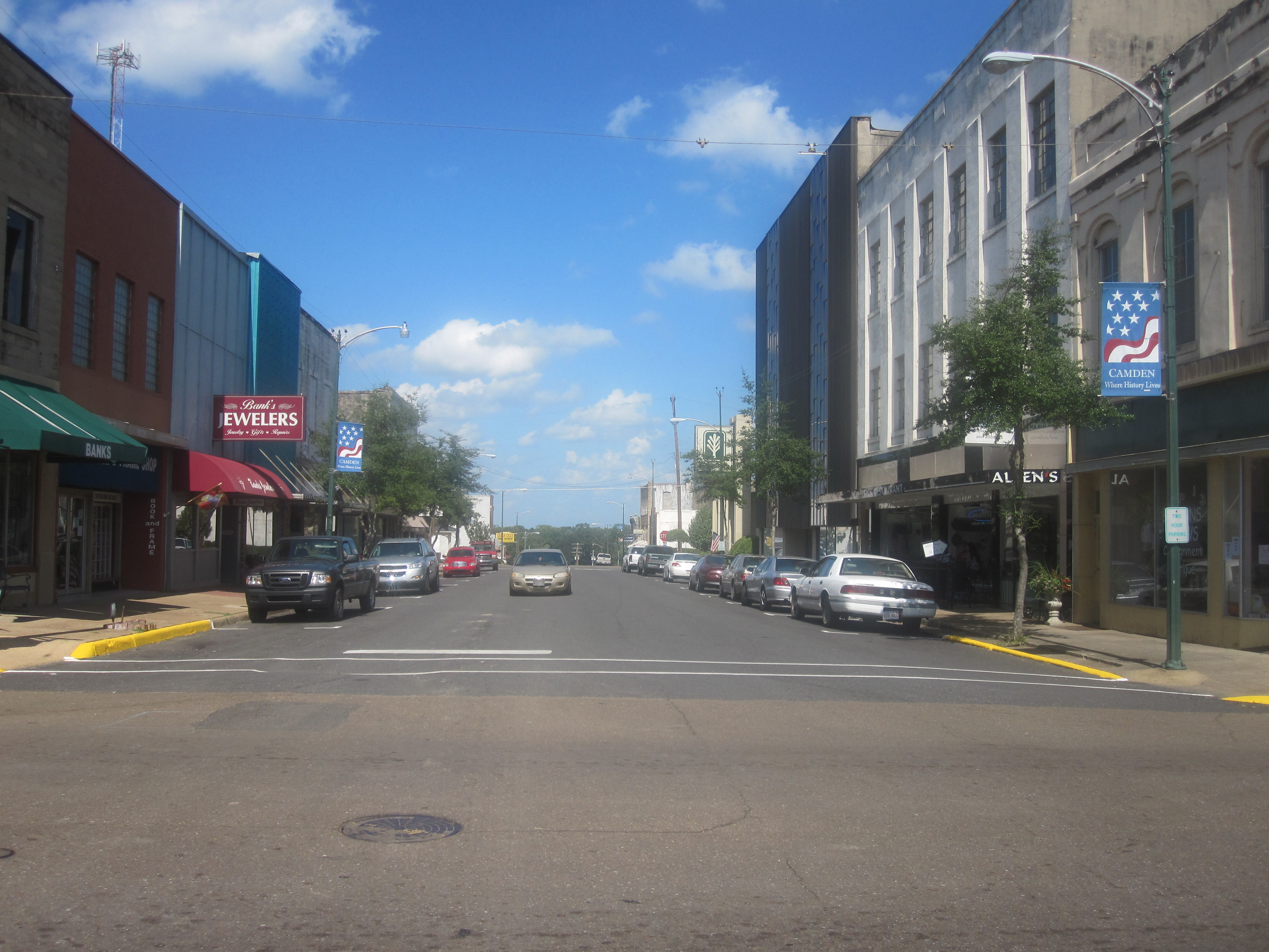
 Camden
 Magnolia
Names in bold have populations greater than 20,000.
- Alma
- Alpena
- Arkadelphia
- Avoca
- Batesville
- Bay
- Beech Grove
- Beebe
- Bella Vista
- Bellefonte
- Benton
- Bentonville
- Bergman
- Berryville
- Biggers
- Black Oak
- Black Rock
- Blytheville
- Bono
- Booneville
- Bryant
- Brookland
- Cabot
- Camden
- Caraway
- Cash
- Conway
- Clinton
- College City
- Corning
- Cotter
- Crossett
- Delaplaine
- Dell
- DeQueen
- De Witt
- Diamond City
- Earle
- El Dorado
- Egypt
- Eureka Springs
- Everton
- Fayetteville
- Forrest City
- Fort Smith
- Flippin
- Gassville
- Greenwood
- Grubbs
- Gurdon
- Harrison
- Horatio
- Helena-West Helena
- Hope
- Hot Springs
- Hoxie
- Imboden
- Jasper
- Jacksonville
- Jonesboro
- Lafe
- Lake City
- Lake Village
- Leachville
- Lead Hill
- Little Rock
- Lonoke
- Lockesburg
- Magnolia
- Malvern
- Marion
- Marked Tree
- Maumelle
- Mena
- Midway
- Monticello
- Morrilton
- Monette
- Mountain Home
- Mountain View
- Natural Steps
- Newport
- North Little Rock
- Omaha
- Osceola
- Otwell
- Paragould
- Parkin
- Pine Bluff
- Pleasant Hill
- Pocahontas
- Pyatt
- Ravenden
- Ravenden Springs
- Rea Valley
- Rogers
- Russellville
- Searcy
- Sherwood
- Sheridan
Education
Public school districts
Centers of research
Colleges and universities
 Arkansas State University, Jonesboro.
- Arkansas Baptist College
- Arkansas State University System
- Arkansas State University – Jonesboro
- Arkansas State University Beebe
- Arkansas State University - Mountain Home
- Arkansas Tech University
- Central Baptist College
- Harding University
- Henderson State University
- Hendrix College
- John Brown University
- Lyon College
- Ouachita Baptist University
- Ozarka College
- Philander Smith College
- Southern Arkansas University
 UAMS is the flagship health education institution of the state.
- University of Arkansas System
- University of Arkansas at Fayetteville
- University of Arkansas at Fort Smith
- University of Arkansas at Little Rock
- University of Arkansas for Medical Sciences
- University of Arkansas at Monticello
- University of Arkansas at Pine Bluff
- University of Arkansas Community College at Batesville
- University of Arkansas Community College at Morrilton
- University of Central Arkansas
- University of the Ozarks
- Williams Baptist College
Notable residents
- Joey Lauren Adams
- Homer M. Adkins
- Bill Alexander
- Dale Alford
- Kris Allen
- Maya Angelou
- Beryl Anthony
- Morris Arnold
- Harry Ashmore
- Wayne H. Babbitt
- Gilbert Baker
- Daisy Bates
- Bruce Bennett
- Robert Marion Berry
- Edwin R. Bethune
- Len Blaylock
- Brian Bohrer
- Fay Boozman
- John Boozman
- Vickey Boozman
- Henry M. Britt
- Maurice L. Britt
- Lou Brock
- Frank Broyles
- Dee Brown
- Helen Gurley Brown
- Paul "Bear" Bryant
- Dale Bumpers
- Preston Bynum
- Glen Campbell
- Hattie Caraway
- Johnny Cash
- Francis Cherry
- Norris Church (Barbara Jean Davis)
- Wesley Clark
- Jerry Climer
- Bill Clinton
- Chelsea Clinton
- L. L. Clover
- Ken Coon
- James Cotten
- Maud Crawford
- Fulham Davies
- Lynn A. Davis
- "Dizzy" Dean
- Elizabeth R. Deans
- Bill Dickey
- Jay Dickey
- Beth Ditto
- David O. Dodd
- Jimmy Driftwood
- Duggar family
- Jimmy Dykes
- Orval Faubus
- Derek Fisher
- John Gould Fletcher
- Connie Franklin
- Woody Freeman
- J. William Fulbright
- Augustus Garland
- Tyson Gay
- David Delano Glover
- Robert W. Glover
- Leon Griffith
- John Grisham
- E. Lynn Harris
- John Paul Hammerschmidt
- Ronnie Hawkins
- Brooks Hays
- Levon Helm
- Ernest Hemingway
- Kim Hendren
- Peyton Hillis
- Harlan Holleman
- Mike Huckabee
- Johnnie Bryan Hunt
- Torii Hunter
- Asa Hutchinson
- Tim Hutchinson
- Joe Jackson
- Keith Jackson
- Travis Jackson
- James Douglas "Justice Jim" Johnson
- Joe Johnson
- John H. Johnson
- Virginia Morris Johnson
- Jerry Jones
- Scott Joplin
- Jim Keet
- George Kell
- Larry Lacewell
- Alan Ladd
- Benjamin T. Laney
- Marjorie Lawrence
- Amy Lee
- Cliff Lee
- Blanche Lambert Lincoln
- Jim Lindsey
- Sonny Liston
- A. Lynn Lowe
- Josh Lucas
- Douglas MacArthur
- Charlotte Mailliard
- Mark Martin
- John L. McClellan
- Hayes McClerkin
- James S. McDonnell
- James McDougall
- Darren McFadden
- Sid McMath
- Ada Mills
- Wilbur Mills
- Martha Beall Mitchell
- Ben Moody
- Justin Moore
- Jonathan Moreira
- Joe Nichols
- Sheffield Nelson
- Robert Palmer
- Bobby Petrino
- Judy Petty Wolf
- Albert Pike
- Scottie Pippen
- Odell Pollard
- Charles Portis
- Dick Powell
- A. T. Powers
- David H. Pryor
- Mark Pryor
- Joe Purcell
- Pratt Remmel
- Willis Ricketts
- Thomas Robb
- Brooks Robinson
- Joseph T. Robinson
- Tommy F. Robinson
- Winthrop Rockefeller
- Winthrop Paul Rockefeller
- Mike Ross
- Monroe Schwarzlose
- Shaffer Smith
- John W. Snyder
- Jefferson W. Speck
- Sir Henry Morton Stanley
- Mary Steenburgen
- Edward Durell Stone
- Pat Summerall
- Barry Switzer
- Jermain Taylor
- Jerry Thomasson
- Billy Bob Thornton
- Leona Troxell
- Jim Guy Tucker
- Don Tyson
- C. Vann Woodward
- Arky Vaughan
- Ehron VonAllen
- Sam Walton
- Joseph H. Weston
- Frank D. White
- Travis Wood
- Archibald Yell
See also
- Outline of Arkansas
- Index of Arkansas-related articles
- List of National Register of Historic Places in Arkansas
- List of people from Arkansas
- List of places in Arkansas
- U.S. state
References
- ^ "Arkansawyer definition". Arkansawyer definition. 18 May 2010. http://encarta.msn.com/dictionary_1861695659_1861695659/prevpage.html.
- ^ http://www.census.gov/prod/cen2010/briefs/c2010br-01.pdf
- ^ "Mag". NGS data sheet. U.S. National Geodetic Survey. http://www.ngs.noaa.gov/cgi-bin/ds_mark.prl?PidBox=FG1888. Retrieved October 20, 2011.
- ^ a b "Elevations and Distances in the United States". United States Geological Survey. 2001. http://egsc.usgs.gov/isb/pubs/booklets/elvadist/elvadist.html. Retrieved October 21, 2011.
- ^ a b Elevation adjusted to North American Vertical Datum of 1988.
- ^ Jones, Daniel. (1997) English Pronouncing Dictionary, 15th ed. Cambridge University Press. ISBN 0-521-45272-4
- ^ a b c The name Arkansas has been pronounced and spelled in a variety of fashions. The region was organized as the Territory of Arkansaw on July 4, 1819, but the territory was admitted to the Union as the State of Arkansas on June 15, 1836. The name was historically /ˈɑrkənsɔː/, /ɑrˈkænzəs/, and several other variants. In 1881, the Arkansas General Assembly passed the following concurrent resolution, now Arkansas Code 1-4-105 (official text):
Whereas, confusion of practice has arisen in the pronunciation of the name of our state and it is deemed important that the true pronunciation sould be determined for use in oral official proceedings.
And, whereas, the matter has been thoroughly investigated by the State Historical Society and the Eclectic Society of Little Rock, which have agreed upon the correct pronunciation as derived from history, and the early usage of the American immigrants.
Be it therefore resolved by both houses of the General Assembly, that the only true pronunciation of the name of the state, in the opinion of this body, is that received by the French from the native Indians and committed to writing in the French word representing the sound. It should be pronounced in three (3) syllables, with the final "s" silent, the "a" in each syllable with the Italian sound, and the accent on the first and last syllables. The pronunciation with the accent on the second syllable with the sound of "a" in "man" and the sounding of the terminal "s" is an innovation to be discouraged.
Citizens of the State of Kansas often pronounce the Arkansas River as /ɑrˈkænzəs ˈrɪvər/, in a manner similar to the common pronunciation of the name of their state.
- ^ Gambrell, John. "Senate gives support to possessive form of Arkansas." Arkansas Democrat Gazette, March 13, 2007.
- ^ Arkansas State Boundaries from the Encyclopedia of Arkansas
- ^ "Managing Upland Forests of the Midsouth". United States Forestry Service. http://www.srs.fs.usda.gov/4106/about/HotSpringsOffice.htm. Retrieved 2007-10-13.
- ^ "A Tapestry of Time and Terrain: The Union of Two Maps – Geology and Topography". United States Geological Survey. http://tapestry.usgs.gov/physiogr/physio.html. Retrieved 2007-10-13.
- ^ "Crater of Diamonds: History of diamonds, diamond mining in Arkansas". Craterofdiamondsstatepark.com. http://www.craterofdiamondsstatepark.com/history/. Retrieved 2010-07-30.
- ^ "US Diamond Mines – Diamond Mining in the United States". Geology.com. http://geology.com/gemstones/united-states-diamond-production.shtml. Retrieved 2010-07-30.
- ^ a b "Arkansas". National Park Service. http://www.nps.gov/state/ar. Retrieved 2008-07-15.
- ^ Average Annual Precipitation – Arkansas. Spatial Climate Analysis Service, Oregon State University. Published 2000. Last Retrieved 2007-10-26.
- ^ "Linguist list 14.4". Listserv.linguistlist.org. 2003-02-11. http://listserv.linguistlist.org/cgi-bin/wa?A2=ind0302b&L=ads-l&P=7800. Retrieved 2010-07-30.
- ^ Taylor, Jim. "Old Washington State Park Conserves Town's Heyday". http://www.arkansasmediaroom.com/news-releases/listings/display.asp?id=165.
- ^ Historical Census Browser, 1860 US Census, University of Virginia. Retrieved March 21, 2008.
- ^ "Brooks-Baxter War – Encyclopedia of Arkansas". http://www.encyclopediaofarkansas.net/encyclopedia/entry-detail.aspx?entryID=2276. Retrieved 2007-08-24.
- ^ William D. Baker, Minority Settlement in the Mississippi River Counties of the Arkansas Delta, 1870–1930, Arkansas Preservation Commission [1], accessed 14 May 2008
- ^ http://www.oldstatehouse.com/educational_programs/classroom/arkansas_news/detail.asp?id=800&issue_id=36&page=3 "White Primary" System Bars Blacks from Politics – 1900", The Arkansas News, Old State House, Spring 1987, p.3. Retrieved March 22, 2008.
- ^ "Little Rock Nine – Encyclopedia of Arkansas". http://www.encyclopediaofarkansas.net/encyclopedia/entry-detail.aspx?search=1&entryID=723. Retrieved 2007-08-24.
- ^ http://2010.census.gov/2010census/data/apportionment-pop-text.php
- ^ "Annual Estimates of the Population for the United States and States, and for Puerto Rico: April 1, 2000 to July 1, 2005" (CSV). 2005 Population Estimates. U.S. Census Bureau, Population Division. June 21, 2006. http://www.census.gov/popest/states/tables/NST-EST2005-01.csv. Retrieved November 15, 2006.
- ^ "Arkansas QuickFacts from the US Census Bureau". http://quickfacts.census.gov/qfd/states/05000.html.
- ^ http://factfinder2.census.gov/faces/tableservices/jsf/pages/productview.xhtml?pid=DEC_10_PL_QTPL&prodType=table
- ^ American FactFinder, United States Census Bureau. "Arkansas – Selected Social Characteristics in the United States: 2006–2008". Factfinder.census.gov. http://factfinder.census.gov/servlet/ADPTable?_bm=y&-geo_id=04000US05&-qr_name=ACS_2008_3YR_G00_DP3YR2&-ds_name=ACS_2008_3YR_G00_&-_lang=en&-_sse=on. Retrieved 2010-07-30.
- ^ David Hackett Fischer, Albion's Seed: Four British Folkways in America, New York: Oxford University Press, 1989, pp.633–639
- ^ CDC's State System – State Comparison Report Cigarette Use (Adults) – BRFSS for 2006, lists the state as having 23.7% smokers. The national average is 20.8% according to Cigarette Smoking Among Adults --- United States, 2006 article in the CDC's Morbidity and Mortality Weekly Report.
- ^ "American Religious Identification Survey, 2001". Gc.cuny.edu. http://www.gc.cuny.edu/faculty/research_briefs/aris/key_findings.htm. Retrieved 2010-07-30.
- ^ "The Association of Religion Data Archives | Maps & Reports". Thearda.com. http://www.thearda.com/mapsReports/reports/state/05_2000.asp. Retrieved 2010-07-30.
- ^ "GDP by State". Greyhill Advisors. http://greyhill.com/gdp-by-state. Retrieved 23 September 2011.
- ^ Arkansas QuickFacts from the US Census Bureau
- ^ "Local Area Unemployment Statistics". BLS. http://www.bls.gov/web/laus/laumstch.htm. Retrieved 23 September 2011.
- ^ Staff Writer. "Fortune Global 500." CNN/Fortune. 2007. Retrieved on November 8, 2007.
- ^ "Table: The Best States For Business". Forbes.com. July 11, 2007. http://www.forbes.com/2007/07/10/washington-virginia-utah-biz-cz_kb_0711bizstates-table.html. Retrieved 2010-07-30.
- ^ a b "Arkansas’ Largest Employers -- 2010" (August 2010). Arkansas Economic Development Commission, Research Division.
- ^ [2] from USDA NASS
- ^ [3] Arkansas Farm Bureau Federation
- ^ "Winners in '06 Governors races" (PDF). http://archive.stateline.org/weekly/Stateline.org-Weekly-Original-Content-2006-11-06.pdf. Retrieved 2010-07-30.
- ^ "Arkansas.gov Administration page for Governor". Dwe.arkansas.gov. 2007-03-16. http://dwe.arkansas.gov/GenIfo/administration.html. Retrieved 2010-07-30.
- ^ http://upload.wikimedia.org/wikipedia/commons/5/54/Election-state-04-08.png
Further reading
- Blair, Diane D. & Jay Barth Arkansas Politics & Government: Do the People Rule? (2005)
- Deblack, Thomas A. With Fire and Sword: Arkansas, 1861–1874 (2003)
- Donovan, Timothy P. and Willard B. Gatewood Jr., eds. The Governors of Arkansas (1981)
- Dougan, Michael B. Confederate Arkansas (1982),
- Duvall, Leland. ed., Arkansas: Colony and State (1973)
- Fletcher, John Gould. Arkansas (1947)
- Hamilton, Peter Joseph. The Reconstruction Period (1906), full length history of era; Dunning School approach; 570 pp; ch 13 on Arkansas
- Hanson, Gerald T. and Carl H. Moneyhon. Historical Atlas of Arkansas (1992)
- Key, V. O. Southern Politics (1949)
- Kirk, John A., Redefining the Color Line: Black Activism in Little Rock, Arkansas, 1940–1970 (2002).
- McMath, Sidney S. Promises Kept (2003)
- Moore, Waddy W. ed., Arkansas in the Gilded Age, 1874–1900 (1976).
- Peirce, Neal R. The Deep South States of America: People, Politics, and Power in the Seven Deep South States (1974)\
- Thompson, Brock. The Un-Natural State: Arkansas and the Queer South (2010)
- Thompson, George H. Arkansas and Reconstruction (1976)
- Whayne, Jeannie M. et al. Arkansas: A Narrative History (2002)
- Whayne, Jeannie M. Arkansas Biography: A Collection of Notable Lives (2000)
- White, Lonnie J. Politics on the Southwestern Frontier: Arkansas Territory, 1819–1836 (1964)
- Williams, C. Fred. ed. A Documentary History Of Arkansas (2005)
- WPA., Arkansas: A Guide to the State (1941)
External links
- Official State website
- Arkansas State Code (the state statutes of Arkansas)
- Arkansas State Databases – Annotated list of searchable databases produced by Arkansas state agencies and compiled by the Government Documents Roundtable of the American Library Association.
- Arkansas State Facts
- Official State tourism website
- The Encyclopedia of Arkansas History & Culture
- Energy & Environmental Data for Arkansas
- U.S. Census Bureau
- 2000 Census of Population and Housing for Arkansas, U.S. Census Bureau
- USGS real-time, geographic, and other scientific resources of Arkansas
- Arkansas at Ballotpedia
- Arkansas at Judgepedia
- Arkansas at Sunshine Review
- Arkansas at the Open Directory Project

Missouri Tennessee Oklahoma 
Mississippi  Arkansas

Texas Louisiana Links to related articles  State of Arkansas
Topics - Index
- Arkansans
- Constitution
- Delegations
- Geography
- Government
- Governor (List)
- History
- Images
- Places
- Transportation
- Visitor Attractions
Society - Culture
- Crime
- Demographics
- Economy
- Education
- Politics
Regions Metros Largest cities Other cities Counties - Arkansas
- Ashley
- Baxter
- Benton
- Boone
- Bradley
- Calhoun
- Carroll
- Chicot
- Clark
- Clay
- Cleburne
- Cleveland
- Columbia
- Conway
- Craighead
- Crawford
- Crittenden
- Cross
- Dallas
- Desha
- Drew
- Faulkner
- Franklin
- Fulton
- Garland
- Grant
- Greene
- Hempstead
- Hot Spring
- Howard
- Independence
- Izard
- Jackson
- Jefferson
- Johnson
- Lafayette
- Lawrence
- Lee
- Lincoln
- Little River
- Logan
- Lonoke
- Madison
- Marion
- Miller
- Mississippi
- Monroe
- Montgomery
- Nevada
- Newton
- Ouachita
- Perry
- Phillips
- Pike
- Poinsett
- Polk
- Pope
- Prairie
- Pulaski
- Randolph
- Saline
- Scott
- Searcy
- Sebastian
- Sevier
- Sharp
- St. Francis
- Stone
- Union
- Van Buren
- Washington
- White
- Woodruff
- Yell
Political divisions of the United States States - Alabama
- Alaska
- Arizona
- Arkansas
- California
- Colorado
- Connecticut
- Delaware
- Florida
- Georgia
- Hawaii
- Idaho
- Illinois
- Indiana
- Iowa
- Kansas
- Kentucky
- Louisiana
- Maine
- Maryland
- Massachusetts
- Michigan
- Minnesota
- Mississippi
- Missouri
- Montana
- Nebraska
- Nevada
- New Hampshire
- New Jersey
- New Mexico
- New York
- North Carolina
- North Dakota
- Ohio
- Oklahoma
- Oregon
- Pennsylvania
- Rhode Island
- South Carolina
- South Dakota
- Tennessee
- Texas
- Utah
- Vermont
- Virginia
- Washington
- West Virginia
- Wisconsin
- Wyoming
Federal district Insular areas Outlying islands Former Confederate States of America (CSA) 
Alabama · Arkansas · Florida · Georgia · Kentucky · Louisiana · Mississippi · Missouri · North Carolina · South Carolina · Tennessee · Texas · Virginia
Preceded by
MissouriList of U.S. states by date of statehood
Admitted on June 15, 1836 (25th)Succeeded by
MichiganCoordinates: 34°48′N 92°12′W / 34.8°N 92.2°W
United States (Outline) History Pre-Columbian era · Colonial era (Thirteen Colonies · Colonial American military history) · American Revolution (War) · Federalist Era · War of 1812 · Territorial acquisitions · Territorial evolution · Mexican–American War · Civil War · Reconstruction era · Indian Wars · Gilded Age · African-American Civil Rights Movement (1896–1954) · Spanish–American War · Imperialism · World War I · Roaring Twenties · Great Depression · World War II (Home front) · Cold War · Korean War · Space Race · African-American Civil Rights Movement (1955–1968) · Feminist Movement · Vietnam War · Post-Cold War (1991–present) · War on Terror (War in Afghanistan · Iraq War) · Timeline of modern American conservatismTopicsDemographic · Discoveries · Economic (Debt Ceiling) · Inventions (before 1890 · 1890–1945 · 1946–1991 · after 1991) · Military · Postal · Technological and industrialFederal
governmentLegislature - Congress
Senate
· Vice President
· President pro tem
House of Representatives
· Speaker
Judiciary - Supreme Court
Federal courts
Courts of appeal
District courtsExecutive - President
Executive Office
Cabinet / Executive departments
Civil service
Independent agencies
Law enforcement
Public policy
Intelligence
Central Intelligence Agency
Defense Intelligence Agency
National Security Agency
Federal Bureau of InvestigationPolitics Divisions · Elections (Electoral College) · Foreign policy · Foreign relations · Ideologies · Local governments · Parties (Democratic Party · Republican Party · Third parties) · Political status of Puerto Rico · Red states and blue states · Scandals · State governments · Uncle SamGeography Cities, towns, and villages · Counties · Extreme points · Islands · Mountains (Peaks · Appalachian · Rocky) · National Park System · Regions (Great Plains · Mid-Atlantic · Midwestern · New England · Northwestern · Southern · Southwestern · Pacific · Western) · Rivers (Colorado · Columbia · Mississippi · Missouri · Ohio · Rio Grande) · States · Territory · Water supply and sanitationEconomy Agriculture · Banking · Communications · Companies · Dollar · Energy · Federal Budget · Federal Reserve System · Financial position · Insurance · Mining · Public debt · Taxation · Tourism · Trade · Transportation · Wall StreetSociety TopicsCrime · Demographics · Education · Family structure · Health care · Health insurance · Incarceration · Languages (American English · Spanish · French) · Media · People · Public holidays · Religion · SportsArchitecture · Art · Cinema · Cuisine · Dance · Fashion · Flag · Folklore · Literature · Music · Philosophy · Radio · Television · TheaterIssuesCategories:- Arkansas
- States of the United States
- States of the Confederate States of America
- States and territories established in 1836
- States of the Southern United States


Wikimedia Foundation. 2010.