- Cross County, Arkansas
-
Cross County, Arkansas 
Location in the state of Arkansas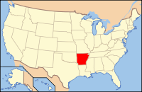
Arkansas's location in the U.S.Founded November 15, 1862 Seat Wynne Area
- Total
- Land
- Water
622.33 sq mi (1,612 km²)
615.85 sq mi (1,595 km²)
6.49 sq mi (17 km²), 1.04%Population
- (2010)
- Density
17,870
29/sq mi (11.2/km²)Congressional district 1st Cross County is a county located in the U.S. state of Arkansas. As of the 2010 census, the population was 17,870. The county seat is Wynne.[1] Cross County is Arkansas's 53rd county, formed on 15 November 1862 and named for Confederate Colonel David C. Cross, a political leader in the area.
Contents
Geography
According to the 2000 census, the county has a total area of 622.33 square miles (1,611.8 km2), of which 615.85 square miles (1,595.0 km2) (or 98.96%) is land and 6.49 square miles (16.8 km2) (or 1.04%) is water.[2]
Major Highways
 U.S. Highway 49
 U.S. Highway 64
 Highway 1
 Highway 42
 Highway 75
Adjacent counties
- Poinsett County (north)
- Crittenden County (east)
- St. Francis County (south)
- Woodruff County (west)
- Jackson County (northwest)
Demographics
Historical populations Census Pop. %± 1870 3,915 — 1880 5,050 29.0% 1890 7,693 52.3% 1900 11,051 43.7% 1910 14,042 27.1% 1920 18,579 32.3% 1930 25,723 38.5% 1940 26,046 1.3% 1950 24,757 −4.9% 1960 19,551 −21.0% 1970 19,783 1.2% 1980 20,434 3.3% 1990 19,225 −5.9% 2000 19,526 1.6% 2010 17,870 −8.5% [3][4][5]  Age pyramid Cross County[6]
As of the census[7] of 2000, there were 19,526 people, 7,391 households, and 5,447 families residing in the county. The population density was 32 people per square mile (12/km²). There were 8,030 housing units at an average density of 13 per square mile (5/km²). The racial makeup of the county was 74.80% White, 23.70% Black or African American, 0.23% Native American, 0.31% Asian, 0.01% Pacific Islander, 0.21% from other races, and 0.74% from two or more races. 0.93% of the population were Hispanic or Latino of any race.
There were 7,391 households out of which 34.70% had children under the age of 18 living with them, 55.20% were married couples living together, 14.10% had a female householder with no husband present, and 26.30% were non-families. 23.50% of all households were made up of individuals and 11.10% had someone living alone who was 65 years of age or older. The average household size was 2.60 and the average family size was 3.07.
In the county the population was spread out with 27.80% under the age of 18, 8.50% from 18 to 24, 27.40% from 25 to 44, 22.60% from 45 to 64, and 13.70% who were 65 years of age or older. The median age was 36 years. For every 100 females there were 94.00 males. For every 100 females age 18 and over, there were 89.40 males.
The median income for a household in the county was $29,362, and the median income for a family was $34,044. Males had a median income of $27,880 versus $20,133 for females. The per capita income for the county was $15,726. About 16.40% of families and 19.90% of the population were below the poverty line, including 27.90% of those under age 18 and 17.50% of those age 65 or over.
Cities and towns
Townships
 Townships in Cross County, Arkansas as of 2010
Townships in Arkansas are the divisions of a county. Each township includes unincorporated areas and some may have incorporated towns or cities within part of their space. Townships have limited purposes in modern times. However, the US Census does list Arkansas population based on townships (often referred to as "minor civil divisions"). Townships are also of value for historical purposes in terms of genealogical research. Each town or city is within one or more townships in an Arkansas county based on census maps. The townships of Cross County are listed below with the town(s) and/or city that are fully or partially inside them listed in parentheses. [8]
- Bedford (small part of Wynne)
- Brushy Lake
- Coldwater
- Ellis
- Fair Oaks
- Hickory Ridge (Hickory Ridge)
- Mitchell (Cherry Valley)
- Searcy
- Smith
- Twist
- Tyronza (Parkin)
- Wynne (most of Wynne)
See also
References
- ^ "Find a County". National Association of Counties. http://www.naco.org/Counties/Pages/FindACounty.aspx. Retrieved 2011-06-07.
- ^ "Census 2000 U.S. Gazetteer Files: Counties". United States Census. http://www.census.gov/tiger/tms/gazetteer/county2k.txt. Retrieved 2011-02-13.
- ^ http://www.census.gov/population/www/censusdata/cencounts/files/ar190090.txt
- ^ http://factfinder2.census.gov
- ^ http://mapserver.lib.virginia.edu/
- ^ Based on 2000 census data
- ^ "American FactFinder". United States Census Bureau. http://factfinder.census.gov. Retrieved 2008-01-31.
- ^ US Census Bureau. 2011 Boundary and Annexation Survey (BAS): Cross County, AR (Map). http://www2.census.gov/geo/pvs/bas/bas11/st05_ar/cou/c05037_cross/BAS11C20503700000_000.pdf. Retrieved 20110806.
External links

Jackson County Poinsett County Woodruff County 
Crittenden County  Cross County, Arkansas

St. Francis County Municipalities and communities of Cross County, Arkansas Cities 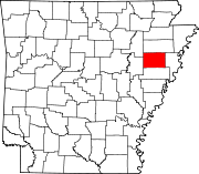
Unincorporated
communitiesFair Oaks | Twist | Vanndale | Wilkins
 State of Arkansas
Topics - Index
- Arkansans
- Constitution
- Delegations
- Geography
- Government
- Governor (List)
- History
- Images
- Places
- Transportation
- Visitor Attractions
Society - Culture
- Crime
- Demographics
- Economy
- Education
- Politics
Regions Metros Largest cities Other cities Counties - Arkansas
- Ashley
- Baxter
- Benton
- Boone
- Bradley
- Calhoun
- Carroll
- Chicot
- Clark
- Clay
- Cleburne
- Cleveland
- Columbia
- Conway
- Craighead
- Crawford
- Crittenden
- Cross
- Dallas
- Desha
- Drew
- Faulkner
- Franklin
- Fulton
- Garland
- Grant
- Greene
- Hempstead
- Hot Spring
- Howard
- Independence
- Izard
- Jackson
- Jefferson
- Johnson
- Lafayette
- Lawrence
- Lee
- Lincoln
- Little River
- Logan
- Lonoke
- Madison
- Marion
- Miller
- Mississippi
- Monroe
- Montgomery
- Nevada
- Newton
- Ouachita
- Perry
- Phillips
- Pike
- Poinsett
- Polk
- Pope
- Prairie
- Pulaski
- Randolph
- Saline
- Scott
- Searcy
- Sebastian
- Sevier
- Sharp
- St. Francis
- Stone
- Union
- Van Buren
- Washington
- White
- Woodruff
- Yell
Coordinates: 35°17′30″N 90°46′24″W / 35.29167°N 90.77333°W
Categories:- Arkansas counties
- Cross County, Arkansas
- 1862 establishments


Wikimedia Foundation. 2010.