- Baxter County, Arkansas
-
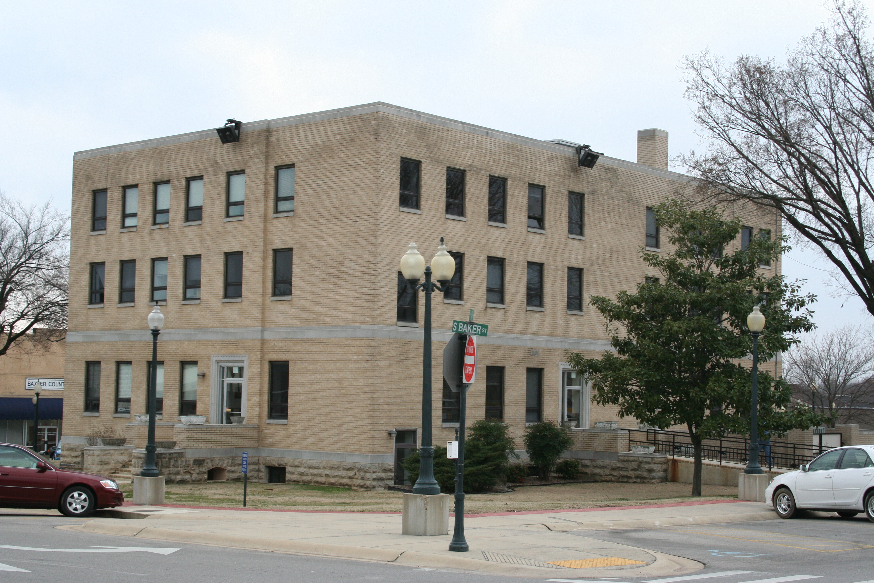
Baxter County, Arkansas  Baxter County courthouse in Mountain Home, Arkansas
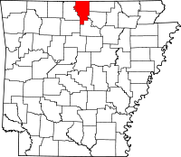
Location in the state of Arkansas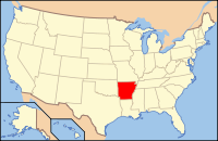
Arkansas's location in the U.S.Founded March 24, 1873 Seat Mountain Home Largest city Mountain Home Area
- Total
- Land
- Water
586.74 sq mi (1,520 km²)
554.36 sq mi (1,436 km²)
32.38 sq mi (84 km²), 5.52%Population
- (2010)
- Density
41,513
77/sq mi (29.7/km²)Congressional district 1st Baxter County is a county located in the U.S. state of Arkansas. It is in the northern part of the state, and shares a border with Missouri. It is commonly referred to as the Twin Lakes Area because it is bordered by two of Arkansas' largest lakes, Bull Shoals Lake and Norfork Lake. On its southern border is the Norfork Tailwater and the Buffalo National River.
The county seat is Mountain Home,[1] which is ranked as the 2nd Best Fishing Town in America by Field and Stream magazine and Baxter County today it is primarily known as a retirement and resort destination. Its Big Creek Golf Course has consistently earned 5 star ratings in Golf Digest magazine and is ranked in its top 10 places to play. It has also been rated the number 1 public course in Arkansas for four years in a row.
Baxter County is Arkansas's 66th county, formed on 24 March 1873 and named for Elisha Baxter, the tenth governor of Arkansas.
As of the 2000 census, the county's population was 38,386 in 2000. As of July 2007, the county's population is 41,307.[2] The Mountain Home Micropolitan Statistical Area includes all of Baxter County.
The Baxter Bulletin weekly newspaper was named in 1973 by the Newspaper Enterprise Association as the "Best Overall Weekly Newspaper in the United States" in the over 10,000-circulation category. At the time it was published by Harold E. Martin and was the largest weekly paper in Arkansas.
Contents
Geography
According to the 2000 census, the county has a total area of 586.74 square miles (1,519.6 km2), of which 554.36 square miles (1,435.8 km2) (or 94.48%) is land and 32.38 square miles (83.9 km2) (or 5.52%) is water.[3]
List Of Highways

 US 62/US 412
 U.S. Route 62 Business
 Arkansas Highway 5
 Arkansas Highway 14
 Arkansas Highway 101
 Arkansas Highway 126
 Arkansas Highway 177
 Arkansas Highway 178
 Arkansas Highway 201
 Arkansas Highway 202
 Arkansas Highway 201 Spur
 Arkansas Highway 263
 Arkansas Highway 341
 Arkansas Highway 342
 Arkansas Highway 345
Adjacent counties
- Ozark County, Missouri (north)
- Fulton County (east)
- Izard County (southeast)
- Stone County (south)
- Searcy County (southwest)
- Marion County (west)
National protected areas
- Buffalo National River (part)
- Ozark National Forest (part)
Demographics
Historical populations Census Pop. %± 1880 6,004 — 1890 8,527 42.0% 1900 9,298 9.0% 1910 10,389 11.7% 1920 10,216 −1.7% 1930 9,519 −6.8% 1940 10,281 8.0% 1950 11,683 13.6% 1960 9,943 −14.9% 1970 15,319 54.1% 1980 27,409 78.9% 1990 31,186 13.8% 2000 38,386 23.1% 2010 41,513 8.1% UVA Census Browser 1880-1950[4]
Arkansas Counties 1900-1990[5]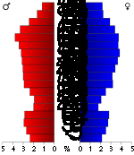
As of the census[7] of 2000, there were 38,386 people, 17,052 households, and 11,799 families residing in the county. The population density was 69 people per square mile (27/km²). There were 19,891 housing units at an average density of 36 per square mile (14/km²). The racial makeup of the county was 97.81% White, 0.11% Black or African American, 0.52% Native American, 0.34% Asian, 0.02% Pacific Islander, 0.22% from other races, and 0.97% from two or more races. 1.00% of the population were Hispanic or Latino of any race.
There were 17,052 households out of which 22.00% had children under the age of 18 living with them, 59.00% were married couples living together, 7.70% had a female householder with no husband present, and 30.80% were non-families. 27.50% of all households were made up of individuals and 15.10% had someone living alone who was 65 years of age or older. The average household size was 2.21 and the average family size was 2.65.
In the county the population was spread out with 19.00% under the age of 18, 5.80% from 18 to 24, 21.10% from 25 to 44, 27.40% from 45 to 64, and 26.80% who were 65 years of age or older. The median age was 48 years. For every 100 females there were 92.30 males. For every 100 females age 18 and over, there were 89.10 males.
The median income for a household in the county was $29,106, and the median income for a family was $34,578. Males had a median income of $25,976 versus $18,923 for females. The per capita income for the county was $16,859. About 7.90% of families and 11.10% of the population were below the poverty line, including 14.70% of those under age 18 and 8.90% of those age 65 or over.
As of 2010 Baxter County had a population of 41,513. The racial makeup was 95.96% Non-Hispanic whites, 0.16% blacks, 0.56% Native Americans, 0.41% Asians, 0.04% Pacific Islanders, 1.25% Non-Hispanics reporting more than one race and 1.66% Hispanic or Latino.
Cities and towns
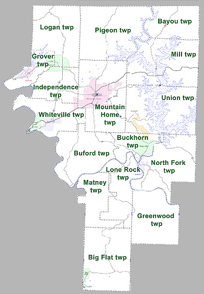
Townships
 Townships in Baxter County, Arkansas as of 2010
Townships in Arkansas are the divisions of a county. Each township includes unincorporated areas and some may have incorporated towns or cities within part of their space. Townships have limited purposes in modern times. However, the US Census does list Arkansas population based on townships (often referred to as "minor civil divisions"). Townships are also of value for historical purposes in terms of genealogical research. Each town or city is within one or more townships in an Arkansas county based on census maps. The townships of Baxter County are listed below with the town(s) and/or city that are fully or partially inside them listed in parentheses. [8]
- Bayou
- Big Flat (Big Flat)
- Buckhorn (Briarcliff, small portion of Norfork, Salesville)
- Buford
- Greenwood
- Grover (Lakeview, Midway)
- Independence (Midway, small portion of Mountain Home)
- Logan (Midway)
- Lone Rock (small portion of Norfork)
- Matney
- Mill
- Mountain Home (Mountain Home)
- North Fork (Norfork)
- Pigeon
- Union (Briarcliff)
- Whiteville (Cotter, Gassville, small portion of Mountain Home)
Notable residents - past and present
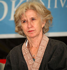 Carolyn D. Wright, poet
- Richard Antrim - American naval Rear Admiral; World War II veteran and Medal of Honor recipient
- Wes Bentley - an American film actor
- Lonnie D. Bentley - is a Professor and the Department Head of Computer and Information Technology at Purdue University
- Robbie Branscum (1937—1997) - writer of children's books and young adult fiction
- Ed Dugan - Chef and author of Help! I Gotta Cook
- Richard A. Knaak - an American author; wrote the Minotaur Wars and other contributions to Dragonlance
- Derin McMains - a Former Minor League Baseball Player Now Coach for the San Francisco Giants organization
- Roy Stone - blacksmith and wagon maker
- Carolyn D. Wright - poet, was born in Mountain Home.
See also
References
- ^ "Find a County". National Association of Counties. http://www.naco.org/Counties/Pages/FindACounty.aspx. Retrieved 2011-06-07.
- ^ Table of United States primary census statistical areas
- ^ "Census 2000 U.S. Gazetteer Files: Counties". United States Census. http://www.census.gov/tiger/tms/gazetteer/county2k.txt. Retrieved 2011-02-13.
- ^ Historical Census Browser, University of Virginia, Geospatial and Statistical Data Center, 2004, http://mapserver.lib.virginia.edu/
- ^ Arkansas Counties 1900-1990, U.S. Census Bureau, http://www.census.gov/population/cencounts/ar190090.txt
- ^ Based on 2000 census data
- ^ "American FactFinder". United States Census Bureau. http://factfinder.census.gov. Retrieved 2008-01-31.
- ^ US Census Bureau. 2011 Boundary and Annexation Survey (BAS): Baxter County, AR (Map). http://www2.census.gov/geo/pvs/bas/bas11/st05_ar/cou/c05005_baxter/BAS11C20500500000_000.pdf. Retrieved 20110726.
External links
- Baxter County government's website
- Baxter County, Arkansas at the Open Directory Project
- Baxter County Map from the US Census Bureau

Ozark County, Missouri Marion County 
Fulton County  Baxter County, Arkansas

Searcy County Stone County Izard County Municipalities and communities of Baxter County, Arkansas Cities Cotter | Gassville | Lakeview | Mountain Home | Norfork | Salesville

Towns CDP Unincorporated
communitiesArkana | Buffalo City | Buford | Clarkridge | Gamaliel | Henderson | Hopewell | Monkey Run | Old Joe
Footnotes ‡This populated place also has portions in an adjacent county or counties
 State of Arkansas
Topics - Index
- Arkansans
- Constitution
- Delegations
- Geography
- Government
- Governor (List)
- History
- Images
- Places
- Transportation
- Visitor Attractions
Society - Culture
- Crime
- Demographics
- Economy
- Education
- Politics
Regions Metros Largest cities Other cities Counties - Arkansas
- Ashley
- Baxter
- Benton
- Boone
- Bradley
- Calhoun
- Carroll
- Chicot
- Clark
- Clay
- Cleburne
- Cleveland
- Columbia
- Conway
- Craighead
- Crawford
- Crittenden
- Cross
- Dallas
- Desha
- Drew
- Faulkner
- Franklin
- Fulton
- Garland
- Grant
- Greene
- Hempstead
- Hot Spring
- Howard
- Independence
- Izard
- Jackson
- Jefferson
- Johnson
- Lafayette
- Lawrence
- Lee
- Lincoln
- Little River
- Logan
- Lonoke
- Madison
- Marion
- Miller
- Mississippi
- Monroe
- Montgomery
- Nevada
- Newton
- Ouachita
- Perry
- Phillips
- Pike
- Poinsett
- Polk
- Pope
- Prairie
- Pulaski
- Randolph
- Saline
- Scott
- Searcy
- Sebastian
- Sevier
- Sharp
- St. Francis
- Stone
- Union
- Van Buren
- Washington
- White
- Woodruff
- Yell
Coordinates: 36°18′25″N 92°21′17″W / 36.30694°N 92.35472°W
Categories:- Arkansas counties
- Baxter County, Arkansas
- 1873 establishments


Wikimedia Foundation. 2010.