- Cotter, Arkansas
-
Cotter, Arkansas — City — Location in Baxter County and the state of Arkansas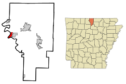
Coordinates: 36°16′29″N 92°31′42″W / 36.27472°N 92.52833°WCoordinates: 36°16′29″N 92°31′42″W / 36.27472°N 92.52833°W Country United States State Arkansas County Baxter Area – Total 2.5 sq mi (6.4 km2) – Land 2.5 sq mi (6.4 km2) – Water 0 sq mi (0 km2) Elevation 633 ft (193 m) Population (2010) – Total 970 – Density 368.4/sq mi (143.9/km2) Time zone Central (CST) (UTC-6) – Summer (DST) CDT (UTC-5) ZIP code 72626 Area code(s) 870 FIPS code 05-15490 GNIS feature ID 0076681 Cotter is a city in Baxter County, Arkansas, United States. The population was 970 at the 2010 census.
Contents
History
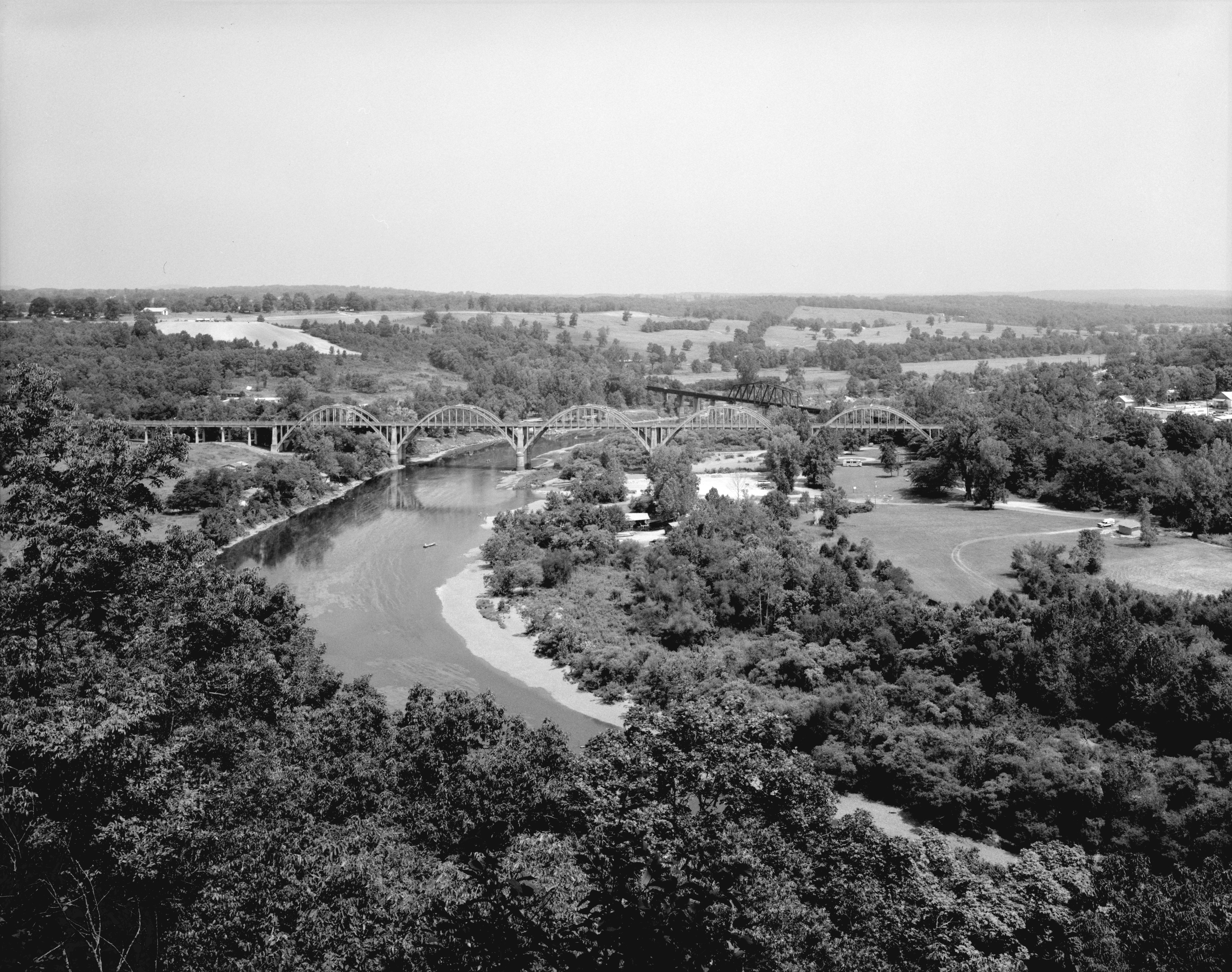
 The Cotter Bridge was critical in the development of The Ozarks.
Originally, the river bend was known as Lake's Ferry. In 1905, the Missouri Pacific Railroad bought the area and sold over one thousand lots, mostly to railroad employees.[1] The city was incorporated in 1905 as Cotter, Arkansas.[2] The mercurial White River caused many motorists problems, as the nearest crossing was over 100 miles (160 km) to the north in Branson, Missouri. An inconvenient ferry system made the need for a bridge apparent. Locals wanted a bridge, but they strongly opposed a toll bridge.[3] Arkansas did not have a central highway body at the time, and was instead a patchwork of "road districts", which made the bridge-building efforts even more difficult. Without a toll, funding wasn't available until Arkansas Highway 12 was redesignated U.S. Route 62 in 1930. The Cotter Bridge was constructed through the area using a unique rainbow arch design.
Geography
Cotter is located at 36°16′29″N 92°31′42″W / 36.27472°N 92.52833°W (36.274772, -92.528336)[4].
According to the United States Census Bureau, the city has a total area of 2.5 square miles (6.5 km2), all of it land.
List Of Highways

 US 62/US 412
 U.S. Route 62 Business
 Arkansas Highway 345
School District
Cotter is in the Cotter School District.[5]
Demographics
As of the census[6] of 2010, there were 970 people, 449 households, and 265 families residing in the city. The population density was 373.6 people per square mile (144.0/km²). There were 501 housing units at an average density of 203.2 per square mile (78.3/km²). The racial makeup of the city was 97.07% White, 0.87% Native American, 0.22% Asian, and 1.85% from two or more races. 1.52% of the population were Hispanic or Latino of any race.
There were 545[7] households out of which 20.8% had children under the age of 18 living with them, 48.5% were married couples living together, 8.6% had a female householder with no husband present, and 40.0% were non-families. 35.4% of all households were made up of individuals and 16.7% had someone living alone who was 65 years of age or older. The average household size was 2.08 and the average family size was 2.67.
In the city the population was spread out with 19.7% under the age of 18, 8.7% from 18 to 24, 24.8% from 25 to 44, 26.7% from 45 to 64, and 20.2% who were 65 years of age or older. The median age was 43 years. For every 100 females there were 97.2 males. For every 100 females age 18 and over, there were 99.5 males.
The median income for a household in the city was $22,857, and the median income for a family was $34,375. Males had a median income of $26,298 versus $17,266 for females. The per capita income for the city was $15,893. About 11.9% of families and 16.8% of the population were below the poverty line, including 18.3% of those under age 18 and 13.3% of those age 65 or over.
External Links
- Map of Cotter (US Census Bureau)
- Map of Baxter County (US Census Bureau)
- Cotter School District
- Baxter County Historical and Genealogical Society
References
- ^ Bennett, Lola and Smith, Corinne. "Historic American Engineering Record Cotter Bridge (R.M. Ruthven Bridge)." 1988. History. Page 3. Retrieved August 20, 2010.
- ^ Ramey, Ann. "Cotter Historical Briefs." History. Retrieved August 20, 2010.
- ^ Bennett, Lola and Smith, Corinne. "Historic American Engineering Record Cotter Bridge (R.M. Ruthven Bridge)." 1988. History. Page 6. Retrieved August 20, 2010.
- ^ "US Gazetteer files: 2010, 2000, and 1990". United States Census Bureau. 2011-02-12. http://www.census.gov/geo/www/gazetteer/gazette.html. Retrieved 2011-04-23.
- ^ US Census Bureau. School District Reference Map (2010 Census) Baxter County, AR (Map). http://www2.census.gov/geo/maps/dc10map/sch_dist/st05_ar/c05005_baxter/DC10SD_C05005_001.pdf. Retrieved 2011-07-12.
- ^ "American FactFinder". United States Census Bureau. http://factfinder.census.gov. Retrieved 2008-01-31.
- ^ "2010 Census Results". http://factfinder2.census.gov/faces/tableservices/jsf/pages/productview.xhtml?fpt=table. Retrieved April 9, 2011.
Municipalities and communities of Baxter County, Arkansas Cities Cotter | Gassville | Lakeview | Mountain Home | Norfork | Salesville
Towns CDP Unincorporated
communitiesArkana | Buffalo City | Buford | Clarkridge | Gamaliel | Henderson | Hopewell | Monkey Run | Old Joe
Footnotes ‡This populated place also has portions in an adjacent county or counties
Categories:- Populated places in Baxter County, Arkansas
- Cities in Arkansas
- Populated places established in 1905


Wikimedia Foundation. 2010.