- Phillips County, Arkansas
Infobox U.S. County
county = Phillips County
state = Arkansas
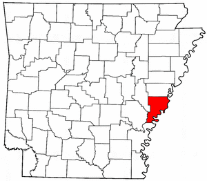
map size = 225
founded = May 1, 1820
seat = Helena-West Helena | area_total_sq_mi =727
area_land_sq_mi =693
area_water_sq_mi =35
area percentage = 4.76%
census yr = 2000
pop = 26445
density_km2 =15
web =
|Phillips County is a
county located in theU.S. state ofArkansas . As of 2000, the population was 26,445. Thecounty seat is Helena-West Helena.GR|6 Phillips County is Arkansas's seventh county, formed onMay 1 ,1820 and named forSylvanus Phillips , the area's first-known white settler and representative to the first Territorial Legislature of theArkansas Territory .The Helena-West Helena
Micropolitan Statistical Area includes all of Phillips County.Geography
According to the
U.S. Census Bureau , the county has a total area of 727square mile s (1,884km² ), of which, 693 square miles (1,794 km²) of it is land and 35 square miles (90 km²) of it (4.76%) is water.Major highways
*
*
*
*Adjacent counties
*Lee County (north)
*Tunica County,Mississippi (northeast)
*Coahoma County,Mississippi (east)
*Bolivar County,Mississippi (southeast)
*Desha County (south)
*Arkansas County (southwest)
*Monroe County (northwest)National
protected area s*
St. Francis National Forest (part)
*White River National Wildlife Refuge (part)Demographics
As of the
census GR|2 of 2000, there were 26,445 people, 9,711 households, and 6,768 families residing in the county. Thepopulation density was 38 people per square mile (15/km²). There were 10,859 housing units at an average density of 16 per square mile (6/km²). The racial makeup of the county was 59.04% Black or African American, 39.25% White, 0.43% from other races, 0.32% Asian, 0.17% Native American, 0.01% Pacific Islander, and 0.78% from two or more races. 1.44% of the population were Hispanic or Latino of any race.There were 9,711 households out of which 34.20% had children under the age of 18 living with them, 40.30% were married couples living together, 25.10% had a female householder with no husband present, and 30.30% were non-families. 27.60% of all households were made up of individuals and 13.00% had someone living alone who was 65 years of age or older. The average household size was 2.69 and the average family size was 3.29.
In the county the population was spread out with 32.20% under the age of 18, 9.40% from 18 to 24, 23.20% from 25 to 44, 21.20% from 45 to 64, and 13.90% who were 65 years of age or older. The median age was 33 years. For every 100 females there were 84.70 males. For every 100 females age 18 and over, there were 77.70 males.
The median income for a household in the county was $22,231, and the median income for a family was $26,570. Males had a median income of $24,675 versus $17,520 for females. The
per capita income for the county was $12,288. About 28.70% of families and 32.70% of the population were below thepoverty line , including 45.50% of those under age 18 and 26.20% of those age 65 or over.Cities and towns
Unincorporated places
*Modoc
*Poplar Grove
*Turkey ScratchReferences
Wikimedia Foundation. 2010.