- National Register of Historic Places listings in Phillips County, Arkansas
-
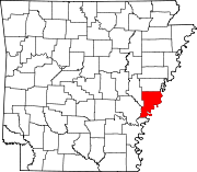
 Location of Phillips County in Arkansas
This is a list of the National Register of Historic Places listings in Phillips County, Arkansas.
This is intended to be a complete list of the properties and districts on the National Register of Historic Places in Phillips County, Arkansas, United States. The locations of National Register properties and districts for which the latitude and longitude coordinates are included below, may be seen in a Google map.[1]
There are 49 properties and districts listed on the National Register in the county, including 2 National Historic Landmarks.
Contents: Counties in Arkansas Arkansas - Ashley - Baxter - Benton - Boone - Bradley - Calhoun - Carroll - Chicot - Clark - Clay - Cleburne - Cleveland - Columbia - Conway - Craighead - Crawford - Crittenden - Cross - Dallas - Desha - Drew - Faulkner - Franklin - Fulton - Garland - Grant - Greene - Hempstead - Hot Spring - Howard - Independence - Izard - Jackson - Jefferson - Johnson - Lafayette - Lawrence - Lee - Lincoln - Little River - Logan - Lonoke - Madison - Marion - Miller - Mississippi - Monroe - Montgomery - Nevada - Newton - Ouachita - Perry - Phillips - Pike - Poinsett - Polk - Pope - Prairie - Pulaski (Little Rock) - Randolph - St. Francis - Saline - Scott - Searcy - Sebastian - Sevier - Sharp - Stone - Union - Van Buren - Washington - White - Woodruff - Yell
-
- This National Park Service list is complete through NPS recent listings posted November 10, 2011.[2]
Current listings
[3] Landmark name [4] Image Date listed Location City or town Summary 1 Allin House June 4, 1973 515 Columbia St.
34°31′38″N 90°35′30″W / 34.527222°N 90.591667°WHelena-West Helena 2 Almer Store October 18, 1974 824 Columbia St.
34°31′42″N 90°35′20″W / 34.528333°N 90.588889°WHelena-West Helena 3 Altman House January 21, 1988 1202 Perry St.
34°31′47″N 90°35′50″W / 34.529722°N 90.597222°WHelena-West Helena 4 Battery A Site, Battle of Helena August 18, 1992 Northwest of the junction of Adams and Columbia Sts.
34°32′15″N 90°35′33″W / 34.5375°N 90.5925°WHelena-West Helena 5 Battery B Site, Battle of Helena August 18, 1992 Northeast of the junction of Liberty St. and Summit Rd.
34°32′02″N 90°35′51″W / 34.533889°N 90.5975°WHelena-West Helena 6 Battery C Site December 1, 1978 Clark and York Sts.
34°31′29″N 90°35′39″W / 34.524722°N 90.594167°WHelena-West Helena 7 Battery D September 17, 1974 Military Rd.
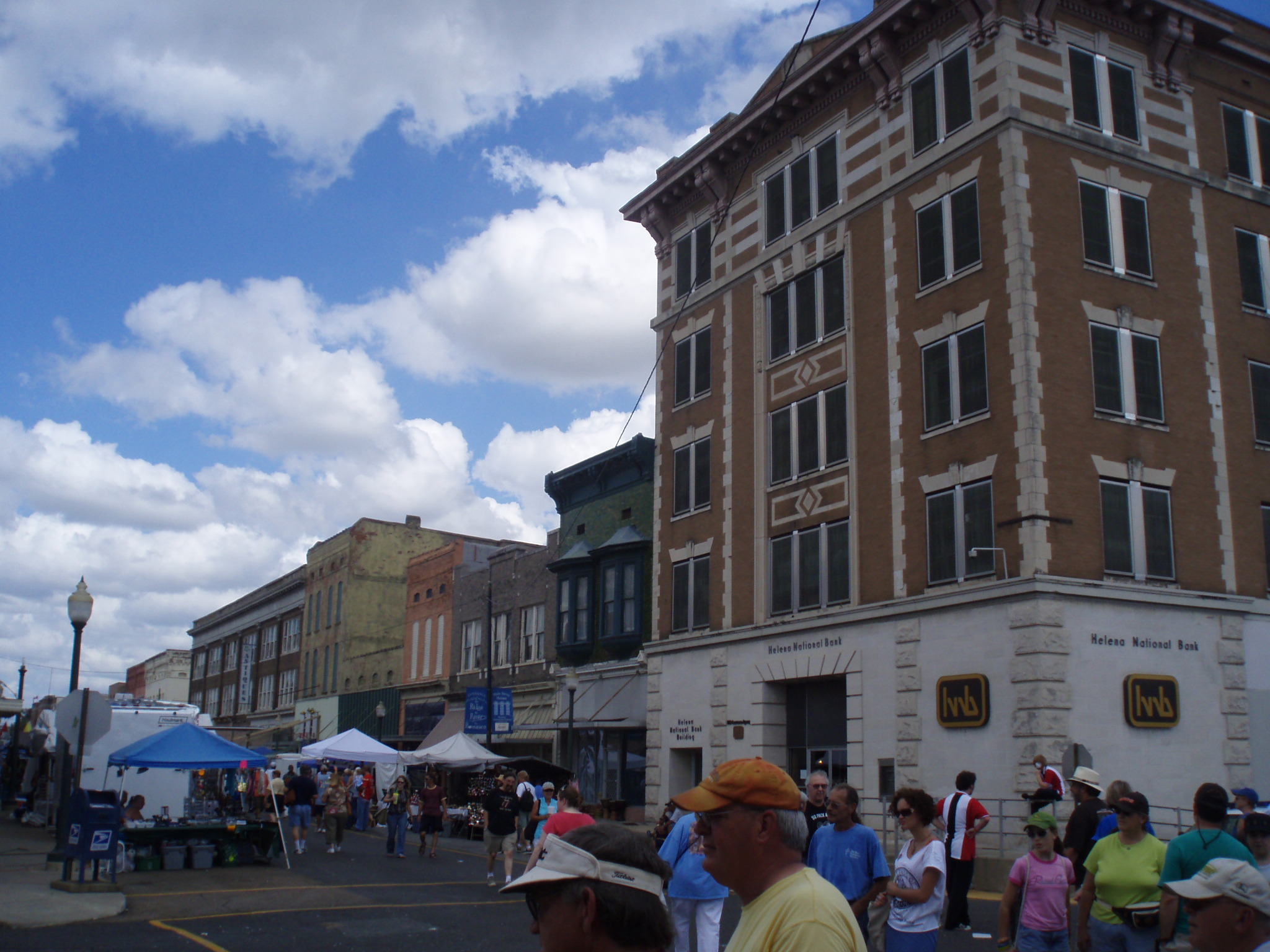
34°31′05″N 90°35′22″W / 34.518056°N 90.589444°WHelena-West Helena 8 Beech Street Historic District January 30, 1987 Roughly bounded by McDonough, Columbia, Beech, Elm, Perry, and College
34°31′38″N 90°35′48″W / 34.527222°N 90.596667°WHelena-West Helena 9 Centennial Baptist Church March 26, 1987 York and Columbia Sts.
34°31′32″N 90°35′27″W / 34.525556°N 90.590833°WHelena-West Helena 10 Cherry Street Historic District 
August 17, 1987 Along Cherry St. between Porter and Elm Sts.
34°31′36″N 90°35′8″W / 34.52667°N 90.58556°W
Boundary increase (listed 5/27/2010): Cherry St. between Porter and Perry Sts. and from Elm to the south side of Missouri St.Helena-West Helena 11 Chicago Mill Company Office Building October 31, 1996 129 N. Washington St.
34°32′39″N 90°39′22″W / 34.544167°N 90.656111°WHelena-West Helena 12 Coolidge House September 8, 1983 820 Perry St.
34°31′46″N 90°35′36″W / 34.529444°N 90.593333°WHelena-West Helena 13 Denison House October 31, 1996 427 Garland Ave.
34°32′44″N 90°38′25″W / 34.545556°N 90.640278°WHelena-West Helena 14 Estevan Hall October 22, 1974 653 S. Biscoe St.
34°30′48″N 90°35′37″W / 34.513333°N 90.593611°WHelena-West Helena 15 Faust House October 31, 1996 114 Richmond Hill
34°32′36″N 90°38′02″W / 34.543333°N 90.633889°WHelena-West Helena 16 First Baptist Church May 13, 1991 Junction of Pine and Carruth Sts.
34°33′26″N 90°54′44″W / 34.557222°N 90.912222°WMarvell 17 Henry and Cornelia Ford Farm March 2, 2006 1335 County Road 249
34°37′12″N 90°42′28″W / 34.62°N 90.707778°WLexa 18 Gemmill-Faust House October 31, 1996 321 St. Andrew's Terrace
34°32′20″N 90°38′01″W / 34.538889°N 90.633611°WHelena-West Helena 19 Helena Confederate Cemetery 
May 3, 1996 Southwestern corner of Maple Hill Cemetery, approximately 0.5 miles north of the junction of Poplar and Adams Sts.
34°32′30″N 90°35′34″W / 34.541667°N 90.592778°WHelena-West Helena 20 Helena Depot November 5, 1987 Natchez and Missouri Sts.
34°31′19″N 90°35′09″W / 34.521944°N 90.585833°WHelena-West Helena 21 Helena Library and Museum December 6, 1975 623 Peach St.
34°31′42″N 90°35′19″W / 34.528333°N 90.588611°WHelena-West Helena 22 Helena National Guard Armory January 24, 2007 511 Miller St.
34°31′53″N 90°35′19″W / 34.531339°N 90.588619°WHelena-West Helena 23 Sidney H. Horner House 
December 4, 1975 626 Porter St.
34°31′41″N 90°35′26″W / 34.528056°N 90.590556°WHelena-West Helena 24 Keesee House September 8, 1983 723 Arkansas St.
34°31′18″N 90°35′31″W / 34.521667°N 90.591944°WHelena-West Helena 25 Richard L. Kitchens Post No. 41 September 30, 1976 409 Porter St.
34°31′40″N 90°35′16″W / 34.527778°N 90.587778°WHelena-West Helena 26 Little Cypress Creek Bridge May 18, 1995 County Road 66G over Little Cypress Creek
34°33′27″N 91°01′24″W / 34.5575°N 91.023333°WPostelle 27 Louisiana Purchase Survey Marker February 23, 1972 Southeast of Blackton at the corner of Monroe and Phillips counties
34°38′48″N 91°03′05″W / 34.646667°N 91.051389°WBlackton Extends into Lee and Monroe counties 28 Maple Hill Cemetery April 6, 2000 N. Holly St.
34°32′35″N 90°35′28″W / 34.543056°N 90.591111°WHelena-West Helena 29 Mayo House December 19, 1997 302 Elm St.
34°33′28″N 90°54′44″W / 34.557778°N 90.912222°WMarvell 30 Moore-Hornor House June 4, 1973 323 Beech St.
34°31′31″N 90°36′08″W / 34.525278°N 90.602222°WHelena-West Helena 31 Myers House October 31, 1996 221 St. Andrew's Terrace
34°32′27″N 90°38′00″W / 34.540833°N 90.633333°WHelena-West Helena 32 Nelson House October 31, 1996 303 St. Andrew's Terrace
34°32′22″N 90°38′00″W / 34.539444°N 90.633333°WHelena-West Helena 33 New Light Missionary Baptist Church December 7, 1995 522 Arkansas St.
34°31′18″N 90°35′25″W / 34.521667°N 90.590278°WHelena-West Helena 34 Perry Street Historic District November 26, 1986 Perry St. between Pecan and Franklin and Pecan St. from Porter to Perry
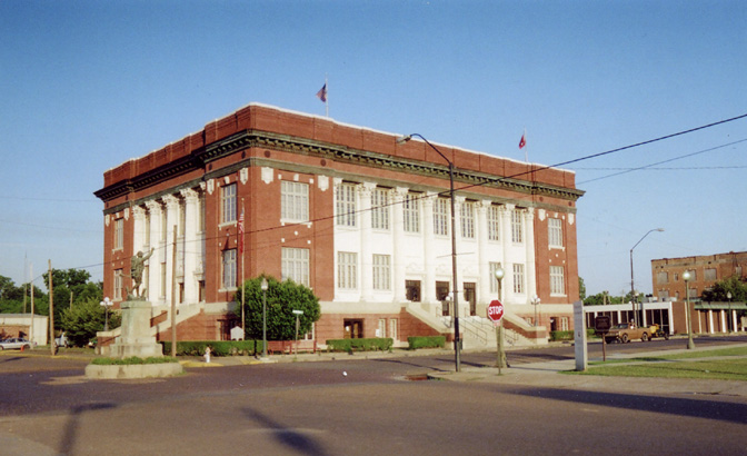
34°31′43″N 90°35′21″W / 34.528611°N 90.589167°WHelena-West Helena 35 Phillips County Courthouse 
July 15, 1977 622 Cherry St.
34°31′42″N 90°35′06″W / 34.528333°N 90.585°WHelena-West Helena 36 Phillips County Penal Farm Historic District January 24, 2007 County Road 353 south of U.S. Route 49
34°33′06″N 90°48′11″W / 34.551667°N 90.803056°WPoplar Grove 37 Jerome Bonaparte Pillow House 
May 7, 1973 718 Perry St.
34°31′44″N 90°35′31″W / 34.528889°N 90.591944°WHelena-West Helena 38 E.S. Ready House January 1, 1976 929 Beech St.
34°31′55″N 90°35′33″W / 34.531944°N 90.5925°WHelena-West Helena 39 Richardson-Turner House May 29, 1998 1469 Highway 1, N.
34°35′09″N 90°47′17″W / 34.585833°N 90.788056°WLexa 40 St. Mary's Catholic Church January 24, 2007 123 Columbia
34°31′28″N 90°35′31″W / 34.524444°N 90.591944°WHelena-West Helena 41 William A. Short House April 18, 1985 317 Biscoe St.
34°31′05″N 90°35′31″W / 34.518056°N 90.591944°WHelena-West Helena 42 Spirit of the American Doughboy Monument-Helena May 23, 1997 Junction of Cherry and Perry Sts.
34°31′42″N 90°35′06″W / 34.528333°N 90.585°WHelena-West Helena 43 William Nicholas Straub House April 18, 1985 531 Perry St.
34°31′37″N 90°35′31″W / 34.526944°N 90.591944°WHelena-West Helena 44 James C. Tappan House June 4, 1973 717 Poplar St.
34°31′46″N 90°35′38″W / 34.529444°N 90.593889°WHelena-West Helena 45 Maj. James Alexander Tappan House September 9, 1974 727 Columbia St.
34°31′59″N 90°35′28″W / 34.533056°N 90.591111°WHelena-West Helena 46 Turner Historic District March 2, 2006 Corners of Highway 318 and County Road 606
34°29′31″N 90°57′24″W / 34.491944°N 90.956667°WCypert 47 Warrens Bridge May 18, 1995 County Road 14I over Lambrook Levee Ditch
34°20′09″N 91°00′42″W / 34.335833°N 91.011667°WLambrook 48 West House September 8, 1983 229 Beech St.
34°31′39″N 90°35′33″W / 34.5275°N 90.5925°WHelena-West Helena 49 White House December 22, 1982 1015 Perry St.
34°31′57″N 90°35′56″W / 34.5325°N 90.598889°WHelena-West Helena See also
- List of National Historic Landmarks in Arkansas
- National Register of Historic Places listings in Arkansas
References
- ^ The latitude and longitude information provided in this table was derived originally from the National Register Information System, which has been found to be fairly accurate for about 99% of listings. For about 1% of NRIS original coordinates, experience has shown that one or both coordinates are typos or otherwise extremely far off; some corrections may have been made. A more subtle problem causes many locations to be off by up to 150 yards, depending on location in the country: most NRIS coordinates were derived from tracing out latitude and longitudes off of USGS topographical quadrant maps created under the North American Datum of 1927, which differs from the current, highly accurate WGS84 GPS system used by Google maps. Chicago is about right, but NRIS longitudes in Washington are higher by about 4.5 seconds, and are lower by about 2.0 seconds in Maine. Latitudes differ by about 1.0 second in Florida. Some locations in this table may have been corrected to current GPS standards.
- ^ "National Register of Historic Places: Weekly List Actions". National Park Service, United States Department of the Interior. Retrieved on November 10, 2011.
- ^ Numbers represent an ordering by significant words. Various colorings, defined here, differentiate National Historic Landmark sites and National Register of Historic Places Districts from other NRHP buildings, structures, sites or objects.
- ^ "National Register Information System". National Register of Historic Places. National Park Service. . http://nrhp.focus.nps.gov/natreg/docs/All_Data.html.
U.S. National Register of Historic Places Topics Lists by states Alabama • Alaska • Arizona • Arkansas • California • Colorado • Connecticut • Delaware • Florida • Georgia • Hawaii • Idaho • Illinois • Indiana • Iowa • Kansas • Kentucky • Louisiana • Maine • Maryland • Massachusetts • Michigan • Minnesota • Mississippi • Missouri • Montana • Nebraska • Nevada • New Hampshire • New Jersey • New Mexico • New York • North Carolina • North Dakota • Ohio • Oklahoma • Oregon • Pennsylvania • Rhode Island • South Carolina • South Dakota • Tennessee • Texas • Utah • Vermont • Virginia • Washington • West Virginia • Wisconsin • WyomingLists by territories Lists by associated states Other Municipalities and communities of Phillips County, Arkansas Cities Elaine | Helena-West Helena | Lake View | Lexa | Marvell
Unincorporated
communitiesBarton | Crumrod | Ferguson | Lambrook | Mellwood | Modoc | Oneida | Poplar Grove | Turner | Wabash | Walnut Corner
Categories:- Phillips County, Arkansas
- National Register of Historic Places in Arkansas by county
-


Wikimedia Foundation. 2010.