- National Register of Historic Places listings in Franklin County, Arkansas
-
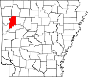
 Location of Franklin County in Arkansas
This is a list of the National Register of Historic Places listings in Franklin County, Arkansas.
This is intended to be a complete list of the properties and districts on the National Register of Historic Places in Franklin County, Arkansas, United States. The locations of National Register properties and districts for which the latitude and longitude coordinates are included below, may be seen in a Google map.[1]
There are 22 properties and districts listed on the National Register in the county.
Contents: Counties in Arkansas Arkansas - Ashley - Baxter - Benton - Boone - Bradley - Calhoun - Carroll - Chicot - Clark - Clay - Cleburne - Cleveland - Columbia - Conway - Craighead - Crawford - Crittenden - Cross - Dallas - Desha - Drew - Faulkner - Franklin - Fulton - Garland - Grant - Greene - Hempstead - Hot Spring - Howard - Independence - Izard - Jackson - Jefferson - Johnson - Lafayette - Lawrence - Lee - Lincoln - Little River - Logan - Lonoke - Madison - Marion - Miller - Mississippi - Monroe - Montgomery - Nevada - Newton - Ouachita - Perry - Phillips - Pike - Poinsett - Polk - Pope - Prairie - Pulaski (Little Rock) - Randolph - St. Francis - Saline - Scott - Searcy - Sebastian - Sevier - Sharp - Stone - Union - Van Buren - Washington - White - Woodruff - Yell
-
- This National Park Service list is complete through NPS recent listings posted November 10, 2011.[2]
Current listings
[3] Landmark name [4] Image Date listed Location City or town Summary 1 Altus Well Shed-Gazebo September 12, 1996 Northwestern corner of the junction of N. Franklin and E. Main Sts.
35°26′46″N 93°45′44″W / 35.446111°N 93.762222°WAltus 2 Bristow Hotel February 18, 1999 112 S. 2nd St.
35°29′10″N 93°49′33″W / 35.486111°N 93.825833°WOzark 3 Center Cross School October 8, 1992 County Road 95, west of Altus
35°26′14″N 93°47′17″W / 35.437222°N 93.788056°WAltus 4 Charleston Commercial Historic District May 29, 2008 Main St. roughly from Highway 217 to Tilden St. Charleston 5 First Methodist Episcopal Church, South September 4, 1992 503 W. Commercial St.
35°29′13″N 93°49′46″W / 35.486944°N 93.829444°WOzark 6 Franklin County Courthouse September 22, 1995 211 W. Commercial St.
35°29′11″N 93°49′36″W / 35.486389°N 93.826667°WOzark 7 Franklin County Courthouse, Southern District October 18, 1976 Highway 22
35°17′47″N 94°02′11″W / 35.296389°N 94.036389°WCharleston 8 Franklin County Jail June 23, 1982 3rd and River Sts.
35°29′06″N 93°49′37″W / 35.485°N 93.826944°WOzark 9 German-American Bank September 13, 1990 Junction of Franklin and Main Sts.
35°26′47″N 93°45′42″W / 35.446389°N 93.761667°WAltus 10 Gray Spring Recreation Area-Forest Service Road 1003 Historic District September 11, 1995 Forest Service Rd. 1003 in the Ozark-St. Francis National Forest
35°40′16″N 93°54′14″W / 35.671111°N 93.903889°WCass 11 Johnson County Line-Ozark-Crawford County Line Road, Altus Segment February 24, 2010 Connector Rd. between Robin Way and Pierce Rd.
35°28′25″N 93°46′52″W / 35.473744°N 93.780975°WAltus 12 Missouri-Pacific Depot-Altus July 8, 1992 Highway 64
35°26′48″N 93°45′45″W / 35.446667°N 93.7625°WAltus 13 Missouri-Pacific Depot-Ozark June 11, 1992 South of the junction of River and 1st Sts.
35°29′06″N 93°49′31″W / 35.485°N 93.825278°WOzark 14 Mulberry River Bridge 
January 24, 2007 County Road 67
35°31′57″N 94°02′27″W / 35.5325°N 94.040833°WPleasant Hill Extends into Crawford County 15 Mulberry River Bridge January 24, 2007 Highway 23
35°40′18″N 93°49′46″W / 35.671667°N 93.829444°WTurner's Bend 16 O'Kane-Jacobs House May 14, 1991 Rossville Rd.
35°26′34″N 93°45′41″W / 35.442778°N 93.761389°WAltus 17 Our Lady of Perpetual Help Church 
May 3, 1976 North of Altus
35°27′08″N 93°45′30″W / 35.452222°N 93.758333°WAltus 18 Ozark Courthouse Square Historic District December 27, 2002 Roughly W. Commercial, W. Main, 2nd, and 3rd Sts. on Courthouse Sq.
35°29′11″N 93°49′36″W / 35.486497°N 93.826753°WOzark 19 Shelton-Rich Farmstead November 20, 1989 Address Restricted Webb City 20 Singleton Family Cemetery September 28, 2005 Highway 22
35°17′47″N 94°04′41″W / 35.296389°N 94.078056°WCharleston 21 Merle Whitman Tourist Cabin November 8, 2006 200 N. Bell St.
35°29′20″N 93°49′19″W / 35.488889°N 93.821944°WOzark 22 Wiederkehr Wine Cellar May 2, 1977 North of Altus at St. Mary's Mountain
35°32′56″N 93°45′04″W / 35.548889°N 93.751111°WAltus See also
- List of National Historic Landmarks in Arkansas
- National Register of Historic Places listings in Arkansas
References
- ^ The latitude and longitude information provided in this table was derived originally from the National Register Information System, which has been found to be fairly accurate for about 99% of listings. For about 1% of NRIS original coordinates, experience has shown that one or both coordinates are typos or otherwise extremely far off; some corrections may have been made. A more subtle problem causes many locations to be off by up to 150 yards, depending on location in the country: most NRIS coordinates were derived from tracing out latitude and longitudes off of USGS topographical quadrant maps created under the North American Datum of 1927, which differs from the current, highly accurate WGS84 GPS system used by Google maps. Chicago is about right, but NRIS longitudes in Washington are higher by about 4.5 seconds, and are lower by about 2.0 seconds in Maine. Latitudes differ by about 1.0 second in Florida. Some locations in this table may have been corrected to current GPS standards.
- ^ "National Register of Historic Places: Weekly List Actions". National Park Service, United States Department of the Interior. Retrieved on November 10, 2011.
- ^ Numbers represent an ordering by significant words. Various colorings, defined here, differentiate National Historic Landmark sites and National Register of Historic Places Districts from other NRHP buildings, structures, sites or objects.
- ^ "National Register Information System". National Register of Historic Places. National Park Service. . http://nrhp.focus.nps.gov/natreg/docs/All_Data.html.
U.S. National Register of Historic Places Topics Lists by states Alabama • Alaska • Arizona • Arkansas • California • Colorado • Connecticut • Delaware • Florida • Georgia • Hawaii • Idaho • Illinois • Indiana • Iowa • Kansas • Kentucky • Louisiana • Maine • Maryland • Massachusetts • Michigan • Minnesota • Mississippi • Missouri • Montana • Nebraska • Nevada • New Hampshire • New Jersey • New Mexico • New York • North Carolina • North Dakota • Ohio • Oklahoma • Oregon • Pennsylvania • Rhode Island • South Carolina • South Dakota • Tennessee • Texas • Utah • Vermont • Virginia • Washington • West Virginia • Wisconsin • WyomingLists by territories Lists by associated states Other Municipalities and communities of Franklin County, Arkansas Cities Altus | Branch | Charleston | Ozark | Wiederkehr Village
Town Unincorporated
communitiesAlix | Cecil
Categories:- Franklin County, Arkansas
- National Register of Historic Places in Arkansas by county
-


Wikimedia Foundation. 2010.