- National Register of Historic Places listings in Faulkner County, Arkansas
-
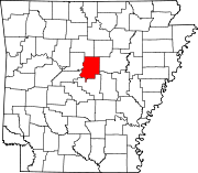
 Location of Faulkner County in Arkansas
This is a list of the National Register of Historic Places listings in Faulkner County, Arkansas.
This is intended to be a complete list of the properties and districts on the National Register of Historic Places in Faulkner County, Arkansas, United States. The locations of National Register properties and districts for which the latitude and longitude coordinates are included below, may be seen in a Google map.[1]
There are 61 properties and districts listed on the National Register in the county.
Contents: Counties in Arkansas Arkansas - Ashley - Baxter - Benton - Boone - Bradley - Calhoun - Carroll - Chicot - Clark - Clay - Cleburne - Cleveland - Columbia - Conway - Craighead - Crawford - Crittenden - Cross - Dallas - Desha - Drew - Faulkner - Franklin - Fulton - Garland - Grant - Greene - Hempstead - Hot Spring - Howard - Independence - Izard - Jackson - Jefferson - Johnson - Lafayette - Lawrence - Lee - Lincoln - Little River - Logan - Lonoke - Madison - Marion - Miller - Mississippi - Monroe - Montgomery - Nevada - Newton - Ouachita - Perry - Phillips - Pike - Poinsett - Polk - Pope - Prairie - Pulaski (Little Rock) - Randolph - St. Francis - Saline - Scott - Searcy - Sebastian - Sevier - Sharp - Stone - Union - Van Buren - Washington - White - Woodruff - Yell
-
- This National Park Service list is complete through NPS recent listings posted November 10, 2011.[2]
Current listings
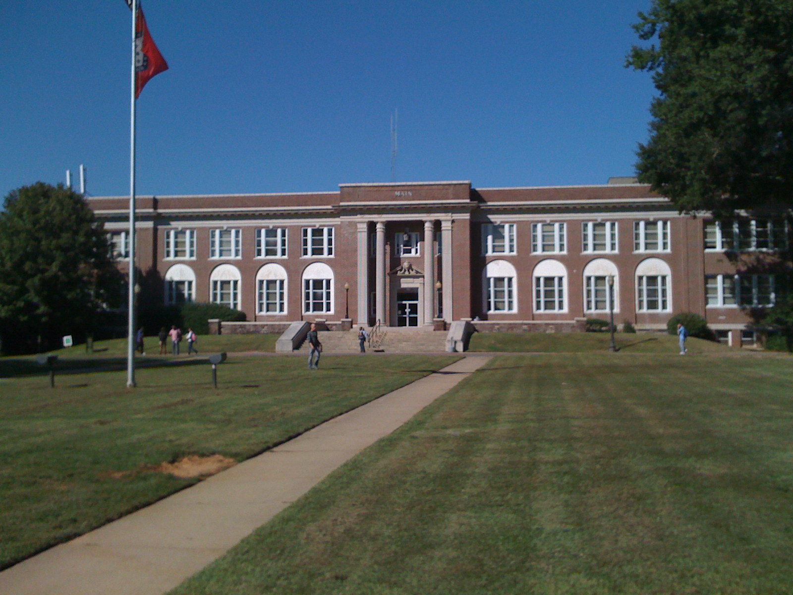
[3] Landmark name [4] Image Date listed Location City or town Summary 1 Administration Building, University of Central Arkansas 
January 24, 2011 201 Donaghey Ave.
35°04′45″N 92°27′26″W / 35.079167°N 92.457222°WConway New Deal Recovery Efforts in Arkansas MPS 2 Blessing Farmstead September 5, 1990 North of Enola
35°15′08″N 92°14′30″W / 35.252222°N 92.241667°WBarney 3 Brown House December 22, 1982 1604 Caldwell St.
35°05′24″N 92°26′44″W / 35.09°N 92.445556°WConway 4 Cadron Settlement May 17, 1974 Address Restricted Conway 5 Castleberry-Harrington Historic District June 5, 2007 Castleberry Rd.
35°15′36″N 92°25′36″W / 35.26°N 92.426667°WRepublican 6 Century Flyer May 28, 2010 150 E. Siebenmorgan Rd.
35°05′56″N 92°25′45″W / 35.098889°N 92.429167°WConway Amusement park train on the grounds of the Conway Human Development Center 7 Church of Christ February 15, 2005 Highway 310
35°19′33″N 92°20′07″W / 35.325833°N 92.335278°WGuy 8 Conway Commercial Historic District September 23, 2010 Roughly bounded by Main St. on the south, Harkrider St. and Spencer St. on the east, just south of Mill St. to the north, and Locust St.
35°05′34″N 92°26′24″W / 35.092778°N 92.44°WConway 9 Conway Confederate Monument April 26, 1996 Southwestern corner of the courthouse lawn, east of the junction of Robinson Ave. and Center St.
35°05′19″N 92°26′35″W / 35.088611°N 92.443056°WConway 10 Earl and Oza Crownover-Brown House March 2, 2006 133 S. Broadway
35°21′25″N 92°24′48″W / 35.356944°N 92.413333°WDamascus 11 O.L. Dunaway House July 19, 1996 920 Center St.
35°05′26″N 92°26′42″W / 35.090556°N 92.445°WConway 12 Richard and Mettie Ealy House September 30, 2005 280 Solomon Grove Rd.
35°18′45″N 92°26′51″W / 35.3125°N 92.4475°WTwin Groves 13 Farmers State Bank December 22, 1982 1001 Front St.
35°05′31″N 92°26′28″W / 35.091944°N 92.441111°WConway 14 Faulkner County Courthouse November 27, 1995 801 Locust St.
35°05′20″N 92°26′34″W / 35.088889°N 92.442778°WConway 15 Faulkner County Jail July 20, 1978 Courthouse Sq.
35°05′21″N 92°26′37″W / 35.089167°N 92.443611°WConway 16 First United Methodist Church November 20, 1992 Northwestern corner of the junction of Prince and Clifton Sts.
35°05′32″N 92°26′44″W / 35.092222°N 92.445556°WConway 17 Frauenthal & Schwarz Building October 23, 1992 824 Front St.
35°05′29″N 92°26′27″W / 35.091389°N 92.440833°WConway 18 Fraunthal House December 22, 1982 631 Western
35°05′14″N 92°27′28″W / 35.087222°N 92.457778°WConway 19 Galloway Hall December 22, 1982 Hendrix College campus
35°06′06″N 92°26′28″W / 35.101667°N 92.441111°WConway 20 Dennis and Christine Garrison House September 29, 2005 105 Garrison Rd.
35°14′25″N 92°27′03″W / 35.240256°N 92.450881°WGreenbrier 21 Greeson-Cone House September 7, 1995 928 Center St.
35°05′28″N 92°26′41″W / 35.091111°N 92.444722°WConway 22 Guy High School Gymnasium September 10, 1992 Highway 25
35°19′24″N 92°19′24″W / 35.323333°N 92.323333°WGuy 23 Guy Home Economics Building September 10, 1992 Highway 25
35°19′25″N 92°19′22″W / 35.323611°N 92.322778°WGuy 24 Charlie Hall House June 1, 2005 221 Old U.S. Route 65
35°20′25″N 92°23′59″W / 35.340278°N 92.399722°WTwin Groves 25 Frank U. Halter House August 29, 1980 1355 College Ave.
35°05′03″N 92°26′26″W / 35.084167°N 92.440556°WConway 26 Hardy Cemetery October 8, 2009 722 Highway 225, E.
35°15′24″N 92°15′15″W / 35.256528°N 92.254247°WCenterville 27 Harton House May 25, 1979 1821 Robinson Ave.
35°05′16″N 92°26′56″W / 35.087778°N 92.448889°WConway 28 D.O. Harton House July 19, 1996 607 Davis St.
35°05′11″N 92°26′53″W / 35.086389°N 92.448056°WConway 29 Hendrix College Addition Neighborhood Historic District September 20, 2007 Roughly bounded by Washington Ave., Fleming St., Harkrider St., and Winfield St.
35°06′16″N 92°26′34″W / 35.104317°N 92.442667°WConway 30 Michael M. Hiegel House August 14, 1998 504 2nd St.
35°05′17″N 92°25′57″W / 35.088056°N 92.4325°WConway 31 E.E. Hooten House February 15, 2005 400 Highway 25, N.
35°19′13″N 92°20′17″W / 35.320278°N 92.338056°WGuy 32 Farris and Evelyn Langley House June 1, 2005 12 Langley Ln.
35°17′17″N 92°23′53″W / 35.288056°N 92.398056°WRepublican 33 Lasley's College Apartments May 25, 2011 1916 & 1922 Bruce St.
35°04′58″N 92°27′03″W / 35.082778°N 92.450833°WConway 34 Lee Service Station February 15, 2005 28 S. Broadway
35°21′56″N 92°24′38″W / 35.365556°N 92.410556°WDamascus 35 Liberty School Cafeteria September 10, 1992 Highway 36, north of its junction with U.S. Route 64
35°04′53″N 92°18′21″W / 35.081389°N 92.305833°WHamlet 36 J.E. Little House January 26, 1999 427 Western Ave.
35°05′03″N 92°27′22″W / 35.084167°N 92.456111°WConway 37 Martin Hall December 22, 1982 Hendrix College campus
35°05′58″N 92°26′28″W / 35.099444°N 92.441111°WConway 38 Merritt House September 28, 2005 139 N. Broadview
35°15′15″N 92°23′16″W / 35.254167°N 92.387778°WGreenbrier 39 S.D. Merritt House February 15, 2005 45 Highway 25, N.
35°16′24″N 92°22′59″W / 35.273333°N 92.383056°WGreenbrier 40 Military Road-Cadron Segment January 28, 2004 Address Restricted Conway Segment of the Trail of Tears 41 Mt. Zion Missionary Baptist Church February 5, 2009 249 Highway 107
35°11′46″N 92°12′12″W / 35.196111°N 92.203267°WEnola 42 Oak Grove Cemetery Historic Section November 4, 2009 E. Bruce St. approximately 0.3 miles east of Harkrider St.
35°04′51″N 92°25′50″W / 35.080728°N 92.430622°WConway 43 Silas Owens Sr. House February 15, 2005 157 Solomon Grove Rd.
35°19′16″N 92°26′04″W / 35.321111°N 92.434444°WTwin Groves 44 Patton House September 30, 1993 Highway 25
35°12′04″N 92°27′09″W / 35.201111°N 92.4525°WWooster 45 President's House December 22, 1982 Hendrix College campus
35°05′53″N 92°26′32″W / 35.098056°N 92.442222°WConway 46 Quattlebaum-Pelletier House June 1, 2005 43 Ozark
35°18′10″N 92°23′56″W / 35.302778°N 92.398889°WTwin Groves 47 Frank E. Robins House May 20, 1994 567 Locust St.
35°05′09″N 92°26′29″W / 35.085833°N 92.441389°WConway 48 Reuben W. Robins House September 28, 2005 508 Locust St.
35°05′14″N 92°26′26″W / 35.087222°N 92.440556°WConway 49 Robinson Historic District January 29, 2001 Roughly bounded by Cross, Prince, Faulkner, and Watkins Sts., and Robinson Ave.
35°05′23″N 92°26′54″W / 35.089722°N 92.448333°WConway 50 James and Jewell Salter House June 1, 2005 159 S. Broadview
35°12′50″N 92°23′19″W / 35.213889°N 92.388611°WGreenbrier 51 Sellers House February 15, 2005 89 Acklin Gap Rd.
35°08′05″N 92°23′23″W / 35.134722°N 92.389722°WConway 52 S.G. Smith House December 22, 1982 1837 Caldwell St.
35°05′24″N 92°27′01″W / 35.09°N 92.450278°WConway 53 Solomon Grove Smith-Hughes Building December 9, 1994 South of County Road 29
35°19′14″N 92°26′00″W / 35.320556°N 92.433333°WTwin Groves 54 Spears House February 15, 2005 1235 Highway 65, N.
35°17′11″N 92°23′32″W / 35.286389°N 92.392222°WGreenbrier 55 Springfield Bridge July 21, 1988 County Road 222 at Cadron Creek
35°15′09″N 92°30′45″W / 35.2525°N 92.5125°WSpringfield 56 Titan II ICBM Launch Complex 374-5 Site February 18, 2000 East of U.S. Route 65, 0.4 miles north of its junction with E. Cadron Ridge Rd.
35°09′52″N 92°23′46″W / 35.164444°N 92.396111°WSpringhill 57 Tyler-Southerland House October 19, 2005 36 Southerland
35°04′17″N 92°24′20″W / 35.071389°N 92.405556°WConway 58 Earl and Mildred Ward House October 19, 2005 1157 Mitchell St.
35°05′40″N 92°26′59″W / 35.094444°N 92.449722°WConway 59 Washburn House January 23, 2007 40 Battles Loop
35°19′03″N 92°21′31″W / 35.3175°N 92.358611°WGuy 60 Joe and Nina Webb House October 19, 2005 2945 Prince
35°05′31″N 92°28′22″W / 35.091944°N 92.472778°WConway 61 Young Memorial July 19, 1996 1601 Harkrider Dr., north of Reynolds Science Hall
35°06′01″N 92°26′30″W / 35.100278°N 92.441667°WConway See also
- List of National Historic Landmarks in Arkansas
- National Register of Historic Places listings in Arkansas
References
- ^ The latitude and longitude information provided in this table was derived originally from the National Register Information System, which has been found to be fairly accurate for about 99% of listings. For about 1% of NRIS original coordinates, experience has shown that one or both coordinates are typos or otherwise extremely far off; some corrections may have been made. A more subtle problem causes many locations to be off by up to 150 yards, depending on location in the country: most NRIS coordinates were derived from tracing out latitude and longitudes off of USGS topographical quadrant maps created under North American Datum of 1927, which differs from the current, highly accurate GPS system used by Google maps. Chicago is about right, but NRIS longitudes in Washington are higher by about 4.5 seconds, and are lower by about 2.0 seconds in Maine. Latitudes differ by about 1.0 second in Florida. Some locations in this table may have been corrected to current GPS standards.
- ^ "National Register of Historic Places: Weekly List Actions". National Park Service, United States Department of the Interior. Retrieved on November 10, 2011.
- ^ Numbers represent an ordering by significant words. Various colorings, defined here, differentiate National Historic Landmark sites and National Register of Historic Places Districts from other NRHP buildings, structures, sites or objects.
- ^ "National Register Information System". National Register of Historic Places. National Park Service. . http://nrhp.focus.nps.gov/natreg/docs/All_Data.html.
U.S. National Register of Historic Places Topics Lists by states Alabama • Alaska • Arizona • Arkansas • California • Colorado • Connecticut • Delaware • Florida • Georgia • Hawaii • Idaho • Illinois • Indiana • Iowa • Kansas • Kentucky • Louisiana • Maine • Maryland • Massachusetts • Michigan • Minnesota • Mississippi • Missouri • Montana • Nebraska • Nevada • New Hampshire • New Jersey • New Mexico • New York • North Carolina • North Dakota • Ohio • Oklahoma • Oregon • Pennsylvania • Rhode Island • South Carolina • South Dakota • Tennessee • Texas • Utah • Vermont • Virginia • Washington • West Virginia • Wisconsin • WyomingLists by territories Lists by associated states Other  Category:National Register of Historic Places •
  Portal:National Register of Historic Places
Municipalities and communities of Faulkner County, Arkansas County seat: Conway Cities Conway | Greenbrier | Holland | Mayflower | Quitman‡
Towns Damascus‡ | Enola | Guy | Mount Vernon | Twin Groves | Vilonia | Wooster
Unincorporated
communityCenterville
Footnotes ‡This populated place also has portions in an adjacent county or counties
Categories:- Faulkner County, Arkansas
- National Register of Historic Places in Arkansas by county
-

Wikimedia Foundation. 2010.