- National Register of Historic Places listings in Stone County, Arkansas
-
 Location of Stone County in Arkansas
This is a list of the National Register of Historic Places listings in Stone County, Arkansas.
This is intended to be a complete list of the properties and districts on the National Register of Historic Places in Stone County, Arkansas, United States. The locations of National Register properties and districts for which the latitude and longitude coordinates are included below, may be seen in a Google map.[1]
There are 58 properties and districts listed on the National Register in the county.
Contents: Counties in Arkansas Arkansas - Ashley - Baxter - Benton - Boone - Bradley - Calhoun - Carroll - Chicot - Clark - Clay - Cleburne - Cleveland - Columbia - Conway - Craighead - Crawford - Crittenden - Cross - Dallas - Desha - Drew - Faulkner - Franklin - Fulton - Garland - Grant - Greene - Hempstead - Hot Spring - Howard - Independence - Izard - Jackson - Jefferson - Johnson - Lafayette - Lawrence - Lee - Lincoln - Little River - Logan - Lonoke - Madison - Marion - Miller - Mississippi - Monroe - Montgomery - Nevada - Newton - Ouachita - Perry - Phillips - Pike - Poinsett - Polk - Pope - Prairie - Pulaski (Little Rock) - Randolph - St. Francis - Saline - Scott - Searcy - Sebastian - Sevier - Sharp - Stone - Union - Van Buren - Washington - White - Woodruff - Yell
-
- This National Park Service list is complete through NPS recent listings posted November 10, 2011.[2]
Current listings
[3] Landmark name [4] Image Date listed Location City or town Summary 1 Jessie Abernathy House September 17, 1985 Off Highway 14
35°47′16″N 91°52′55″W / 35.787778°N 91.881944°WMarcella 2 Alco School September 4, 1992 Just north of Highway 66
35°53′28″N 92°22′21″W / 35.891111°N 92.3725°WAlco 3 Clarence Anderson Barn September 17, 1985 Highway 66
35°53′20″N 92°15′03″W / 35.888889°N 92.250833°WNewnata 4 George Anderson House September 17, 1985 West of Big Springs
35°54′03″N 92°16′56″W / 35.900833°N 92.282222°WBig Springs 5 John Avey Barn September 17, 1985 Off Highway 66
35°53′56″N 92°16′03″W / 35.898889°N 92.2675°WBig Springs 6 John Bettis House September 17, 1985 Highway 14
35°48′53″N 91°54′18″W / 35.814722°N 91.905°WPleasant Grove 7 Bluff Springs Church and School September 17, 1985 3.5 miles west of Onia
35°55′29″N 92°23′41″W / 35.924722°N 92.394722°WOnia 8 Bonds House February 3, 1992 County Road 2 east of Meadow Creek
35°46′17″N 92°20′43″W / 35.771389°N 92.345278°WFox 9 Brewer's Mill September 17, 1985 Highway 66
35°52′05″N 92°07′15″W / 35.868056°N 92.120833°WMountain View 10 A.B. Brewer Building October 25, 1985 Highway 66
35°52′06″N 92°07′06″W / 35.868333°N 92.118333°WMountain View 11 John F. Brewer House October 25, 1985 Highway 9
35°52′03″N 92°07′06″W / 35.8675°N 92.118333°WMountain View 12 Samuel Brown House September 17, 1985 Off Highway 9
35°49′49″N 92°08′39″W / 35.830278°N 92.144167°WWest Richwoods 13 C.B. Case Motor Co. Building September 17, 1985 Highway 66
35°52′08″N 92°07′08″W / 35.868889°N 92.118889°WMountain View 14 Clark-King House September 17, 1985 Northeast of Mountain View
35°53′04″N 92°07′32″W / 35.884444°N 92.125556°WMountain View 15 Commercial Hotel September 17, 1985 Off Highway 66
35°52′10″N 92°07′03″W / 35.869444°N 92.1175°WMountain View 16 Henry Copeland House September 17, 1985 Highway 14
35°48′56″N 91°54′29″W / 35.815556°N 91.908056°WPleasant Grove 17 Wesley Copeland House September 17, 1985 Southeast of Timbo
35°51′11″N 92°18′25″W / 35.853056°N 92.306944°WTimbo 18 Davis Barn September 17, 1985 West of Pleasant Grove
35°48′43″N 91°55′40″W / 35.811944°N 91.927778°WPleasant Grove 19 Dew Drop Inn September 17, 1985 Off Highway 66
35°52′10″N 92°07′13″W / 35.869444°N 92.120278°WMountain View 20 William Dillard Homestead September 17, 1985 Near the White River
35°56′00″N 92°02′04″W / 35.933333°N 92.034444°WRound Bottom 21 H.J. Doughtery House September 17, 1985 Highway 14
35°47′31″N 91°53′03″W / 35.791944°N 91.884167°WMarcella 22 Farmers and Merchants Bank September 17, 1985 Highway 66
35°52′07″N 92°07′02″W / 35.868611°N 92.117222°WMountain View 23 Zachariah Ford House September 17, 1985 Near the White River
35°51′07″N 91°52′04″W / 35.851944°N 91.867778°WPleasant Grove 24 Fox Pictograph May 4, 1982 Address Restricted Fox 25 Orvall Gammill Barn September 17, 1985 Northwest of Big Springs
35°54′36″N 92°16′25″W / 35.91°N 92.273611°WBig Springs 26 Walter Gray House September 17, 1985 Off Highway 14
35°44′20″N 91°51′04″W / 35.738889°N 91.851111°WMelrose 27 Joe Guffey House September 17, 1985 Highway 110
35°43′12″N 92°24′34″W / 35.72°N 92.409444°WOld Lexington 28 Binks Hess House and Barn September 17, 1985 Off Highway 14
35°47′20″N 91°52′53″W / 35.788889°N 91.881389°WMarcella 29 Thomas E. Hess House December 27, 1983 Highway 14
35°47′19″N 91°53′05″W / 35.788611°N 91.884722°WMarcella 30 Thomas M. Hess House September 17, 1985 Off Highway 14
35°47′24″N 91°52′45″W / 35.79°N 91.879167°WMarcella 31 Miles Jeffery Barn September 17, 1985 Off Highway 5
35°59′11″N 92°07′21″W / 35.986389°N 92.1225°WOptimus 32 Lackey General Merchandise and Warehouse September 17, 1985 Highway 66
35°52′07″N 92°07′03″W / 35.868611°N 92.1175°WMountain View 33 George W. Lackey House October 2, 1990 Junction of King and Washington Sts.
35°52′10″N 92°07′07″W / 35.869444°N 92.118611°WMountain View 34 Fred Lancaster Barn September 17, 1985 Near the White River
35°56′19″N 92°02′45″W / 35.938611°N 92.045833°WRound Bottom 35 John L. Lancaster House September 17, 1985 Off Highway 66
35°52′10″N 92°07′07″W / 35.869444°N 92.118611°WMountain View 36 Luber School September 4, 1992 County Road 214
35°46′11″N 92°05′15″W / 35.769722°N 92.0875°WLuber 37 H.S. Mabry Barn September 17, 1985 Near Johnson Creek
35°49′11″N 92°06′53″W / 35.819722°N 92.114722°WEast Richwoods 38 Marcella Church & School September 17, 1985 Highway 14
35°47′16″N 91°53′03″W / 35.787778°N 91.884167°WMarcella 39 Owen Martin House October 25, 1985 Highway 14
35°47′14″N 91°53′07″W / 35.787222°N 91.885278°WMarcella 40 Noah McCarn House September 17, 1985 Highway 5
35°49′16″N 92°02′27″W / 35.821111°N 92.040833°WMountain View 41 Mirror Lake Historic District September 11, 1995 Forest Service Road 1110E in the Ozark-St. Francis National Forest
35°57′37″N 92°10′26″W / 35.960278°N 92.173889°WFifty-Six 42 Jim Morris Barn September 17, 1985 Highway 66
35°52′07″N 92°18′40″W / 35.868611°N 92.311111°WTimbo 43 Mountain View Waterworks October 5, 2006 Junction of Gaylor St. and King St.
35°52′22″N 92°07′10″W / 35.872778°N 92.119444°WMountain View 44 Newton Sutterfield Farmstead May 20, 2003 1797 Horton Hill Rd.
35°54′44″N 92°23′29″W / 35.912222°N 92.391389°WAlco 45 Noricks Chapel School June 4, 1998 Meisenheimer Rd., 10 miles southeast of Mountain View
35°47′08″N 92°01′12″W / 35.785556°N 92.02°WMountain View 46 North Sylamore Creek Bridge February 24, 2010 Forest Service Road 1102 over N. Sylamore Creek
35°59′44″N 92°12′46″W / 35.99555°N 92.212736°WFifty-Six 47 Pictograph Cave May 4, 1982 Address Restricted Mountain View 48 Pinky Pruitt Barn September 17, 1985 Highway 14
35°50′17″N 91°56′07″W / 35.838056°N 91.935278°WSt. James 49 Roasting Ear Church and School September 17, 1985 Northeast of Onia
35°56′51″N 92°17′20″W / 35.9475°N 92.288889°WOnia 50 C.L. Smith & Son General Store September 17, 1985 Highway 66
35°52′06″N 92°07′05″W / 35.868333°N 92.118056°WMountain View 51 Stegall General Store September 17, 1985 Highway 66
35°52′06″N 92°07′05″W / 35.868333°N 92.118056°WMountain View 52 Stone County Courthouse 
September 29, 1976 Courthouse Sq.
35°52′08″N 92°07′05″W / 35.868889°N 92.118056°WMountain View 53 Stone County Recorder Building September 17, 1985 Off Highway 66
35°52′09″N 92°07′08″W / 35.869167°N 92.118889°WMountain View 54 Sugarloaf Fire Tower Historic District September 11, 1995 End of Forest Service Road 1123 in the Ozark-St. Francis National Forest
36°05′02″N 92°09′48″W / 36.083889°N 92.163333°WCalico Rock 55 Sylamore Creek Bridge November 18, 1999 County Road 283 over Sylamore Creek
35°56′09″N 92°07′18″W / 35.935833°N 92.121667°WAllison 56 Taylor-Stokes House September 17, 1985 Off Highway 14
35°45′36″N 91°51′57″W / 35.76°N 91.865833°WMarcella 57 Turkey Creek School October 25, 1985 Highway 9
35°45′31″N 92°13′54″W / 35.758611°N 92.231667°WTurkey Creek 58 West Richwoods Church & School September 17, 1985 Highway 9
35°49′35″N 92°10′19″W / 35.826389°N 92.171944°WWest Richwoods See also
- List of National Historic Landmarks in Arkansas
- National Register of Historic Places listings in Arkansas
References
- ^ The latitude and longitude information provided in this table was derived originally from the National Register Information System, which has been found to be fairly accurate for about 99% of listings. For about 1% of NRIS original coordinates, experience has shown that one or both coordinates are typos or otherwise extremely far off; some corrections may have been made. A more subtle problem causes many locations to be off by up to 150 yards, depending on location in the country: most NRIS coordinates were derived from tracing out latitude and longitudes off of USGS topographical quadrant maps created under the North American Datum of 1927, which differs from the current, highly accurate WGS84 GPS system used by Google maps. Chicago is about right, but NRIS longitudes in Washington are higher by about 4.5 seconds, and are lower by about 2.0 seconds in Maine. Latitudes differ by about 1.0 second in Florida. Some locations in this table may have been corrected to current GPS standards.
- ^ "National Register of Historic Places: Weekly List Actions". National Park Service, United States Department of the Interior. Retrieved on November 10, 2011.
- ^ Numbers represent an ordering by significant words. Various colorings, defined here, differentiate National Historic Landmark sites and National Register of Historic Places Districts from other NRHP buildings, structures, sites or objects.
- ^ "National Register Information System". National Register of Historic Places. National Park Service. . http://nrhp.focus.nps.gov/natreg/docs/All_Data.html.
U.S. National Register of Historic Places Topics Lists by states Alabama • Alaska • Arizona • Arkansas • California • Colorado • Connecticut • Delaware • Florida • Georgia • Hawaii • Idaho • Illinois • Indiana • Iowa • Kansas • Kentucky • Louisiana • Maine • Maryland • Massachusetts • Michigan • Minnesota • Mississippi • Missouri • Montana • Nebraska • Nevada • New Hampshire • New Jersey • New Mexico • New York • North Carolina • North Dakota • Ohio • Oklahoma • Oregon • Pennsylvania • Rhode Island • South Carolina • South Dakota • Tennessee • Texas • Utah • Vermont • Virginia • Washington • West Virginia • Wisconsin • WyomingLists by territories Lists by associated states Other Municipalities and communities of Stone County, Arkansas Cities 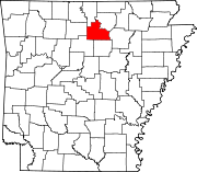
Unincorporated
communitiesCategories:- Stone County, Arkansas
- National Register of Historic Places in Arkansas by county
-

Wikimedia Foundation. 2010.