- National Register of Historic Places listings in Lawrence County, Arkansas
-
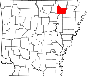
 Location of Lawrence County in Arkansas
This is a list of the National Register of Historic Places listings in Lawrence County, Arkansas.
This is intended to be a complete list of the properties and districts on the National Register of Historic Places in Lawrence County, Arkansas, United States. The locations of National Register properties and districts for which the latitude and longitude coordinates are included below, may be seen in a Google map.[1]
There are 23 properties and districts listed on the National Register in the county.
Contents: Counties in Arkansas Arkansas - Ashley - Baxter - Benton - Boone - Bradley - Calhoun - Carroll - Chicot - Clark - Clay - Cleburne - Cleveland - Columbia - Conway - Craighead - Crawford - Crittenden - Cross - Dallas - Desha - Drew - Faulkner - Franklin - Fulton - Garland - Grant - Greene - Hempstead - Hot Spring - Howard - Independence - Izard - Jackson - Jefferson - Johnson - Lafayette - Lawrence - Lee - Lincoln - Little River - Logan - Lonoke - Madison - Marion - Miller - Mississippi - Monroe - Montgomery - Nevada - Newton - Ouachita - Perry - Phillips - Pike - Poinsett - Polk - Pope - Prairie - Pulaski (Little Rock) - Randolph - St. Francis - Saline - Scott - Searcy - Sebastian - Sevier - Sharp - Stone - Union - Van Buren - Washington - White - Woodruff - Yell
-
- This National Park Service list is complete through NPS recent listings posted November 10, 2011.[2]
Current listings
[3] Landmark name [4] Image Date listed Location City or town Summary 1 Bethel Cemetery June 15, 2011 1.1 miles north of AR 117 on County Rd. 225
36°06′06″N 91°14′05″W / 36.101667°N 91.234722°WDenton vicinity 2 Dr. F.W. Buercklin House July 24, 1998 104 Main St.
36°05′15″N 91°04′02″W / 36.0875°N 91.067222°WPortia 3 Cache River Bridge 
April 9, 1990 Highway 25, over the Cache River
36°04′09″N 90°49′28″W / 36.069167°N 90.824444°WWalnut Ridge 4 Clover Bend High School August 17, 1983 Highway 228
35°59′07″N 91°05′15″W / 35.985278°N 91.0875°WClover Bend 5 Clover Bend Historic District September 17, 1990 Junction of Highway 228 and County Road 1220
35°58′57″N 91°05′38″W / 35.9825°N 91.093889°WClover Bend 6 Commandant's House January 21, 2010 264 McClellan Dr.
36°07′47″N 90°56′21″W / 36.129722°N 90.939167°WWalnut Ridge 7 Ficklin-Imboden House October 16, 1989 3rd and Main Sts.
36°04′55″N 91°07′00″W / 36.081944°N 91.116667°WPowhatan 8 Dr. John Octavius Hatcher House October 23, 1992 210 3rd St.
36°12′11″N 91°10′28″W / 36.203056°N 91.174444°WImboden 9 Home Economics-F.F.A. Building June 14, 1990 City Park Dr.
36°05′06″N 91°04′11″W / 36.085°N 91.069722°WPortia 10 Imboden Methodist Episcopal Church, South June 30, 2004 113 Main St.
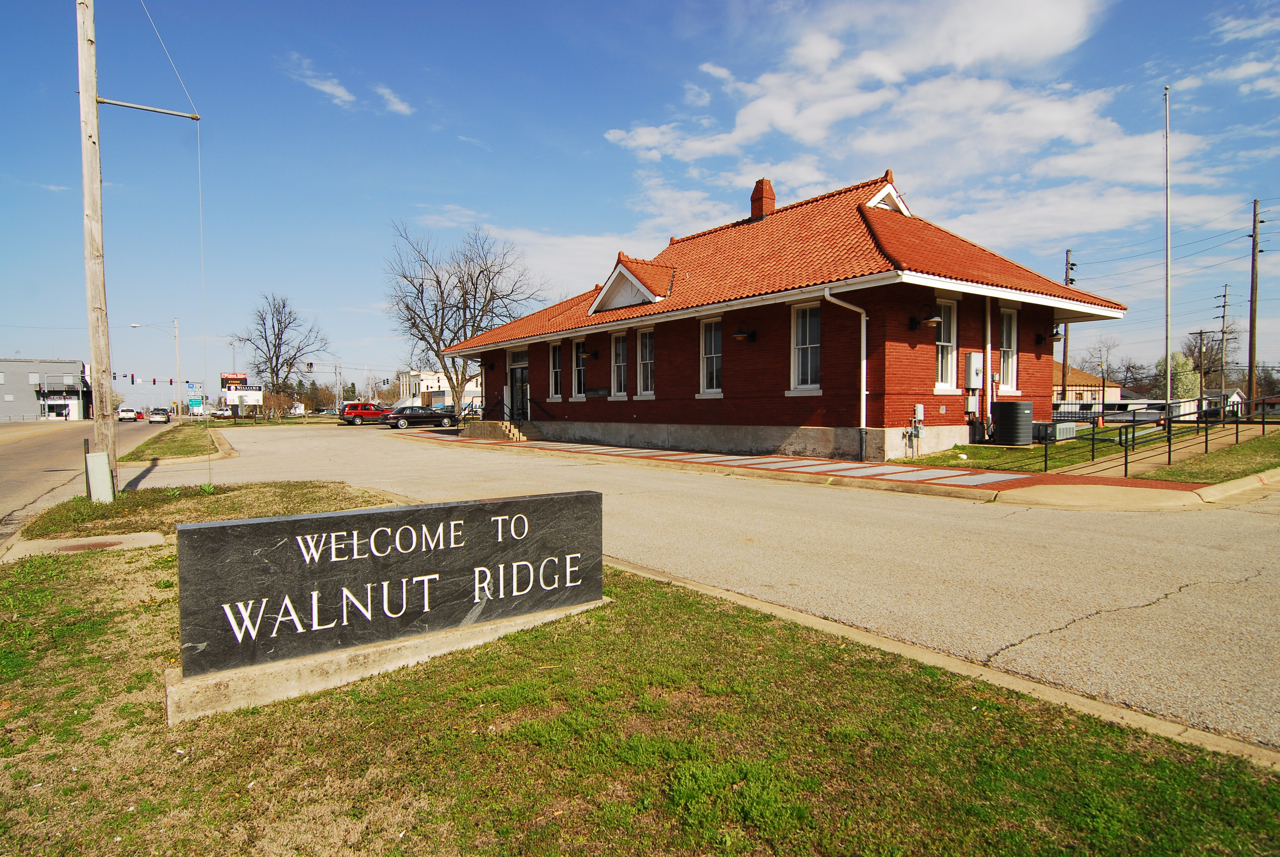
36°12′17″N 91°10′25″W / 36.204722°N 91.173611°WImboden 11 Missouri-Pacific Depot-Walnut Ridge 
June 11, 1992 SW. 1st St.
36°04′03″N 90°57′24″W / 36.0675°N 90.956667°WWalnut Ridge 12 Old US 67, Alicia to Hoxie May 18, 2003 1st St., County Roads 747 and 549, and immediately east of the current U.S. Route 67
35°55′43″N 91°03′39″W / 35.928611°N 91.060833°WAlicia 13 Old Walnut Ridge Post Office May 20, 1994 225 W. Main St.
36°04′10″N 90°57′27″W / 36.069444°N 90.9575°WWalnut Ridge 14 Portia School December 13, 1978 City Park
36°05′05″N 91°04′15″W / 36.084722°N 91.070833°WPortia 15 Powhatan Courthouse February 16, 1970 Off Highway 25
36°4′54″N 91°7′12″W / 36.08167°N 91.12°W[5]Powhatan 16 Powhatan Jail October 16, 1989 Highway 25
36°04′56″N 91°07′06″W / 36.082222°N 91.118333°WPowhatan 17 Powhatan Methodist Church November 23, 1977 Highway 25
36°04′55″N 91°07′12″W / 36.081944°N 91.12°WPowhatan 18 Powhatan Schoolhouse July 31, 1978 Highway 25
36°04′55″N 91°07′15″W / 36.081944°N 91.120833°WPowhatan 19 St. Louis-San Francisco Overpass 
April 9, 1990 U.S. Route 62 over the Spring River
36°12′24″N 91°10′17″W / 36.206667°N 91.171389°WImboden 20 Smithville Public School Building January 14, 1993 Highway 117
36°04′48″N 91°18′20″W / 36.08°N 91.305556°WSmithville 21 Telephone Exchange Building October 16, 1989 1st and Main Sts.
36°04′54″N 91°06′58″W / 36.081667°N 91.116111°WPowhatan 22 US 63 Black River Bridge June 9, 2000 U.S. Route 63
36°05′52″N 91°05′32″W / 36.097778°N 91.092222°WBlack Rock 23 Walnut Ridge Commercial Historic District May 28, 2010 Roughly bounded by East and West Main, North and South Front Sts, West Vine, and Southwest Third Sts
36°04′06″N 90°57′21″W / 36.068419°N 90.955953°WWalnut Ridge See also
- List of National Historic Landmarks in Arkansas
- National Register of Historic Places listings in Arkansas
References
- ^ The latitude and longitude information provided in this table was derived originally from the National Register Information System, which has been found to be fairly accurate for about 99% of listings. For about 1% of NRIS original coordinates, experience has shown that one or both coordinates are typos or otherwise extremely far off; some corrections may have been made. A more subtle problem causes many locations to be off by up to 150 yards, depending on location in the country: most NRIS coordinates were derived from tracing out latitude and longitudes off of USGS topographical quadrant maps created under the North American Datum of 1927, which differs from the current, highly accurate WGS84 GPS system used by Google maps. Chicago is about right, but NRIS longitudes in Washington are higher by about 4.5 seconds, and are lower by about 2.0 seconds in Maine. Latitudes differ by about 1.0 second in Florida. Some locations in this table may have been corrected to current GPS standards.
- ^ "National Register of Historic Places: Weekly List Actions". National Park Service, United States Department of the Interior. Retrieved on November 10, 2011.
- ^ Numbers represent an ordering by significant words. Various colorings, defined here, differentiate National Historic Landmark sites and National Register of Historic Places Districts from other NRHP buildings, structures, sites or objects.
- ^ "National Register Information System". National Register of Historic Places. National Park Service. . http://nrhp.focus.nps.gov/natreg/docs/All_Data.html.
- ^ Location derived from this Arkansas state parks document; the NRIS provides coordinates but lists the site as "Address unknown at this time"
U.S. National Register of Historic Places Topics Lists by states Alabama • Alaska • Arizona • Arkansas • California • Colorado • Connecticut • Delaware • Florida • Georgia • Hawaii • Idaho • Illinois • Indiana • Iowa • Kansas • Kentucky • Louisiana • Maine • Maryland • Massachusetts • Michigan • Minnesota • Mississippi • Missouri • Montana • Nebraska • Nevada • New Hampshire • New Jersey • New Mexico • New York • North Carolina • North Dakota • Ohio • Oklahoma • Oregon • Pennsylvania • Rhode Island • South Carolina • South Dakota • Tennessee • Texas • Utah • Vermont • Virginia • Washington • West Virginia • Wisconsin • WyomingLists by territories Lists by associated states Other Municipalities and communities of Lawrence County, Arkansas Cities Alicia | Black Rock | Hoxie | Walnut Ridge
Towns College City | Imboden | Lynn | Minturn | Portia | Powhatan | Ravenden | Sedgwick | Smithville | Strawberry
Unincorporated
communitiesClover Bend | Hopewell | Saffell
Categories:- Lawrence County, Arkansas
- National Register of Historic Places in Arkansas by county
-


Wikimedia Foundation. 2010.