- National Register of Historic Places listings in Ashley County, Arkansas
-
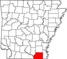 Location of Ashley County in Arkansas
This is a list of the National Register of Historic Places listings in Ashley County, Arkansas.
This is intended to be a complete list of the properties on the National Register of Historic Places in Ashley County, Arkansas, United States. The locations of National Register properties for which the latitude and longitude coordinates are included below, may be seen in a Google map.[1]
There are 25 properties listed on the National Register in the county. Another property was once listed but has been removed.
Contents: Counties in Arkansas Arkansas - Ashley - Baxter - Benton - Boone - Bradley - Calhoun - Carroll - Chicot - Clark - Clay - Cleburne - Cleveland - Columbia - Conway - Craighead - Crawford - Crittenden - Cross - Dallas - Desha - Drew - Faulkner - Franklin - Fulton - Garland - Grant - Greene - Hempstead - Hot Spring - Howard - Independence - Izard - Jackson - Jefferson - Johnson - Lafayette - Lawrence - Lee - Lincoln - Little River - Logan - Lonoke - Madison - Marion - Miller - Mississippi - Monroe - Montgomery - Nevada - Newton - Ouachita - Perry - Phillips - Pike - Poinsett - Polk - Pope - Prairie - Pulaski (Little Rock) - Randolph - St. Francis - Saline - Scott - Searcy - Sebastian - Sevier - Sharp - Stone - Union - Van Buren - Washington - White - Woodruff - Yell
-
- This National Park Service list is complete through NPS recent listings posted November 10, 2011.[2]
Current listings
[3] Landmark name [4] Image Date listed Location City or town Summary 1 W.R. Bunckley House March 17, 1994 509 E. Parker St.
33°13′23″N 91°44′12″W / 33.223056°N 91.736667°WHamburg 2 Crossett Experimental Forest Building No. 2 October 20, 1993 Highway 133 south of Crossett
33°02′03″N 91°56′22″W / 33.034167°N 91.939444°WCrossett 3 Crossett Experimental Forest Building No. 6 October 20, 1993 Highway 133 south of Crossett
33°01′58″N 91°56′19″W / 33.032778°N 91.938611°WCrossett 4 Crossett Experimental Forest Building No. 8 October 20, 1993 Highway 133 south of Crossett
33°02′00″N 91°56′19″W / 33.033333°N 91.938611°WCrossett 5 Crossett Methodist Church February 17, 2010 500 Main St.
33°07′47″N 91°57′41″W / 33.129597°N 91.9614°WCrossett 6 Crossett Municipal Auditorium September 20, 2007 1100 Main St.
33°07′16″N 91°57′40″W / 33.121111°N 91.961111°WCrossett 7 Crossett Municipal Building September 20, 2007 307-309 Main St.
33°07′41″N 91°57′41″W / 33.128056°N 91.961389°WCrossett 8 Crossett Post Office January 8, 2003 125 Main St.
33°08′02″N 91°57′39″W / 33.133889°N 91.960833°WCrossett 9 Crossroads Fire Tower March 2, 2006 2262 Highway 133 N.
33°13′58″N 91°55′28″W / 33.232778°N 91.924444°WHamburg 10 Dean House December 22, 1982 Off U.S. Route 165
33°14′22″N 91°30′46″W / 33.239444°N 91.512778°WPortland 11 First United Methodist Church April 27, 1992 204 S. Main
33°13′29″N 91°47′52″W / 33.224722°N 91.797778°WHamburg 12 John P. Fisher House September 29, 1995 Junction of Highway 278 and County Road 50, west of Bayou Bartholomew Bridge
33°14′19″N 91°32′16″W / 33.238611°N 91.537778°WPortland 13 Hamburg Cemetery Historic Section September 23, 2011 800 E. Parker St.
33°13′26″N 91°47′10″W / 33.223889°N 91.786111°WHamburg 14 Hamburg Commercial Historic District March 23, 2009 100-200 block of E. Adams, 100 block of N. Mulberry, 201 S. Mulberry, and 201 and 205 N. Main St.
33°13′35″N 91°47′48″W / 33.226389°N 91.796667°WHamburg 15 Hamburg Presbyterian Church May 14, 1991 Junction of Cherry and Lincoln Sts.
33°13′32″N 91°47′40″W / 33.225556°N 91.794444°WHamburg 16 Dr. M.C. Hawkins House March 28, 1996 4684 Highway 8
33°07′14″N 91°32′53″W / 33.120556°N 91.548056°WParkdale 17 Naff House July 24, 1992 Northwestern corner of the junction of 3rd Ave. and Fir St.
33°14′18″N 91°30′10″W / 33.238333°N 91.502778°WPortland 18 Parkdale Baptist Church-AS0051 January 24, 2007 127 Bride St.
33°07′22″N 91°32′57″W / 33.122778°N 91.549167°WParkdale 19 Parkdale Methodist Church June 5, 2007 S. Church St.
33°07′12″N 91°32′58″W / 33.12°N 91.549444°WParkdale 20 Portland United Methodist Church October 18, 2006 300 N. Main St.
33°14′28″N 91°30′41″W / 33.241111°N 91.511389°WPortland 21 Pugh House December 22, 1982 Off U.S. Route 165
33°14′19″N 91°30′48″W / 33.238611°N 91.513333°WPortland 22 Sumner-White Dipping Vat March 2, 2006 4 miles east of the junction of Highway 82 and County Road 69; 0.5 miles south in the woods at the Hunt Camp
33°21′05″N 91°39′14″W / 33.351389°N 91.653889°WHamburg 23 Watson House December 28, 1977 300 N. Cherry
33°13′37″N 91°47′40″W / 33.226944°N 91.794444°WHamburg 24 Watson-Sawyer House December 6, 1975 502 E. Parker St.
33°13′25″N 91°47′36″W / 33.223611°N 91.793333°WHamburg 25 Dr. Robert George Williams House October 4, 1984 Highways 8 and 209
33°07′17″N 91°32′56″W / 33.121389°N 91.548889°WParkdale Former listing
Landmark name Image Dates Location City or Town Summary 1 Greenview Cafe January 23, 2008 (delisted) 3rd Ave. and Arkansas St.
33°7′56.58″N 91°57′51.51″W / 33.1323833°N 91.9643083°WCrossett See also
- List of National Historic Landmarks in Arkansas
- National Register of Historic Places listings in Arkansas
References
- ^ The latitude and longitude information provided in this table was derived originally from the National Register Information System, which has been found to be fairly accurate for about 99% of listings. For about 1% of NRIS original coordinates, experience has shown that one or both coordinates are typos or otherwise extremely far off; some corrections may have been made. A more subtle problem causes many locations to be off by up to 150 yards, depending on location in the country: most NRIS coordinates were derived from tracing out latitude and longitudes off of USGS topographical quadrant maps created under the North American Datum of 1927, which differs from the current, highly accurate WGS84 GPS system used by Google maps. Chicago is about right, but NRIS longitudes in Washington are higher by about 4.5 seconds, and are lower by about 2.0 seconds in Maine. Latitudes differ by about 1.0 second in Florida. Some locations in this table may have been corrected to current GPS standards.
- ^ "National Register of Historic Places: Weekly List Actions". National Park Service, United States Department of the Interior. Retrieved on November 10, 2011.
- ^ Numbers represent an ordering by significant words. Various colorings, defined here, differentiate National Historic Landmark sites and National Register of Historic Places Districts from other NRHP buildings, structures, sites or objects.
- ^ "National Register Information System". National Register of Historic Places. National Park Service. . http://nrhp.focus.nps.gov/natreg/docs/All_Data.html.
U.S. National Register of Historic Places Topics Lists by states Alabama • Alaska • Arizona • Arkansas • California • Colorado • Connecticut • Delaware • Florida • Georgia • Hawaii • Idaho • Illinois • Indiana • Iowa • Kansas • Kentucky • Louisiana • Maine • Maryland • Massachusetts • Michigan • Minnesota • Mississippi • Missouri • Montana • Nebraska • Nevada • New Hampshire • New Jersey • New Mexico • New York • North Carolina • North Dakota • Ohio • Oklahoma • Oregon • Pennsylvania • Rhode Island • South Carolina • South Dakota • Tennessee • Texas • Utah • Vermont • Virginia • Washington • West Virginia • Wisconsin • WyomingLists by territories Lists by associated states Other Municipalities and communities of Ashley County, Arkansas Cities 
Town CDPs Unincorporated
communitiesBerlin | Bovine | Crossroad | Rawls | Sulphur Springs | Sunshine
Categories:- Ashley County, Arkansas
- National Register of Historic Places in Arkansas by county
-

Wikimedia Foundation. 2010.