- National Register of Historic Places listings in Hot Spring County, Arkansas
-
 Location of Hot Spring County in Arkansas
This is a list of the National Register of Historic Places listings in Hot Spring County, Arkansas.
This is intended to be a complete list of the properties and districts on the National Register of Historic Places in Hot Spring County, Arkansas, United States. The locations of National Register properties and districts for which the latitude and longitude coordinates are included below, may be seen in a Google map.[1]
There are 25 properties and districts listed on the National Register in the county.
Contents: Counties in Arkansas Arkansas - Ashley - Baxter - Benton - Boone - Bradley - Calhoun - Carroll - Chicot - Clark - Clay - Cleburne - Cleveland - Columbia - Conway - Craighead - Crawford - Crittenden - Cross - Dallas - Desha - Drew - Faulkner - Franklin - Fulton - Garland - Grant - Greene - Hempstead - Hot Spring - Howard - Independence - Izard - Jackson - Jefferson - Johnson - Lafayette - Lawrence - Lee - Lincoln - Little River - Logan - Lonoke - Madison - Marion - Miller - Mississippi - Monroe - Montgomery - Nevada - Newton - Ouachita - Perry - Phillips - Pike - Poinsett - Polk - Pope - Prairie - Pulaski (Little Rock) - Randolph - St. Francis - Saline - Scott - Searcy - Sebastian - Sevier - Sharp - Stone - Union - Van Buren - Washington - White - Woodruff - Yell
-
- This National Park Service list is complete through NPS recent listings posted November 10, 2011.[2]
Current listings
[3] Landmark name [4] Image Date listed Location City or town Summary 1 Alderson-Coston House May 26, 1995 204 Pine Bluff St.
34°21′43″N 92°48′33″W / 34.361944°N 92.809167°WMalvern 2 Bank of Malvern March 13, 1987 212 S. Main St.
34°21′48″N 92°48′49″W / 34.363333°N 92.813611°WMalvern 3 Bethel African Methodist Episcopal Church May 26, 2004 519 W. Page St.
34°21′35″N 92°48′58″W / 34.359722°N 92.816111°WMalvern 4 Blakely House May 3, 1976 West of Social Hill on Highway 84
34°20′06″N 93°01′32″W / 34.335°N 93.025556°WSocial Hill 5 Cabin No. 1 April 20, 1995 Cabin area access road at Lake Catherine State Park
34°26′15″N 92°54′46″W / 34.4375°N 92.912778°WShorewood Hills 6 Clark House December 22, 1982 1324 S. Main St.
34°21′24″N 92°48′30″W / 34.356667°N 92.808333°WMalvern 7 Couchwood December 4, 1986 On the grounds of the Couchwood estate
34°26′47.5″N 92°54′50.4″W / 34.446528°N 92.914°W[5]Shorewood Hills Extends into Garland County 8 Couchwood Historic District May 17, 2001 601 Couchwood Rd.
34°26′50″N 92°54′50″W / 34.447222°N 92.913889°WHot Springs 9 Gatewood House July 24, 1992 235 Pine Bluff St.
34°21′41″N 92°48′30″W / 34.361389°N 92.808333°WMalvern 10 Hodges House June 2, 1995 Highway 7
34°16′23″N 93°08′53″W / 34.273056°N 93.148056°WBismarck 11 Hot Spring County Courthouse November 7, 1996 210 Locust St.
34°21′46″N 92°48′53″W / 34.362778°N 92.814722°WMalvern 12 Hot Springs Railroad Roundhouse May 29, 2003 132 Front St.
34°21′53″N 92°48′59″W / 34.364722°N 92.816389°WMalvern 13 Jones Mill Site (3HS28) September 12, 1988 Address Restricted Jones Mill 14 Lake Catherine Quarry September 11, 1975 Address Restricted Malvern 15 Lake Catherine State Park-Bridge No. 2 May 28, 1992 Highway 171 west of Slunger Creek in Lake Catherine State Park
34°25′46″N 92°56′21″W / 34.429444°N 92.939167°WShorewood Hills 16 Lake Catherine State Park-Cabin No. 2 May 28, 1992 Cabin area access road in Lake Catherine State Park
34°26′15″N 92°54′45″W / 34.4375°N 92.9125°WShorewood Hills 17 Lake Catherine State Park-Cabin No. 3 May 28, 1992 Cabin area access road in Lake Catherine State Park
34°26′15″N 92°54′44″W / 34.4375°N 92.912222°WShorewood Hills 18 Lake Catherine State Park-Nature Cabin May 28, 1992 Camping area access road in Lake Catherine State Park
34°26′15″N 92°55′03″W / 34.4375°N 92.9175°WShorewood Hills 19 Malvern Rosenwald School September 28, 2005 836 Acme St.
34°21′45″N 92°49′18″W / 34.3625°N 92.821667°WMalvern 20 Missouri-Pacific Railroad Depot-Malvern June 11, 1992 1st St.
34°21′56″N 92°48′49″W / 34.365556°N 92.813611°WMalvern 21 Morrison Plantation Smokehouse December 28, 1977 Off Interstate 30
34°16′12″N 92°56′50″W / 34.27°N 92.947222°WSaginaw 22 Pine Bluff Street Historic District February 16, 1999 Pine Bluff St., roughly from Bois D'Arc to McNeal St.
34°21′42″N 92°48′17″W / 34.361667°N 92.804722°WMalvern 23 Remmel Dam September 4, 1992 Remmel Dam Rd.
34°25′37″N 92°53′38″W / 34.426944°N 92.893889°WJones Mill 24 Rockport Cemetery January 28, 2002 U.S. Route 270
34°22′48″N 92°49′57″W / 34.38°N 92.8325°WRockport 25 Strauss House December 22, 1982 528 E. Page St.
34°21′50″N 92°48′26″W / 34.363889°N 92.807222°WMalvern See also
- List of National Historic Landmarks in Arkansas
- National Register of Historic Places listings in Arkansas
References
- ^ The latitude and longitude information provided in this table was derived originally from the National Register Information System, which has been found to be fairly accurate for about 99% of listings. For about 1% of NRIS original coordinates, experience has shown that one or both coordinates are typos or otherwise extremely far off; some corrections may have been made. A more subtle problem causes many locations to be off by up to 150 yards, depending on location in the country: most NRIS coordinates were derived from tracing out latitude and longitudes off of USGS topographical quadrant maps created under North American Datum of 1927, which differs from the current, highly accurate GPS system used by Google maps. Chicago is about right, but NRIS longitudes in Washington are higher by about 4.5 seconds, and are lower by about 2.0 seconds in Maine. Latitudes differ by about 1.0 second in Florida. Some locations in this table may have been corrected to current GPS standards.
- ^ "National Register of Historic Places: Weekly List Actions". National Park Service, United States Department of the Interior. Retrieved on November 10, 2011.
- ^ Numbers represent an ordering by significant words. Various colorings, defined here, differentiate National Historic Landmark sites and National Register of Historic Places Districts from other NRHP buildings, structures, sites or objects.
- ^ "National Register Information System". National Register of Historic Places. National Park Service. . http://nrhp.focus.nps.gov/natreg/docs/All_Data.html.
- ^ Location derived from the Couchwood Historic District article of the Encyclopedia of Arkansas History and Culture; the NRIS lists the site as "Address Restricted"
U.S. National Register of Historic Places Topics Lists by states Alabama • Alaska • Arizona • Arkansas • California • Colorado • Connecticut • Delaware • Florida • Georgia • Hawaii • Idaho • Illinois • Indiana • Iowa • Kansas • Kentucky • Louisiana • Maine • Maryland • Massachusetts • Michigan • Minnesota • Mississippi • Missouri • Montana • Nebraska • Nevada • New Hampshire • New Jersey • New Mexico • New York • North Carolina • North Dakota • Ohio • Oklahoma • Oregon • Pennsylvania • Rhode Island • South Carolina • South Dakota • Tennessee • Texas • Utah • Vermont • Virginia • Washington • West Virginia • Wisconsin • WyomingLists by territories Lists by associated states Other  Category:National Register of Historic Places •
  Portal:National Register of Historic Places
Municipalities and communities of Hot Spring County, Arkansas County seat: Malvern City 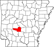
Towns Donaldson | Friendship | Magnet Cove | Midway | Perla | Rockport
Unincorporated
communitiesBismarck | Bonnerdale | Jones Mill
Categories:- Hot Spring County, Arkansas
- National Register of Historic Places in Arkansas by county
-

Wikimedia Foundation. 2010.