- National Register of Historic Places listings in Howard County, Arkansas
-
 Location of Howard County in Arkansas
This is a list of the National Register of Historic Places listings in Howard County, Arkansas.
This is intended to be a complete list of the properties on the National Register of Historic Places in Howard County, Arkansas, United States. The locations of National Register properties for which the latitude and longitude coordinates are included below, may be seen in a Google map.[1]
There are 12 properties listed on the National Register in the county. Six other properties were once listed but have been removed.
Contents: Counties in Arkansas Arkansas - Ashley - Baxter - Benton - Boone - Bradley - Calhoun - Carroll - Chicot - Clark - Clay - Cleburne - Cleveland - Columbia - Conway - Craighead - Crawford - Crittenden - Cross - Dallas - Desha - Drew - Faulkner - Franklin - Fulton - Garland - Grant - Greene - Hempstead - Hot Spring - Howard - Independence - Izard - Jackson - Jefferson - Johnson - Lafayette - Lawrence - Lee - Lincoln - Little River - Logan - Lonoke - Madison - Marion - Miller - Mississippi - Monroe - Montgomery - Nevada - Newton - Ouachita - Perry - Phillips - Pike - Poinsett - Polk - Pope - Prairie - Pulaski (Little Rock) - Randolph - St. Francis - Saline - Scott - Searcy - Sebastian - Sevier - Sharp - Stone - Union - Van Buren - Washington - White - Woodruff - Yell
-
- This National Park Service list is complete through NPS recent listings posted November 10, 2011.[2]
Current listings
[3] Landmark name [4] Image Date listed Location City or town Summary 1 Ebenezer Campground March 26, 1976 North of Center Point off Highway 4
34°03′23″N 93°57′57″W / 34.056389°N 93.965833°WCenter Point 2 First Presbyterian Church May 4, 1976 2nd and Hempstead Sts.
33°56′33″N 93°50′54″W / 33.9425°N 93.848333°WNashville 3 Garrett Whiteside Hall November 21, 1994 Southwestern corner of the junction of N. 3rd Ave. and Lockesburg St.
33°57′01″N 93°50′59″W / 33.950278°N 93.849722°WNashville 4 Elbert W. Holt House September 20, 1984 902 N. Main St.
33°57′35″N 93°51′11″W / 33.959722°N 93.853056°WNashville 5 Flavius Holt House December 1, 1978 Kohler St. Nashville 6 Howard County Courthouse June 14, 1990 Junction of N. Main St. and Bishop St.
33°56′52″N 93°50′51″W / 33.947778°N 93.8475°WNashville 7 Memphis, Paris, and Gulf Depot December 4, 1978 Highway 27
33°52′32″N 93°54′40″W / 33.875556°N 93.911111°WMineral Springs 8 Mineral Springs Waterworks May 29, 2007 South of the junction of W. Runnels and S. Hall
33°52′30″N 93°55′17″W / 33.875°N 93.921389°WMineral Springs 9 Nashville American Legion Building September 13, 1990 Highway 27, west of Main St.
33°56′01″N 93°51′01″W / 33.933611°N 93.850278°WNashville 10 Nashville Commercial Historic District September 23, 2010 Bounded roughly by Shepherd St., Missouri Pacific Railroad, Hempstead St. and Second St.
33°56′38″N 93°50′50″W / 33.943889°N 93.847222°WNashville 11 Nashville Post Office August 14, 1998 220 N. Main St.
33°56′43″N 93°50′46″W / 33.945278°N 93.846111°WNashville 12 Womack-Parker House December 1, 1978 Off Highway 4
33°57′14″N 93°50′47″W / 33.953889°N 93.846389°WNashville Former listings
Landmark name Image Date removed Location City or Town Summary 1 Adam Boyd House September 23, 2011 East of Center Point on Highway 26
34°1′33″N 93°56′36″W / 34.02583°N 93.94333°WCenter Point Listed May 13, 1976 2 Clardy-Lee House September 23, 2011 Highway 26
34°1′26″N 93°57′38″W / 34.02389°N 93.96056°WCenter Point Listed November 10, 1977 3 First Christian Church September 24, 2010 N. Main St.
33°56′55″N 93°50′47″W / 33.94861°N 93.84639°WNashville Listed November 4, 1982 4 Noel Owen Neal House January 26, 2006 184 Blue Bayou Rd., S.
33°56′41″N 93°57′20″W / 33.94472°N 93.95556°WNashville Listed on the NRHP September 27, 2003 5 Russey-Murray House September 23, 2011 South of Center Point on Highway 4
34°0′12″N 93°56′14″W / 34.00333°N 93.93722°WCenter Point Listed May 4, 1976 6 Tollette Shop Building May 28, 2010 Town Hall Dr.
33°48′56″N 93°53′56″W / 33.81556°N 93.89889°WTollette Listed on the NRHP September 27, 2003 See also
- List of National Historic Landmarks in Arkansas
- National Register of Historic Places listings in Arkansas
References
- ^ The latitude and longitude information provided in this table was derived originally from the National Register Information System, which has been found to be fairly accurate for about 99% of listings. For about 1% of NRIS original coordinates, experience has shown that one or both coordinates are typos or otherwise extremely far off; some corrections may have been made. A more subtle problem causes many locations to be off by up to 150 yards, depending on location in the country: most NRIS coordinates were derived from tracing out latitude and longitudes off of USGS topographical quadrant maps created under the North American Datum of 1927, which differs from the current, highly accurate WGS84 GPS system used by Google maps. Chicago is about right, but NRIS longitudes in Washington are higher by about 4.5 seconds, and are lower by about 2.0 seconds in Maine. Latitudes differ by about 1.0 second in Florida. Some locations in this table may have been corrected to current GPS standards.
- ^ "National Register of Historic Places: Weekly List Actions". National Park Service, United States Department of the Interior. Retrieved on November 10, 2011.
- ^ Numbers represent an ordering by significant words. Various colorings, defined here, differentiate National Historic Landmark sites and National Register of Historic Places Districts from other NRHP buildings, structures, sites or objects.
- ^ "National Register Information System". National Register of Historic Places. National Park Service. . http://nrhp.focus.nps.gov/natreg/docs/All_Data.html.
U.S. National Register of Historic Places Topics Lists by states Alabama • Alaska • Arizona • Arkansas • California • Colorado • Connecticut • Delaware • Florida • Georgia • Hawaii • Idaho • Illinois • Indiana • Iowa • Kansas • Kentucky • Louisiana • Maine • Maryland • Massachusetts • Michigan • Minnesota • Mississippi • Missouri • Montana • Nebraska • Nevada • New Hampshire • New Jersey • New Mexico • New York • North Carolina • North Dakota • Ohio • Oklahoma • Oregon • Pennsylvania • Rhode Island • South Carolina • South Dakota • Tennessee • Texas • Utah • Vermont • Virginia • Washington • West Virginia • Wisconsin • WyomingLists by territories Lists by associated states Other Municipalities and communities of Howard County, Arkansas Cities 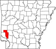
Town Unincorporated
communitiesCenter Point | Mineola | Saratoga | Umpire
Categories:- Howard County, Arkansas
- National Register of Historic Places in Arkansas by county
-

Wikimedia Foundation. 2010.