- Dierks, Arkansas
-
Dierks, Arkansas — City — Location in Howard County and the state of Arkansas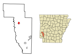
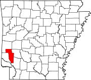
Coordinates: 34°7′11″N 94°1′3″W / 34.11972°N 94.0175°WCoordinates: 34°7′11″N 94°1′3″W / 34.11972°N 94.0175°W Country United States State Arkansas County Howard Area – Total 1.9 sq mi (4.8 km2) – Land 1.9 sq mi (4.8 km2) – Water 0 sq mi (0 km2) Elevation 443 ft (135 m) Population (2000) – Total 1,230 – Density 647.4/sq mi (256.3/km2) Time zone Central (CST) (UTC-6) – Summer (DST) CDT (UTC-5) ZIP code 71833 Area code(s) 870 FIPS code 05-18970 GNIS feature ID 0076796 Website http://dierkschamberofcommerce.com/ Dierks is a city in Howard County, Arkansas, United States. The population was 1,230 at the 2000 census.
Contents
Geography
Dierks is located at 34°7′11″N 94°1′3″W / 34.11972°N 94.0175°W (34.119793, -94.017452)[1].
According to the United States Census Bureau, the city has a total area of 1.9 square miles (4.9 km2), all of it land. Dierks is located in Howard County. Dierks was formerly known as Hardscrabble. It was then changed to Dierks after Herman Dierks, who owned the Dierks Lumber Company. Dierks has a lake that is used as a fishing spot. It also has three different areas to camp: Jefferson Ridge, Blue Ridge, and Horseshoe Bend.
In 2007, Dierks celebrated its 100th birthday.
Dierks holds an annual Pine Tree Festival the first weekend in August every year. Vendors come and set up booths and there are games and activities that go on all weekend. There is a loader contest, BBQ cook-off, tractor show, car show, talent show, and on Saturday there is a concert with a country singer or band. In 2008, Craig Morgan was the artist. Throughout the years many country music artists played the Pine Tree Festival. Examples are Reba McEntire, Hank Williams Jr., Skeeter Davis, and John Anderson.[citation needed]
There are two schools in the city. JoAnn Walters Elementary School and Dierks High School. They are the Outlaws and the actual mascot uniform is a horse named Blue. Their colors are royal blue and white.
Demographics
As of the census[2] of 2000, there were 1,230 people, 465 households, and 349 families residing in the city. The population density was 660.2 people per square mile (255.3/km²). There were 542 housing units at an average density of 290.9/sq mi (112.5/km²). The racial makeup of the city was 95.93% White, 0.57% Black or African American, 1.14% Native American, 0.08% Asian, 1.46% from other races, and 0.81% from two or more races. 1.95% of the population were Hispanic or Latino of any race.
There were 465 households out of which 32.5% had children under the age of 18 living with them, 63.9% were married couples living together, 6.9% had a female householder with no husband present, and 24.9% were non-families. 22.4% of all households were made up of individuals and 13.8% had someone living alone who was 65 years of age or older. The average household size was 2.56 and the average family size was 2.96.
In the city the population was spread out with 25.1% under the age of 18, 8.3% from 18 to 24, 26.7% from 25 to 44, 19.8% from 45 to 64, and 20.1% who were 65 years of age or older. The median age was 38 years. For every 100 females there were 85.8 males. For every 100 females age 18 and over, there were 85.3 males.
The median income for a household in the city was $27,900, and the median income for a family was $31,667. Males had a median income of $26,765 versus $18,125 for females. The per capita income for the city was $13,515. About 9.8% of families and 12.6% of the population were below the poverty line, including 14.5% of those under age 18 and 22.1% of those age 65 or over.
2009 Tornado
Severe thunderstorms that moved through southwest Arkansas on Thursday, April 9, 2009 produced an EF3 tornado that destroyed the city’s water treatment plant.[3] A training technician from the Arkansas Rural Water Association helped the utility operators establish a temporary connection to the neighboring Nashville Rural Water System until the National Guard could deliver a pair of portable water purification systems.[4] The Boy Scouts of America helped to give water bottles to families that were on the city water.
2010 Tornado
In addition to the 2009 tornado, there was also a smaller tornado in 2010 which hit the local laundromat and tore down a few power lines. No injuries or deaths were reported.
References
- ^ "US Gazetteer files: 2010, 2000, and 1990". United States Census Bureau. 2011-02-12. http://www.census.gov/geo/www/gazetteer/gazette.html. Retrieved 2011-04-23.
- ^ "American FactFinder". United States Census Bureau. http://factfinder.census.gov. Retrieved 2008-01-31.
- ^ Associated Press (2009-04-14). "Forecasters: EF3 tornado knocked out Dierks' water treatment plant". KSFM-TV. http://www.kfsm.com/news/sns-ap-ar--arktornadoes-dierks,0,6528540.story. Retrieved 2009-04-14.[dead link]
- ^ "Tornado destroys Arkansas utility, rural water rushes to help". National Rural Water Association. 2009-04-13. http://nrwa.org/NRWAupdates/2009%2004%20April/Tornado.htm. Retrieved 2009-04-13.
Municipalities and communities of Howard County, Arkansas Cities Dierks | Mineral Springs | Nashville
Town Unincorporated
communitiesCenter Point | Mineola | Saratoga | Umpire
Categories:- Cities in Arkansas
- Populated places in Howard County, Arkansas


Wikimedia Foundation. 2010.