- National Register of Historic Places listings in Logan County, Arkansas
-
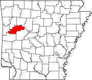
 Location of Logan County in Arkansas
This is a list of the National Register of Historic Places listings in Logan County, Arkansas.
This is intended to be a complete list of the properties and districts on the National Register of Historic Places in Logan County, Arkansas, United States. The locations of National Register properties and districts for which the latitude and longitude coordinates are included below, may be seen in a Google map.[1]
There are 41 properties and districts listed on the National Register in the county.
Contents: Counties in Arkansas Arkansas - Ashley - Baxter - Benton - Boone - Bradley - Calhoun - Carroll - Chicot - Clark - Clay - Cleburne - Cleveland - Columbia - Conway - Craighead - Crawford - Crittenden - Cross - Dallas - Desha - Drew - Faulkner - Franklin - Fulton - Garland - Grant - Greene - Hempstead - Hot Spring - Howard - Independence - Izard - Jackson - Jefferson - Johnson - Lafayette - Lawrence - Lee - Lincoln - Little River - Logan - Lonoke - Madison - Marion - Miller - Mississippi - Monroe - Montgomery - Nevada - Newton - Ouachita - Perry - Phillips - Pike - Poinsett - Polk - Pope - Prairie - Pulaski (Little Rock) - Randolph - St. Francis - Saline - Scott - Searcy - Sebastian - Sevier - Sharp - Stone - Union - Van Buren - Washington - White - Woodruff - Yell
-
- This National Park Service list is complete through NPS recent listings posted November 10, 2011.[2]
Current listings
[3] Landmark name [4] Image Date listed Location City or town Summary 1 American Legion Post No. 121 June 20, 1995 Legion Hut Rd., off Highway 107
35°16′33″N 93°44′03″W / 35.275833°N 93.734167°WParis 2 Anhalt Barn February 25, 1993 County Road 68
35°17′56″N 93°28′46″W / 35.298889°N 93.479444°WNew Blaine 3 Arkansas Tuberculosis Sanatorium Historic District October 5, 2006 Eastern end of Highway 116 S.
35°05′48″N 93°54′54″W / 35.096667°N 93.915°WBooneville 4 Bank of Booneville Building April 26, 1978 1 W. Main St.
35°08′26″N 93°55′17″W / 35.140556°N 93.921389°WBooneville 5 Booneville Methodist Episcopal Church South May 25, 2011 355 N. Broadway
35°08′28″N 93°55′20″W / 35.141111°N 93.922222°WBooneville 6 Burnett Springs September 22, 1995 End of County Road 704, approximately one mile east of Corley
35°12′58″N 93°38′34″W / 35.216111°N 93.642778°WCorley 7 Chicago, Rock Island, and Pacific Railroad Depot February 14, 1978 Off Highway 10
35°07′47″N 93°42′34″W / 35.129722°N 93.709444°WBlue Mountain 8 Dr. Stephen N. Chism House August 16, 1994 Eastern side of Highway 23, south of its junction with Highway 217
35°13′03″N 93°56′23″W / 35.2175°N 93.939722°WBooneville 9 Cove Creek Bridge May 26, 1995 Highway 309 over Cove Creek
35°11′35″N 93°37′24″W / 35.193056°N 93.623333°WCorley 10 Cove Creek Tributary Bridge May 26, 1995 Highway 309 over a tributary of Cove Creek
35°14′31″N 93°38′22″W / 35.241944°N 93.639444°WCorley 11 Cove Lake Bathhouse September 11, 1995 Forest Service Rd. 1608A in the Ozark-St. Francis National Forest
35°13′44″N 93°37′45″W / 35.228889°N 93.629167°WCorley 12 Cove Lake Spillway Dam-Bridge September 11, 1995 Highway 309, 9 miles south of Paris in the Ozark-St. Francis National Forest
35°13′58″N 93°37′45″W / 35.232778°N 93.629167°WCorley 13 Elizabeth Hall May 4, 1976 Off Highway 22
35°17′03″N 93°24′32″W / 35.284167°N 93.408889°WNew Blaine 14 Farmer's State Bank July 11, 2002 100 Seallars St.
35°17′24″N 93°25′16″W / 35.29°N 93.421111°WNew Blaine 15 Farmers and Merchants Bank-Masonic Lodge November 19, 1993 288 N. Broadway
35°08′24″N 93°55′17″W / 35.14°N 93.921389°WBooneville 16 First Christian Church June 30, 1995 120 E. Walnut St.
35°17′29″N 93°43′41″W / 35.291389°N 93.728056°WParis 17 John Gabriel Fort House March 28, 1996 Reveille Valley Rd., southeast of Driggs
35°12′26″N 93°44′05″W / 35.207222°N 93.734722°WDriggs 18 Tolbert E. Gill House September 30, 1993 Highway 22 west of its junction with Highway 109
35°17′31″N 93°44′00″W / 35.291944°N 93.733333°WParis 19 Jack Creek Bathhouse October 21, 1993 Forest Service Road 141, southwest of Sugar Grove, in the Ouachita National Forest
35°02′04″N 93°50′44″W / 35.034444°N 93.845556°WSugar Grove 20 Freeborn T. Lasater House July 11, 2002 494 Highway 197
35°17′22″N 93°25′06″W / 35.289444°N 93.418333°WNew Blaine 21 Liberty Schoolhouse January 21, 2010 12682 Spring Lake Rd.
35°11′33″N 93°36′58″W / 35.192386°N 93.6162°WCorley 22 Little Rock to Cantonment Gibson Road-Short Mountain Segment January 24, 2008 Short Mountain Rd. between Horseshoe Mountain and Short Mountain Creek
35°18′41″N 93°44′39″W / 35.311389°N 93.744167°WParis 23 Logan County Courthouse, Eastern District 
July 30, 1976 Courthouse Sq.
35°17′32″N 93°43′48″W / 35.292222°N 93.73°WParis 24 Logan County Courthouse, Southern Judicial District March 8, 1997 Southeastern corner of the junction of 4th and N. Broadway Sts.
35°04′08″N 93°55′13″W / 35.068889°N 93.920278°WBooneville 25 Magazine City Hall-Jail June 8, 1993 Northwest of the junction of Garland and Priddy Sts.
35°09′01″N 93°48′32″W / 35.150278°N 93.808889°WMagazine 26 Main Street Bridge July 11, 2002 Sellers St. at Silver Smith Branch
35°17′19″N 93°25′13″W / 35.288611°N 93.420278°WNew Blaine 27 Methodist Episcopal Church, South June 20, 1995 205 N. Elm St.
35°17′38″N 93°43′46″W / 35.293889°N 93.729444°WParis 28 New Blaine School August 18, 1992 Junction of Highway 22 and Spring Rd.
35°17′06″N 93°25′17″W / 35.285°N 93.421389°WNew Blaine 29 New Liberty School September 10, 1992 South of Highway 22
35°16′53″N 93°21′43″W / 35.281389°N 93.361944°WLiberty 30 Old Arkansas Highway 22 September 27, 2003 Part of Highway 197, the Highway 197 Loop, and Rainwater Loop
35°17′11″N 93°25′23″W / 35.286389°N 93.423056°WNew Blaine 31 Old Logan County Jail 
November 19, 1993 204 N. Vine St.
35°17′37″N 93°43′54″W / 35.293611°N 93.731667°WParis 32 Paris Commercial Historic District May 12, 2009 Roughly bounded by N. Express, Short Mountain, N. 1st, E. Pine, and E. and W. Academy Sts.
35°17′31″N 93°43′48″W / 35.292033°N 93.729917°WParis 33 Paris Post Office August 14, 1998 206 N. Elm St.
35°17′39″N 93°43′47″W / 35.294167°N 93.729722°WParis 34 Petit Jean River Bridge May 26, 1995 Highway 109 over the Petit Jean River
35°05′48″N 93°48′03″W / 35.096667°N 93.800833°WSugar Grove 35 Saint Anthony's Catholic Church August 21, 1986 North of Highway 22
35°18′48″N 93°52′55″W / 35.313333°N 93.881944°WRatcliff 36 Schriver House September 22, 1995 Leo Ave., north of its junction with Highway 22
35°18′08″N 93°39′01″W / 35.302222°N 93.650278°WSubiaco 37 Short Mountain Creek Bridge September 24, 2004 County Road 64
35°18′41″N 93°44′37″W / 35.311389°N 93.743611°WParis 38 Smith Hospital April 11, 1994 Northern terminus of Express St.
35°17′53″N 93°43′50″W / 35.298056°N 93.730556°WParis 39 Troy Lasater Service Station October 4, 2002 Highway 197 Loop
35°17′20″N 93°25′11″W / 35.288889°N 93.419722°WNew Blaine 40 Union Church and School June 1, 2005 2158 Union Rd.
35°19′31″N 93°39′53″W / 35.325278°N 93.664722°WParis 41 Evelyn Gill Walker House September 16, 1993 18 S. Spruce St.
35°17′30″N 93°44′00″W / 35.291667°N 93.733333°WParis See also
- List of National Historic Landmarks in Arkansas
- National Register of Historic Places listings in Arkansas
References
- ^ The latitude and longitude information provided in this table was derived originally from the National Register Information System, which has been found to be fairly accurate for about 99% of listings. For about 1% of NRIS original coordinates, experience has shown that one or both coordinates are typos or otherwise extremely far off; some corrections may have been made. A more subtle problem causes many locations to be off by up to 150 yards, depending on location in the country: most NRIS coordinates were derived from tracing out latitude and longitudes off of USGS topographical quadrant maps created under the North American Datum of 1927, which differs from the current, highly accurate WGS84 GPS system used by Google maps. Chicago is about right, but NRIS longitudes in Washington are higher by about 4.5 seconds, and are lower by about 2.0 seconds in Maine. Latitudes differ by about 1.0 second in Florida. Some locations in this table may have been corrected to current GPS standards.
- ^ "National Register of Historic Places: Weekly List Actions". National Park Service, United States Department of the Interior. Retrieved on November 10, 2011.
- ^ Numbers represent an ordering by significant words. Various colorings, defined here, differentiate National Historic Landmark sites and National Register of Historic Places Districts from other NRHP buildings, structures, sites or objects.
- ^ "National Register Information System". National Register of Historic Places. National Park Service. . http://nrhp.focus.nps.gov/natreg/docs/All_Data.html.
U.S. National Register of Historic Places Topics Lists by states Alabama • Alaska • Arizona • Arkansas • California • Colorado • Connecticut • Delaware • Florida • Georgia • Hawaii • Idaho • Illinois • Indiana • Iowa • Kansas • Kentucky • Louisiana • Maine • Maryland • Massachusetts • Michigan • Minnesota • Mississippi • Missouri • Montana • Nebraska • Nevada • New Hampshire • New Jersey • New Mexico • New York • North Carolina • North Dakota • Ohio • Oklahoma • Oregon • Pennsylvania • Rhode Island • South Carolina • South Dakota • Tennessee • Texas • Utah • Vermont • Virginia • Washington • West Virginia • Wisconsin • WyomingLists by territories Lists by associated states Other Municipalities and communities of Logan County, Arkansas Cities Booneville | Magazine | Paris | Ratcliff | Scranton
Towns CDP Unincorporated
communitiesCategories:- Logan County, Arkansas
- National Register of Historic Places in Arkansas by county
-


Wikimedia Foundation. 2010.