- National Register of Historic Places listings in Grant County, Arkansas
-
 Location of Grant County in Arkansas
This is a list of the National Register of Historic Places listings in Grant County, Arkansas.
This is intended to be a complete list of the properties on the National Register of Historic Places in Grant County, Arkansas, United States. The locations of National Register properties for which the latitude and longitude coordinates are included below, may be seen in a Google map.[1]
There are 10 properties listed on the National Register in the county, including 1 National Historic Landmark.
Contents: Counties in Arkansas Arkansas - Ashley - Baxter - Benton - Boone - Bradley - Calhoun - Carroll - Chicot - Clark - Clay - Cleburne - Cleveland - Columbia - Conway - Craighead - Crawford - Crittenden - Cross - Dallas - Desha - Drew - Faulkner - Franklin - Fulton - Garland - Grant - Greene - Hempstead - Hot Spring - Howard - Independence - Izard - Jackson - Jefferson - Johnson - Lafayette - Lawrence - Lee - Lincoln - Little River - Logan - Lonoke - Madison - Marion - Miller - Mississippi - Monroe - Montgomery - Nevada - Newton - Ouachita - Perry - Phillips - Pike - Poinsett - Polk - Pope - Prairie - Pulaski (Little Rock) - Randolph - St. Francis - Saline - Scott - Searcy - Sebastian - Sevier - Sharp - Stone - Union - Van Buren - Washington - White - Woodruff - Yell
-
- This National Park Service list is complete through NPS recent listings posted November 10, 2011.[2]
Current listings
[3] Landmark name [4] Image Date listed Location City or town Summary 1 Dr. John L. Butler House October 9, 1986 313 Oak St.
34°18′35″N 92°24′06″W / 34.309722°N 92.401667°WSheridan 2 Samuel D. Byrd, Sr., Homestead January 20, 2005 15966 US 270, W.
34°20′30″N 92°39′43″W / 34.341667°N 92.661944°WPoyen 3 Glaser-Kelly House January 23, 1992 310 N. Oak St.
34°18′35″N 92°24′03″W / 34.309722°N 92.400833°WSheridan 4 Jenkins' Ferry Battleground January 21, 1970 Northeast of Leola on Highway 46
34°11′53″N 92°34′00″W / 34.198056°N 92.566667°WLeola One of the Camden Expedition Sites, a National Historic Landmark consisting of sites in several counties 5 Koon House #1 October 14, 1999 Junction of US 167 and County Road 523
34°16′29″N 92°23′57″W / 34.274722°N 92.399167°WSheridan 6 Koon House #2 October 14, 1999 2959 US 167
34°16′04″N 92°23′58″W / 34.267778°N 92.399444°WSheridan 7 Koon House #3 October 14, 1999 2988 US 167
34°16′04″N 92°23′57″W / 34.267778°N 92.399167°WSheridan 8 Koon House #4 October 14, 1999 3004 US 167
34°16′03″N 92°23′57″W / 34.2675°N 92.399167°WSheridan 9 Koon House #6 October 14, 1999 3253 US 167
34°15′49″N 92°23′58″W / 34.263611°N 92.399444°WSheridan 10 Oak Grove School June 14, 1991 U.S. Route 270, 6 miles east of Sheridan
34°18′57″N 92°16′51″W / 34.315833°N 92.280833°WOak Grove See also
- List of National Historic Landmarks in Arkansas
- National Register of Historic Places listings in Arkansas
References
- ^ The latitude and longitude information provided in this table was derived originally from the National Register Information System, which has been found to be fairly accurate for about 99% of listings. For about 1% of NRIS original coordinates, experience has shown that one or both coordinates are typos or otherwise extremely far off; some corrections may have been made. A more subtle problem causes many locations to be off by up to 150 yards, depending on location in the country: most NRIS coordinates were derived from tracing out latitude and longitudes off of USGS topographical quadrant maps created under the North American Datum of 1927, which differs from the current, highly accurate WGS84 GPS system used by Google maps. Chicago is about right, but NRIS longitudes in Washington are higher by about 4.5 seconds, and are lower by about 2.0 seconds in Maine. Latitudes differ by about 1.0 second in Florida. Some locations in this table may have been corrected to current GPS standards.
- ^ "National Register of Historic Places: Weekly List Actions". National Park Service, United States Department of the Interior. Retrieved on November 10, 2011.
- ^ Numbers represent an ordering by significant words. Various colorings, defined here, differentiate National Historic Landmark sites and National Register of Historic Places Districts from other NRHP buildings, structures, sites or objects.
- ^ "National Register Information System". National Register of Historic Places. National Park Service. . http://nrhp.focus.nps.gov/natreg/docs/All_Data.html.
U.S. National Register of Historic Places Topics Lists by states Alabama • Alaska • Arizona • Arkansas • California • Colorado • Connecticut • Delaware • Florida • Georgia • Hawaii • Idaho • Illinois • Indiana • Iowa • Kansas • Kentucky • Louisiana • Maine • Maryland • Massachusetts • Michigan • Minnesota • Mississippi • Missouri • Montana • Nebraska • Nevada • New Hampshire • New Jersey • New Mexico • New York • North Carolina • North Dakota • Ohio • Oklahoma • Oregon • Pennsylvania • Rhode Island • South Carolina • South Dakota • Tennessee • Texas • Utah • Vermont • Virginia • Washington • West Virginia • Wisconsin • WyomingLists by territories Lists by associated states Other Municipalities and communities of Grant County, Arkansas City 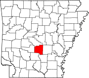
Towns Leola | Poyen | Prattsville | Tull
Unincorporated
communityGrapevine
Categories:- Grant County, Arkansas
- National Register of Historic Places in Arkansas by county
-

Wikimedia Foundation. 2010.