- National Register of Historic Places listings in Fulton County, Arkansas
-
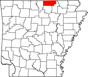
 Location of Fulton County in Arkansas
This is a list of the National Register of Historic Places listings in Fulton County, Arkansas.
This is intended to be a complete list of the properties on the National Register of Historic Places in Fulton County, Arkansas, United States. The locations of National Register properties for which the latitude and longitude coordinates are included below, may be seen in a Google map.[1]
There are 8 properties listed on the National Register in the county.
Contents: Counties in Arkansas Arkansas - Ashley - Baxter - Benton - Boone - Bradley - Calhoun - Carroll - Chicot - Clark - Clay - Cleburne - Cleveland - Columbia - Conway - Craighead - Crawford - Crittenden - Cross - Dallas - Desha - Drew - Faulkner - Franklin - Fulton - Garland - Grant - Greene - Hempstead - Hot Spring - Howard - Independence - Izard - Jackson - Jefferson - Johnson - Lafayette - Lawrence - Lee - Lincoln - Little River - Logan - Lonoke - Madison - Marion - Miller - Mississippi - Monroe - Montgomery - Nevada - Newton - Ouachita - Perry - Phillips - Pike - Poinsett - Polk - Pope - Prairie - Pulaski (Little Rock) - Randolph - St. Francis - Saline - Scott - Searcy - Sebastian - Sevier - Sharp - Stone - Union - Van Buren - Washington - White - Woodruff - Yell
-
- This National Park Service list is complete through NPS recent listings posted November 10, 2011.[2]
Current listings
[3] Landmark name [4] Image Date listed Location City or town Summary 1 AR 289 Bridge Over English Creek January 22, 2009 Highway 289 over English Creek Mammoth Spring 2 Camp Methodist Church May 9, 1997 Highway 9, approximately 6 miles east of Salem
36°24′44″N 91°44′16″W / 36.412222°N 91.737778°WCamp 3 County Line School and Lodge March 27, 1975 Northwest of Gepp on the eastern side of the Baxter-Fulton county line, 2 miles south of the state line
36°29′13″N 92°09′00″W / 36.486944°N 92.15°WGepp 4 Kansas City, Fort Scott and Memphis Railroad Depot June 11, 1992 Southeast of the BNSF railroad tracks on an access road for Mammoth Spring State Park
36°29′45″N 91°31′54″W / 36.495833°N 91.531667°WMammoth Spring 5 Mammoth Spring Dam and Lake 
July 15, 2009 17 U.S. Route 63, N.
36°29′43″N 91°32′12″W / 36.495414°N 91.536531°WMammoth Spring 6 T.H. Morris House September 13, 1990 Junction of 6th and Bethel Sts.
36°29′41″N 91°32′37″W / 36.494722°N 91.543611°WMammoth Spring 7 Saddle Store November 15, 2000 Highway 289
36°21′31″N 91°38′14″W / 36.358611°N 91.637222°WSaddle 8 Saint Andrew's Episcopal Church November 26, 1986 Highway 9
36°29′42″N 91°31′58″W / 36.495°N 91.532778°WMammoth Spring See also
- List of National Historic Landmarks in Arkansas
- National Register of Historic Places listings in Arkansas
References
- ^ The latitude and longitude information provided in this table was derived originally from the National Register Information System, which has been found to be fairly accurate for about 99% of listings. For about 1% of NRIS original coordinates, experience has shown that one or both coordinates are typos or otherwise extremely far off; some corrections may have been made. A more subtle problem causes many locations to be off by up to 150 yards, depending on location in the country: most NRIS coordinates were derived from tracing out latitude and longitudes off of USGS topographical quadrant maps created under the North American Datum of 1927, which differs from the current, highly accurate WGS84 GPS system used by Google maps. Chicago is about right, but NRIS longitudes in Washington are higher by about 4.5 seconds, and are lower by about 2.0 seconds in Maine. Latitudes differ by about 1.0 second in Florida. Some locations in this table may have been corrected to current GPS standards.
- ^ "National Register of Historic Places: Weekly List Actions". National Park Service, United States Department of the Interior. Retrieved on November 10, 2011.
- ^ Numbers represent an ordering by significant words. Various colorings, defined here, differentiate National Historic Landmark sites and National Register of Historic Places Districts from other NRHP buildings, structures, sites or objects.
- ^ "National Register Information System". National Register of Historic Places. National Park Service. . http://nrhp.focus.nps.gov/natreg/docs/All_Data.html.
U.S. National Register of Historic Places Topics Lists by states Alabama • Alaska • Arizona • Arkansas • California • Colorado • Connecticut • Delaware • Florida • Georgia • Hawaii • Idaho • Illinois • Indiana • Iowa • Kansas • Kentucky • Louisiana • Maine • Maryland • Massachusetts • Michigan • Minnesota • Mississippi • Missouri • Montana • Nebraska • Nevada • New Hampshire • New Jersey • New Mexico • New York • North Carolina • North Dakota • Ohio • Oklahoma • Oregon • Pennsylvania • Rhode Island • South Carolina • South Dakota • Tennessee • Texas • Utah • Vermont • Virginia • Washington • West Virginia • Wisconsin • WyomingLists by territories Lists by associated states Other Municipalities and communities of Fulton County, Arkansas Cities Ash Flat‡ | Cherokee Village‡ | Hardy‡ | Horseshoe Bend‡ | Mammoth Spring | Salem
Town Unincorporated
communitiesBexar | Camp | Elizabeth | Gepp | Glencoe | Sturkie
Footnotes ‡This populated place also has portions in an adjacent county or counties
Categories:- Fulton County, Arkansas
- National Register of Historic Places in Arkansas by county
-


Wikimedia Foundation. 2010.