- National Register of Historic Places listings in Fresno County, California
-
This list includes properties and districts listed on the National Register of Historic Places in Fresno County, California. Click the "Map of all coordinates" link to the right to view a Google map of all properties and districts with latitude and longitude coordinates in the table below.[1]
-
- This National Park Service list is complete through NPS recent listings posted November 10, 2011.[2]
[3] Landmark name [4] Image Date listed Location City or town Summary 1 Bank of Italy 
October 29, 1982 1015 Fulton Mall
36°44′02″N 119°47′22″W / 36.733889°N 119.789444°WFresno 2 Ben Gefvert Ranch Historic District January 7, 2011 4770 W. Whites Bridge Rd.
36°44′07″N 119°51′36″W / 36.735278°N 119.86°WFresno vicinity 3 Birdwell Rock Petroglyph Site March 12, 2003 Address Restricted Coalinga 4 H. H. Brix Mansion 
September 15, 1983 2844 Fresno St.
36°44′31″N 119°46′56″W / 36.741944°N 119.782222°WFresno 5 Coalinga Polk Street School May 6, 1982 S. 5th and E. Polk Sts.
36°08′11″N 120°21′15″W / 36.136389°N 120.354167°WCoalinga 6 Dinkey Creek Bridge September 5, 1996 Off Dinkey Creek Rd., W of Camp Fresno, Sierra National Forest
37°04′03″N 119°09′12″W / 37.0675°N 119.153333°WDinkey Creek 7 Einstein House January 31, 1978 1600 M St.
36°44′33″N 119°47′34″W / 36.7425°N 119.792778°WFresno 8 Forestiere Underground Gardens October 28, 1977 5021 W. Shaw Ave.
36°48′26″N 119°52′51″W / 36.807222°N 119.880833°WFresno 9 Fresno Bee Building 
November 1, 1982 1555 Van Ness Ave.
36°44′25″N 119°47′41″W / 36.740278°N 119.794722°WFresno 10 Fresno Brewing Company Office and Warehouse January 5, 1984 100 M St.
36°43′38″N 119°46′32″W / 36.727222°N 119.775556°WFresno 11 Fresno Memorial Auditorium 
May 10, 1994 2425 Fresno St.
36°44′23″N 119°47′15″W / 36.739722°N 119.7875°WFresno 12 Fresno Republican Printery Building 
January 2, 1979 2130 Kern St.
36°44′01″N 119°47′11″W / 36.733611°N 119.786389°WFresno 13 Fresno Sanitary Landfill August 7, 2001 West and Jensen Aves.
36°42′24″N 119°49′37″W / 36.706744°N 119.826914°WFresno 14 Gamlin Cabin March 8, 1977 NW of Wilsonia
36°44′56″N 118°58′13″W / 36.748889°N 118.970278°WWilsonia 15 Holy Trinity Armenian Apostolic Church 
July 31, 1986 2226 Ventura St.
36°43′54″N 119°46′54″W / 36.731667°N 119.781667°WFresno 16 Hotel Californian April 21, 2004 851 Van Ness Ave.
36°44′03″N 119°47′17″W / 36.734167°N 119.788056°WFresno 17 M. Theo Kearney Park and Mansion March 13, 1975 7160 Kearney Blvd.
36°43′32″N 119°55′04″W / 36.725556°N 119.917778°WFresno 18 Paul Kindler House October 29, 1982 1520 E. Olive Ave
36°45′26″N 119°47′27″W / 36.757222°N 119.790833°WFresno 19 Knapp Cabin December 20, 1978 W of Cedar Grove in Kings Canyon National Park
36°47′02″N 118°38′09″W / 36.783889°N 118.635833°WCedar Grove 20 Maubridge Apartments 
May 6, 1982 2344 Tulare St.
36°44′12″N 119°47′07″W / 36.736667°N 119.785278°WFresno 21 Meux House January 13, 1975 1007 R St.
36°44′23″N 119°46′53″W / 36.739722°N 119.781389°WFresno 22 Old Administration Building, Fresno City College 
May 1, 1974 1101 University Ave.
36°46′04″N 119°47′51″W / 36.767778°N 119.7975°WFresno 23 Old Fresno Water Tower 
October 14, 1971 2444 Fresno St.
36°44′21″N 119°47′11″W / 36.739167°N 119.786389°WFresno 24 Orange Cove Santa Fe Railway Depot 
August 29, 1978 633 E. Railroad Ave.
36°37′23″N 119°18′42″W / 36.623056°N 119.311667°WOrange Cove 25 Alexander Pantages Theater 
February 23, 1978 1400 Fulton St.
36°44′17″N 119°47′40″W / 36.738056°N 119.794444°WFresno 26 Physicians Building 
November 20, 1978 2607 Fresno St.
36°44′26″N 119°47′06″W / 36.740556°N 119.785°WFresno 27 Reedley National Bank 
February 28, 1985 1100 G St.
36°35′47″N 119°26′58″W / 36.596389°N 119.449444°WReedley 28 Reedley Opera House Complex 
April 5, 1984 10th and G Sts.
36°35′49″N 119°27′03″W / 36.596944°N 119.450833°WReedley 29 Rehorn House January 8, 1982 1050 S St.
36°44′29″N 119°46′50″W / 36.741389°N 119.780556°WFresno 30 Frank Romain House January 11, 1982 2055 San Joaquin St.
36°44′30″N 119°47′46″W / 36.741667°N 119.796111°WFresno 31 San Joaquin Light and Power Corporation Building 
January 3, 2006 1401 Fulton St.
36°44′13″N 119°47′41″W / 36.736944°N 119.794722°WFresno 32 Santa Fe Hotel March 14, 1991 935 Santa Fe Ave.
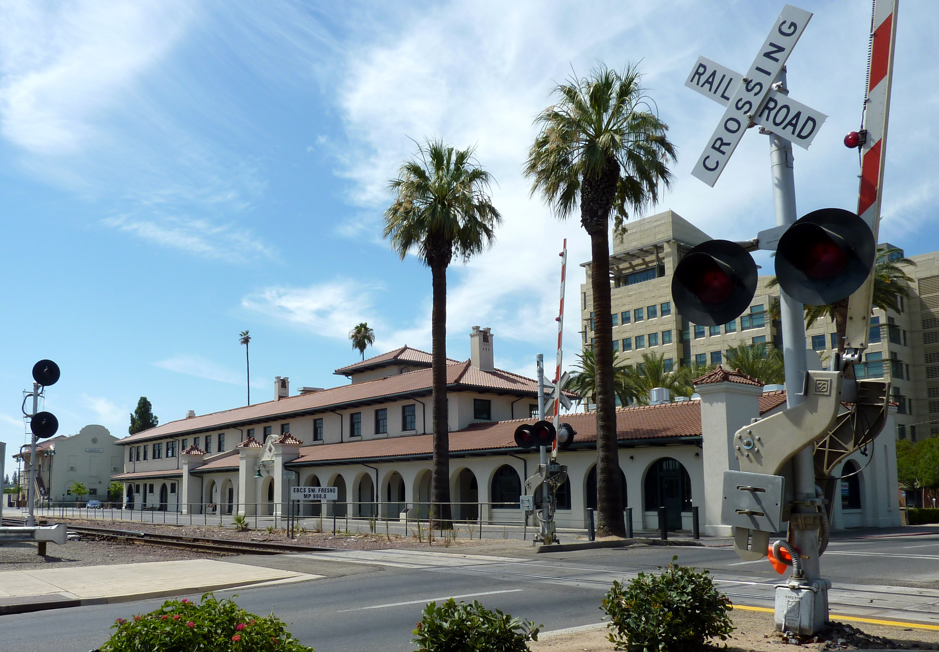
36°44′16″N 119°46′56″W / 36.737778°N 119.782222°WFresno 33 Santa Fe Passenger Depot 
November 7, 1976 2650 Tulare St.
36°44′18″N 119°46′55″W / 36.738333°N 119.781944°WFresno 34 Shorty Lovelace Historic District January 31, 1978 E of Pinehurst on Kings Canyon National Park
36°44′26″N 118°31′03″W / 36.740556°N 118.5175°WPinehurst 35 Southern Pacific Passenger Depot March 21, 1978 1033 H St.
36°43′57″N 119°47′33″W / 36.7325°N 119.7925°WFresno 36 Stoner House October 17, 1985 21143 E. Welson Ave.
36°45′57″N 119°24′26″W / 36.765833°N 119.407222°WSanger 37 Tower Theatre September 24, 1992 1201 N. Wishon Ave.
36°45′29″N 119°48′01″W / 36.758056°N 119.800278°WFresno 38 Twining Laboratories 
March 26, 1991 2527 Fresno St.
36°45′29″N 119°47′12″W / 36.758056°N 119.786667°WFresno 39 Warehouse Row March 24, 1978 722, 744, and 764 P St.
36°44′10″N 119°46′40″W / 36.736111°N 119.777778°WFresno 40 YWCA Building September 21, 1978 1660 M St.
36°44′35″N 119°47′35″W / 36.743056°N 119.793056°WFresno See also
- National Register of Historic Places listings in California
- List of National Historic Landmarks in California
References
- ^ The latitude and longitude information provided in this table was derived originally from the National Register Information System, which has been found to be fairly accurate for about 99% of listings. For about 1% of NRIS original coordinates, experience has shown that one or both coordinates are typos or otherwise extremely far off; some corrections may have been made. A more subtle problem causes many locations to be off by up to 150 yards, depending on location in the country: most NRIS coordinates were derived from tracing out latitude and longitudes off of USGS topographical quadrant maps created under the North American Datum of 1927, which differs from the current, highly accurate WGS84 GPS system used by Google maps. Chicago is about right, but NRIS longitudes in Washington are higher by about 4.5 seconds, and are lower by about 2.0 seconds in Maine. Latitudes differ by about 1.0 second in Florida. Some locations in this table may have been corrected to current GPS standards.
- ^ "National Register of Historic Places: Weekly List Actions". National Park Service, United States Department of the Interior. Retrieved on November 10, 2011.
- ^ Numbers represent an ordering by significant words. Various colorings, defined here, differentiate National Historic Landmark sites and National Register of Historic Places Districts from other NRHP buildings, structures, sites or objects.
- ^ "National Register Information System". National Register of Historic Places. National Park Service. . http://nrhp.focus.nps.gov/natreg/docs/All_Data.html.
U.S. National Register of Historic Places Topics Lists by states Alabama • Alaska • Arizona • Arkansas • California • Colorado • Connecticut • Delaware • Florida • Georgia • Hawaii • Idaho • Illinois • Indiana • Iowa • Kansas • Kentucky • Louisiana • Maine • Maryland • Massachusetts • Michigan • Minnesota • Mississippi • Missouri • Montana • Nebraska • Nevada • New Hampshire • New Jersey • New Mexico • New York • North Carolina • North Dakota • Ohio • Oklahoma • Oregon • Pennsylvania • Rhode Island • South Carolina • South Dakota • Tennessee • Texas • Utah • Vermont • Virginia • Washington • West Virginia • Wisconsin • WyomingLists by territories Lists by associated states Other Municipalities and communities of Fresno County, California Cities 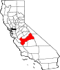
CDPs Auberry | Big Creek | Biola | Bowles | Calwa | Cantua Creek | Caruthers | Centerville | Del Rey | Easton | Fort Washington | Friant | Lanare | Laton | Malaga | Mayfair | Minkler | Monmouth | Old Fig Garden | Raisin City | Riverdale | Shaver Lake | Squaw Valley | Sunnyside | Tarpey Village | Three Rocks | Tranquillity | West Park
Unincorporated
communitiesAlder Springs | Arbios | Avocado | Balch Camp | Barstow | Benito | Big Bunch | Biola Junction | Bretz Mill | Broadview Farms | Burness | Burrel | Calflax | Camden | Cameo | Camp Sierra | Cecile | Cedar Crest | Cedar Grove | Cedarbrook | Cella | Chaney Ranch | Cincotta | Clint | Clotho | Conejo | Crabtree | Cromir | Deer Crossing | Dinkey Creek | Dora Belle | Dunlap | Edmiston | Elk | Elm View | Etheda Springs | Figarden | Five Points | Floyd | Giffen Cantua Ranch | Glorietta | Goldleaf | Goodmill | Gordon | Gravesboro | Helm | Herndon | Highway City | Hoffman Point | Hub | Hume | Hume Station | Humphreys Station | Huntington Lake | Ingle | Ivesta | Jamesan | Kanawyers | La Jolla Ranch | Lacjac | Lakeshore | Lerona | Levis | Locans | Lone Star | Marshall Junction | Mathews Mill | Mattei | Meadow Lakes | Mercey Hot Springs | Miley | Miramonte | Mono Hot Springs | Murietta Farm | Muscatel | Navelencia | New Auberry | Ockenden | Old Bretz Mill | Oleander | Ora | Oro Loma | Oxalis | Panoche Junction | Parkfield Junction | Piedra | Pilibos Ranch | Pinehurst | Pineridge | Prather | Pratton | Raco | Riverbend | Rock Haven | Rodgers Crossing | Rolinda | Sawmill Flat | Schilling | Shaver Lake Heights | Sierra Cedars | Sierra Sky Park | Snow Bend | Tarpey | Tollhouse | Trimmer | Turk | Uva | Vanguard | Wahtoke | Westhaven | Westside | Wildflower | Wineland | Wolf | Wood Ranch | Zediker
Indian
reservationsBig Sandy Rancheria | Cold Springs Rancheria | Table Mountain Rancheria
Ghost towns Andrews | Barton | Bender | Bridge | Bronge | Butler | Cadogan | Caldwell | Carlile | Carmelita | Coalinga Mineral Springs | Collins | Darwin | Dathol | Deseret | Dickerson | El Prado | Elkhorn Station | Eshel | Everts | Fargo | Fort Camp | Fresno Beach | Fresno City | Fruitvale | Garfield | Granz | Hawthorne's Station | Hayes | Kelso | Kingriver | Kingston | La Libertad | Last | Leroy | Letcher | Lillis | Marshall Station | McKenzie Spring | McMullin | Mendota Station | Millerton | Mountain Rest | Nares | Nevills | Oakhurst | Oleander | Peteras Mill | Pinedale | Pool's Ferry | Pool's Fort | Poso de Chane | Portal | Pueblo de las Juntas | Rancho de los Californios | Reka | Riverview | Robinson | Rogers | Rugg | Sanders | Sentinel | Sharpville | Shaver | Shipp | Smith's Ferry | Sparkville | Tarn | Temperance | Thermal | Tisechu | Vanris | Vino | Warsaw
Categories:- Fresno County, California
- History of the San Joaquin Valley Area
- National Register of Historic Places in California by county
- Lists of National Register of Historic Places in California
-


Wikimedia Foundation. 2010.