- Mercey Hot Springs, California
-
Coordinates: 36°42′15″N 120°51′37″W / 36.70417°N 120.86028°W
Mercey Hot Springs — Unincorporated community — Location in California
 Mercey Hot Springs
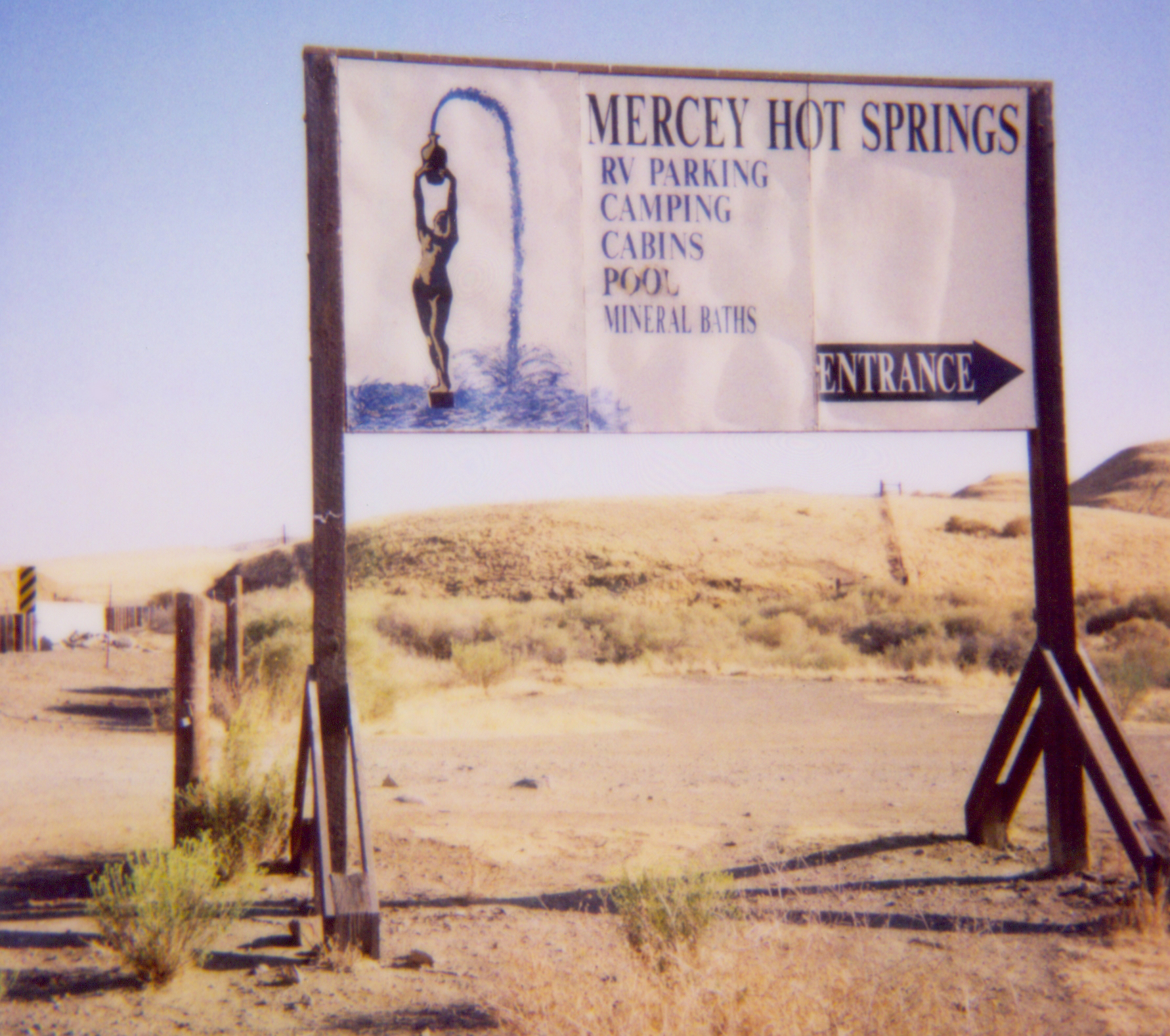
Coordinates: 36°42′15″N 120°51′37″W / 36.70417°N 120.86028°W Country United States State California County Fresno County Elevation[1] 1,161 ft (354 m) Mercey Hot Springs (formerly, Mercy Hot Springs) is an unincorporated community in Fresno County, California,[1] about 60 miles (97 km) west-southwest of Fresno.[2] It is a resort along Little Panoche Road (Fresno County Road J1) located at the western edge of Fresno County. The unincorporated area is about ten driving miles west of Interstate 5. NAD83 latitude and longitude for the site are listed as 36°42′15″N 120°51′37″W / 36.70417°N 120.86028°W in the National Geographic Names Database (NGND).[1] The NGND shows a feature ID number of 1659109. The facility is along the San Andreas Rift Zone. Located in the Panoche Valley, the facility includes a campground and natural hot springs. The ZIP Code is 93622, and the community is inside area code 559. It lies at an elevation of 1161 feet (354 m).[1]
Contents
History
The springs were discovered in 1848 and the resort opened after 1900.[2] The name is in honor of J.N. Mercy, an early stockman.[2]
Nearby
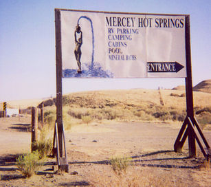
The Mercey Hot Springs Resort has served as an oasis of quiet and relaxation for hundreds of years -- first for Native Americans and later for all Californians since the 1800s. The Resort offers several options for enjoying the hot springs, including both clothed and clothing-optional choices. Lodging includes rustic cabins, tent camping, and RV spaces (no hook-ups; a dump station is available.) No amplified music is allowed in the Resort, and visiting motorcyclists should restrict their riding to entering and leaving the resort only. More information in avaialble at the Resort's website: https://merceyhotsprings.com. The campground also serves visitors to the nearby US Department of Interior, Bureau of Land Management, Panoche Hills Management Area. The Panoche Access Road, entrance to the Area, is just east of the resort. The BLM reservation is used, in part, by off-road driving enthusiasts.
About 7 miles (11 km) south, in San Benito County near the intersection of Panoche Road and Little Panoche Road, is the Panoche Inn. The bar is popular with motorcyclists on weekends in good weather. NAD27 latitude and longitude for the Inn are 36°36′25″N 120°53′07″W / 36.60694°N 120.88528°W.
Four miles northwest, the county lines for Merced County, San Benito County, and Fresno form a "T".
References
Sources
- National Geographic Names Database
- "Mercey Hot Springs, California," 7.5-minute quadrangle, US Geological Survey, 1981.
See also
External links
- Mercey Hot Springs Resort web page
- BLM web page for Panoche Hills.
- Nearby Little Panoche Reservoir.
- US Bureau of Reclamation Panoche Dam page.
Municipalities and communities of Fresno County, California County seat: Fresno Cities 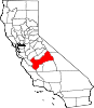
CDPs Auberry | Big Creek | Biola | Bowles | Calwa | Cantua Creek | Caruthers | Centerville | Del Rey | Easton | Fort Washington | Friant | Lanare | Laton | Malaga | Mayfair | Minkler | Monmouth | Old Fig Garden | Raisin City | Riverdale | Shaver Lake | Squaw Valley | Sunnyside | Tarpey Village | Three Rocks | Tranquillity | West Park
Unincorporated
communitiesAlder Springs | Arbios | Avocado | Balch Camp | Barstow | Benito | Big Bunch | Biola Junction | Bretz Mill | Broadview Farms | Burness | Burrel | Calflax | Camden | Cameo | Camp Sierra | Cecile | Cedar Crest | Cedar Grove | Cedarbrook | Cella | Chaney Ranch | Cincotta | Clint | Clotho | Conejo | Crabtree | Cromir | Deer Crossing | Dinkey Creek | Dora Belle | Dunlap | Edmiston | Elk | Elm View | Etheda Springs | Figarden | Five Points | Floyd | Giffen Cantua Ranch | Glorietta | Goldleaf | Goodmill | Gordon | Gravesboro | Helm | Herndon | Highway City | Hoffman Point | Hub | Hume | Hume Station | Humphreys Station | Huntington Lake | Ingle | Ivesta | Jamesan | Kanawyers | La Jolla Ranch | Lacjac | Lakeshore | Lerona | Levis | Locans | Lone Star | Marshall Junction | Mathews Mill | Mattei | Meadow Lakes | Mercey Hot Springs | Miley | Miramonte | Mono Hot Springs | Murietta Farm | Muscatel | Navelencia | New Auberry | Ockenden | Old Bretz Mill | Oleander | Ora | Oro Loma | Oxalis | Panoche Junction | Parkfield Junction | Piedra | Pilibos Ranch | Pinehurst | Pineridge | Prather | Pratton | Raco | Riverbend | Rock Haven | Rodgers Crossing | Rolinda | Sawmill Flat | Schilling | Shaver Lake Heights | Sierra Cedars | Sierra Sky Park | Snow Bend | Tarpey | Tollhouse | Trimmer | Turk | Uva | Vanguard | Wahtoke | Westhaven | Westside | Wildflower | Wineland | Wolf | Wood Ranch | Zediker
Indian
reservationsBig Sandy Rancheria | Cold Springs Rancheria | Table Mountain Rancheria
Ghost towns Andrews | Barton | Bender | Bridge | Bronge | Butler | Cadogan | Caldwell | Carlile | Carmelita | Coalinga Mineral Springs | Collins | Darwin | Dathol | Deseret | Dickerson | El Prado | Elkhorn Station | Eshel | Everts | Fargo | Fort Camp | Fresno Beach | Fresno City | Fruitvale | Garfield | Granz | Hawthorne's Station | Hayes | Kelso | Kingriver | Kingston | La Libertad | Last | Leroy | Letcher | Lillis | Marshall Station | McKenzie Spring | McMullin | Mendota Station | Millerton | Mountain Rest | Nares | Nevills | Oakhurst | Oleander | Peteras Mill | Pinedale | Pool's Ferry | Pool's Fort | Poso de Chane | Portal | Pueblo de las Juntas | Rancho de los Californios | Reka | Riverview | Robinson | Rogers | Rugg | Sanders | Sentinel | Sharpville | Shaver | Shipp | Smith's Ferry | Sparkville | Tarn | Temperance | Thermal | Tisechu | Vanris | Vino | Warsaw
Categories:- Fresno County, California geography stubs
- Populated places in Fresno County, California
- Hot springs of California
- Unincorporated communities in California


Wikimedia Foundation. 2010.