- Huron, California
Infobox Settlement
official_name = Huron, California
settlement_type =City
imagesize =
image_caption =
image_
imagesize =
image_caption =
image_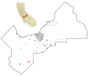
mapsize = 250x200px
map_caption = Location in Fresno County and the state ofCalifornia
mapsize1 =
map_caption1 =
subdivision_type = Country
subdivision_type1 = State
subdivision_type2 = County
subdivision_name =United States
subdivision_name1 =California
subdivision_name2 = Fresno
government_type =
leader_title = Mayor
leader_name =
leader_title1 = Senate
leader_name1 =Dean Florez (D)
leader_title2 = Assembly
leader_name2 =Nicole Parra (D)
leader_title3 = U. S. Congress
leader_name3 =Jim Costa (D)
established_date =
area_magnitude =
area_total_km2 = 3.5
area_total_sq_mi = 1.3
area_land_km2 = 3.5
area_land_sq_mi = 1.3
area_water_km2 = 0
area_water_sq_mi = 0
elevation_ft = 374
elevation_m = 114
population_as_of = 2000
population_footnotes =
population_total = 6306
population_metro =
population_density_km2 = 1801.7
population_density_sq_mi = 4850.8
timezone = PST
utc_offset = -8
latd = 36 |latm = 12 |lats = 11 |latNS = N
longd = 120 |longm = 5 |longs = 59 |longEW = W
timezone_DST = PDT
utc_offset_DST = -7
postal_code_type =ZIP code
postal_code = 93234
area_code = 559
blank_name = FIPS code
blank_info = 06-36084
blank1_name = GNIS feature ID
blank1_info = 1652725
footnotes =
website =Huron is a small town in Fresno County,
California , in theUnited States . As of the 2000 census, the city population was 6,306.Geography
According to the
United States Census Bureau , the city has a total area of 1.3square mile s (3.5km² ), all of it land.Demographics
As of the
census GR|2 of 2000, there were 6,306 people, 1,378 households, and 1,208 families residing in the city. Thepopulation density was 4,704.4 people per square mile (1,817.0/km²). There were 1,414 housing units at an average density of 1,054.9/sq mi (407.4/km²). The racial makeup of the city was 20.36% White, 0.32% Black or African American, 0.98% Native American, 0.40% Asian, 0.13% Pacific Islander, 74.77% from other races, and 3.04% from two or more races. 98.6% of the population were Hispanic or Latino of any race.The greatest percentage of farmland surrounding Huron is devoted to the production of lettuce, onions and tomatoes. During the harvest season, it is not uncommon for the population of the city to swell to over 15,000 people. The city has had 5 violent gang related homicides since 2003.
There were 1,378 households out of which 64.0% had children under the age of 18 living with them, 58.9% were married couples living together, 18.9% had a female householder with no husband present, and 12.3% were non-families. 7.4% of all households were made up of individuals and 3.6% had someone living alone who was 65 years of age or older. The average household size was 4.45 and the average family size was 4.44.
In the city the population was spread out with 39.1% under the age of 18, 13.8% from 18 to 24, 30.2% from 25 to 44, 12.7% from 45 to 64, and 4.2% who were 65 years of age or older. The median age was 24 years. For every 100 females there were 125.8 males. For every 100 females age 18 and over, there were 131.5 males.
The median income for a household in the city was $24,609, and the median income for a family was $23,939. Males had a median income of $21,656 versus $16,442 for females. The
per capita income for the city was $9,425. About 38.3% of families and 39.4% of the population were below thepoverty line , including 48.4% of those under age 18 and 10.7% of those age 65 or over.chools
The city of Huron is within the Coalinga-Huron Unified School District.The schools in Huron are Huron Elementry School(Grades K-5),Huron Middle School(Grades 6-8),Chestnut Continuation School.Coalinga High School is offered to those students who attend grades 9th through 12th.Also in the city there is a community pre-school and Fresno County EOC Headstart.
Huron Police Department
The city has its own police department, consisting of a police chief, two sergeants and 15 patrol officers.The police in huron also make kids choose to be in a gang and always point at them with tasers when the stop miners. One armed officer is assigned to code enforcement and animal control duties for the city. The Huron Police Department is very aggressive in the enforcement of law and order, averaging well over 100 arrests monthly. The city also has a dedicated traffic unit that provides radar traffic enforcement on State Routes 269 and 198. The official sidearm of the department is the .40 caliber Glock pistol and all officers are equipped with X-26 Tasers, Remington 870 shotguns and Colt AR-15 assault rifles. The police department also employs two K9 officers and serves as a substation for Coalinga area CHP units.
Notable Locations in Huron include Keenan Community Center,Huron City Hall and Huron Branch Coalinga-Huron Library.Parks in Huron include Huron Recreation Center,Chestnut Park and Keenan Park.Huron offers one bank which is the Westamerica Bank.
References
External links
Wikimedia Foundation. 2010.