- Mono Hot Springs, California
-
Coordinates: 37°19′36″N 119°01′03″W / 37.32667°N 119.0175°W
Mono Hot Springs — Unincorporated community — Location in California
 Mono Hot Springs
Coordinates: 37°19′36″N 119°01′03″W / 37.32667°N 119.0175°W Country United States State California County Fresno County Elevation[1] 6,562 ft (2,000 m) Mono Hot Springs (formerly Lower Hot Springs and Lower Mineral Hot Springs)[2] is an unincorporated community in Fresno County, California.[1] It lies at an elevation of 6562 feet (2000 m).[1] There are six separate hot springs here, the hottest is 112 °F (44.4 °C).[2]
The Mono Hot Springs post office was established in 1945.[2]
It is near the Lake Thomas Edison and Florence Lake reservoirs. It is reached From Huntington Lake by the Kaiser Pass road, which goes over 9000 feet elevation. There are cabins for rent there.
References
Websites
Municipalities and communities of Fresno County, California County seat: Fresno Cities 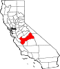
CDPs Auberry | Big Creek | Biola | Bowles | Calwa | Cantua Creek | Caruthers | Centerville | Del Rey | Easton | Fort Washington | Friant | Lanare | Laton | Malaga | Mayfair | Minkler | Monmouth | Old Fig Garden | Raisin City | Riverdale | Shaver Lake | Squaw Valley | Sunnyside | Tarpey Village | Three Rocks | Tranquillity | West Park
Unincorporated
communitiesAlder Springs | Arbios | Avocado | Balch Camp | Barstow | Benito | Big Bunch | Biola Junction | Bretz Mill | Broadview Farms | Burness | Burrel | Calflax | Camden | Cameo | Camp Sierra | Cecile | Cedar Crest | Cedar Grove | Cedarbrook | Cella | Chaney Ranch | Cincotta | Clint | Clotho | Conejo | Crabtree | Cromir | Deer Crossing | Dinkey Creek | Dora Belle | Dunlap | Edmiston | Elk | Elm View | Etheda Springs | Figarden | Five Points | Floyd | Giffen Cantua Ranch | Glorietta | Goldleaf | Goodmill | Gordon | Gravesboro | Helm | Herndon | Highway City | Hoffman Point | Hub | Hume | Hume Station | Humphreys Station | Huntington Lake | Ingle | Ivesta | Jamesan | Kanawyers | La Jolla Ranch | Lacjac | Lakeshore | Lerona | Levis | Locans | Lone Star | Marshall Junction | Mathews Mill | Mattei | Meadow Lakes | Mercey Hot Springs | Miley | Miramonte | Mono Hot Springs | Murietta Farm | Muscatel | Navelencia | New Auberry | Ockenden | Old Bretz Mill | Oleander | Ora | Oro Loma | Oxalis | Panoche Junction | Parkfield Junction | Piedra | Pilibos Ranch | Pinehurst | Pineridge | Prather | Pratton | Raco | Riverbend | Rock Haven | Rodgers Crossing | Rolinda | Sawmill Flat | Schilling | Shaver Lake Heights | Sierra Cedars | Sierra Sky Park | Snow Bend | Tarpey | Tollhouse | Trimmer | Turk | Uva | Vanguard | Wahtoke | Westhaven | Westside | Wildflower | Wineland | Wolf | Wood Ranch | Zediker
Indian
reservationsBig Sandy Rancheria | Cold Springs Rancheria | Table Mountain Rancheria
Ghost towns Andrews | Barton | Bender | Bridge | Bronge | Butler | Cadogan | Caldwell | Carlile | Carmelita | Coalinga Mineral Springs | Collins | Darwin | Dathol | Deseret | Dickerson | El Prado | Elkhorn Station | Eshel | Everts | Fargo | Fort Camp | Fresno Beach | Fresno City | Fruitvale | Garfield | Granz | Hawthorne's Station | Hayes | Kelso | Kingriver | Kingston | La Libertad | Last | Leroy | Letcher | Lillis | Marshall Station | McKenzie Spring | McMullin | Mendota Station | Millerton | Mountain Rest | Nares | Nevills | Oakhurst | Oleander | Peteras Mill | Pinedale | Pool's Ferry | Pool's Fort | Poso de Chane | Portal | Pueblo de las Juntas | Rancho de los Californios | Reka | Riverview | Robinson | Rogers | Rugg | Sanders | Sentinel | Sharpville | Shaver | Shipp | Smith's Ferry | Sparkville | Tarn | Temperance | Thermal | Tisechu | Vanris | Vino | Warsaw
Categories:- Populated places in Fresno County, California
- Unincorporated communities in California


Wikimedia Foundation. 2010.