- Big Creek, California
-
Big Creek — census-designated place — Location in California
 Big Creek
Coordinates: 37°12′18″N 119°14′45″W / 37.205°N 119.24583°WCoordinates: 37°12′18″N 119°14′45″W / 37.205°N 119.24583°W Country  United States
State  California
County Fresno County Area[1] – Total 0.460 sq mi (1.191 km2) – Land 0.460 sq mi (1.191 km2) – Water 0 sq mi (0 km2) 0% Elevation[2] 4,984 ft (1,519 m) Population (2010) – Total 175 – Density 380.6/sq mi (146.9/km2) Time zone Pacific (PST) (UTC-8) – Summer (DST) PDT (UTC-7) ZIP Code 93605 GNIS feature ID 1659696; 2628711 U.S. Geological Survey Geographic Names Information System: Big Creek, California; U.S. Geological Survey Geographic Names Information System: Big Creek, California Big Creek (Big Creek Flats in the 1870s; Manzanita Park in 1902; until 1926, Cascada)[3] is a small census-designated place[4] in Fresno County, California located in the Sierra Nevada Mountains on the north bank of Big Creek. It lies at an elevation of 4984 feet (1519 m).[2] Its population is 175. The ZIP Code is 93605, and the community is inside area code 559.
Contents
History
Big Creek was built at the site of the first dam and power plant of Southern California Edison's Big Creek hydroelectric project, one of the most extensive in the world. Other than the private helipad owned by Southern California Edison, the only way in or out of the town is Big Creek Road, off of State Route 168. The dam has a walkway across it to the south bank, but access is limited to employees of SCE and those residents who have been given a key. Its major industries are electric power generation and tourism. There is camping and water recreation in the summer and snow skiing in the winter. Huntington Lake is to the northeast and Shaver Lake is to the south. Sierra Summit is only about 15 kilometers (9.3 mi) away. Though Big Creek's only school is an elementary, it teaches kindergarten through 8th grade.
Those who reside in Big Creek have many interesting tales of the town and its surroundings. One legend claims that some of the giant steel penstock pipes which carry water from Huntington Lake to the hydroelectric plant, visible running down the mountainside, "are stamped with a swastika because the pipes were purchased from the Krupp Works in Nazi Germany before the United States entered World War II." This is a fallacy. The penstock pipes for the original two units at Big Creek Power Houses One and Two, built 1912-13, were purchased from the Krupp Works in Germany because at that time that manufacturer produced steel pipes of the tensile strength needed to contain the very high water pressures in the pipes in the 1500 foot drop down to Power House One. These pipes were purchased twenty one years before the Nazi Party came to power in Germany, and before the NSDAP party even existed. There is no visual evidence of swastikas (once used as a Hindu symbol of good luck) on any Big Creek penstock pipe. All post-World War One penstock pipes were manufactured in the United States.[5] In addition, Big Creek is the hometown of Carver Mead, a Caltech electrical engineering professor who is responsible for developing the first GaAs MESFET and for his pioneering contributions to VLSI design.
The first post office opened at Big Creek in 1912.[3]
Demographics
The 2010 United States Census[6] reported that Big Creek had a population of 175. The population density was 380.4 people per square mile (146.9/km²). The racial makeup of Big Creek was 158 (90.3%) White, 1 (0.6%) African American, 1 (0.6%) Native American, 5 (2.9%) Asian, 0 (0.0%) Pacific Islander, 3 (1.7%) from other races, and 7 (4.0%) from two or more races. Hispanic or Latino of any race were 27 persons (15.4%).
The Census reported that 175 people (100% of the population) lived in households, 0 (0%) lived in non-institutionalized group quarters, and 0 (0%) were institutionalized.
There were 63 households, out of which 26 (41.3%) had children under the age of 18 living in them, 43 (68.3%) were opposite-sex married couples living together, 1 (1.6%) had a female householder with no husband present, 3 (4.8%) had a male householder with no wife present. There were 4 (6.3%) unmarried opposite-sex partnerships, and 2 (3.2%) same-sex married couples or partnerships. 12 households (19.0%) were made up of individuals and 2 (3.2%) had someone living alone who was 65 years of age or older. The average household size was 2.78. There were 47 families (74.6% of all households); the average family size was 3.21.
The population was spread out with 60 people (34.3%) under the age of 18, 4 people (2.3%) aged 18 to 24, 37 people (21.1%) aged 25 to 44, 58 people (33.1%) aged 45 to 64, and 16 people (9.1%) who were 65 years of age or older. The median age was 37.6 years. For every 100 females there were 86.2 males. For every 100 females age 18 and over, there were 109.1 males.
There were 117 housing units at an average density of 254.3 per square mile (98.2/km²), of which 22 (34.9%) were owner-occupied, and 41 (65.1%) were occupied by renters. The homeowner vacancy rate was 0%; the rental vacancy rate was 31.1%. 47 people (26.9% of the population) lived in owner-occupied housing units and 128 people (73.1%) lived in rental housing units.
References
- ^ U.S. Census
- ^ a b U.S. Geological Survey Geographic Names Information System: Big Creek, California
- ^ a b Durham, David L. (1998). California's Geographic Names: A Gazetteer of Historic and Modern Names of the State. Quill Driver Books. p. 1002. ISBN 9781884995149.
- ^ U.S. Geological Survey Geographic Names Information System: Big Creek, California
- ^ From David H. Redinger, The Story of Big Creek, revised edition (Glendale: Trans-Anglo Books, 1986) ISBN 0-87046-070-6; William A. Myers, Iron Men and Copper Wires, A Centennial History of the Southern California Edison Company (Glendale: Trans-Anglo Books, 1983) ISBN 0-87046-068-4; also notes from interview with David H. Redinger, 1975.
- ^ All data are derived from the United States Census Bureau reports from the 2010 United States Census, and are accessible on-line here. The data on unmarried partnerships and same-sex married couples are from the Census report DEC_10_SF1_PCT15. All other housing and population data are from Census report DEC_10_DP_DPDP1. Both reports are viewable online or downloadable in a zip file containing a comma-delimited data file. The area data, from which densities are calculated, are available on-line here. Percentage totals may not add to 100% due to rounding. The Census Bureau defines families as a household containing one or more people related to the householder by birth, opposite-sex marriage, or adoption. People living in group quarters are tabulated by the Census Bureau as neither owners nor renters. For further details, see the text files accompanying the data files containing the Census reports mentioned above.
External links
See also
Municipalities and communities of Fresno County, California Cities 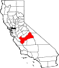
CDPs Auberry | Big Creek | Biola | Bowles | Calwa | Cantua Creek | Caruthers | Centerville | Del Rey | Easton | Fort Washington | Friant | Lanare | Laton | Malaga | Mayfair | Minkler | Monmouth | Old Fig Garden | Raisin City | Riverdale | Shaver Lake | Squaw Valley | Sunnyside | Tarpey Village | Three Rocks | Tranquillity | West Park
Unincorporated
communitiesAlder Springs | Arbios | Avocado | Balch Camp | Barstow | Benito | Big Bunch | Biola Junction | Bretz Mill | Broadview Farms | Burness | Burrel | Calflax | Camden | Cameo | Camp Sierra | Cecile | Cedar Crest | Cedar Grove | Cedarbrook | Cella | Chaney Ranch | Cincotta | Clint | Clotho | Conejo | Crabtree | Cromir | Deer Crossing | Dinkey Creek | Dora Belle | Dunlap | Edmiston | Elk | Elm View | Etheda Springs | Figarden | Five Points | Floyd | Giffen Cantua Ranch | Glorietta | Goldleaf | Goodmill | Gordon | Gravesboro | Helm | Herndon | Highway City | Hoffman Point | Hub | Hume | Hume Station | Humphreys Station | Huntington Lake | Ingle | Ivesta | Jamesan | Kanawyers | La Jolla Ranch | Lacjac | Lakeshore | Lerona | Levis | Locans | Lone Star | Marshall Junction | Mathews Mill | Mattei | Meadow Lakes | Mercey Hot Springs | Miley | Miramonte | Mono Hot Springs | Murietta Farm | Muscatel | Navelencia | New Auberry | Ockenden | Old Bretz Mill | Oleander | Ora | Oro Loma | Oxalis | Panoche Junction | Parkfield Junction | Piedra | Pilibos Ranch | Pinehurst | Pineridge | Prather | Pratton | Raco | Riverbend | Rock Haven | Rodgers Crossing | Rolinda | Sawmill Flat | Schilling | Shaver Lake Heights | Sierra Cedars | Sierra Sky Park | Snow Bend | Tarpey | Tollhouse | Trimmer | Turk | Uva | Vanguard | Wahtoke | Westhaven | Westside | Wildflower | Wineland | Wolf | Wood Ranch | Zediker
Indian
reservationsBig Sandy Rancheria | Cold Springs Rancheria | Table Mountain Rancheria
Ghost towns Andrews | Barton | Bender | Bridge | Bronge | Butler | Cadogan | Caldwell | Carlile | Carmelita | Coalinga Mineral Springs | Collins | Darwin | Dathol | Deseret | Dickerson | El Prado | Elkhorn Station | Eshel | Everts | Fargo | Fort Camp | Fresno Beach | Fresno City | Fruitvale | Garfield | Granz | Hawthorne's Station | Hayes | Kelso | Kingriver | Kingston | La Libertad | Last | Leroy | Letcher | Lillis | Marshall Station | McKenzie Spring | McMullin | Mendota Station | Millerton | Mountain Rest | Nares | Nevills | Oakhurst | Oleander | Peteras Mill | Pinedale | Pool's Ferry | Pool's Fort | Poso de Chane | Portal | Pueblo de las Juntas | Rancho de los Californios | Reka | Riverview | Robinson | Rogers | Rugg | Sanders | Sentinel | Sharpville | Shaver | Shipp | Smith's Ferry | Sparkville | Tarn | Temperance | Thermal | Tisechu | Vanris | Vino | Warsaw
Categories:- Unincorporated communities in California
- Census-designated places in Fresno County, California
- Populated places established in 1912


Wikimedia Foundation. 2010.