- Mayfair, Fresno County, California
-
Mayfair — census-designated place — Position in California.
 Mayfair
Coordinates: 36°46′09″N 119°45′41″W / 36.76917°N 119.76139°WCoordinates: 36°46′09″N 119°45′41″W / 36.76917°N 119.76139°W Country  United States
State  California
County Fresno Area[1] - Total 0.518 sq mi (1.341 km2) - Land 0.518 sq mi (1.341 km2) - Water 0 sq mi (0 km2) 0% Elevation[2] 315 ft (96 m) Population (2010) - Total 4,589 - Density 8,863.1/sq mi (3,422.1/km2) Time zone Pacific (PST) (UTC-8) - Summer (DST) PDT (UTC-7) ZIP Code GNIS feature ID 2583075 U.S. Geological Survey Geographic Names Information System: Mayfair, Fresno County, California Mayfair is a census-designated place in Fresno County, California. Mayfair sits at an elevation of 249 feet (76 m). The 2010 United States census reported Mayfair's population was 4,589.
Demographics
The 2010 United States Census[3] reported that Mayfair had a population of 4,589. The population density was 8,860.5 people per square mile (3,421.1/km²). The racial makeup of Mayfair was 2,030 (44.2%) White, 169 (3.7%) African American, 99 (2.2%) Native American, 310 (6.8%) Asian, 14 (0.3%) Pacific Islander, 1,738 (37.9%) from other races, and 229 (5.0%) from two or more races. Hispanic or Latino of any race were 3,010 persons (65.6%).
The Census reported that 4,581 people (99.8% of the population) lived in households, 8 (0.2%) lived in non-institutionalized group quarters, and 0 (0%) were institutionalized.
There were 1,397 households, out of which 680 (48.7%) had children under the age of 18 living in them, 602 (43.1%) were opposite-sex married couples living together, 315 (22.5%) had a female householder with no husband present, 137 (9.8%) had a male householder with no wife present. There were 137 (9.8%) unmarried opposite-sex partnerships, and 16 (1.1%) same-sex married couples or partnerships. 262 households (18.8%) were made up of individuals and 107 (7.7%) had someone living alone who was 65 years of age or older. The average household size was 3.28. There were 1,054 families (75.4% of all households); the average family size was 3.73.
The population was spread out with 1,464 people (31.9%) under the age of 18, 519 people (11.3%) aged 18 to 24, 1,239 people (27.0%) aged 25 to 44, 952 people (20.7%) aged 45 to 64, and 415 people (9.0%) who were 65 years of age or older. The median age was 29.7 years. For every 100 females there were 99.8 males. For every 100 females age 18 and over, there were 94.2 males.
There were 1,485 housing units at an average density of 2,867.3 per square mile (1,107.1/km²), of which 774 (55.4%) were owner-occupied, and 623 (44.6%) were occupied by renters. The homeowner vacancy rate was 1.8%; the rental vacancy rate was 5.3%. 2,473 people (53.9% of the population) lived in owner-occupied housing units and 2,108 people (45.9%) lived in rental housing units.
References
- ^ U.S. Census
- ^ 2583075 U.S. Geological Survey Geographic Names Information System: Mayfair, Fresno County, California
- ^ All data are derived from the United States Census Bureau reports from the 2010 United States Census, and are accessible on-line here. The data on unmarried partnerships and same-sex married couples are from the Census report DEC_10_SF1_PCT15. All other housing and population data are from Census report DEC_10_DP_DPDP1. Both reports are viewable online or downloadable in a zip file containing a comma-delimited data file. The area data, from which densities are calculated, are available on-line here. Percentage totals may not add to 100% due to rounding. The Census Bureau defines families as a household containing one or more people related to the householder by birth, opposite-sex marriage, or adoption. People living in group quarters are tabulated by the Census Bureau as neither owners nor renters. For further details, see the text files accompanying the data files containing the Census reports mentioned above.
Municipalities and communities of Fresno County, California County seat: Fresno Cities 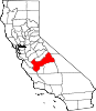
CDPs Auberry | Big Creek | Biola | Bowles | Calwa | Cantua Creek | Caruthers | Centerville | Del Rey | Easton | Fort Washington | Friant | Lanare | Laton | Malaga | Mayfair | Minkler | Monmouth | Old Fig Garden | Raisin City | Riverdale | Shaver Lake | Squaw Valley | Sunnyside | Tarpey Village | Three Rocks | Tranquillity | West Park
Unincorporated
communitiesAlder Springs | Arbios | Avocado | Balch Camp | Barstow | Benito | Big Bunch | Biola Junction | Bretz Mill | Broadview Farms | Burness | Burrel | Calflax | Camden | Cameo | Camp Sierra | Cecile | Cedar Crest | Cedar Grove | Cedarbrook | Cella | Chaney Ranch | Cincotta | Clint | Clotho | Conejo | Crabtree | Cromir | Deer Crossing | Dinkey Creek | Dora Belle | Dunlap | Edmiston | Elk | Elm View | Etheda Springs | Figarden | Five Points | Floyd | Giffen Cantua Ranch | Glorietta | Goldleaf | Goodmill | Gordon | Gravesboro | Helm | Herndon | Highway City | Hoffman Point | Hub | Hume | Hume Station | Humphreys Station | Huntington Lake | Ingle | Ivesta | Jamesan | Kanawyers | La Jolla Ranch | Lacjac | Lakeshore | Lerona | Levis | Locans | Lone Star | Marshall Junction | Mathews Mill | Mattei | Meadow Lakes | Mercey Hot Springs | Miley | Miramonte | Mono Hot Springs | Murietta Farm | Muscatel | Navelencia | New Auberry | Ockenden | Old Bretz Mill | Oleander | Ora | Oro Loma | Oxalis | Panoche Junction | Parkfield Junction | Piedra | Pilibos Ranch | Pinehurst | Pineridge | Prather | Pratton | Raco | Riverbend | Rock Haven | Rodgers Crossing | Rolinda | Sawmill Flat | Schilling | Shaver Lake Heights | Sierra Cedars | Sierra Sky Park | Snow Bend | Tarpey | Tollhouse | Trimmer | Turk | Uva | Vanguard | Wahtoke | Westhaven | Westside | Wildflower | Wineland | Wolf | Wood Ranch | Zediker
Indian
reservationsBig Sandy Rancheria | Cold Springs Rancheria | Table Mountain Rancheria
Ghost towns Andrews | Barton | Bender | Bridge | Bronge | Butler | Cadogan | Caldwell | Carlile | Carmelita | Coalinga Mineral Springs | Collins | Darwin | Dathol | Deseret | Dickerson | El Prado | Elkhorn Station | Eshel | Everts | Fargo | Fort Camp | Fresno Beach | Fresno City | Fruitvale | Garfield | Granz | Hawthorne's Station | Hayes | Kelso | Kingriver | Kingston | La Libertad | Last | Leroy | Letcher | Lillis | Marshall Station | McKenzie Spring | McMullin | Mendota Station | Millerton | Mountain Rest | Nares | Nevills | Oakhurst | Oleander | Peteras Mill | Pinedale | Pool's Ferry | Pool's Fort | Poso de Chane | Portal | Pueblo de las Juntas | Rancho de los Californios | Reka | Riverview | Robinson | Rogers | Rugg | Sanders | Sentinel | Sharpville | Shaver | Shipp | Smith's Ferry | Sparkville | Tarn | Temperance | Thermal | Tisechu | Vanris | Vino | Warsaw
Categories:- Census-designated places in Fresno County, California
- Populated places in California with Hispanic majority populations
- Fresno County, California geography stubs


Wikimedia Foundation. 2010.