- National Register of Historic Places listings in New Mexico
-


List of places in New Mexico on the National Register of Historic Places:
-
- This National Park Service list is complete through NPS recent listings posted November 10, 2011.[1]
This is a list of properties and districts in New Mexico that are on the National Register of Historic Places. There are 1,072 in total. Of these, 44 are National Historic Landmarks. There are listings in each of the state's 33 counties.
Numbers of listings by county
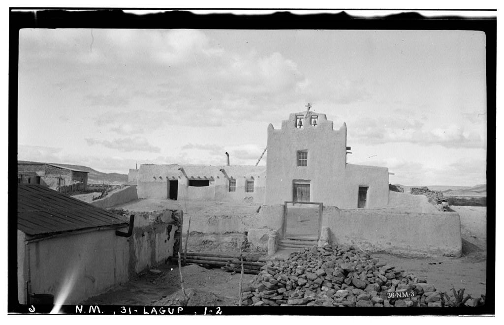
 Laguna Pueblo Valencia County
 Las Trampas Historic District Taos County
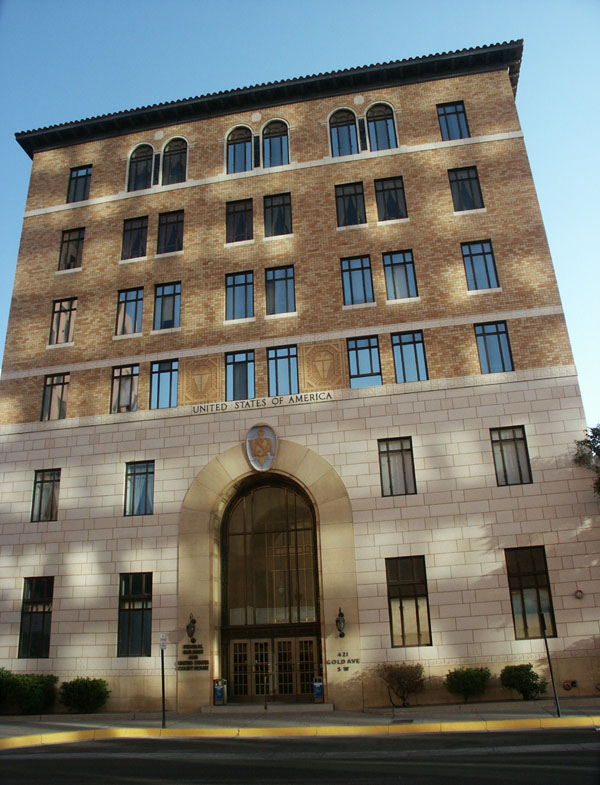
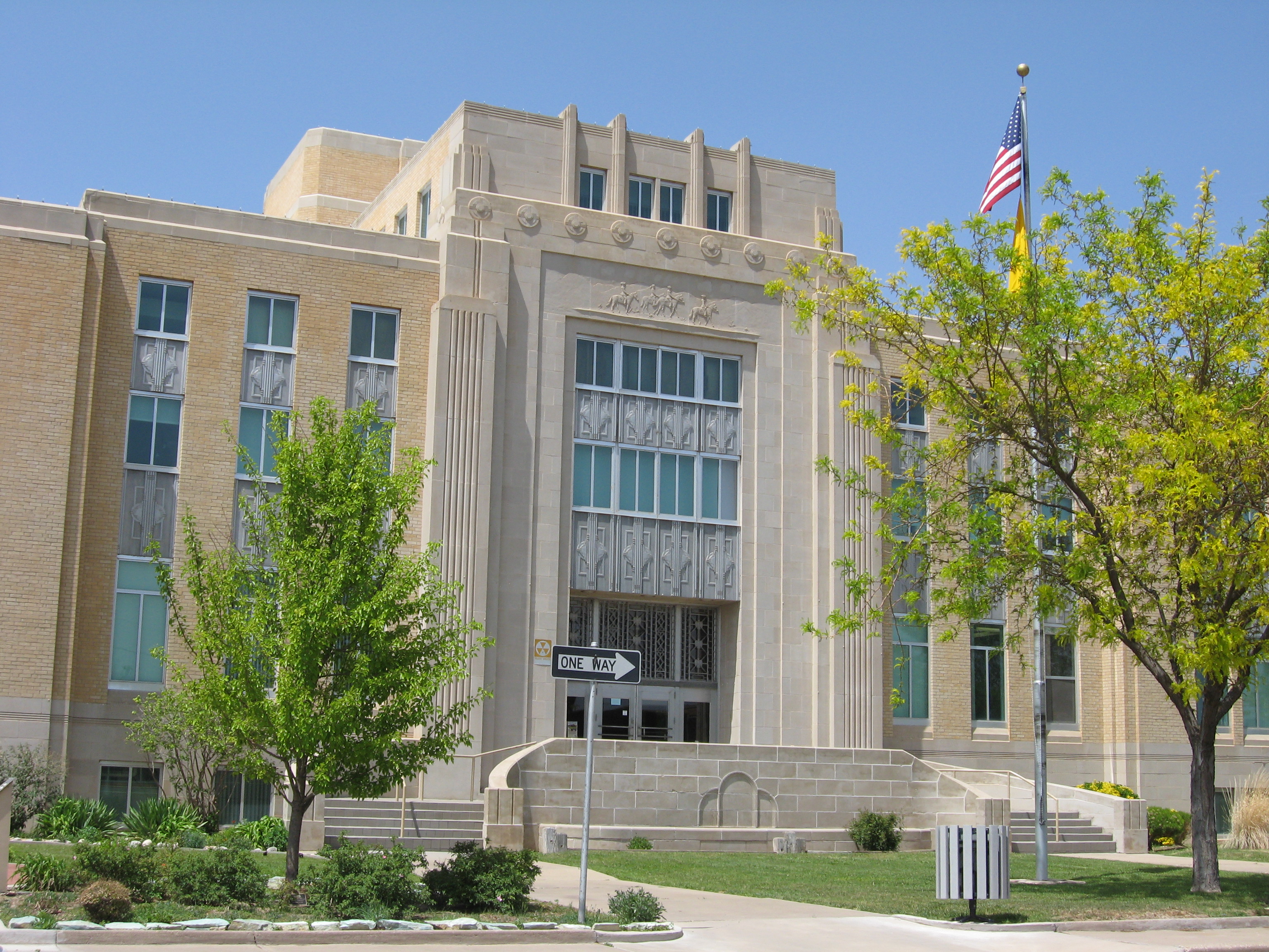
County # of Sites 1 Bernalillo 142 2 Catron 11 3 Chaves 18 4 Cibola 7 5 Colfax 26 6 Curry 10 7 De Baca 5 8 Doña Ana 26 9 Eddy 26 10 Grant 44 11 Guadalupe 9 12 Harding 2 13 Hidalgo 24 14 Lea 5 15 Lincoln 30 16 Los Alamos 11 17 Luna 7 18 McKinley 75 19 Mora 22 20 Otero 29 21 Quay 12 22 Rio Arriba 107 23 Roosevelt 6 24 San Juan 37 25 San Miguel 103 26 Sandoval 62 27 Santa Fe 66 28 Sierra 29 29 Socorro 49 30 Taos 41 31 Torrance 7 32 Union 10 33 Valencia 21 Duplicates 7[2] TOTAL 1,072  Federal Building and U.S. Courthouse (Albuquerque) Bernalillo County
Bernalillo County
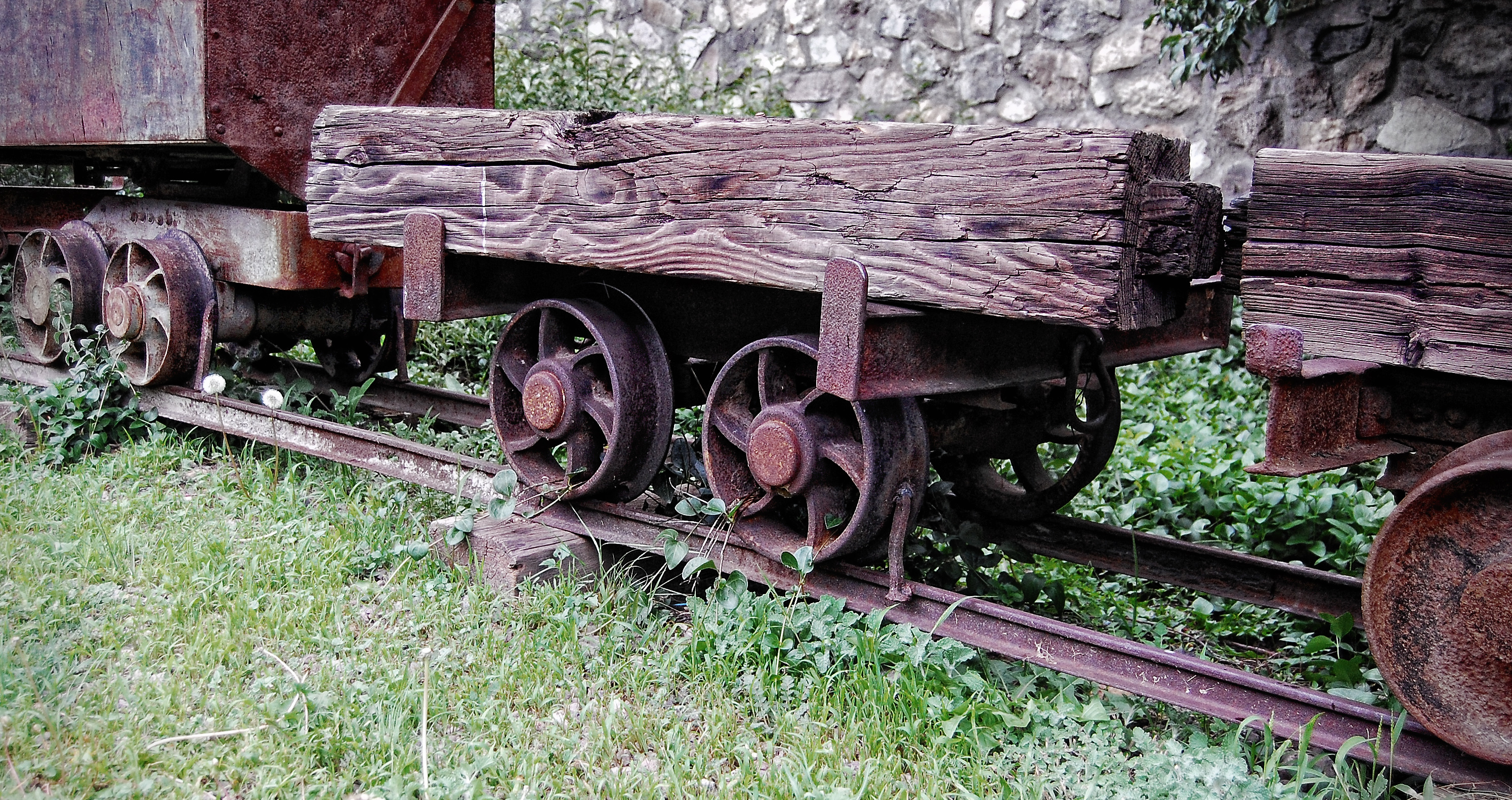
Catron County
Landmark name Image Date listed Location City or Town Summary 1 Ake Site April 2, 1976 Address Restricted Datil 2 Bat Cave April 23, 1976 Address Restricted Old Horse Springs 3 Bearwallow Mountain Lookout Cabins and Shed January 28, 1988 Bearwallow Lookout Rd. in the Gila National Forest
33°26′57″N 108°40′3″W / 33.44917°N 108.6675°WBearwallow Park 4 Black Mountain Lookout Cabin January 28, 1988 Gila National Forest
33°22′41″N 108°13′36″W / 33.37806°N 108.22667°WBlack Mountain 5 El Caso Lookout Complex January 28, 1988 Gila National Forest
34°6′11″N 108°29′39″W / 34.10306°N 108.49417°WEl Caso Lake 6 Gila Cliff Dwellings National Monument 
October 15, 1966 Off New Mexico Highway 15, north of Silver City Silver City 7 Mangas Mountain Lookout Complex January 28, 1988 Mangas Mountain
34°3′7″N 108°18′24″W / 34.05194°N 108.30667°WMangas 8 Mogollon Baldy Lookout Cabin January 28, 1988 Gila National Forest
33°16′17″N 108°35′38″W / 33.27139°N 108.59389°WMogollon Baldy 9 Mogollon Historic District 
September 10, 1987 State Road 78
33°23′45″N 108°47′37″W / 33.39583°N 108.79361°WMogollon 10 Mogollon Pueblo May 5, 1978 Address Restricted Red Hill 11 Socorro Mines Mining Company Mill, Fannie Hill 
September 10, 1987 Fannie Hill and west to Fannie Hill Mill
33°24′11″N 108°47′56″W / 33.40306°N 108.79889°WMogollon Chaves County
Cibola County
Landmark name Image Date listed Location City or Town Summary 1 Acoma Curio Shop October 7, 2009 1090 State Road 124
35°4′56.43″N 107°35′54.06″W / 35.0823417°N 107.59835°WSan Fidel 2 Bowlin's Old Crater Trading Post March 21, 2006 7650 Frontage Rd.
35°17′3″N 107°59′11″W / 35.28417°N 107.98639°WBluewater 3 Candelaria Pueblo March 10, 1983 Address Restricted Grants 4 Route 66 Rural Historic District: Laguna to McCartys 
January 13, 1994 State Road 124 between interchanges on Interstate 40
35°3′43″N 107°29′53″W / 35.06194°N 107.49806°WCubero 5 Route 66, State Maintained from McCartys to Grants November 19, 1997 Former U.S. Route 66 from east of McCartys to east of Grants
35°5′29″N 107°44′15″W / 35.09139°N 107.7375°WGrants 6 Route 66, State maintained from Milan to Continental Divide November 19, 1997 Along former U.S. Route 66 from west of Milan to the Continental Divide Continental Divide 7 Zuni-Cibola Complex December 2, 1974 Address Restricted Zuni Pueblo Extends into McKinley and Valencia counties Colfax County
Curry County
Landmark name Image Date listed Location City or Town Summary 1 1908 Clovis City Hall and Fire Station July 16, 1987 308 Pile St.
34°24′4″N 103°12′2″W / 34.40111°N 103.20056°WClovis 2 Clovis Baptist Hospital February 5, 1982 515 Prince St.
34°24′12″N 103°11′44″W / 34.40333°N 103.19556°WClovis 3 Clovis Central Fire Station July 2, 1987 320 Mitchell St.
34°24′5″N 103°12′23″W / 34.40139°N 103.20639°WClovis 4 Curry County Courthouse 
June 18, 1987 700 block of Main St.
34°24′19″N 103°12′19″W / 34.40528°N 103.20528°WClovis 5 First Methodist Church of Clovis July 2, 1987 622 Main St.
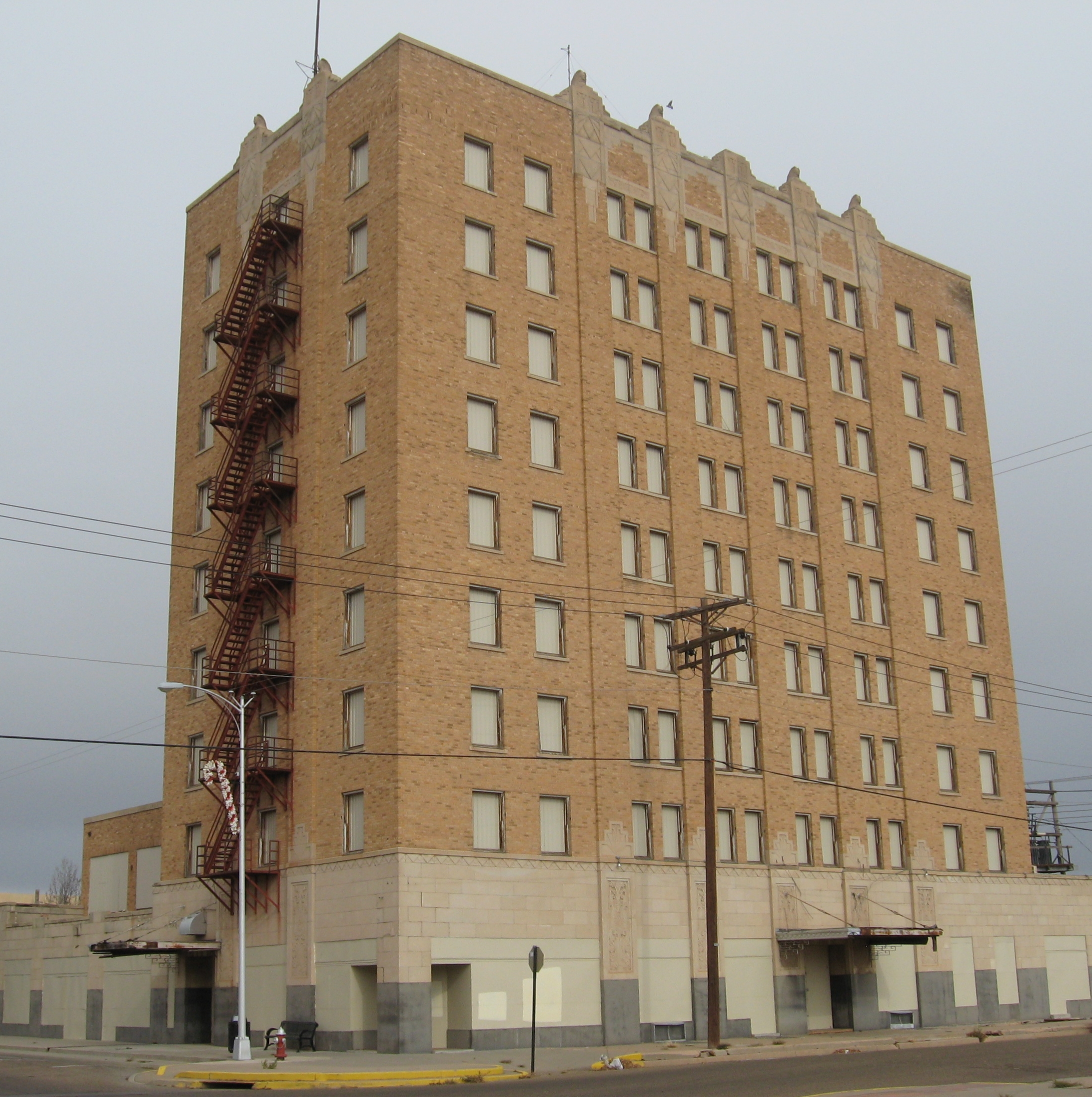
34°24′15″N 103°12′19″W / 34.40417°N 103.20528°WClovis 6 Hotel Clovis 
December 27, 1984 210 Main St.
34°24′0″N 103°12′53″W / 34.4°N 103.21472°WClovis 7 Lyceum Theater January 17, 2007 409 Main St.
34°24′14″N 103°12′19″W / 34.40389°N 103.20528°WClovis 8 Old Clovis Post Office December 27, 1984 4th and Mitchell Sts.
34°24′10″N 103°12′59″W / 34.40278°N 103.21639°WClovis 9 Santa Fe Passenger Depot-Clovis December 14, 1995 221 W. 1st St.
34°23′52″N 103°12′26″W / 34.39778°N 103.20722°WClovis 10 State Theater January 17, 2007 504 Main St.
34°24′18″N 103°12′20″W / 34.405°N 103.20556°WClovis De Baca County
Landmark name Image Date listed Location City or Town Summary 1 De Baca County Courthouse 
December 7, 1987 500 block of Ave. C
34°28′20″N 104°14′35″W / 34.47222°N 104.24306°WFort Sumner 2 Fort Sumner Cemetery Wall and Entry July 2, 2008 17th St. and Dunn Ave., 1 mile north of intersection of 17th and U.S. Route 60
34°28′39″N 104°13′43″W / 34.4775°N 104.22861°WFort Sumner 3 Fort Sumner Community House August 21, 2003 Junction of U.S. Route 84 and Baker Ave.
34°28′42″N 104°14′40″W / 34.47833°N 104.24444°WFort Sumner 4 Fort Sumner Railroad Bridge March 21, 1979 2 miles (3.2 km) west of Fort Sumner over the Pecos River
34°29′6″N 104°15′31″W / 34.485°N 104.25861°WFort Sumner 5 Fort Sumner Ruins August 13, 1974 Address Restricted Fort Sumner Doña Ana County
Eddy County
Grant County
Guadalupe County
Landmark name Image Date listed Location City or Town Summary 1 Abandoned Route 66-Cuervo to NM 156 November 22, 1993 Cuervo southwest to the junction with State Road 156
35°0′14″N 104°26′17″W / 35.00389°N 104.43806°WCuervo 2 Anton Chico de Abajo Historic District September 29, 1986 Address Restricted Anton Chico 3 Jesus M. Casaus House April 1, 1982 628 3rd St.
34°56′9″N 104°40′52″W / 34.93583°N 104.68111°WSanta Rosa 4 Colonias de San Jose Historic District September 29, 1986 Address Restricted Colonias 5 Alexander Grzelachowski House and Store June 24, 1993 Southwest of the junction of State Roads 91 and 203
34°49′49″N 104°37′25″W / 34.83028°N 104.62361°WPuerto de Luna 6 Guadalupe County Courthouse in Santa Rosa 
December 7, 1987 Northwestern corner of S. 4th St. and Parker Ave.
34°56′29″N 104°41′11″W / 34.94139°N 104.68639°WSanta Rosa 7 La Placita De Abajo District September 29, 1986 Address Restricted Colonias 8 Julius J. Moise House December 27, 1984 400 Capitan
34°56′20″N 104°41′0″W / 34.93889°N 104.683333°WSanta Rosa 9 Park Lake Historic District March 15, 1996 Junction of Will Rogers Dr. and Lake Dr.
34°56′28″N 104°40′40″W / 34.94111°N 104.67778°WSanta Rosa Harding County
Landmark name Image Date listed Location City or Town Summary 1 Bueyeros School March 15, 1996 State Road 102, 0.25 miles west of Bueyeros Church
35°58′49″N 103°41′12″W / 35.98028°N 103.68667°WBueyeros 2 Harding County Courthouse December 7, 1987 Pine St.
35°46′30″N 103°57′24″W / 35.775°N 103.95667°WMosquero Hidalgo County
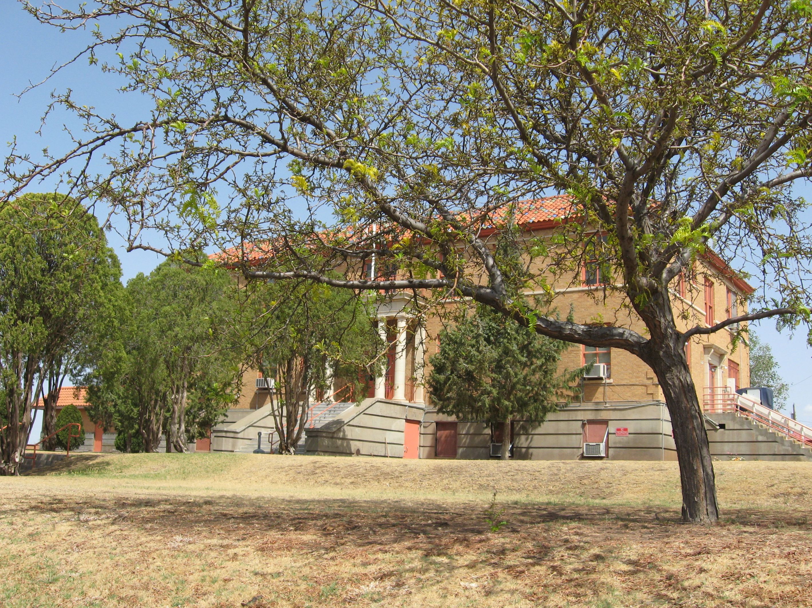
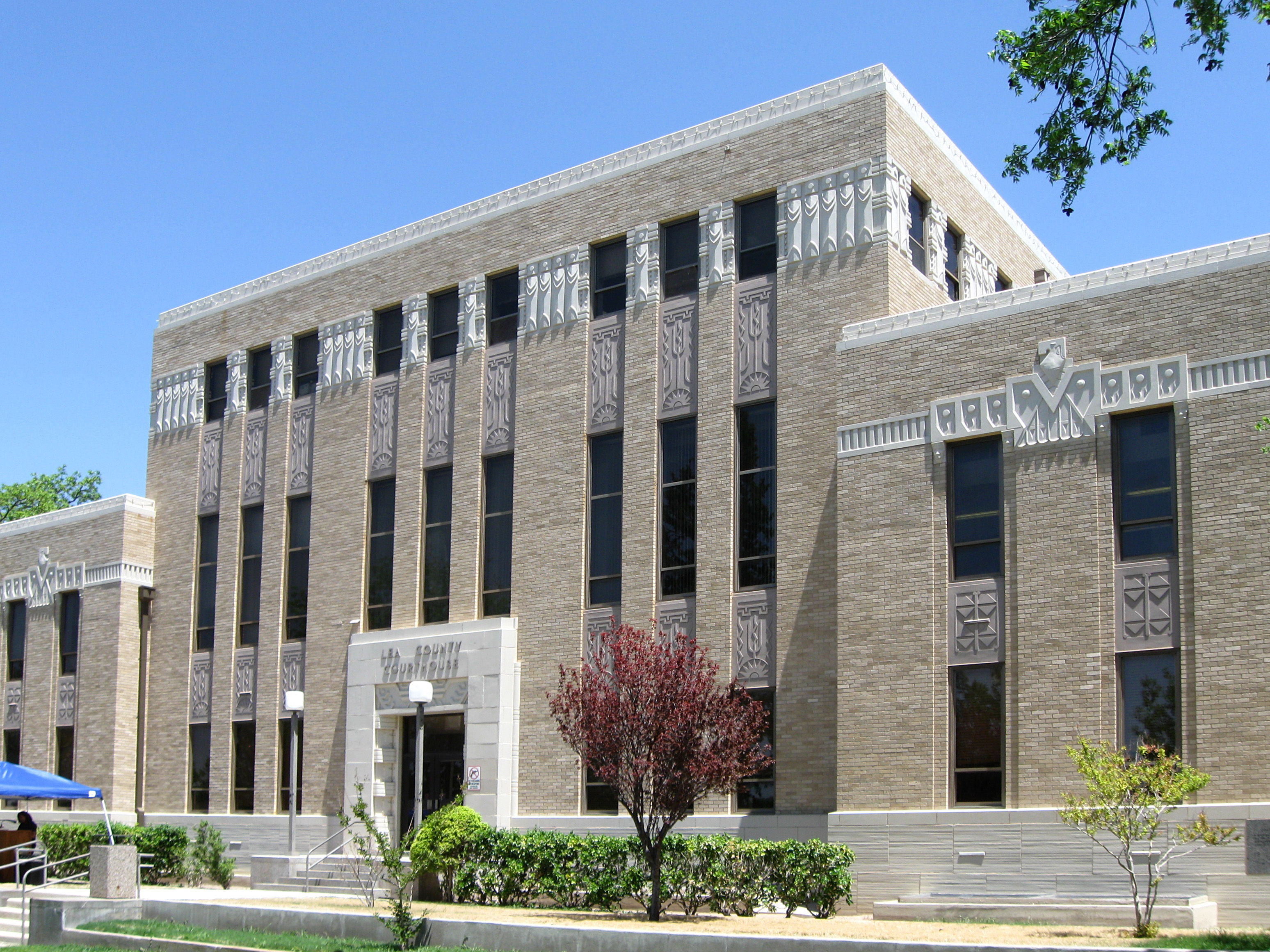
Lea County
Landmark name Image Date listed Location City or Town Summary 1 Laguna Plata Archeological District September 14, 1989 Address Restricted Hobbs 2 Lea County Courthouse 
December 7, 1987 100 block of Main St.
32°56′46″N 103°20′51″W / 32.94611°N 103.3475°WLovington 3 Lea Theater January 17, 2007 106 E. Central St.
32°56′59″N 103°20′54″W / 32.94972°N 103.34833°WLovington 4 Pyburn House December 13, 1995 203 4th St.
32°56′58″N 103°21′13″W / 32.94944°N 103.35361°WLovington 5 Mathew Elmore Sewalt House July 19, 2006 121 E. Jefferson Ave.
32°57′12″N 103°20′52″W / 32.95333°N 103.34778°WLovington Lincoln County
Los Alamos County
Landmark name Image Date listed Location City or Town Summary 1 Bandelier CCC Historic District 
May 28, 1987 Off State Road 4
35°46′50″N 106°16′3″W / 35.78056°N 106.2675°WBandelier National Monument Extends into Sandoval County 2 Bayo Road November 7, 2003 Approximately 420 feet northwest of the junction of Diamond Dr. and San Ildefonso Rd.
35°53′58″N 106°17′51″W / 35.89944°N 106.2975°WLos Alamos 3 Chupaderos Canyon Small Structural Site November 7, 1990 Address Restricted Espanola 4 Chupaderos Mesa Village November 7, 1990 Address Restricted Espanola 5 Grant Road January 14, 2004 Approximately 131 feet north of the northeastern corner of the junction of Diamond Dr. and San Ildefonso Rd.
35°53′57″N 106°17′54″W / 35.89917°N 106.29833°WLos Alamos 6 Guaja Water/Soil Control Site November 7, 1990 Address Restricted Espanola 7 Guaje Site December 7, 1982 Address Restricted Los Alamos 8 Los Alamos Scientific Laboratory 
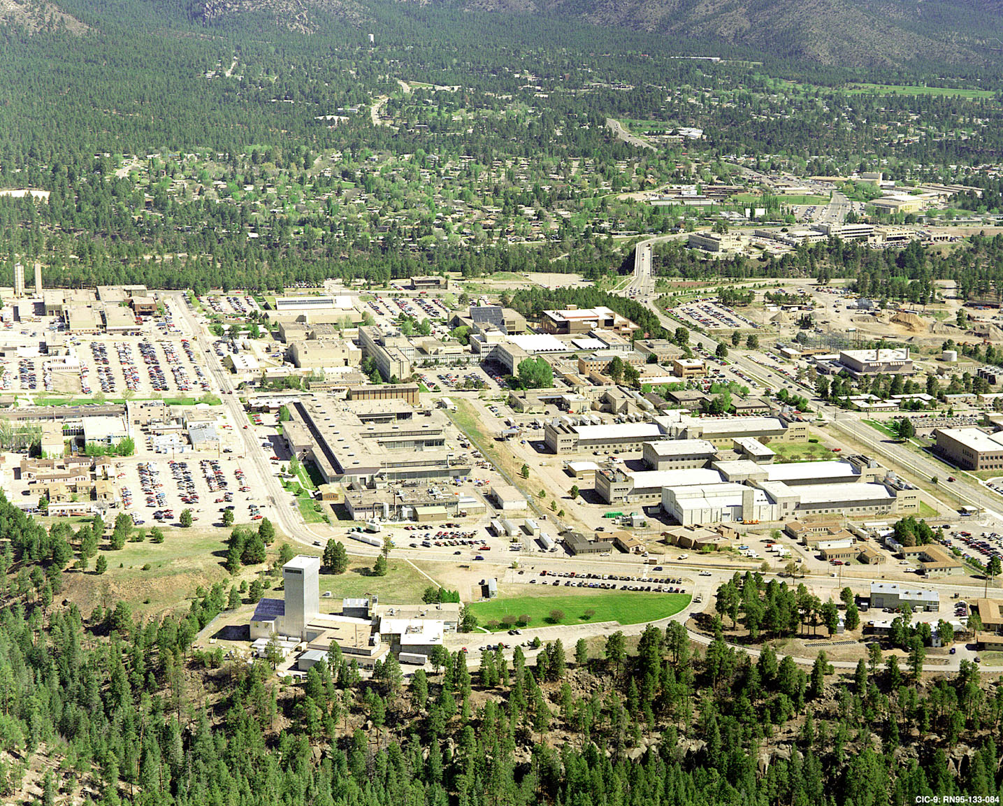
October 15, 1966 Central Ave.
35°52′54″N 106°17′54″W / 35.88167°N 106.29833°WLos Alamos 9 Lujan Road January 12, 2005 Northeast of the junction of Diamond Dr. and San Ildefonso Rd.
35°53′49″N 106°16′52″W / 35.89694°N 106.28111°WLos Alamos 10 Pajarito Springs Site 
December 6, 1982 Address Restricted White Rock 11 White Rock Canyon May 18, 1990 North of White Rock
35°49′39″N 106°12′14″W / 35.8275°N 106.20389°W[3]White Rock Luna County
Landmark name Image Date listed Location City or Town Summary 1 Deming Armory 
April 21, 1983 301 S. Silver Ave.
32°15′59″N 107°45′21″W / 32.26639°N 107.75583°WDeming Now the Deming Luna Mimbres Museum[4] 2 Seaman Field House February 20, 1990 304 Silver Ave.
32°15′57″N 107°45′29″W / 32.26583°N 107.75806°WDeming 3 Luna County Courthouse and Park 
October 5, 1977 700 S. Silver Ave.
32°17′21″N 107°45′24″W / 32.28917°N 107.75667°WDeming 4 Mahoney Building September 30, 1980 Gold and Spruce Sts.
32°16′20″N 107°32′46″W / 32.27222°N 107.54611°WDeming 5 Upton Site December 9, 1980 Address Restricted Deming 6 US Post Office-Deming Main February 23, 1990 201 W. Spruce St.
32°16′3″N 107°45′34″W / 32.2675°N 107.75944°WDeming 7 Village of Columbus and Camp Furlong 
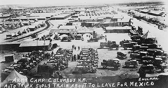
May 15, 1975 Portions of Columbus and Pancho Villa State Park
31°49′39″N 107°37′50″W / 31.8275°N 107.63056°WColumbus McKinley County
Mora County
Otero County
Quay County
Landmark name Image Date listed Location City or Town Summary 1 Blue Swallow Motel November 22, 1993 815 E. Tucumcari Boulevard
35°10′19″N 103°42′57″W / 35.17194°N 103.71583°WTucumcari 2 Cactus Motor Lodge March 21, 2006 1316 E. Tucumcari Boulevard
35°10′24″N 103°42′37″W / 35.17333°N 103.71028°WTucumcari 3 Glenrio Historic District 
January 17, 2007 State Road 1578
35°10′43″N 103°2′33″W / 35.17861°N 103.0425°WGlenrio Extends into Deaf Smith County, Texas 4 Arch Hurley Conservancy District Office Building 
December 16, 1994 101 E. High St.
35°10′34″N 103°43′32″W / 35.17611°N 103.72556°WTucumcari 5 Metropolitan Park Bathhouse and Pool Historic District March 15, 1996 South frontage road of Interstate 40, 1.5 miles west of the western exit for Tucumcari
35°8′43″N 103°48′1″W / 35.14528°N 103.80028°WTucumcari 6 Nara Visa School 
October 31, 1983 U.S. Route 54
35°36′51″N 103°5′53″W / 35.61417°N 103.09806°WNara Visa 7 Odeon Theater 
January 17, 2007 123 S. 2nd St.
35°10′48″N 103°43′37″W / 35.18°N 103.72694°WTucumcari 8 Richardson Store November 16, 1978 Off Interstate 40
35°5′43″N 104°3′53″W / 35.09528°N 104.06472°WMontoya 9 Route 66, Locally Maintained from Glenrio to San Jon March 24, 1994 Texas border west to San Jon
35°8′12″N 103°9′37″W / 35.13667°N 103.16028°WSan Jon 10 Route 66, State maintained from Montoya to Cuervo November 19, 1997 Along former U.S. Route 66 from west of Montoya to Cuervo
35°3′41″N 104°16′1″W / 35.06139°N 104.26694°WCuervo 11 Route 66, State maintained from Palomas to Montoya March 24, 1994 State frontage road from southeast of Palomas west to Montoya
35°6′43″N 103°58′5″W / 35.11194°N 103.96806°WMontoya 12 Route 66, State maintained from San Jon to Tucumari November 19, 1997 Former U.S. Route 66 from east of San Jon to east of the Interstate 40 exit at Tucumari
35°8′46″N 103°27′9″W / 35.14611°N 103.4525°WSan Jon Former listing
Landmark name Image Date delisted Location City or Town Summary 1 Baca-Goodman House 
January 1, 1977 Aber and 3rd Sts.
35°10′38″N 103°43′40″W / 35.17722°N 103.72778°WTucumcari Rio Arriba County
Roosevelt County
Landmark name Image Date listed Location City or Town Summary 1 Administration Building September 22, 1988 Southern side of University Pl. and campus green, Eastern New Mexico University
34°10′44″N 103°20′53″W / 34.17889°N 103.34806°WPortales 2 Anderson Basin October 15, 1966 Off U.S. Route 70 northeast of Portales
34°14′49″N 103°15′16″W / 34.24694°N 103.25444°W[5]Clovis 3 Bank of Portales December 27, 1984 123 Main
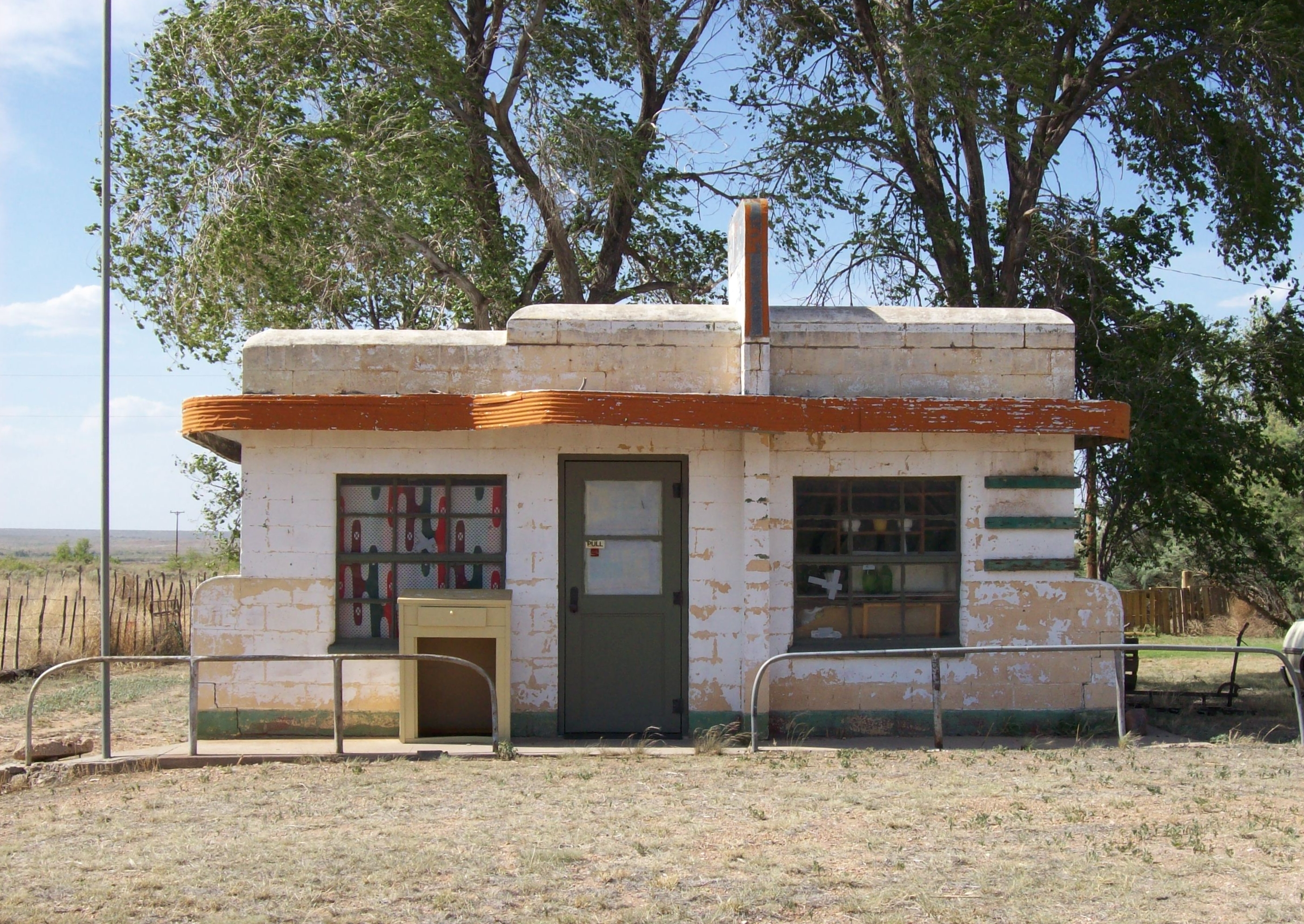
34°11′17″N 103°20′12″W / 34.18806°N 103.33667°WPortales 4 Midway Service Station January 12, 2005 38797 U.S. Route 70
33°50′31″N 103°46′19″W / 33.84194°N 103.77194°WKenna 5 Roosevelt County Courthouse 
December 3, 2008 100 W. 2nd St.
34°11′9.312″N 103°20′11.4″W / 34.18592°N 103.3365°WPortales 6 US Post Office-Portales Main February 23, 1990 116 W. 1st St.
34°11′10″N 103°20′15″W / 34.18611°N 103.3375°WPortales San Juan County
San Miguel County
Sandoval County
Santa Fe County
Sierra County
Socorro County
Taos County
Torrance County
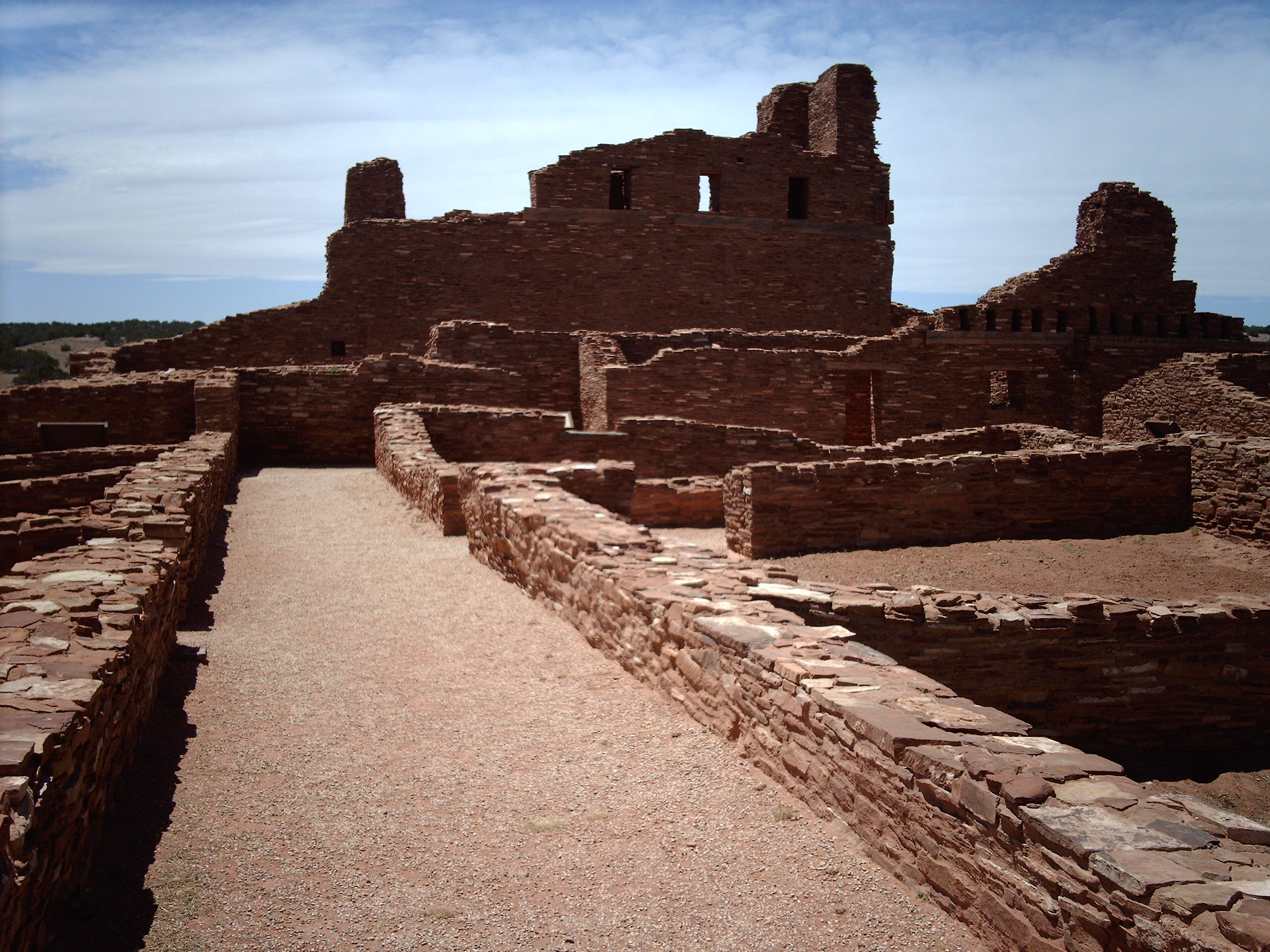
Landmark name Image Date listed Location City or Town Summary 1 Abo 
October 15, 1966 3 miles west of Abo on U.S. Route 60 Abo 2 Greene Evans Garage November 22, 1993 Northwestern corner of the junction of Broadway and former U.S. Route 66
35°0′19″N 106°3′0″W / 35.00528°N 106.05°WMoriarty 3 Moriarty Eclipse Windmill June 4, 1979 2 miles (3.2 km) west of Moriarty off State Road 222
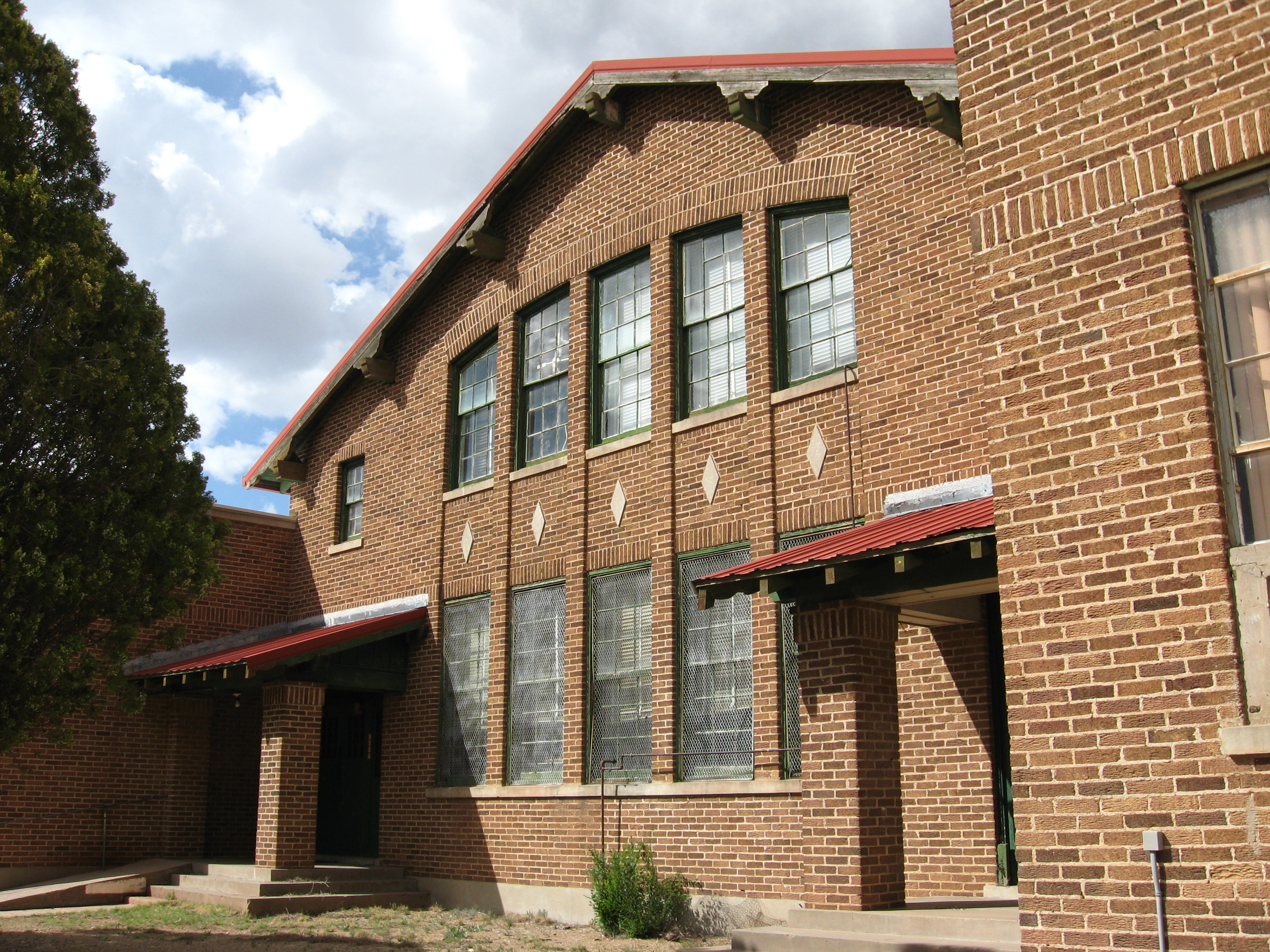
34°59′48″N 106°4′55″W / 34.99667°N 106.08194°WMoriarty 4 Mountainair Municipal Auditorium April 30, 1987 Southwestern corner of Roosevelt Ave. and Beal St.
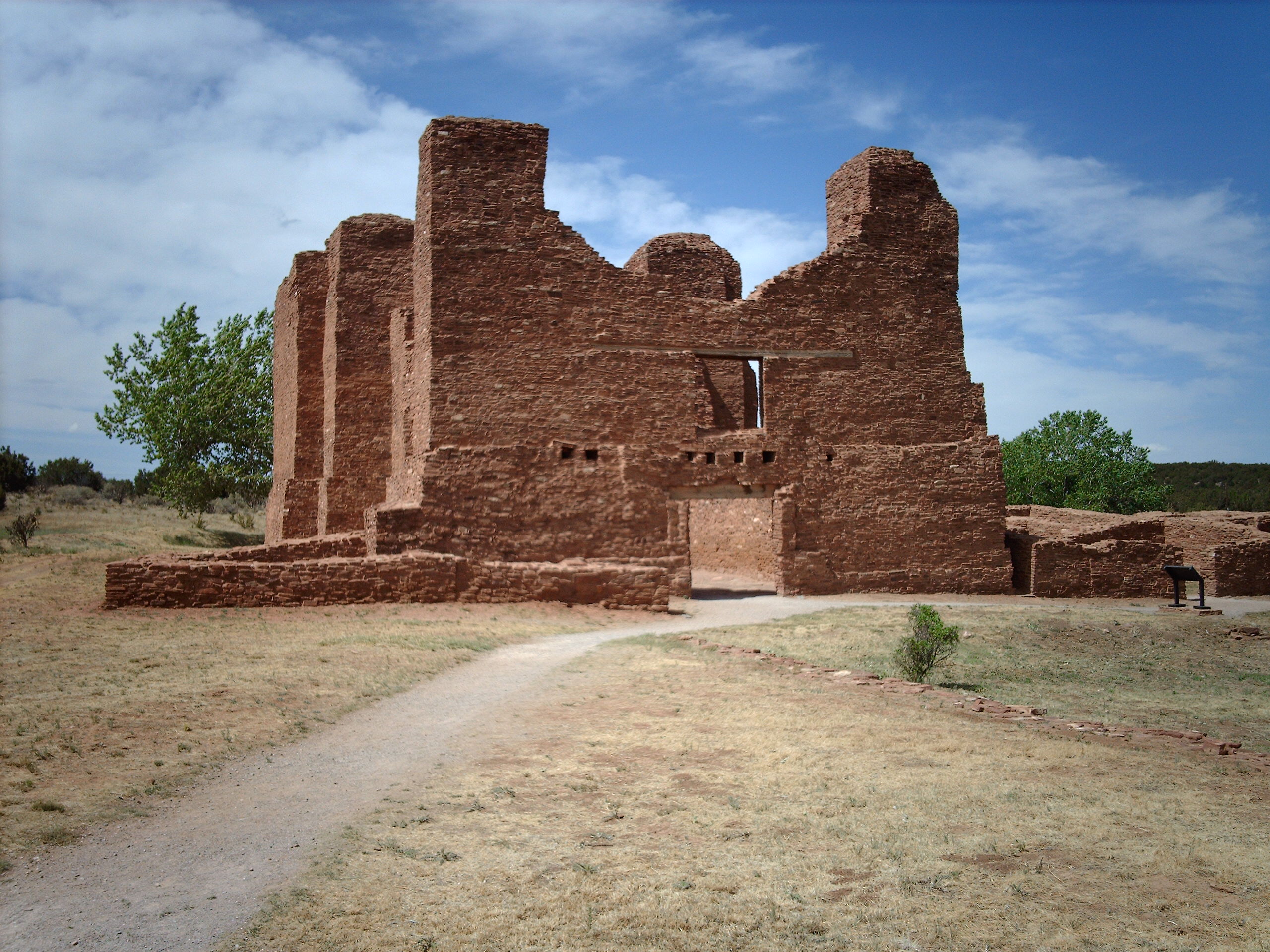
34°31′16″N 106°14′34″W / 34.52111°N 106.24278°WMountainair 5 Quarai 
October 15, 1966 1 mile south of Punta de Agua
34°35′45″N 106°17′42″W / 34.59583°N 106.295°WPunta de Agua 6 Rancho Bonito November 29, 1978 South of Mountainair on Gran Quivera Rd.
34°30′23″N 106°14′21″W / 34.50639°N 106.23917°WMountainair 7 Shaffer Hotel November 15, 1978 Broadway St.
34°31′8″N 106°14′31″W / 34.51889°N 106.24194°WMountainair Union County
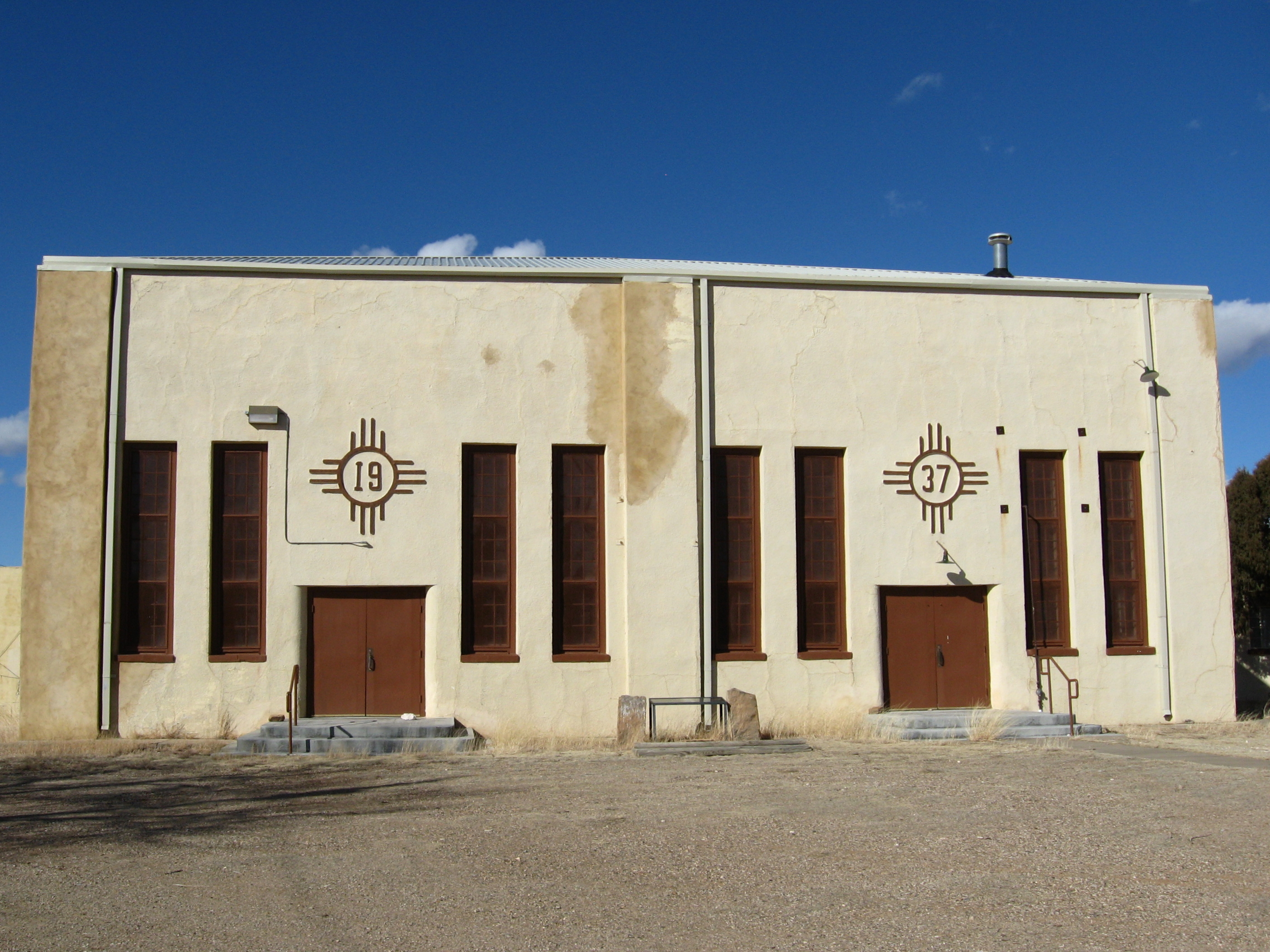
Landmark name Image Date listed Location City or Town Summary 1 Amistad Gymnasium 
March 15, 1996 0.5 miles east of State Road 402
35°55′12″N 103°9′13″W / 35.92°N 103.15361°WAmistad 2 Clayton Public Library December 20, 2002 116 Walnut St.
36°27′3″N 103°10′56″W / 36.45083°N 103.18222°WClayton 3 Clayton Public Schools Historic District March 15, 1996 Four blocks in southeastern Clayton centered on 6th and Cedar Sts.
36°26′59″N 103°10′33″W / 36.44972°N 103.17583°WClayton 4 Eklund Hotel January 17, 2002 15 Main St.
36°27′6″N 103°11′3″W / 36.45167°N 103.18417°WClayton 5 Folsom Hotel May 14, 1987 Southwestern corner of the junction of Grand Ave. and Wall St.
36°50′41″N 103°55′8″W / 36.84472°N 103.91889°WFolsom 6 Gate, Fence and Hollow Tree Shelter Designed by Dionicio Rodriguez November 25, 2008 320 Oak St.
36°27′.612″N 103°10′48.648″W / 36.45017°N 103.18018°WClayton 7 Goodson Memorial School January 8, 2003 State Road 456, approximately 4 miles west of its junction with State Road 406
36°55′7″N 103°5′28″W / 36.91861°N 103.09111°WSeneca 8 Luna Theater January 17, 2007 2-6 Main St.
36°27′11″N 103°11′7″W / 36.45306°N 103.18528°WClayton 9 Rabbit Ears October 15, 1966 Northwest of Clayton
36°35′32″N 103°13′28″W / 36.59222°N 103.22444°WClayton 10 Union County Courthouse 
December 7, 1987 Court St.
36°26′58″N 103°11′13″W / 36.44944°N 103.18694°WClayton Valencia County
See also
- List of National Historic Landmarks in New Mexico
- List of bridges on the National Register of Historic Places in New Mexico
References
- ^ "National Register of Historic Places: Weekly List Actions". National Park Service, United States Department of the Interior. Retrieved on November 10, 2011.
- ^ Bandelier CCC Historic District in Los Alamos and Sandoval counties, Crow Canyon Archaeological District in San Juan and Rio Arriba Counties, Puye Ruins in Rio Arriba and Sandoval counties, White Sands National Monument in Otero and Doña Ana counties, Zuni-Cibola Complex in Cibola, McKinley, and Valencia counties, and Posi-ouinge in Rio Arriba and Taos counties.
- ^ Location derived from its GNIS feature record; the NRIS lists it as "Address Restricted"
- ^ Welcome to the Deming Luna Mimbres Museum, Deming Luna Mimbres Museum, 2003. Accessed 2009-05-31.
- ^ Location and provided coordinates are those of the Blackwater Draw Site and Museum, according to its GNIS feature record; the NRIS lists the site as "Address Restricted"
U.S. National Register of Historic Places Topics Lists by states Alabama • Alaska • Arizona • Arkansas • California • Colorado • Connecticut • Delaware • Florida • Georgia • Hawaii • Idaho • Illinois • Indiana • Iowa • Kansas • Kentucky • Louisiana • Maine • Maryland • Massachusetts • Michigan • Minnesota • Mississippi • Missouri • Montana • Nebraska • Nevada • New Hampshire • New Jersey • New Mexico • New York • North Carolina • North Dakota • Ohio • Oklahoma • Oregon • Pennsylvania • Rhode Island • South Carolina • South Dakota • Tennessee • Texas • Utah • Vermont • Virginia • Washington • West Virginia • Wisconsin • WyomingLists by territories Lists by associated states Other  State of New Mexico
Topics Delegations · Geography · Government · History · Landmarks · Military · Natural history · New Mexicans · Settlements · Transportation · Tribes · Visitor attractions
Society Culture · Demographics · Economy · Education · Politics
Regions Cities Alamogordo · Albuquerque · Artesia · Carlsbad · Clovis · Corrales · Deming · Española · Farmington · Gallup · Grants · Hobbs · Las Cruces · Las Vegas · Los Alamos · Los Lunas · Lovington · Portales · Raton · Rio Rancho · Roswell · Ruidoso · Santa Fe · Silver City · Socorro · Sunland Park · Taos · Tucumcari
Counties Bernalillo · Catron · Chaves · Cibola · Colfax · Curry · De Baca · Doña Ana · Eddy · Grant · Guadalupe · Harding · Hidalgo · Lea · Lincoln · Los Alamos · Luna · McKinley · Mora · Otero · Quay · Rio Arriba · Roosevelt · Sandoval · San Juan · San Miguel · Santa Fe · Sierra · Socorro · Taos · Torrance · Union · Valencia
Categories:- National Register of Historic Places in New Mexico
- National Register of Historic Places lists by state
- New Mexico-related lists
-


Wikimedia Foundation. 2010.