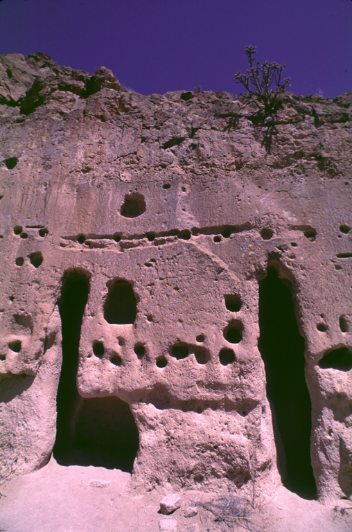
- Puye Cliff Dwellings
Infobox_nrhp | name =Puye Ruins
nrhp_type = nhl

caption = Puye Ruins of Santa Fe, New Mexico
nearest_city=Espanola, NM
area =
built =1250
architect=
architecture=
designated=May 23 ,1966
added =October 15 ,1966
governing_body = Private
refnum=66000481 cite web|url=http://www.nr.nps.gov/|title=National Register Information System|date=2007-01-23|work=National Register of Historic Places|publisher=National Park Service]The Puye Cliff Dwellings are the ruins of an abandoned
pueblo , located in Santa Clara Canyon on Santa Clara Pueblo land nearSanta Fe, New Mexico . The site was declared aNational Historic Landmark in 1966.The site was home to some 1500
pueblo Indians from about the 12th century until 1577 when drought finally forced the villagers to leave for locations nearer to theRio Grande . Oral tradition suggests that the present day inhabitants of Santa Clara Pueblo, some convert|10|mi|km to the east, are the descendants of Puye.The dwellings are remarkable for being carved out of a convert|200|ft|m|abbr=on high (60 m), cliff ridge formed from volcanic
tuff . The rock is relatively soft and can be excavated using wooden tools. Some 740 rooms are carved out of the cliff, although foundations show that additional houses constructed fromtalus blocks lined the base of the cliff. In fact it seem likely that many of these houses grew to be several stories high and the cave rooms were then just the back rooms of these homes.Along with the cave rooms, lines of post holes are carved into the cliff face. These would have supported roof beams for the block house and may also be anchor points for wood ladders and walkways used to reach the cliff houses. There are also about a dozen stairways, more like ladders of foot and hand holds, that lead to the top of the cliff. Many of the stairways lead up to the large 'Community House' which has been partly reconstructed on the top of the cliff.
The American Indians living in pueblo in northern
New Mexico traditionally speak theTewa language . The Tewa name 'Puye' can be translated as 'pueblo ruin where the rabbits assemble or meet'.In 2000, a planned burn of trees in
Bandelier National Monument burned out of control. The resultingwildfire , known as theCerro Grande Fire , eventually claimed convert|46925|acre|km2, some 250 houses in Los Alamos, and devastated Santa Clara Canyon. Puye Cliff Dwellings site is not currently open to the public. Current information can be obtained from Santa Clara Pueblo. [See [http://www.freenewmexican.com/news/43924.html Santa Fe New Mexican article about Santa Clara Canyon] (Accessed 29 May 2006).]ee also
*
Tsankawi
*Tsirege
*Mesa Verde National Park
*Montezuma Castle National Monument References
* [http://www.hanksville.org/voyage/misc/puye.html Notes on Puye] largely based on the pamphlet guide available to visitors of the site.
Notes
External links
* [http://www.100megspopup.com/photo4phood/swarch/puyeindex.html Map and short guide showing how to find Puye]
* [http://tps.cr.nps.gov/nhl/detail.cfm?ResourceId=341&ResourceType=Site Puye Ruins National Historic Landmarks Program]
Wikimedia Foundation. 2010.
