- National Register of Historic Places listings in Santa Fe County, New Mexico
-
 Location of Santa Fe County in New Mexico
This is a list of the National Register of Historic Places listings in Santa Fe County, New Mexico.
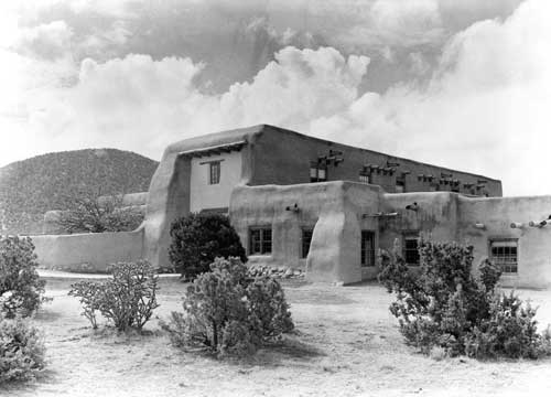
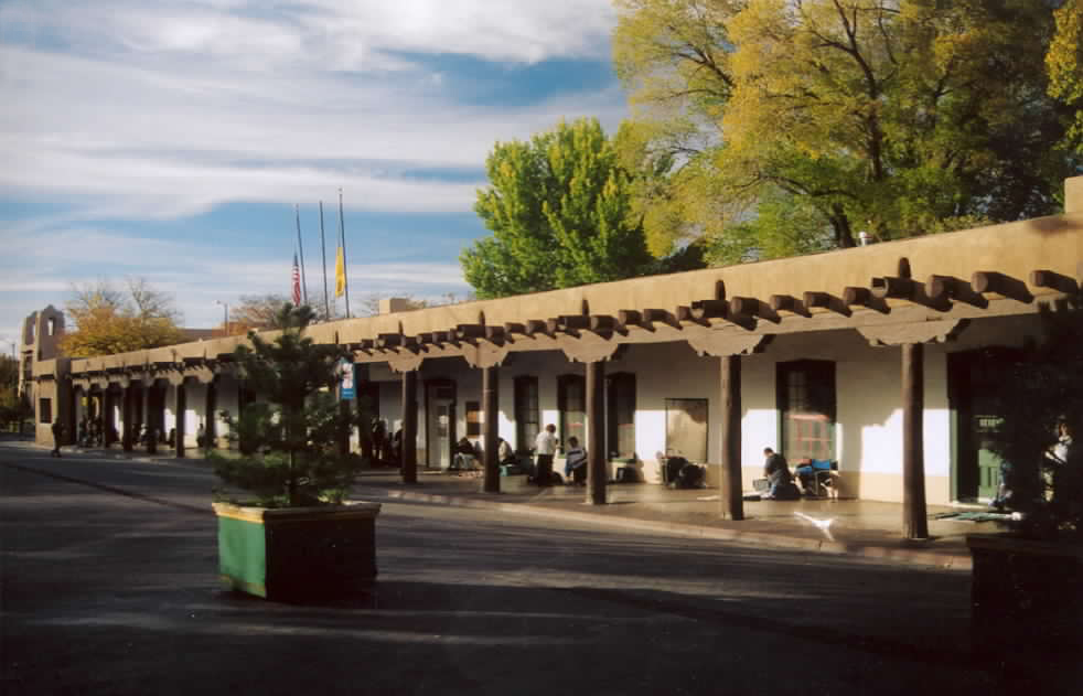
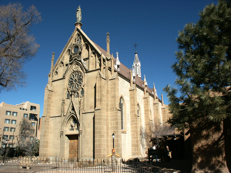
This is intended to be a complete list of the properties and districts on the National Register of Historic Places in Santa Fe County, New Mexico, United States. Latitude and longitude coordinates are provided for many National Register properties and districts; these locations may be seen together in a Google map.[1]
There are 66 properties and districts listed on the National Register in the county, including 7 National Historic Landmarks.
-
- This National Park Service list is complete through NPS recent listings posted November 10, 2011.[2]
Contents: Counties in New Mexico Bernalillo – Catron – Chaves – Cibola – Colfax – Curry – De Baca – Doña Ana – Eddy – Grant – Guadalupe – Harding – Hidalgo – Lea – Lincoln – Los Alamos – Luna – McKinley – Mora – Otero – Quay – Rio Arriba – Roosevelt – San Juan – San Miguel – Sandoval – Santa Fe – Sierra – Socorro – Taos – Torrance – Union – Valencia Current listings
[3] Landmark name [4] Image Date listed Location City or town Summary 1 Acequia System of El Rancho de las Golondrinas February 1, 1980 12 miles southeast of Santa Fe
35°34′28″N 106°06′33″W / 35.574444°N 106.109167°WSanta Fe 2 Ricardo Alarid House August 30, 1984 534 Alarid St.
35°40′56″N 105°57′07″W / 35.682222°N 105.951944°WSanta Fe 3 Allison Dormitory November 29, 1984 433 Paseo de Peralta
35°41′34″N 105°56′11″W / 35.692778°N 105.936389°WSanta Fe 4 Apache Canyon Railroad Bridge April 27, 1979 3 miles (4.8 km) northeast of Lamy over Galisteo Creek
35°30′49″N 105°51′17″W / 35.513611°N 105.854722°WLamy 5 Archbishop Lamy's Chapel 
August 19, 1988 Bishop's Lodge Rd.
35°43′50″N 105°54′32″W / 35.730556°N 105.908889°WSanta Fe 6 Arroyo Hondo Pueblo September 13, 2007 Address Restricted Santa Fe 7 Barrio de Analco Historic District 
November 24, 1968 Roughly bounded by E. De Vargas and College Sts.
35°41′00″N 105°56′11″W / 35.683333°N 105.936389°WSanta Fe Contributing buildings 8 Alfred M. Bergere House October 1, 1975 135 Grant Ave.
35°41′21″N 105°56′22″W / 35.689167°N 105.939444°WSanta Fe 9 Jean Bouquet Historic/Archeological District January 5, 1983 Address Restricted Pojoaque 10 Camino del Monte Sol Historic District 
July 11, 1988 Roughly bounded by Acequia Madre, Camino del Monte Sol, El Caminito, and Garcia St.
35°40′41″N 105°55′46″W / 35.678056°N 105.929444°WSanta Fe Contributing buildings 11 Connor Hall September 22, 1988 1060 Cerrillos Rd. at the New Mexico School for the Deaf
35°40′34″N 105°57′25″W / 35.676111°N 105.956944°WSanta Fe 12 Gregorio Crespin House 
May 29, 1975 132 E. De Vargas St.
35°41′02″N 105°56′19″W / 35.683889°N 105.938611°WSanta Fe 13 Randall Davey House July 9, 1970 Upper Canyon Rd. Santa Fe 14 Digneo-Valdes House November 21, 1978 1231 Paseo de Peralta
35°40′53″N 105°56′22″W / 35.681389°N 105.939444°WSanta Fe 15 Dodge-Bailey House May 8, 2007 3775 Old Santa Fe Trail
35°43′26″N 105°54′01″W / 35.723889°N 105.900278°WSanta Fe 16 Don Gaspar Bridge 
October 16, 2002 Don Gaspar Ave. crossing over the Santa Fe River between Alameda and E. De Vargas Sts.
35°41′06″N 105°56′22″W / 35.685°N 105.939444°WSanta Fe 17 Don Gaspar Historic District July 21, 1983 Roughly bounded by the Old Santa Fe Trail, Paseo de Peralta, Don Cubero and Houghton
35°40′42″N 105°56′28″W / 35.678333°N 105.941111°WSanta Fe 18 El Puente de Los Hidalgos July 25, 2001 Grant Ave. approximately 50 yards north of its junction with Paseo de Peralta
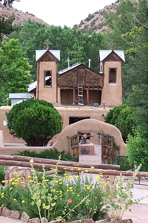
35°41′34″N 105°56′20″W / 35.692778°N 105.938889°WSanta Fe 19 El Santuario de Chimayo 
April 15, 1970 1 mile northwest of the Santa Cruz Reservoir Dam
35°59′23″N 105°55′38″W / 35.989722°N 105.927222°WChimayo 20 Fairview Cemetery January 20, 2005 1134 Cerrillos Rd.
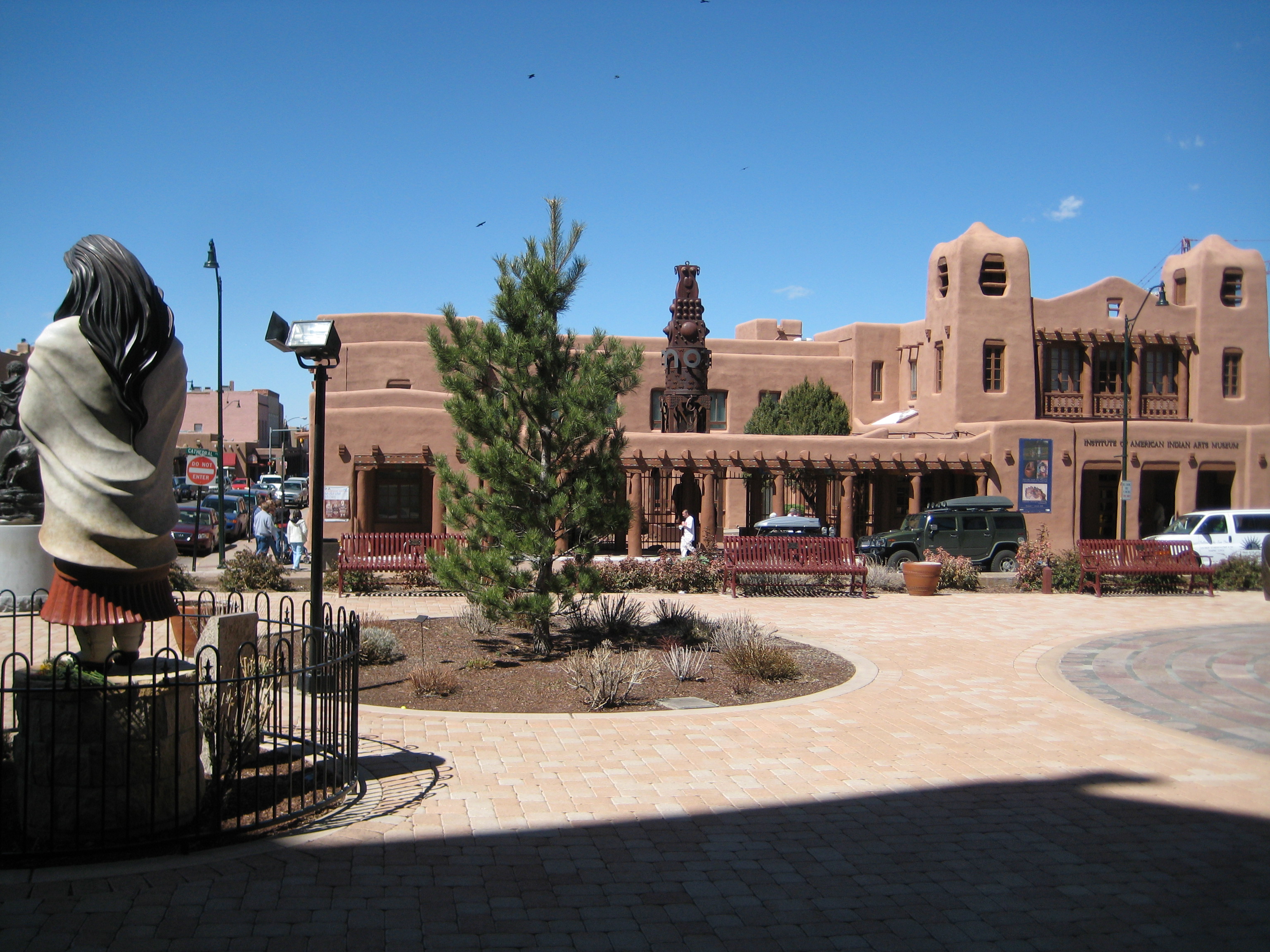
35°40′38″N 105°57′33″W / 35.677222°N 105.959167°WSanta Fe 21 Federal Building 
August 15, 1974 Cathedral Pl. at Palace St.
35°41′13″N 105°56′11″W / 35.686944°N 105.936389°WSanta Fe Now the Institute of American Indian Arts Museum 22 Fort Marcy Officer's Residence June 20, 1975 116 Lincoln Ave.
35°41′19″N 105°56′17″W / 35.688611°N 105.938056°WSanta Fe 23 Fort Marcy Ruins April 14, 1975 Off State Road 475
35°41′23″N 105°55′48″W / 35.689722°N 105.93°WSanta Fe 24 Hayt-Wientge House May 6, 1977 620 Paseo de la Cuma
35°41′39″N 105°56′21″W / 35.694167°N 105.939167°WSanta Fe 25 Hospital September 22, 1988 1060 Cerrillos Rd. at the New Mexico School for the Deaf
35°40′37″N 105°57′23″W / 35.676944°N 105.956389°WSanta Fe 26 J.B. Jackson House June 4, 1999 268 Los Pinos Rd.
35°34′54″N 106°06′12″W / 35.581667°N 106.103333°WSanta Fe 27 Everret Jones House January 15, 2004 210 Brownell Howland Rd.
35°43′26″N 105°54′01″W / 35.723889°N 105.900278°WSanta Fe 28 Daniel T. Kelly House October 19, 2005 531 E. Palace Ave.
35°41′14″N 105°55′44″W / 35.687222°N 105.928889°WSanta Fe 29 La Bajada Mesa Agricultural Site December 15, 1983 Address Restricted La Bajada 30 La Iglesia de Santa Cruz and Site of the Plaza of Santa Cruz de la Canada 
August 17, 1973 100 block of Santa Cruz Plaza
35°59′26″N 106°02′50″W / 35.990556°N 106.047222°WEspanola 31 Laboratory of Anthropology July 12, 1983 708 Camino Lejo
35°39′52″N 105°55′28″W / 35.664444°N 105.924444°WSanta Fe 32 Lujan-Ortiz House January 14, 2000 1 mile from State Road 502 on County Road 84
35°53′11″N 106°03′31″W / 35.886389°N 106.058611°WJaconita 33 Madrid Historic District 
November 9, 1977 25 miles southwest of Santa Fe on State Road 14
35°24′24″N 106°09′11″W / 35.406667°N 106.153056°WMadrid 34 National Park Service Southwest Regional Office 
October 6, 1970 Old Santa Fe Trail
35°40′01″N 105°55′21″W / 35.666944°N 105.9225°WSanta Fe 35 Navawi December 8, 1982 On a bluff above State Route 4, 1.8 miles north of the Rover Boulevard intersection
35°50′52″N 106°12′51″W / 35.84778°N 106.21417°W[5]White Rock 36 New Mexico Supreme Court Building 
January 18, 2002 237 Don Gaspar Ave.
35°41′04″N 105°56′21″W / 35.684444°N 105.939167°WSanta Fe 37 Nuestra Senora de Luz Church and Cemetery 
December 14, 1995 13 miles southeast of Santa Fe, north of an Interstate 25 frontage road
35°32′58″N 105°49′32″W / 35.549444°N 105.825556°WCanoncito 38 Otowi Historic District December 4, 1975 25 miles north of Santa Fe, on State Road 4 in the Rio Grande valley
35°52′31″N 106°08′31″W / 35.875278°N 106.141944°WSanta Fe 39 Otowi Suspension Bridge July 15, 1997 State Road 4 over the Rio Grande
35°52′29″N 106°08′29″W / 35.874722°N 106.141389°WSan Ildefonso Pueblo 40 Palace of the Governors 
October 15, 1966 Palace Avenue at Santa Fe Plaza
35°41′16″N 105°56′15″W / 35.687778°N 105.9375°WSanta Fe 41 Pflueger General Merchandise Store and Annex Saloon June 23, 1987 State Road 41
35°28′51″N 105°52′48″W / 35.480833°N 105.88°WLamy 42 Plaza del Cerro July 17, 1972 Southwest of the junction of State Roads 4 and 76
35°53′19″N 105°56′00″W / 35.888611°N 105.933333°WChimayo 43 Pueblo of Nambe January 21, 1974 About 16 miles off State Road 4
35°53′05″N 105°57′52″W / 35.884722°N 105.964444°WNambé Pueblo 44 Pueblo of Tesuque 
July 16, 1973 About 8 miles north of Santa Fe on the western bank of the Tesuque River
35°48′10″N 105°58′31″W / 35.802778°N 105.975278°WTesuque 45 Reredos of Our Lady of Light 
September 4, 1970 Christo Rey Church, Canyon Rd. and Cristo Rey St.
35°40′43″N 105°55′00″W / 35.678611°N 105.916667°WSanta Fe 46 Route 66 and National Old Trails Road Historic District at La Bajada June 30, 2005 Approximately 0.5 miles northeast of the northern terminus of State Road 16
35°33′31″N 106°13′35″W / 35.558611°N 106.226389°WLa Bajada 47 Ignacio Roybal House February 13, 1986 County Road 84 west of State Road 4 and U.S. Routes 84/285
35°53′27″N 106°02′28″W / 35.890833°N 106.041111°WJacona 48 San Ildefonso Pueblo 
June 20, 1974 Southwest of Espanola off State Road 4
35°53′29″N 106°07′05″W / 35.891389°N 106.118056°WSan Ildefonso Pueblo 49 San Lazaro October 15, 1966 Address Restricted Santa Fe 50 San Marcos Pueblo March 26, 1982 Address Restricted Capitan 51 Santa Fe Historic District 
July 23, 1973 Roughly bounded by Camino Cabra, Camino de las Animas, W. Manhattan Ave., S. St. Francis Dr., and Griffin St.
35°41′13″N 105°56′06″W / 35.686944°N 105.935°WSanta Fe 52 Santa Fe Plaza 
October 15, 1966 Santa Fe Plaza
35°41′14″N 105°56′15″W / 35.687222°N 105.9375°WSanta Fe 53 Santa Fe River Park Channel 
December 10, 2008 Santa Fe River Park Santa Fe 54 Albert Schmidt House and Studio July 25, 2003 1505 A and B Bishop's Lodge Rd.
35°45′21″N 105°55′25″W / 35.755833°N 105.923611°WTesuque 55 School Building Number 2 September 22, 1988 1060 Cerrillos Rd. at the New Mexico School for the Deaf
35°40′35″N 105°57′24″W / 35.676389°N 105.956667°WSanta Fe 56 Scottish Rite Cathedral 
March 13, 1987 463 Paseo de Peralta
35°41′30″N 105°56′09″W / 35.691667°N 105.935833°WSanta Fe 57 Second Ward School March 30, 1978 312 Sandoval St.
35°41′09″N 105°56′37″W / 35.685833°N 105.943611°WSanta Fe 58 Seton Village 
October 15, 1966 6 miles south of Santa Fe off U.S. Route 84
35°35′56″N 105°55′54″W / 35.598889°N 105.931667°WSanta Fe 59 Eugenie Shonnard House September 5, 1975 Address Restricted Santa Fe 60 Spiegelberg House May 25, 1973 237 E. Palace St.
35°41′13″N 105°56′00″W / 35.686944°N 105.933333°WSanta Fe 61 Superintendent's Residence September 22, 1988 1060 Cerrillos Rd. at the New Mexico School for the Deaf
35°40′37″N 105°57′17″W / 35.676944°N 105.954722°WSanta Fe 62 Pinckney R. Tully House November 5, 1974 136 Grant Ave.
35°41′26″N 105°56′24″W / 35.690556°N 105.94°WSanta Fe 63 U.S. Courthouse 
May 25, 1973 Federal Pl.
35°41′27″N 105°56′12″W / 35.690833°N 105.936667°WSanta Fe 64 Carlos Vierra House 
August 3, 1979 1002 Old Pecos Trail
35°40′28″N 105°56′12″W / 35.674444°N 105.936667°WSanta Fe 65 Donaciano Vigil House 
June 28, 1972 518 Alto St.
35°41′16″N 105°56′45″W / 35.687778°N 105.945833°WSanta Fe 66 Wheelwright Museum of the American Indian December 18, 1990 704 Camino Lejo
35°39′45″N 105°55′38″W / 35.6625°N 105.927222°WSanta Fe See also
- List of National Historic Landmarks in New Mexico
- National Register of Historic Places listings in New Mexico
References
- ^ The latitude and longitude information provided in this table was derived originally from the National Register Information System, which has been found to be fairly accurate for about 99% of listings. For about 1% of NRIS original coordinates, experience has shown that one or both coordinates are typos or otherwise extremely far off; some corrections may have been made. A more subtle problem causes many locations to be off by up to 150 yards, depending on location in the country: most NRIS coordinates were derived from tracing out latitude and longitudes off of USGS topographical quadrant maps created under the North American Datum of 1927, which differs from the current, highly accurate WGS84 GPS system used by Google maps. Chicago is about right, but NRIS longitudes in Washington are higher by about 4.5 seconds, and are lower by about 2.0 seconds in Maine. Latitudes differ by about 1.0 second in Florida. Some locations in this table may have been corrected to current GPS standards.
- ^ "National Register of Historic Places: Weekly List Actions". National Park Service, United States Department of the Interior. Retrieved on November 10, 2011.
- ^ Numbers represent an ordering by significant words. Various colorings, defined here, differentiate National Historic Landmark sites and National Register of Historic Places Districts from other NRHP buildings, structures, sites or objects.
- ^ "National Register Information System". National Register of Historic Places. National Park Service. . http://nrhp.focus.nps.gov/natreg/docs/All_Data.html.
- ^ Location derived from its GNIS feature record; the NRIS lists the site as "Address Restricted".
U.S. National Register of Historic Places Topics Lists by states Alabama • Alaska • Arizona • Arkansas • California • Colorado • Connecticut • Delaware • Florida • Georgia • Hawaii • Idaho • Illinois • Indiana • Iowa • Kansas • Kentucky • Louisiana • Maine • Maryland • Massachusetts • Michigan • Minnesota • Mississippi • Missouri • Montana • Nebraska • Nevada • New Hampshire • New Jersey • New Mexico • New York • North Carolina • North Dakota • Ohio • Oklahoma • Oregon • Pennsylvania • Rhode Island • South Carolina • South Dakota • Tennessee • Texas • Utah • Vermont • Virginia • Washington • West Virginia • Wisconsin • WyomingLists by territories Lists by associated states Other Municipalities and communities of Santa Fe County, New Mexico Cities 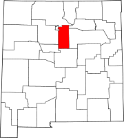
Town CDPs Agua Fria | Canada de los Alamos | Cedar Grove | Chimayo‡ | Chupadero | Cuartelez | Cundiyo | Cuyamungue | El Rancho | El Valle de Arroyo Seco | Eldorado at Santa Fe | Galisteo | Glorieta | Jaconita | La Cienega | La Puebla | Lamy | Los Cerrillos | Madrid | Pojoaque | Rio Chiquito | Rio en Medio | San Ildefonso Pueblo | Santa Cruz | Sombrillo | Tesuque
Unincorporated
communitiesNambé Pueblo | Seton Village | Stanley | Waldo
Indian reservation Footnotes ‡This populated place also has portions in an adjacent county or counties
Categories:- National Register of Historic Places in New Mexico by county
- Santa Fe County, New Mexico
- History of Santa Fe County, New Mexico
-


Wikimedia Foundation. 2010.