- Glorieta, New Mexico
Infobox Settlement
official_name = Glorieta, New Mexico
settlement_type = CDP
nickname =
motto =
imagesize =
image_caption =
image_
imagesize =
image_caption =
image_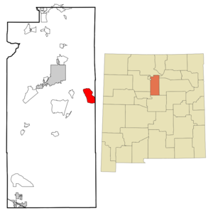
mapsize = 250px
map_caption = Location of Glorieta, New Mexico
mapsize1 =
map_caption1 =subdivision_type = Country
subdivision_name =United States
subdivision_type1 = State
subdivision_name1 =New Mexico
subdivision_type2 = County
subdivision_name2 = Santa Fe
government_footnotes =
government_type =
leader_title =
leader_name =
leader_title1 =
leader_name1 =
established_title =
established_date =unit_pref = Imperial
area_footnotes =area_magnitude =
area_total_km2 = 32.4
area_land_km2 = 32.4
area_water_km2 = 0.0
area_total_sq_mi = 12.5
area_land_sq_mi = 12.5
area_water_sq_mi = 0.0population_as_of = 2000
population_footnotes =
population_total = 859
population_density_km2 = 26.5
population_density_sq_mi = 68.7timezone = Mountain (MST)
utc_offset = -7
timezone_DST = MDT
utc_offset_DST = -6
elevation_footnotes =
elevation_m = 2265
elevation_ft = 7431
latd = 35 |latm = 34 |lats = 40 |latNS = N
longd = 105 |longm = 45 |longs = 35 |longEW = Wpostal_code_type =
ZIP code
postal_code = 87535
area_code = 505
blank_name = FIPS code
blank_info = 35-29860
blank1_name = GNIS feature ID
blank1_info = 0918193
website =
footnotes =Glorieta is a
census-designated place (CDP) in Santa Fe County,New Mexico ,United States . It is part of theSanta Fe, New Mexico Metropolitan Statistical Area . The population was 859 at the 2000 census. The community is located in the southernSangre de Cristo Mountains alongInterstate 25 on the east side ofGlorieta Pass .Geography
Glorieta is located at coor dms|35|34|40|N|105|45|35|W|city (35.577653, -105.759655)GR|1.
According to the
United States Census Bureau , the CDP has a total area of 12.5square mile s (32.4km² ), all of it land.Demographics
As of the
census GR|2 of 2000, there were 859 people, 315 households, and 223 families residing in the CDP. Thepopulation density was 68.7 people per square mile (26.5/km²). There were 339 housing units at an average density of 27.1/sq mi (10.5/km²). The racial makeup of the CDP was 78.11% White, 0.23% African American, 2.10% Native American, 0.23% Asian, 15.83% from other races, and 3.49% from two or more races. Hispanic or Latino of any race were 56.00% of the population.There were 315 households out of which 34.0% had children under the age of 18 living with them, 52.4% were married couples living together, 13.0% had a female householder with no husband present, and 29.2% were non-families. 19.7% of all households were made up of individuals and 2.2% had someone living alone who was 65 years of age or older. The average household size was 2.59 and the average family size was 3.00.
In the CDP the population was spread out with 25.7% under the age of 18, 5.6% from 18 to 24, 31.4% from 25 to 44, 28.3% from 45 to 64, and 9.0% who were 65 years of age or older. The median age was 38 years. For every 100 females there were 97.5 males. For every 100 females age 18 and over, there were 96.9 males.
The median income for a household in the CDP was $36,250, and the median income for a family was $46,429. Males had a median income of $34,432 versus $31,625 for females. The
per capita income for the CDP was $19,564. About 7.7% of families and 16.4% of the population were below thepoverty line , including 13.3% of those under age 18 and none of those age 65 or over.References
External links
Wikimedia Foundation. 2010.