- San Ildefonso Pueblo, New Mexico
Infobox Settlement
official_name = San Ildefonso Pueblo, New Mexico
settlement_type = CDP
nickname =
motto =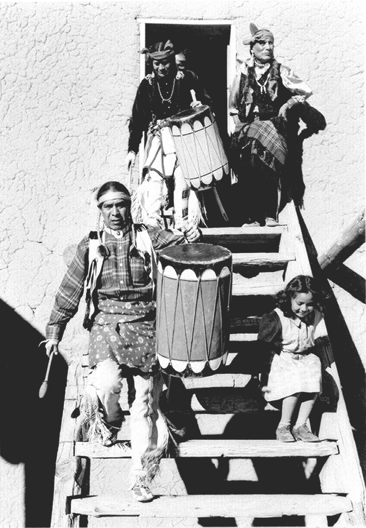
imagesize = 300px
image_caption = Dancers at San Ildefonso Pueblo, 1942.Ansel Adams , photographer
image_
image_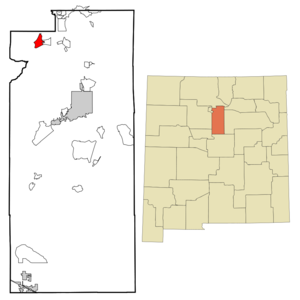
mapsize = 250px
map_caption = Location of San Ildefonso Pueblo, New Mexico
mapsize1 =
map_caption1 =subdivision_type = Country
subdivision_name =United States
subdivision_type1 = State
subdivision_name1 =New Mexico
subdivision_type2 = County
subdivision_name2 = Santa Fe
government_footnotes =
government_type =
leader_title =
leader_name =
leader_title1 =
leader_name1 =
established_title =
established_date =unit_pref = Imperial
area_footnotes =area_magnitude =
area_total_km2 = 10.8
area_land_km2 = 10.2
area_water_km2 = 0.6
area_total_sq_mi = 4.2
area_land_sq_mi = 3.9
area_water_sq_mi = 0.2population_as_of = 2000
population_footnotes =
population_total = 458
population_density_km2 = 45.1
population_density_sq_mi = 116.7timezone = Mountain (MST)
utc_offset = -7
timezone_DST = MDT
utc_offset_DST = -6
elevation_footnotes =
elevation_m = 1691
elevation_ft = 5548
latd = 35 |latm = 53 |lats = 52 |latNS = N
longd = 106 |longm = 7 |longs = 19 |longEW = Wpostal_code_type =
ZIP code
postal_code = 87501
area_code = 505
blank_name = FIPS code
blank_info = 35-68010
blank1_name = GNIS feature ID
blank1_info = 0933092
website =
footnotes =San Ildefonso Pueblo (Tewa: Pohwoge) is a
census-designated place (CDP) in Santa Fe County,New Mexico ,United States . It is part of theSanta Fe, New Mexico Metropolitan Statistical Area . The population was 458 at the 2000 census. San Ildefonso Pueblo is a member of theEight Northern Pueblos , and thepueblo people are from theTewa ethnic group of Native Americans, who speak theTewa language .Geography
San Ildefonso Pueblo is located at coor dms|35|53|52|N|106|7|19|W|city (35.897902, -106.121834)GR|1.
According to the
United States Census Bureau , the CDP has a total area of 4.2square mile s (10.7km² ), of which, 3.9 square miles (10.2 km²) of it is land and 0.2 square miles (0.6 km²) of it (5.54%) is water.runs through San Ildefonso Pueblo and the lowest elevation is approximately 1676 meters (5500 feet).
Demographics
As of the
census GR|2 of 2000, there were 458 people, 150 households, and 118 families residing in the CDP. Thepopulation density was 116.7 people per square mile (45.1/km²). There were 178 housing units at an average density of 45.4/sq mi (17.5/km²). The racial makeup of the CDP was 16.16% White, 79.48% Native American, 2.84% from other races, and 1.53% from two or more races. Hispanic or Latino of any race were 10.48% of the population.There were 150 households out of which 38.7% had children under the age of 18 living with them, 48.0% were married couples living together, 24.0% had a female householder with no husband present, and 20.7% were non-families. 15.3% of all households were made up of individuals and 6.7% had someone living alone who was 65 years of age or older. The average household size was 3.05 and the average family size was 3.43.
In the CDP the population was spread out with 31.4% under the age of 18, 10.0% from 18 to 24, 26.4% from 25 to 44, 22.5% from 45 to 64, and 9.6% who were 65 years of age or older. The median age was 32 years. For every 100 females there were 90.8 males. For every 100 females age 18 and over, there were 98.7 males.
The median income for a household in the CDP was $30,000, and the median income for a family was $30,972. Males had a median income of $19,792 versus $19,250 for females. The
per capita income for the CDP was $11,039. About 19.1% of families and 14.9% of the population were below thepoverty line , including none of those under age 18 and 50.0% of those age 65 or over.History
The pueblo (Spanish for town) was founded when people came from the
Mesa Verde complex in SouthernColorado . These people had first moved to Bandelier just south of present-day Los Alamos. There these people thrived due to the rainfall (elevation about 7000 feet) and the ease of constructing living structures from the surrounding soft volcanic rock. But after a prolonged drought, the people moved down into the valleys of the Rio Grande around 1300 AD. The Rio Grande and otherarroyo s provided the water for irrigation.The Spanish
conquistador s tried to subdue the native people and force their religion on the native people during the early 1600’s, which lead to thePueblo Revolt of1680 . The people withstood the Spaniards by climbing to the top of the Black Mesa. The siege ended with the surrender of the native people, but the Spanish gave the native people some freedom of religion and other self-governing rights.The pueblo natives continued to lead an agricultural based economy until the early 1900’s when
Maria Martinez and her husbandJulian Martinez rediscovered how to make the Black-on Black pottery for which San Ildefonso Pueblo would soon become famous. From that time the pueblo has become more tourist-oriented, with numerous tourist shops existing in the Pueblo. Because of close proximity to the state capital, Santa Fe, and the presence of theLos Alamos National Laboratory , many of those employed in the pueblo have government jobs.ee also
*
Maria Martinez
*Tsankawi cliff dwellings
*Tsirege archaeological site
*Santa Clara Pueblo, New Mexico
*New Mexico locations by per capita income References
External links
* [http://www.indianpueblo.org Indian Pueblo Cultural Center]
* [http://www.newmexico.org/native_america/pueblos/san_ildefonso.php New Mexico Tourism | San Ildefonso Pueblo]
* [http://www.nps.gov/history/nr/travel/amsw/ American Southwest, a National Park Service "Discover Our Shared Heritage" Travel Itinerary]
* [http://www.mariajulianpottery.com/ Maria and Julian Martinez and San Ildefonso History]
Wikimedia Foundation. 2010.