- National Register of Historic Places listings in Sandoval County, New Mexico
-
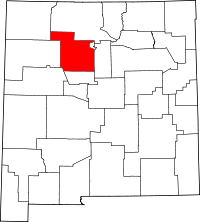 Location of Sandoval County in New Mexico
This is a list of the National Register of Historic Places listings in Sandoval County, New Mexico.
This is intended to be a complete list of the properties and districts on the National Register of Historic Places in Sandoval County, New Mexico, United States. Latitude and longitude coordinates are provided for many National Register properties and districts; these locations may be seen together in a Google map.[1]
There are 62 properties and districts listed on the National Register in the county, including 4 National Historic Landmarks.
-
- This National Park Service list is complete through NPS recent listings posted November 10, 2011.[2]
Contents: Counties in New Mexico Bernalillo – Catron – Chaves – Cibola – Colfax – Curry – De Baca – Doña Ana – Eddy – Grant – Guadalupe – Harding – Hidalgo – Lea – Lincoln – Los Alamos – Luna – McKinley – Mora – Otero – Quay – Rio Arriba – Roosevelt – San Juan – San Miguel – Sandoval – Santa Fe – Sierra – Socorro – Taos – Torrance – Union – Valencia Current listings
[3] Landmark name [4] Image Date listed Location City or town Summary 1 Abenicio Salazar Historic District June 6, 1980 U.S. Route 85
35°18′50″N 106°32′44″W / 35.313889°N 106.545556°WBernalillo 2 Amoxiumqua Site (FS-530, LA481) May 21, 1984 Address Restricted Jemez Springs 3 Archeological Site FS-18, LA-5920 May 21, 1984 Address Restricted Jemez Springs 4 Archeological Site FS-199, LA-135 May 21, 1984 Address Restricted Jemez Springs 5 Archeological Site FS-3 May 21, 1984 Address Restricted Jemez Springs 6 Archeological Site FS-535, LA-385 May 21, 1984 Address Restricted Jemez Springs 7 Archeological Site FS-554, LA-386 May 21, 1984 Address Restricted Jemez Springs 8 Archeological Site FS-574 May 21, 1984 Address Restricted Jemez Springs 9 Archeological Site FS-575 May 21, 1984 Address Restricted Jemez Springs 10 Archeological Site FS-580, LA-137 May 21, 1984 Address Restricted Jemez Springs 11 Archeological Site FS-647, LA-128 May 21, 1984 Address Restricted Jemez Springs 12 Archeological Site FS-688 May 21, 1984 Address Restricted Jemez Springs 13 Archeological Site FS-689, LA-403 May 21, 1984 Address Restricted Jemez Springs 14 Archeological Site FS-8 May 21, 1984 Address Restricted Jemez Springs 15 Archeological Site No. AR-03-10-03-620 April 19, 1990 Address Restricted Jemez Springs 16 Astialakwa Archeological District (FS-360, LA-1825) May 21, 1984 Address Restricted Jemez Springs 17 Bandelier CCC Historic District 
May 28, 1987 Off State Road 4
35°46′50″N 106°16′03″W / 35.780556°N 106.2675°WBandelier National Monument Extends into Los Alamos County 18 Bandelier National Monument 
October 15, 1966 12 miles south of Los Alamos on State Road 4
35°46′32″N 106°19′06″W / 35.775556°N 106.318333°WLos Alamos 19 Big Bead Mesa October 15, 1966 Address Restricted Casa Salazar 20 Boletsakwa Site (FS-2, LA-136) May 21, 1984 Address Restricted Jemez Springs 21 Borrego Mesa Agricultural Site April 19, 1990 Address Restricted Jemez Springs 22 Cochiti Pueblo November 20, 1974 27 miles southwest of Santa Fe on the Rio Grande
35°36′32″N 106°20′41″W / 35.608889°N 106.344722°WCochiti 23 Espinaso Ridge Pueblo January 27, 1984 Address Restricted Budaghers 24 Forest Service Archeological Site No. FS-7 May 21, 1984 Address Restricted Jemez Springs 25 Guacamayo Site (FS0572, LA-189) May 21, 1984 Address Restricted Jemez Springs 26 Guadalupe Ruin March 24, 1980 Address Restricted Guadalupe 27 Hanakwa Site (FS-578) May 21, 1984 Address Restricted Jemez Springs 28 Holiday Mesa Logging Camp September 11, 1992 Address Restricted Jemez Springs 29 Hot Springs Pueblo (FS-505, Bj-73) May 21, 1984 Northeast of Jemez Springs, off State Road 4
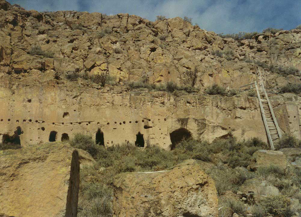
35°49′42″N 106°38′37″W / 35.82833°N 106.64361°W[5]Jemez Springs 30 Jemez Cave April 19, 1990 Address Restricted Jemez Springs 31 Jemez Pueblo 
May 2, 1977 28 miles north of Bernalillo on State Road 4
35°36′49″N 106°43′41″W / 35.613611°N 106.728056°WJemez Pueblo 32 Jemez State Monument 
March 14, 1973 State Road 4
35°46′38″N 106°41′11″W / 35.777222°N 106.686389°WJemez Springs 33 Kiashita Site May 21, 1984 Northwest of Jemez Springs
35°49′39″N 106°44′30″W / 35.8275°N 106.74167°W[6]Jemez Springs 34 Kiatsukwa Site (FS-31 and 504, LA-132 and 133) May 21, 1984 Address Restricted Jemez Springs 35 Kuaua Ruin January 1, 1976 Coronado State Monument
35°19′51″N 106°33′26″W / 35.33083°N 106.55722°W[7]Bernalillo 36 Kwastiyukwa Site (FS-11, LA-482) May 21, 1984 Address Restricted Jemez Springs 37 Nanishagi Site (FS-320, LA-541) May 21, 1984 Address Restricted Jemez Springs 38 Our Lady of Sorrows Church April 29, 1977 U.S. Route 85
35°18′55″N 106°32′48″W / 35.315278°N 106.546667°WBernalillo 39 Patokwa Site (FS-5, LA-96) May 21, 1984 Address Restricted Jemez Springs 40 Pejunkwa Site (FS-571, LA-130) May 21, 1984 Address Restricted Jemez Springs 41 Pueblo of Santo Domingo (Kiua) December 12, 1973 35 miles northeast of Albuquerque, off Interstate 25
35°30′49″N 106°21′49″W / 35.513611°N 106.363611°WAlbuquerque 42 Pueblo Tuerto January 19, 1984 Address Restricted Budaghers 43 Puye Ruins 
October 15, 1966 Address Restricted Espanola Extends into Rio Arriba County 44 Roosevelt School March 15, 1996 Calle Malinche
35°18′16″N 106°33′04″W / 35.304444°N 106.551111°WBernalillo 45 San Jose de las Huertas July 5, 1990 Address Restricted Placitas 46 San Juan Mesa Ruin July 9, 1970 Address Restricted Jemez Springs 47 San Ysidro Church July 30, 1980 Church Rd.
35°14′01″N 106°36′53″W / 35.233611°N 106.614722°WCorrales 48 Sandia Cave October 15, 1966 Along State Road 156 south of Placitas
35°15′16.6536″N 106°24′22.14″W / 35.254626°N 106.40615°W[8]Bernalillo 49 Santo Domingo Indian Trading Post January 9, 1998 Former U.S. Route 66 crossing of the Santa Fe railroad tracks at Domingo
35°30′41″N 106°19′14″W / 35.511389°N 106.320556°WDomingo 50 Tamaya November 1, 1974 North of Bernalillo
35°25′41″N 106°37′03″W / 35.428056°N 106.6175°WBernalillo 51 Tonque Pueblo January 12, 1984 Southeast of San Felipe Pueblo
35°21′49″N 106°21′7″W / 35.36361°N 106.35194°W[9]Tejon Grant 52 Tostaskwinu Site (FS-579, LA-479) May 21, 1984 Address Restricted Jemez Springs 53 Tovakwa Site May 21, 1984 Address Restricted Jemez Springs 54 Unshagi Site (FS-337, LA-123) May 21, 1984 Address Restricted Jemez Springs 55 Virgin Canyon Logging Camp No. 1 September 11, 1992 Address Restricted Jemez Springs 56 Virgin Mesa Logging Camp No. 1 September 11, 1992 Address Restricted Jemez Springs 57 Virgin Mesa Logging Camp No. 2 September 11, 1992 Address Restricted Jemez Springs 58 Virgin Mesa Logging Camp No. 3 September 11, 1992 Address Restricted Jemez Springs 59 Virgin Mesa Rock Art Site April 19, 1990 Address Restricted Jemez Springs 60 Wabakwa Site (FS-400, LA-478) May 21, 1984 Address Restricted Jemez Springs 61 Wahajhamka (FS-573) May 21, 1984 Address Restricted Jemez Springs 62 Zia Pueblo 
April 3, 1973 18 miles west of Bernalillo on State Road 44
35°30′22″N 106°43′41″W / 35.506111°N 106.728056°WZia Pueblo See also
- List of National Historic Landmarks in New Mexico
- National Register of Historic Places listings in New Mexico
References
- ^ The latitude and longitude information provided in this table was derived originally from the National Register Information System, which has been found to be fairly accurate for about 99% of listings. For about 1% of NRIS original coordinates, experience has shown that one or both coordinates are typos or otherwise extremely far off; some corrections may have been made. A more subtle problem causes many locations to be off by up to 150 yards, depending on location in the country: most NRIS coordinates were derived from tracing out latitude and longitudes off of USGS topographical quadrant maps created under the North American Datum of 1927, which differs from the current, highly accurate WGS84 GPS system used by Google maps. Chicago is about right, but NRIS longitudes in Washington are higher by about 4.5 seconds, and are lower by about 2.0 seconds in Maine. Latitudes differ by about 1.0 second in Florida. Some locations in this table may have been corrected to current GPS standards.
- ^ "National Register of Historic Places: Weekly List Actions". National Park Service, United States Department of the Interior. Retrieved on November 10, 2011.
- ^ Numbers represent an ordering by significant words. Various colorings, defined here, differentiate National Historic Landmark sites and National Register of Historic Places Districts from other NRHP buildings, structures, sites or objects.
- ^ "National Register Information System". National Register of Historic Places. National Park Service. . http://nrhp.focus.nps.gov/natreg/docs/All_Data.html.
- ^ Location derived from its GNIS feature record; the NRIS lists the site as "Address Restricted"
- ^ Location derived from its GNIS feature record; the NRIS lists the site as "Address Restricted"
- ^ Location derived from its GNIS feature record; the NRIS lists the site as "Address Restricted"
- ^ Location derived from this Albuquerque Journal article, and coordinates derived from USGS topographical maps
- ^ Location derived from its GNIS feature record; the NRIS lists the site as "Address Restricted"
U.S. National Register of Historic Places Topics Lists by states Alabama • Alaska • Arizona • Arkansas • California • Colorado • Connecticut • Delaware • Florida • Georgia • Hawaii • Idaho • Illinois • Indiana • Iowa • Kansas • Kentucky • Louisiana • Maine • Maryland • Massachusetts • Michigan • Minnesota • Mississippi • Missouri • Montana • Nebraska • Nevada • New Hampshire • New Jersey • New Mexico • New York • North Carolina • North Dakota • Ohio • Oklahoma • Oregon • Pennsylvania • Rhode Island • South Carolina • South Dakota • Tennessee • Texas • Utah • Vermont • Virginia • Washington • West Virginia • Wisconsin • WyomingLists by territories Lists by associated states Other Municipalities and communities of Sandoval County, New Mexico City 
Town Villages Corrales | Cuba | Jemez Springs | San Ysidro
CDPs Indian reservations Cochiti Pueblo‡ | Jemez Pueblo | Jicarilla Apache Indian Reservation‡ | Laguna Pueblo‡ | Navajo Nation‡ | San Felipe Pueblo | San Ildefonso Pueblo‡ | Sandia Pueblo‡ | Santa Ana Pueblo | Santa Clara Indian Reservation‡ | Santo Domingo Pueblo‡ | Zia Pueblo
Footnotes ‡This populated place also has portions in an adjacent county or counties
Categories:- National Register of Historic Places in New Mexico by county
- Sandoval County, New Mexico
- History of Sandoval County, New Mexico
-


Wikimedia Foundation. 2010.